
Linscott, Mellon C. (sold)

Mellon C. Linscott (fl. c. 1930 - 1970) was an American artist and engineer who lived and worked in Maine and New Hampshire. He was commissioned by the state of Maine and various municipalities in the 1930s to create maps of these areas. He included artistic views of local landmarks and recreational activities along with the standard elements found on maps. He also created a few specially commissioned maps for individual families. Today, Linscott's grandson operates a business named Linscott Maps that follows in Linscott's footsteps: creating custom-made maps for private clients.
Highlights the natural wonders of the State of Maine - including Acadia National Park on Mount Desert Island.
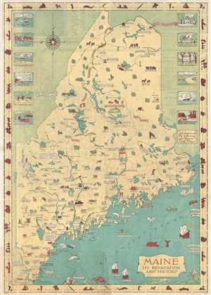
Maine Its Recreation and History
sold
- Digital Map Information
- Suitable for large format printing
- File Size: 10.17 MB
- File Type: ZIP / TIFF
- ICC color profile embedded
- Delivered instantly via download link
This is a 1935 Mellon C. Linscott pictorial map of Maine. The map depicts the entire state from New Hampshire and Quebec to New Brunswick and from Quebec and New Brunswick to the Atlantic Ocean. Charmingly illustrated and attractively colored, Linscott's map traces ... (more details)
Highlights the natural wonders of the State of Maine - including Acadia National Park on Mount Desert Island.
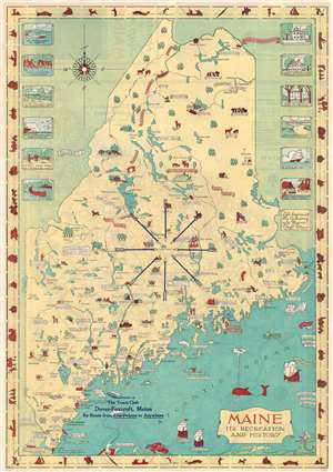
Maine Its Recreation and History.
sold
- Digital Map Information
- Suitable for large format printing
- File Size: 25.41 MB
- File Type: ZIP / TIFF
- ICC color profile embedded
- Delivered instantly via download link
This is a 1935 Mellon C. Linscott pictorial map of Maine. Charmingly illustrated and attractively colored, Linscott's map traces Maine's history, promotes its industries, and highlights the many recreational opportunities afforded to locals and visitors alike. Maine's frontier past is placed at the forefront, with numerous forts illustrated throughout the state, including Fort William Henry, Fort Halifax, and Fort Western. Both Champlain and Captain John Smith's voyages are referenced, and sites visited by Champlain are noted. Birthplaces of luminaries that hail from Maine are also marked, including Henry Wadsworth Longfellow and Harriet Beecher Stowe. Colleges and universities are illustrated throughout the state, as are other famous buildings. (more details)
Highlights the natural wonders of the State of Maine - including Acadia National Park on Mount Desert Island.
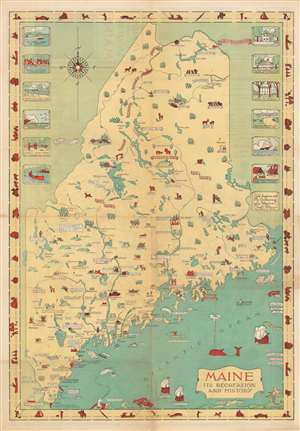
Maine Its Recreation and History.
sold
- Digital Map Information
- Suitable for large format printing
- File Size: 25.34 MB
- File Type: ZIP / TIFF
- ICC color profile embedded
- Delivered instantly via download link
This is a 1935 Mellon C. Linscott pictorial map of Maine. Charmingly illustrated and attractively colored, Linscott's map traces Maine's history, promotes its industries, and highlights the many recreational opportunities afforded to locals and visitors alike. Maine's frontier past is placed at the forefront, with numerous forts illustrated throughout the state, including Fort William Henry, Fort Halifax, and Fort Western. Both Champlain and Captain John Smith's voyages are references, and sites visited by Champlain are noted. Birthplaces of luminaries that hail from Maine are also marked, including Henry Wadsworth Longfellow and Harriet Beecher Stowe. Colleges and universities are illustrated throughout the state, as are other famous buildings. (more details)