
Linton, Samuel Benton (sold)

Samuel Benton Linton (1838 – August 28, 1927) was a mapmaker, draughtsman, and lithographer active in Philadelphia in the second half of the 19th century. Linton was born at Spring House, Montgomery County, PA, in 1838. He entered the army where he was trained as a draughtsman and assigned to the U.S. Coast Survey. During his tenure with the Coast Survey he completed an important map of Hawaii. Although, like most Coast Survey Men, Linton supported the Union, on a visit to his sister in Richmond near the end of the war he was impressed into the Confederate Army. He refused to fight against Union soldiers and was instead assigned to the Engineering Corps, to which his talents were better suited. As an engineer he created a detailed plan of the Battle of Chickamauga (September 18-20, 1863). Unfortunately, with his name attached to a known Confederate Battle Plan, Linton was unable to resume his duties with the U. S. Coast Survey. Instead he relocated to Philadelphia where he established himself as an engraver and lithographer. He produced a number of maps for various publishers including Warren Holt's important maps of California. During this period Linton maintained offices at 148 1/2 South Fourth Street, Philadelphia, PA. Around 1877 he relocated to Chester County Pennsylvania to take a position as a school director. He Died in Devon, PA in 1927.
No amount of time spent on this map would be wasted; its detail is fascinating. - Wheat

Map of the States of California and Nevada. Carefully Compiled from the Latest Authentic Sources. By Chas. Drayton Gibbes, C.E.
sold
- Digital Map Information
- Suitable for large format printing
- File Size: 44.84 MB
- File Type: ZIP / TIFF
- ICC color profile embedded
- Delivered instantly via download link
A beautiful and rare variant on the first edition second state of Warren Holt and Charles Drayton Gibbes' 1873 map of California and Nevada, considered to be one of the finest large-scale maps of California to appear in the second half of the 19th century. The map ... (more details)
No amount of time spent on this map would be wasted; its detail is fascinating. - Wheat
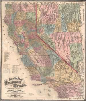
Map of the States of California and Nevada. Carefully Compiled from the Latest Authentic Sources. By Chas. Drayton Gibbes, C.E.
sold
- Digital Map Information
- Suitable for large format printing
- File Size: 95.74 MB
- File Type: ZIP / TIFF
- ICC color profile embedded
- Delivered instantly via download link
A beautiful and rare variant on the first edition second state of Warren Holt and Charles Drayton Gibbes' 1873 map of California and Nevada. This map considered to be one of the finest large-scale maps of California to appear in the second half of the 19th century. Depicting all of California and Nevada, the map offers exceptional detail throughout. To the left, a key identifies 14 Federal Land Districts, 20 California Judicial Districts, and 9 Nevada Counties. The key, which was inherited from the first edition first state, is somewhat out of sync with the updated second state, which adds Eureka County, Nevada. Additional coding identifies 10, 20, and 30 mile railroad grants to the Central Pacific, Western Pacific, C. and O., Southern Pacific, P. and S., S. and C., and A. and P. Railroads. (more details)