
López de Vargas Machuca, Tomás (sold)
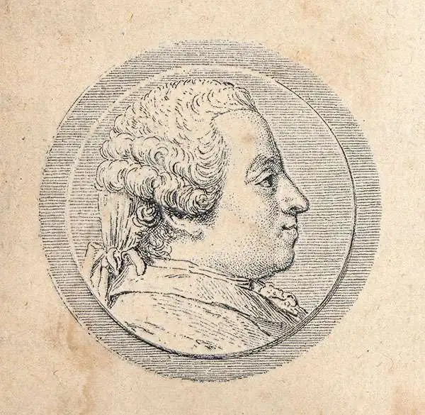
Tomás López de Vargas Machuca (1730 - July 19, 1802) was a Spanish cartographer active in the later part of the 18th century. Vargas was born in Toledo and studied mathematics, grammar, and rhetoric at the Colegio Imperial in Madrid. In 1752, with the patronage of the Marquis de la Ensenada, he relocated to Paris to study. López attended the Mazarin College, where he received two courses in Mathematics and lessons in geography from the Abbé de la Caille, Joseph Jérome de Lalande, and Louis Gabriel. He also studied cartography direclty under the legendary French mapmaker Jean Baptiste Bourguignon d'Anville (1697 - 1782). Back in Madrid, he collaborated with the geographer Juan de la Cruz on two educational atlases, published in 1757 and 1758. Around 1770, King Carolos III, appointed him Geógrafo de los Dominios de Su Magestad and gave him charge over the newly created Gabinete de Geografía. In this position, he dedicated the remainder of his life to a detailed mapping of Spain, producing numerous important regional maps, many correcting common mistakes made by foreign geographers. He also ran a private map publishing business in Madrid, first on San Bernardo (1761 - 65), the on Las Carretas (opposite Gamete; 1765 - 1783), and infamy on Atocha (1783 - 1802). He was a member of the Real Academia de San Fernando, the Real Sociedad Bascongada de Amigos del País and the Academia de Bellas Letras de Sevilla. López was succeeded by his two sons, Juan (1765 - 1825) and Tomás Lopez, also cartographers, who published several atlases based upon his work. The appraisal of his estate at the time was 489,800 reales (about 1,000,000 USD today), a figure indicative of his success.
First Accurate Map of Galicia by Spain's 18th century greatest cartographer.
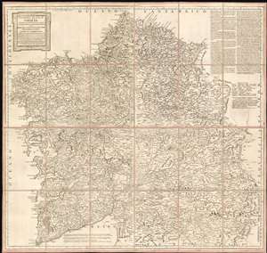
Mapa geográfico del Reyno de Galicia contiene las provincias de Santiago, Coruña, Betanzos, Lugo, Mondoñedo, Orense, y Tuy.
sold
- Digital Map Information
- Suitable for large format printing
- Full resolution TIFF file
- ICC color profile embedded
- Delivered instantly via download link
This is a 1784 map of the Kingdom of Galicia by Tomás López de Vargas Machuca, the preeminent Spanish cartographer of his generation. This is most authoritative map of Galicia ever committed to print, which López argued should be considered the first such map overall. In the text at the upper right, López wrote:
Se puede decir que este mapa es el primero impreso de Galicia... porque el del Pe. Ojea es tan diminuto, que de su lectura solo sacamos una instruccion muy limitada; el de Mr. De Fer y otros estrangeros son un monton de desalinos.López's boast is not baseless. The map of Hernando Ojea (1543 - 1615) to which he refers was first committed to print in the 1603 J.B. Vrients edition of the Ortelius atlas (he obtained a manuscript from Ojea.) This, in absolute terms, was the first printed map of Galicia, and was considered sufficiently correct that virtually every map printed of Galicia in that century was copied directly from it. Even so, in terms of detail López's criticism of the Ojea is valid: its scale limits detail. The maps of De Fer - which appear to be derived from, or from the same sources as the Cantelli and the Coronelli maps - did contain more data than their precursor, but even if they did not deserve the appellation un monton de desalinos, None approach this López map in either size or detail. Lopez credits an impressive array of sources - in sum, the map compiled a wealth of state-of-the-art data from a roster dominated by leading lights of the Spanish Enlightenment. They include the statesman Gaspar Melchor de Jovellanos (1744 - 1811); Pedro Varela y Ulloa (1737- 1797), then an official of the Secretary of State, who would eventually become Secretary of the Navy. Particular credit was given to José Andrés Cornide de Folgueira y Saavedra (D. Joseph Cornide; 1737 - 1803), a noted Galician geographer, naturalist and humanist (more details)
'It can be said that this map is the first printed of Galicia... because that of Father Ojea is so tiny, that from its reading we only get a very limited instruction; those of Mr. De Fer and other foreigners are a bunch of slops.'
Scarce map of the Balearic Islands.
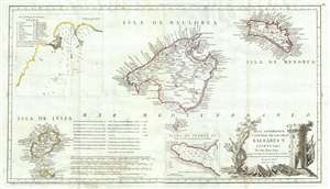
Mapa Geografico, y General de Las Islas Baleares Y Pithuyusas.
sold
- Digital Map Information
- Suitable for large format printing
- DPI: 300
- File Size: 9.9 MB
- File Type: ZIP / TIFF
- ICC color profile embedded
- Delivered instantly via download link
A scarce 1793 of the Balearic Islands of Ibiza, Majorca, and Minorca by the Spanish cartographer Tomás López de Vargas Machuca. The map has an unusual elongated format centered on Majorca (Mallorca). There are insets of the town of Ibiza (Iviza) and Puerto Pi ... (more details)
One of the few specific maps of Puerto Rico from the early 19th century.
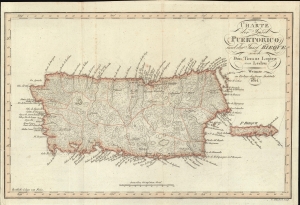
Charte der Insel Puerto Rico und der Bieque nach Don Thomas Lopez von Ledru.
sold
- Digital Map Information
- Suitable for large format printing
- File Size: 6.43 MB
- File Type: ZIP / TIFF
- ICC color profile embedded
- Delivered instantly via download link
This is a rare 1814 Thomas Lopez and Andree Pierre Ledru map of Puerto Rico, one of the few specific maps of this island dating to the early 19th century. (more details)