
Maw, Samuel Herbert (sold)

Samuel Herbert Maw (September 12, 1881-1952) was a English engineer, architect, photographer artist, and graphic designer active in Quebec during the first half of the 20th century. Maw was born in England where he attended the Ackworth School. Although not formally trained as an architect, he apprenticed with John. S. Dorden of Ipswich and Edward W. Mountfort, of London. From about 1904 on he worked as a draftsman with the London firm of Bradshaw, Gass and Bolton. In 1912 Maw emigrated to the United States where he became a partner in the firm of Brown and Maw. This must not have worked out, because he relocated to Toronto later in the same year, taking a position with the firm of Darling and Pearson. Maw moved from firm to firm within Canada, briefly working in Toronto, Montreal, Ottawa, and Halifax. During World War II, Maw was assigned to the Engineering and Maintenance Branch of the Naval Service Department in Ottawa. He produced pictorial maps of Quebec City (1932), Montreal, Ottawa (1944), and the Gaspé Peninsula (1929). When Maw died he was working on a similar map of Halifax, but it is unclear if it was ever completed or published.
Rare pictorial map of the Gaspé Peninsula, Quebec by Maw.
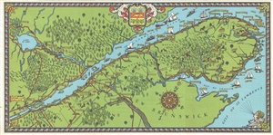
[Gaspé Peninsula]
sold
- Digital Map Information
- Suitable for large format printing
- Full resolution TIFF file
- ICC color profile embedded
- Delivered instantly via download link
Rare 1929 Pictorial Map of the Gaspé Peninsula, Quebec, by the artist and architect Samuel Herbert Maw. Centered on the St. Lawrence River, the map cover from Quebec City to the Gulf of St. Lawrence. Towns and forests are rendered pictorially. Sailing, steam ... (more details)
Stunning pictorial map of Quebec City, Quebec.
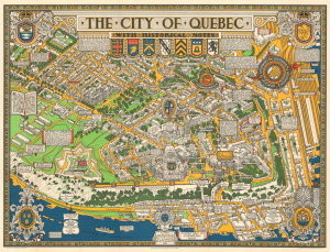
The City of Quebec with Historical Notes.
sold
- Digital Map Information
- Suitable for large format printing
- Full resolution TIFF file
- ICC color profile embedded
- Delivered instantly via download link
This is an exceptional 1932 Samuel Herbert Maw pictorial map of the city of Quebec, Canada. The map beautifully captures the old city of Quebec in exceptional detail, with the St. Lawrence River around it. (more details)
Stunning pictorial map of Quebec City, Quebec.
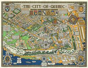
This is an exceptional 1932 bird’s eye view map of the city of Quebec, Canada by Samuel Herbert Maw. This pictorial map beautifully captures the old city of Quebec in exceptional detail with the St. Lawrence River around it. Individual streets are noted, ... (more details)