
Muela, Andrés (sold)

Andrés Muela (1760 - 18xx), also known as Andrés de la Muela, was a Spanish artist, printer, and engraver active in Madrid in the second half of the 18th century and the very early years of the 19h. He is best known for his devotional ephemera, but he also produced maps, botanicals, and zoological prints. His last known work is a zoological image of an anteater dating to 1804.
Seminal Map of the north Amazon and Orinoco.
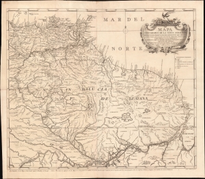
Mapa Coro-Grafico de La Nueva Andalucia, Provincias de Cumaná, y Guyana, Vertientes de Orinoco, su cierto origen, Ccomunicación con el de las Amazonas, situación de la Laguna Parime, y nuevas Poblaciónes.
sold
- Digital Map Information
- Suitable for large format printing
- Full resolution TIFF file
- ICC color profile embedded
- Delivered instantly via download link
An extraordinary 1778 Spanish map of northern Brazil, eastern Venezuela, and Guyana, prepared by Luis de Surville y Villerey. When issued, this was the most comprehensive study of the overlapping and complex Orinoco-Amazon-Rio Negro basin system. (more details)