
Neerland, Oliver (sold)

Oliver Neerland (March 5, 1881 - November 2, 1960) was a Norwegian painter, graphic designer, and theater designer. Neerland was born in Sandefjord, Vesgold, Sweden. He studied painting under the Norwegian artists Christian Krohg and Halfdan Strøm. In 1909 he enrolled in the Academy of Beaux Arts in Paris, later working as a theater artist in London. He was a set painter at the National theater from 1918 to 1934, then at the New Theater in Oslo from 1937 - 1939. Neerland became the set designer for the Edderkoppen Theatre in Oslo in 1942 and remained there until he retired in 1950. While most of Neerland's work focused on the theater, he did produce at least two large format pictorial maps, both illustrating the northern half of the globe in three-dimensional form centered on the Pacific.
Spectacular pictorial world map illustrating Post-WII situation in Europe and America.
[Oliver Neerlands Bildkarta]
sold
- Digital Map Information
- Suitable for large format printing
- Full resolution TIFF file
- ICC color profile embedded
- Delivered instantly via download link
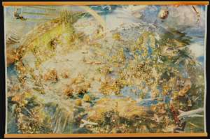
This is an utterly stunning 1949 pictorial color lithograph wall map of the northern part of the western world by the Norwegian artist Oliver Neerland. The map covers all of North America, the North Atlantic, and Europe as far east as the Caspian Sea, as well as from the North Pole to the Amazon River and Liberia. Lavish illustration depicts historic figures, monuments, art and architecture, animals, airplanes, dirigibles, sailing ships of all types, aircraft characters, and more. (more details)
Optimism and danger in Post-WWII Europe and America.
[Oliver Neerlands Bildkarta].
sold
- Digital Map Information
- Suitable for large format printing
- Full resolution TIFF file
- ICC color profile embedded
- Delivered instantly via download link
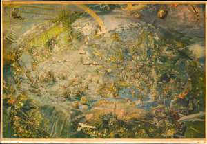
This is an utterly stunning 1949 pictorial color lithograph wall map of the northern part of the western world by the Norwegian artist Oliver Neerland. The map covers all of North America, the North Atlantic, and Europe as far east as the Caspian Sea, as well as from the North Pole to the Amazon River and Liberia. Lavish illustration depicts historic figures, monuments, art and architecture, animals, airplanes, dirigibles, sailing ships of all types, aircraft adventurers, and more. (more details)