
Norie, John William

John William Norie (June 3, 1772 - December 24, 1843) was a British teacher of navigation, hydrographer, chart maker, and publisher of maritime manuals active in London, England in the late 18th and early 19th centuries. Norie was born in Wapping, London, an area long associated with the maritime sciences. Norie's career as a chart maker commenced under the tutelage of William Heather, a prominent purveyor and publisher of nautical charts, pilot books, and navigational tools who took over the firm of Mount and Page in 1765. Heather and Norie were likely acquainted through John Hamilton Moore, another important chart maker with whom both seem to have been associated early in their careers. Heather hired Norie to teach basic navigation at his shop at 157 Leadenhall Street. Under Heather Norie also distinguished himself as a draftsman, completing many of the early charts associated with the Heather firm. When Heather died in 1812 John Norie partnered with George Wilson, a moneyed 'man about town' with little experience in the maritime trades, to acquire the map and chart business at 9500 British Pounds. It proved a good deal for Norie, who retained all copyright privileges and drew 1/4 quarter share of business profits, as well an impressive quarterly salary and, for doing all of the work, 1/3rd of Wilson's share. The firm, referred to as the 'Naval Warehouse' quickly acquired a reputation for quality navigational materials and became a favorite of merchant seamen. It was even referenced in Charles Dickens' classic novel Dombey and Son. In 1819, Norie and Wilson acquired the failing chart business of David Steel, which significantly increased the size, though not quality, of their chart catalogue. With the rise of the British Admiralty and its own maritime chart productions, the business of "Chart Purveyor" in London dramatically changed. Admiralty charts and pilot books, designed for military use, were offered through established intermediaries, like Norie, at bargain prices. Most chart makers of the period found it profitable to use the highly technical Admiralty charts to update their own more decorative vernacular charts. For a brief time this practice proved exceptionally profitable but eventually began to draw criticism. Nonetheless, Norie retired to Edinburgh in 1840 and died a wealthy man in 1843. In 1840 the business passed to a nephew of George Wilson, Charles Wilson, who renamed the firm "Norie & Wilson". William Heather Norie, J. W. Norie's own son, produced few charts, instead pursuing a career in the legal field. Norie & Wilson merged with James Imray's prosperous chart business in 1899, becoming Imray, Laurie, Norie & Wilson, a profitable concern that remains active in the maritime charting industry.
The Wash and the Humber.
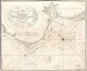
To the Merchants and Masters of Vessels Employed in the Coasting Trade etc. This Chart of the East Coast of England is most respectfully dedicated by their obliged and humble servant Wm. Heather.
$350.00
Acquire
- Digital Map Information
- Suitable for large format printing
- Full resolution TIFF file
- ICC color profile embedded
- Delivered instantly via download link
This is an 1810 William Heather and John Norie nautical chart or maritime map of the east coast of England, including parts of Suffolk, Norfolk, and Lincolnshire. The coasts are illustrated in astonishing detail. Numerous depth soundings appear along the coast, with the greatest concentrations off the coast of Yarmouth, in The Wash (the rectangular estuary/bay between Norfolk and Lincolnshire) and the Humber, a tidal estuary in Lincolnshire. Sands, overfalls, shoals, and other hazards are marked, and depth soundings state the difference in depth above those hazards. Coastal towns are identified, and river mouths are illustrated, but no other inland detail is provided. A beautiful compass rose appears in the North Sea. (more details)
Key passage on the route to India.
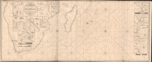
A New Chart From the Cape of Good Hope to the Islands of Madagascar, Mauritus, and c. Shewing the Mozambique Passages, drawn from the Surveys and Observations of Several Distinguished Navigators, Including all the Modern Discoveries.
$2,000.00
Acquire
- Digital Map Information
- Suitable for large format printing
- Full resolution TIFF file
- ICC color profile embedded
- Delivered instantly via download link
This is the 1818 / 1827 edition of John Norie's essential nautical map of the Cape of Good Hope and passages to Madagascar, Reunion, and other Indian Ocean ports. It was a key China Trade chart marking one of the most important and fraught passages on the voyage - rounding Africa and passing through the pirate-filled waters around Madagascar to reach the Indian Ocean. (more details)
Pacific Coast of Newly Independent Countries.
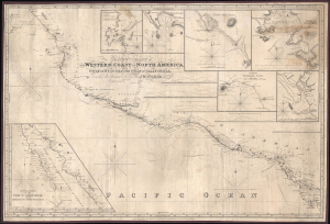
A New Chart of the Western Coast of North America from the Gulf of Nicoya to the Gulf of California, Drawn Chiefly From the late Spanish Surveys.
$1,600.00
Acquire
- Digital Map Information
- Suitable for large format printing
- File Size: 42.58 MB
- File Type: ZIP / TIFF
- ICC color profile embedded
- Delivered instantly via download link
This is J. W. Norie's 1828 large-format nautical chart of the west coast of Mexico and Central America, corrected to 1846. The map was updated and republished to capitalize on increased activity along this strategic coastline during the Mexican-American War (1846 - 1848). Being outside of U.S. waters, naval commanders resorted to existing and updated commercial charts, like this one, to control the coast. (more details)
Sailed nautical chart of the English Channel.
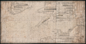
A Chart of the British Channel, Drawn From the Ordnance and Admiralty Surveys, the Observations of Admiral Sir John Knight, K. C. B., and Other Authentic Documents.
$1,200.00
Acquire
- Digital Map Information
- Suitable for large format printing
- DPI: 300
- File Size: 59.28 MB
- File Type: ZIP / TIFF
- ICC color profile embedded
- Delivered instantly via download link
This is a large 1838 John William Norie blueback nautical chart or maritime map of the English Channel. The map depicts the region from just west of Ireland to the North Sea and from England, Wales, and Ireland to northern France. This chart has all of the atmospheric hallmarks of a working nautical chart and a life at sea. Myriad depth soundings are included throughout, including along the coast of St. George's Channel and in Bristol Channel. Numerous soundings are indicated in the Thames Estuary, and the Thames is illustrated all the way to London. Locations along the English, Welsh, Irish, and French coasts are labeled, including Cork, Cardiff, Bristol, Lands' End, Southampton, and Brighton. The Isle of Wight is labeled. Inset maps along the top border include Mounts Bay, Land's End, Spithead and Portsmouth, Portland, New Haven, and the Isle of Sheppy. Along the right and bottom borders, inset maps detail Exmouth Bar, the Scilly Isles, and Dartmouth Harbor. Several coastal views are also illustrated, including Lizard, Portland, Berry Head, Start Point, Bembridge Point, Beachy Head, Looe Island, the Needle Rocks, and the Scilly Islands. Manuscript red and yellow notations note the location of lighthouses along the English coast. Several lighthouses are illustrated in profile. (more details)
Stunningly dense classic blueback.

[The English Channel] To the Right Honorable the Master, Wardens and Elder Bretheren of the Trinity House, This Chart of the English Channel, is by Permission Most Respectfully Dedicated by their Obliged and Grateful Servant, JW Norie, Hydrographer.
$2,000.00
Acquire
- Digital Map Information
- Suitable for large format printing
- File Size: 138.97 MB
- File Type: ZIP / TIFF
- ICC color profile embedded
- Delivered instantly via download link
A stunning, enormous, and rare 1842 nautical map of the English Channel by John William Norie. (more details)
Bedrock of the British Empire.
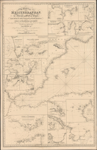
A General Chart of the Mediterranean, Adriatic and Black Seas together with the Grecian Archipelago... [First Sheet].
$1,600.00
Acquire
- Digital Map Information
- Suitable for large format printing
- File Size: 59.98 MB
- File Type: ZIP / TIFF
- ICC color profile embedded
- Delivered instantly via download link
This is John Norie's large-format 1850 nautical chart of the western Mediterranean Sea, including the Strait of Gibraltar and the Balearic Islands. Among other features, it highlights the critically important Strait of Gibraltar, the crux of British naval power in the Mediterranean. (more details)
Andaman and Nicobar Islands, suddenly significant.
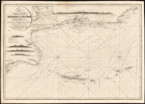
A Chart of the Andaman and Nicobar Islands with the Adjacent Continent, Drawn from the latest Surveys, by J. W. Norie, Hydrographer.
$1,000.00
Acquire
- Digital Map Information
- Suitable for large format printing
- File Size: 52.14 MB
- File Type: ZIP / TIFF
- ICC color profile embedded
- Delivered instantly via download link
A scarce 1856 blueback nautical map by J. W. Norie depicting the Andaman Islands and the Nicobar Islands, as well as parts of modern-day Burma (Pegu) and Thailand (Tanasserim). (more details)
A stunning decorative sea chart detailing Madeira.
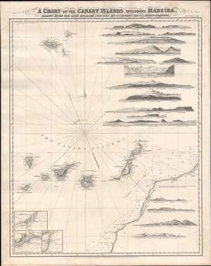
A Chart of the Canary Islands Including Madeira.
$850.00
Acquire
- Digital Map Information
- Suitable for large format printing
- File Size: 32.97 MB
- File Type: ZIP / TIFF
- ICC color profile embedded
- Delivered instantly via download link
An exceptionally beautiful 1867 James Norie and Charles Wilson nautical chart or maritime map of the Canary Islands and Madeira, including part of western Africa. As a whole the map offers excellent detail with inland topography on all of the islands as well as countless depth soundings. There are three inset detail maps in the lower left focusing on Arrecife, Funchal, and Santa Cruz. An additional seventeen land profile charts filling the upper right and lower right. The title is set in an elaborate typeface just outside the map's upper border. (more details)
Detailing the English Channel.
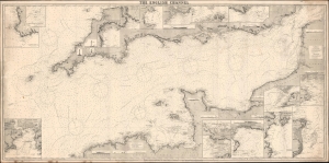
The English Channel.
$800.00
Acquire
- Digital Map Information
- Suitable for large format printing
- File Size: 137.27 MB
- File Type: ZIP / TIFF
- ICC color profile embedded
- Delivered instantly via download link
This is a rare 1887 Norie and Wilson blueback nautical chart of the English Channel. This massive chart is nearly 7 feet long and contains excellent coastal detail and beautiful insets of ports along the English and French coasts. (more details)
The Height of 19th Century Hydrography.
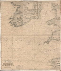
A Chart of the Approaches to the St. George's and English Channels showing the navigation from 47°43 N. Lat. and 11°28 W. Long. to Bristol, Liverpool, and Dublin, Falmouth and Plymouth; Part of the North Coast of France, and the South and West Coasts of Ireland to Cork and Galway.
$500.00
Acquire
- Digital Map Information
- Suitable for large format printing
- File Size: 78.18 MB
- File Type: ZIP / TIFF
- ICC color profile embedded
- Delivered instantly via download link
An unrecorded blueback nautical chart / map of St. George's Channel and the western portion of the English Channel, published by Norie and Wilson in 1894. (more details)