
Norie, John William (sold)

John William Norie (June 3, 1772 - December 24, 1843) was a British teacher of navigation, hydrographer, chart maker, and publisher of maritime manuals active in London, England in the late 18th and early 19th centuries. Norie was born in Wapping, London, an area long associated with the maritime sciences. Norie's career as a chart maker commenced under the tutelage of William Heather, a prominent purveyor and publisher of nautical charts, pilot books, and navigational tools who took over the firm of Mount and Page in 1765. Heather and Norie were likely acquainted through John Hamilton Moore, another important chart maker with whom both seem to have been associated early in their careers. Heather hired Norie to teach basic navigation at his shop at 157 Leadenhall Street. Under Heather Norie also distinguished himself as a draftsman, completing many of the early charts associated with the Heather firm. When Heather died in 1812 John Norie partnered with George Wilson, a moneyed 'man about town' with little experience in the maritime trades, to acquire the map and chart business at 9500 British Pounds. It proved a good deal for Norie, who retained all copyright privileges and drew 1/4 quarter share of business profits, as well an impressive quarterly salary and, for doing all of the work, 1/3rd of Wilson's share. The firm, referred to as the 'Naval Warehouse' quickly acquired a reputation for quality navigational materials and became a favorite of merchant seamen. It was even referenced in Charles Dickens' classic novel Dombey and Son. In 1819, Norie and Wilson acquired the failing chart business of David Steel, which significantly increased the size, though not quality, of their chart catalogue. With the rise of the British Admiralty and its own maritime chart productions, the business of "Chart Purveyor" in London dramatically changed. Admiralty charts and pilot books, designed for military use, were offered through established intermediaries, like Norie, at bargain prices. Most chart makers of the period found it profitable to use the highly technical Admiralty charts to update their own more decorative vernacular charts. For a brief time this practice proved exceptionally profitable but eventually began to draw criticism. Nonetheless, Norie retired to Edinburgh in 1840 and died a wealthy man in 1843. In 1840 the business passed to a nephew of George Wilson, Charles Wilson, who renamed the firm "Norie & Wilson". William Heather Norie, J. W. Norie's own son, produced few charts, instead pursuing a career in the legal field. Norie & Wilson merged with James Imray's prosperous chart business in 1899, becoming Imray, Laurie, Norie & Wilson, a profitable concern that remains active in the maritime charting industry.

A New Chart of the Straits of Malacca and Sincapore Drawn from the Latest Surveys, with Additions and Improvemetns, by J. W. Norie.
sold
- Digital Map Information
- Suitable for large format printing
- DPI: 300
- File Size: 37.68 MB
- File Type: ZIP / TIFF
- ICC color profile embedded
- Delivered instantly via download link
An extremely scarce 1815 map of the Strait of Malacca and Singapore (Sincapore) by John William Norie. This map covers from Aceh in northwestern Sumatra (Acheen) to Singapore Island and Pulu Bintang. This map first appeared in 1803 when it was issued by William ... (more details)
Exceedingly rare, highly decorative, and important map of the Cape of Good Hope.
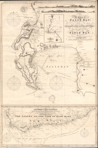
A Chart of False Bay Surveyed by Order of Rear Admiral Stopford, Commander in Chief at the Cape of Good Hope, by P. W. Gawthorpe, Master of His Majesty's Ship Lion, 1812; to which is added Table Bay, with Cape Town and its Environs.
sold
- Digital Map Information
- Suitable for large format printing
- File Size: 37.11 MB
- File Type: ZIP / TIFF
- ICC color profile embedded
- Delivered instantly via download link
A remarkable and rare 1819 / 1827 J. W. Norie commercial nautical chart of False Bay and the Cape of Good Hope, South Africa. The chart was issued shortly after the 1814 Treaty of Vienna when British sovereignty over the Cape Colony was internationally recognized. Norie issued it as False Bay and Simon's Town were emerging as key British naval and commercial winter shelters and resupply depots - marking them as strategic stopping points on voyages to Asia. (more details)
The quintessential early 19th century English blueback nautical chart.
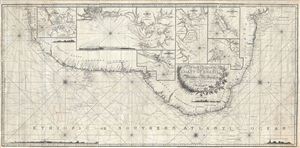
A New Chart of the Coast of Brazil from Maranham to Rio Janeiro.
sold
- Digital Map Information
- Suitable for large format printing
- DPI: 300
- File Size: 45.42 MB
- File Type: ZIP / TIFF
- ICC color profile embedded
- Delivered instantly via download link
An extraordinary 1819 John Norie nautical chart or portolan map of the coast of Brazil. This fantastic map, a quintessential example of early 19th century British chart making, covers the eastern coastline of South America from the mouth of the Amazon River at ... (more details)
Scarce nautical chart of the eastern Mediterranean Sea by William Heather.
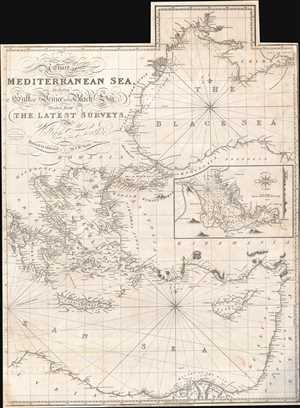
A Chart of the Mediterranean Sea, Including the Gulf of Venice and Black Sea.
sold
- Digital Map Information
- Suitable for large format printing
- Full resolution TIFF file
- ICC color profile embedded
- Delivered instantly via download link
A dramatic 1822 nautical chart of the eastern part of the Mediterranean Sea by William Heather and John Norie. This map was first issued by William Heather's Navigation Warehouse and Naval Academy in 1812. The original map covered the entire Mediterranean on three sheets, of which this is the easternmost panel. The panel's were intended to be joined, or as here used as stand-alone charts. The present example covers from the Ionian Islands to modern day Israel and from the Crimea to the Nile Delta, encapsulating all of modern-day Greece, the western Black Sea, Cyprus, much of modern day Turkey, the Balkans, Israel and Lebanon, and northern Egypt. A detachable flap extends coverage of the Black Sea northwards as far as Odessa. An inset map details the harbor of Smyrna, or modern-day Izmir, Turkey. (more details)
South Sea whaling.
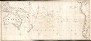
[South Pacific]
sold
- Digital Map Information
- Suitable for large format printing
- Full resolution TIFF file
- ICC color profile embedded
- Delivered instantly via download link
A rare 1825 James Norie blueback nautical chart or maritime map of the South Pacific with notations from a whaling voyage undertaken between 1855 and 1856. The chart, a composite of three charts joined by the original owner, covers from Borneo and Australia to South America and The Falkland Islands. (more details)

A New Chart of the Andaman and Nicobar Islands with the Adjacent Continent, Drawn from the latest Surveys, by J. W. Norie, Hydrographer.
sold
- Digital Map Information
- Suitable for large format printing
- DPI: 300
- File Size: 26.48 MB
- File Type: ZIP / TIFF
- ICC color profile embedded
- Delivered instantly via download link
An extremely scarce 1831 nautical chart or maritime map by J. W. Noire depicting the Andaman Islands and Nicobar Islands as well as parts of modern-day Burma (Pegu) and Thailand (Tanasserim). Oriented to the East, Norie's map covers from Ramree Island and Sandoway (today a popular resort known as Nagapali Beach, Myanmar), then south east around Pegu and past Rangoon (Yangon), then along the Myanmar and Thai coastline as far south as Ko Tarutao (Trotto), in modern day south Thailand. The map includes the large Thai coastal city of and island of Phuket, then known as Junkseylon Island. (more details)
Beautiful, rare, and important, this blueback chart of Jamaica was issued in the year of the Great Jamaican Slave Revolt or Baptist War.
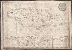
The Island of Jamaica, by W. Heather.
sold
- Digital Map Information
- Suitable for large format printing
- Full resolution TIFF file
- ICC color profile embedded
- Delivered instantly via download link
This is a rare and stunning 1832 blueback nautical chart or map of Jamaica by William Heather and John W. Norie. As a working chart, it bears all of the hallmarks of a shipboard chart and a life at sea. The map details all of Jamaica with four inset detail harbor maps along the bottom, from left: Savanna, Portland Point, Kingston, Morant. Sounding along the south coast, and in the insets, in fathoms.
Unlike many British blueback charts, the present map actually offers considerable inland detail. Here Jamaica is divided into three counties (Cornwall, Middlesex and Surry), each of which is in turn subdivided into Parishes. The chart includes significant topographical detail, including roads, rivers, mountains, towns, churches, military camps, and more. (more details)
Unlike many British blueback charts, the present map actually offers considerable inland detail. Here Jamaica is divided into three counties (Cornwall, Middlesex and Surry), each of which is in turn subdivided into Parishes. The chart includes significant topographical detail, including roads, rivers, mountains, towns, churches, military camps, and more. (more details)
Extremely rare nautical chart of the Kattegat and Baltic Seas.
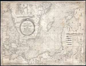
A New Chart of the Cattegat and Baltic or East Sea.
sold
- Digital Map Information
- Suitable for large format printing
- DPI: 300
- File Size: 45.15 MB
- File Type: ZIP / TIFF
- ICC color profile embedded
- Delivered instantly via download link
This is an extremely rare and extraordinarily beautiful 1837 William Heather and John William Norie blueback nautical chart or maritime map of the Kattegat and Baltic Seas. The map depicts the region from Norway and Denmark (Jutland) to the Baltic States of Estonia and Latvia (Eastland, Livonia, Courland) and from Norway and the Gulf of Finland to northern Europe. The map is highly detailed with numerous cities are labeled, including Copenhagen, Stockholm (Christiana), Gdańsk (Danzig), Talinn (Revel), and Riga. Myriad depth soundings are indicated, particularly in the Kattegat Sea and along the coastlines. Numerous inset maps are included along three of the four sides. Along the top border, three inset maps situated and illustrate the entrances to Gothenburg, the principal entrance to Stockholm, and the harbor of Sleete or Slitehamn, on the island of Gottland. Along the right side and bottom border, inset maps depict the entrance to Klaipėda (Memel), Lithuania, Riga, Rogerwyck, the entrance to Szczecin (Stettin), Poland, Baltiysk, Poland, and a second inset map illustrating the entrance to Szczecin. Manuscript notations in yellow ink throughout the map mark the locations of lighthouses and other lights used for navigation. Twenty-eight different lighthouses are illustrated in profile, along with notes concerning others. One such note, located on the Jutland Peninsula, informs the viewer that a striped flag is hoisted from the Scaw lighthouse if ice in the Kattegat impedes navigation. Other notes inform the viewer on improvements to harbors, or when the lighthouses in certain parts of the region are lit. Several coastal views are also illustrated, allowing a mariner to have a better understanding of what they should be seeing when passing a given stretch of coastline. An extremely decorative title cartouche is situated slightly to the left of center. (more details)
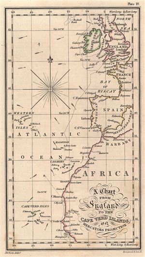
A Chart from England to the Cape Verd Islands on Mercators Projection.
sold
- Digital Map Information
- Suitable for large format printing
- File Size: 1.06 MB
- File Type: ZIP / TIFF
- ICC color profile embedded
- Delivered instantly via download link
A fine 19th century chart of the Atlantic Ocean from england to the Cape Verde Islands by J.W. Norie. This map covers the sea route from england to the Cape Verde Islands along Ireland, england, France, Spain, the Western Isles and Africa. The boundaries are ... (more details)
Extremely rare large nuatical chart of Scottish waters by David Steel!
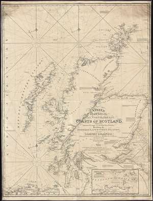
Steel's New Chart of the West, North, and East Coasts of Scotland from the Frith of Clyde to the Frith of Forth, Including the Hebrides, or Western Islands, and the Orkney Islands.
sold
- Digital Map Information
- Suitable for large format printing
- DPI: 300
- File Size: 50.25 MB
- File Type: ZIP / TIFF
- ICC color profile embedded
- Delivered instantly via download link
This is an 1844 David Steel and John William Norie nautical chart or maritime map of the coasts of Scotland. The chart depicts the region from the Atlantic Ocean to Fair Island, Aberdeenshire, and the Murray Bank and from the Orkney Island to Northumberland, Ayreshire, and Ireland. Highly detailed, myriad depth soundings are indicated throughout. Counties within Scotland are labeled, along with several Lochs (including Loch Ness). Numerous firths along the Scottish coast are also illustrated in detail. Cities, towns, villages, and other locations are labeled all along the coast, including Aberdeen, Montrose, Dundee, Perth, Stirling, and Glasgow. Castle Urquhart is also labeled along the coast of Loch Ness. An inset map of Pentland Firth is situated along the bottom border. Lighthouses are labeled throughout the map and indicated by red and yellow manuscript notations. Information concerning each of these lighthouses is present as well, providing details about each lighthouse's functionality. (more details)
Rare working nautical chart of the Canadian Maritimes.
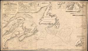
A Chart of the Coast of North America, from the Strait of Belle Isle to Boston including the Banks and Island of Newfoundland, The Gulf and River of St. Lawrence, Nova Scotia, Bay of Fundy, and c.
sold
- Digital Map Information
- Suitable for large format printing
- Full resolution TIFF file
- ICC color profile embedded
- Delivered instantly via download link
A scarce 1848 John Stratton Hobbs British blueback nautical chart or maritime map of the Canadian Maritime Provinces and the Gulf of St. Lawrence. The map covers from Labrador to Boston, including Newfoundland, Nova Scotia, Anticosti Island, and New Brunswick, as far as Cape Cod, including the entire New England coastline from Connecticut to Maine. Inset maps detail Halifax Harbor, Boston Harbor, St. John, the Island of St. Paul, Port St. Andrew, Liverpool Bay, St. Johns, and the Island of St. Pierre. Exhibit copious soundings and annotations of practical use to the mariner. (more details)
Extraordinary and rare blueback nautical chart of the East Coast.
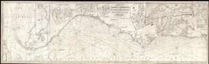
Chart of the Coast of America, from New York and Philadelphia, to the Strait or Gulf of Florida, and from thence to the Mississippi.
sold
- Digital Map Information
- Suitable for large format printing
- Full resolution TIFF file
- ICC color profile embedded
- Delivered instantly via download link
An utterly spectacular and sprawling 1850 John Williams Norie blueback nautical chart or maritime map depicting the North American coastline from New York to the Florida Keys. The map is oriented to the west, as a navigator from Europe would approach the ... (more details)
Making the Mediterranean a British Lake.
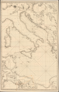
[A General Chart of the Mediterranean, Adriatic and Black Seas together with the Grecian Archipelago... Second Sheet].
sold
- Digital Map Information
- Suitable for large format printing
- File Size: 57.52 MB
- File Type: ZIP / TIFF
- ICC color profile embedded
- Delivered instantly via download link
This is John Norie's impressive, large-format 1850 nautical chart of the central Mediterranean Sea, Adriatic Sea, and Ionian Sea, covering the waters around the Italian Peninsula and the North African coasts of Tunisia and Libya. Produced late in the Age of Sail, the chart was both a product of and contributor to increasing British commercial and military dominance of the Mediterranean. (more details)
Herring Boom.
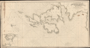
A Chart of the Coasts of Great Britain, Ireland, Frace, Spain, Portugal, and c. Showing the whole Navigation from Feroe and Orkney Isles to Gibraltar, Barcelona, Algeries, etc.
sold
- Digital Map Information
- Suitable for large format printing
- File Size: 102.58 MB
- File Type: ZIP / TIFF
- ICC color profile embedded
- Delivered instantly via download link
This is an expansive west-oriented 1858 J. H. Hobbs nautical map of the eastern Atlantic Ocean, covering England, Ireland, Scotland, the Faroe Islands, the English Channel, and the Bay of Biscay. The chart was likely intended to serve the late 19th-century British Herring Boom. (more details)
Busy but treacherous seas.
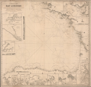
A Chart of the Bay of Biscay compiled from the latest French and Spanish surveys.
sold
- Digital Map Information
- Suitable for large format printing
- File Size: 52 MB
- File Type: ZIP / TIFF
- ICC color profile embedded
- Delivered instantly via download link
A rare 1860 blueback nautical map of the Bay of Biscay, prepared by John Stratton Hobbs and published by Charles Wilson. The Bay represents some of the worlds most active but unpredictably dangerous waters notorious for rough seas and treacherous storms. (more details)
Exceedingly rare, highly decorative, and important map of the Cape of Good Hope.
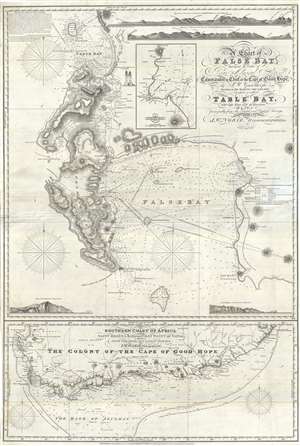
A Chart of False Bay Surveyed by Order of Rear Admiral Stopford, Commander in Chief at the Cape of Good Hope, by P. W. Gawthorpe, Master of His Majesty's Ship Lion, 1812; to which is added Table Bay, with Cape Town and its Environs.
sold
- Digital Map Information
- Suitable for large format printing
- File Size: 22.91 MB
- File Type: ZIP / TIFF
- ICC color profile embedded
- Delivered instantly via download link
A remarkable and very rare 1860 British commercial nautical chart of False Bay and the Cape of Good Hope, South Africa. Issued by John William Norie, this map is based upon surveys ordered by Sir Robert Stopford during his time as Commander-in-Chief of the Cape of Good Hope Station (1810 – 1827). The chart depicts from Robben Island south to the Cape of Good Hope and False Cape, including Rocky Bank. False Bay and the Promontory of the Cape are illustrated in full. In the vicinity of Cape Town, the map offers exceptional inland detail, identifying numerous private estates by the name of their owners, along the various rivers between Table Bay and False Bay. An inset of Simon's Bay appears in the upper right, near the title area, with important buildings identified. (more details)
Microscopic View of Trade along the Thames.
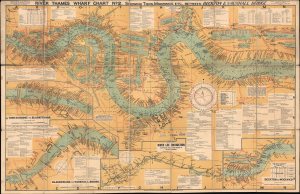
River Thames Wharf Chart No. 2 showing Tiers, Moorings Etc. between Becton and Vauxhall Bridge.
sold
- Digital Map Information
- Suitable for large format printing
- File Size: 75.94 MB
- File Type: ZIP / TIFF
- ICC color profile embedded
- Delivered instantly via download link
This is a large-format folding map and nautical chart of the River Thames in London and environs, published by Imray, Laurie, Norie, and Wilson. Cataloging individual wharves and their owners in great detail, it provides a comprehensive overview of London's bustling commercial activity in the later days of British global hegemony. (more details)