
Norman, Benjamin Moore (sold)

Benjamin Moore Norman (December 22, 1809 - February 1, 1860) was an American bookseller, publisher, and writer active in the first part of the 19th century. Norman was born in Hudson, New York, where his father William E. Norman was a local bookseller. He had a brief clerkship in New York City that he left when his father died, at which time he returned to Hudson to take over the book business. Shortly thereafter he relocated to Philadelphia and, in 1837, to New Orleans. A few years later, Norman took inspiration from the seminal archeological work of John Lloyd Stephens (1805 - 1852), who pioneered research on ancient Mayan civilization in the Yucatán. On his own reconnaissance, Norman booked traveled to the Yucatán Peninsula, where he visited and documented Valladolid, Chichén Itzá, Uxmal, and San Francisco de Campeche, among other sites. The scholarly merit of Norman's resultant works, Rambles in Yucatán (1842) and Views of Ancient Monuments in Central America, Chiapas, and Yucatan (1844) have been harshly criticized, both then and today. The work was nonetheless popular with the public, establishing Norman's financial security. By 1845 he established a bookbinding ,publishing, and printing establishment at 18 Camp Street, New Orleans. There, in 1845, he published Norman's Plan of New Orleans and Environs, an excellent map of New Orleans drawn by the Prussian surveyor Carl August Henry Möllhausen (1814 - 1882). This map was republished in 1854. In 1858, Norman partnered with the French surveyor and painter Marie Adrien Persac (1823 - 1873) to issue a phenomenal large scale real-estate map depicting the plantations of the Mississippi. The grand work, today practically unobtainable, was supposed to be one of three such maps, covering Mississippi Plantations as far north as Memphis. Norman died of pneumonia in Mississippi in 1860, just before the outbreak of the American Civil War (1861 - 1865).
Plantations along the 'Father of Waters'.
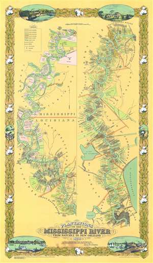
This is an attractive 1967, special edition, Joseph Anthony Aiena re-envisioning of the famous 'Persac Map' or 'Norman Map', illustrating the plantations on the Mississippi River from New Orleans to Natchez. The map is divided into two sections. The left section covers from Natchez to Baton Rouge, and the right section from Baton Rouge to New Orleans. Along the way, plantation estates are illustrated and color-coded with the owners duly named. The properties are universally long and thin, assuring all-important river access to all. The map is surrounded by a decorative cotton-themed border. (more details)