
Ogawa Tazaemon (sold) (小川多左衛門)

Ogawa Tazaemon (小川多左衛門; fl. c. 1670 - 1900) was an active publisher of books and maps based in Kyoto from the mid-Edo period to the late Meiji period. The publishing house was likely named after its founder and carried on the name after his death.
AKA: 小川多左衛門
Before the Great Kyoto Fire of 1788.
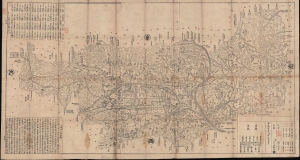
山城州大繪圖 / [Large Map of Yamashiro Prefecture].
sold
- Digital Map Information
- Suitable for large format printing
- File Size: 158.1 MB
- File Type: ZIP / TIFF
- ICC color profile embedded
- Delivered instantly via download link
This is a detailed 1778 Hyakuga large-format folding map of Kyoto, Japan, and its surrounding countryside, issued just 10 years before the Great Fire of 1788. The map includes a wealth of information on the temples and geography of Yamashiro, as well as a number of hand-drawn annotations. (more details)