
Petri, Heinrich

Heinrich Petri (1508 - 1579) and his son Sebastian Henric Petri (1545 – 1627) were printers based in Basel, Switzerland. Heinrich was the son of the printer Adam Petri and Anna Selber. After Adam died in 1527, Anna married the humanist and geographer Sebastian Münster - one of Adam's collaborators. Sebastian contracted his stepson, Henricus Petri (Petrus), to print editions of his wildly popular Cosmographia. Later Petri, brought his son, Sebastian Henric Petri, into the family business. Their firm was known as the Officina Henricpetrina. In addition to the Cosmographia, they also published a number of other seminal works including the 1566 second edition of Nicolaus Copernicus's De Revolutionibus Orbium Coelestium and Georg Joachim Rheticus's Narratio.
Münster's first map of Greece.
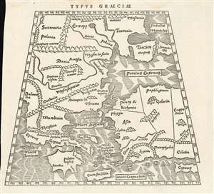
Typus Graeciae.
$600.00
Acquire
- Digital Map Information
- Suitable for large format printing
- Full resolution TIFF file
- ICC color profile embedded
- Delivered instantly via download link
This is a rare 1538 map of Greece and the region surrounding Constantinople, executed by Sebastian Münster for inclusion in his edition of Solinus' Polyhistor. It predates by two years the map of Greece in Münster's 1540 edition of Ptolemy'sGeographia, but it shares with other early maps of Greece the Ptolemaic conic projection. It is a sixteenth century woodcut showing third century geographical knowledge of the region - although at its northern extents, contemporary place names intrude. The map extends from Dalmatia in the west to Cappadocia, Cilicia and Cyprus in the east; it extends from Crete and Cyprus in the south to Poland, Muscovy and Sarmatia in Europe in the north. The Black Sea and the Meotian Swamp (the Sea of Azov) also appear. The map is boldly and legibly presented, with hachured oceans, and with mountains shown pictorially. The cities of Adrianopolis and Constantinople are marked pictorially as well, suggesting their greatness. (more details)
Desirable Edition of the Earliest Printed Map of the African Continent.
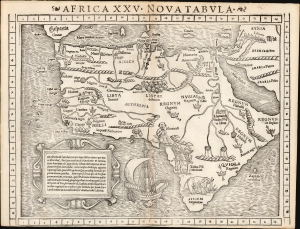
Africa XXV Nova Tabula.
$2,750.00
Acquire
- Digital Map Information
- Suitable for large format printing
- Full resolution TIFF file
- ICC color profile embedded
- Delivered instantly via download link
This is Sebastian Münster's 1540 map of Africa, the earliest detailed map of the continent available to the collector, here in the distinctive 1552 state appearing in the last edition of Münster's Ptolemy. This attractive and evocative map was broadly influential. For more than 30 years during the age of discovery, this map would be the predominant representation of Africa available to the European reader. Moreover, it is one of the last issues of this map printed during the author's lifetime. (more details)
Earliest obtainable modern map of Poland and Hungary.
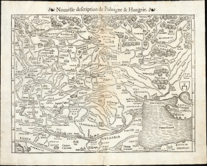
Nouvelle description de Poloigne et Hongrie.
$450.00
Acquire
- Digital Map Information
- Suitable for large format printing
- Full resolution TIFF file
- ICC color profile embedded
- Delivered instantly via download link
This is Sebastian Münster's 1540 map of Poland and Hungary, the first acquirable map to focus on the region using contemporary place names and geographical knowledge, in a French-text edition of 1556. (more details)
Earliest acquirable map of Europe based on contemporaneous knowledge.
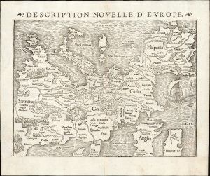
Description Nouvelle D'Europe.
$2,750.00
Acquire
- Digital Map Information
- Suitable for large format printing
- Full resolution TIFF file
- ICC color profile embedded
- Delivered instantly via download link
This is a 1556 edition of Sebastian Münster's 1540, southern-oriented map of Europe: the first acquirable map of Europe based on contemporary geographical information and the earliest acquirable derivative of Martin Waldseemüller's unobtainable 1511 map of Europe. Münster's Geographia and Cosmographia provided for many years the literate European's only glimpses of the world, and these two works contained a number of maps with previously unseen, contemporaneous knowledge of the areas they depicted. For Münster's readership, this map was almost certainly the first depiction of their home continent, not based on the 2nd-century work of Claudius Ptolemy. (more details)
Earliest acquirable map of Transylvania.
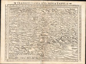
Transsylvania XXI. Nova Tabula.
$850.00
Acquire
- Digital Map Information
- Suitable for large format printing
- Full resolution TIFF file
- ICC color profile embedded
- Delivered instantly via download link
This is a superb example of Sebastian Münster's modern map of Transylvania (part of modern-day Romania) in the desirable 1552 Geographia edition, the only one to include distinctive coordinate borders. It is the earliest acquirable derivative of Johannes Honter's foundational 1532 map of his homeland, Chorographia Transylvaniae. Sybembürgen. Honter's work, a woodcut printed on two sheets, was the first printed map of Transylvania, but Honter was dissatisfied with his work and suppressed it, resulting in the survival of only a single example. Münster's single-sheet copy of Honter's map, first appearing in the 1544 edition of Cosmographia, is thus the earliest acquirable iteration of the first map of this region. (more details)
First Printed Modern Map of Asia.
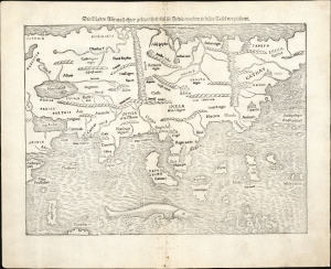
Die Laender Asie nach ihrer gelegenheit biss in India werden in diser Tafel verzeichnet.
$2,000.00
Acquire
- Digital Map Information
- Suitable for large format printing
- Full resolution TIFF file
- ICC color profile embedded
- Delivered instantly via download link
This is a 1574 strike of Sebastian Münster's 1540 map of Asia, the first printed map of that continent based on contemporary data and the earliest obtainable map of the continent overall. The map depicts the Asian continent from the Caspian Sea and the Persian Gulf to the Pacific Ocean and from the Arctic Ocean to the Indian Ocean. Although the interior detail is based heavily on Ptolemy, Münster also blends in information gleaned from recent discoveries by Portuguese traders and adventurers, including Vasco da Gama (c. 1460 - 1624). Both the Portuguese outposts of Goa and Calicut, on the Indian subcontinent, are labeled, and the depiction of India is improved, moving closer to a truly accurate depiction, although still undersized. The inclusion of Sri Lanka (Zaylon) as an island is also an improvement; Münster applies Ptolemy's historical name for Sri Lanka - Taprobana - to Sumatra, which is placed correctly to the west of the Malay peninsula. (more details)
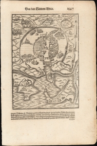
Eternal City, Evocatively Presented.
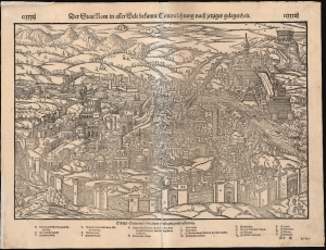
Der Statt Rom in aller Welt bekannt Contrafehtung nach jetziger gelegenheit.
$400.00
Acquire
- Digital Map Information
- Suitable for large format printing
- Full resolution TIFF file
- ICC color profile embedded
- Delivered instantly via download link
This is Sebastian Münster's lively 1550 bird's-eye view of Rome, Italy, among the earliest roughly contemporaneous depictions of the city. The woodcut presents the walled city with its churches, universities, and palaces, along with classical ruins. Twenty of these structures are keyed to a list at the bottom of the woodcut, but still more, such as triumphal columns, the famed Colosseum, and the city aqueducts, can be recognized. St. Peter's Cathedral and the Papal Palace are marked. (more details)
The Earliest Collectible Printed Image of Belgrade.
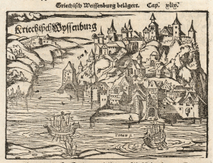
Kriechisch Wyssenburg.
$500.00
Acquire
- Digital Map Information
- Suitable for large format printing
- Full resolution TIFF file
- ICC color profile embedded
- Delivered instantly via download link
This is the 1550 Sebastian Münster woodcut view of Belgrade - the earliest obtainable printed image of that city. (more details)
Earliest Printed View of Geneva.
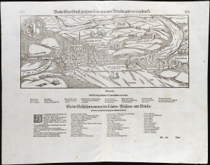
Beyde stett Genff, gross und klein, mit einer Brucken zusammen gehenckt.
$450.00
Acquire
- Digital Map Information
- Suitable for large format printing
- Full resolution TIFF file
- ICC color profile embedded
- Delivered instantly via download link
This is an edition of Sebastian Münster's 1550 prospect of Geneva, Switzerland. It presents the first accurate glimpse of the 'Protestant Rome,' the seat of the Reformation in Europe. It is the earliest version of the earliest printed image of Geneva based on actual observation. (more details)
First edition of the earliest acquirable view of Worms am Rhine.
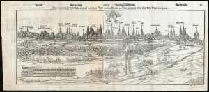
Ware abcontrafactur der loblichen/alten und des heiligen Reichs frei statt Wormbs am Rhein gelegen/so bei den alten Urbs Vangionum genant.
$450.00
Acquire
- Digital Map Information
- Suitable for large format printing
- Full resolution TIFF file
- ICC color profile embedded
- Delivered instantly via download link
This Sebastian Münster's lively, panoramic 1550 view of Worms, Germany, here in its first edition representing the earliest acquirable printed image of the religiously significant imperial free city. (more details)
Earliest Printed Image of Riga.
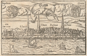
Riga.
$500.00
Acquire
- Digital Map Information
- Suitable for large format printing
- File Size: 5.42 MB
- File Type: ZIP / TIFF
- ICC color profile embedded
- Delivered instantly via download link
This is the 1550 / 1572 Sebastian Münster woodcut view of Riga, Latvia - the earliest printed image of that city and one of the only glimpses of the city as it was prior to the great fire that destroyed the city in 1547. It represents the standard view of the city for about a century. (more details)
The Earliest Printed Image of Besançon, France.
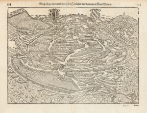
Warhafftige abcontrafehtung der Herzlichen und Beruempten Statt Bisantz.
$325.00
Acquire
- Digital Map Information
- Suitable for large format printing
- Full resolution TIFF file
- ICC color profile embedded
- Delivered instantly via download link
This lively and remarkably accurate woodcut bird's eye view of Besançon, France, is the earliest acquirable printed image of that city. (more details)
Earliest Acquirable Image of Tunis, Tunisia.
[Untitled plan of Tunis and fort of Goleta, Tunisia.]
$500.00
Acquire
- Digital Map Information
- Suitable for large format printing
- Full resolution TIFF file
- ICC color profile embedded
- Delivered instantly via download link
Sebastian Münster's woodcut view of Tunis, Tunisia, is the earliest acquirable printed image of that city based on contemporaneous information, resulting from Charles V's 1535 siege of the Tunisian port. (more details)
Antwerp pictured prior to the Spanish Fury.
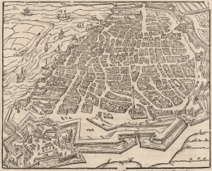
[Bird's-Eye View of Antwerp.]
$300.00
Acquire
- Digital Map Information
- Suitable for large format printing
- DPI: 600
- File Size: 16.38 MB
- File Type: ZIP / TIFF
- ICC color profile embedded
- Delivered instantly via download link
This detailed bird's-eye view of Antwerp is among the earliest printed images of the city. This woodcut first appeared in the 1574 German edition of Sebastian Münster's Cosmographia. It is a careful miniature of the 1572 view printed in Cologne by Braun and Hogenberg, the first of two views of that city appearing in their Civitates Orbis Terrarum. Both were drawn by Joris Hoefnagel, who was a native of the city, here shown on the River Schelde as it stood in the first part of the Eighty Years’ War (1568 - 1648). While it was at the heart of the Dutch Revolt, it was also the seat of Spanish power in the Low Countries. This is evidenced by the fort, built by the Grand Duke of Alba, commanding the southern approaches to the city. Within Antwerp's city walls are the Cathedral, town hall, Grote Markt, and fish market. The portrait below the view is Fernando Álvarez de Toledo y Pimentel, 3rd Duke of Alba (1507 – 1582), known as the Grand Duke of Alba whose bloody but ultimately futile repression failed to suppress the Dutch Revolt. (In 1576, two years after the first appearance of this view, Spanish forces visited the Spanish Fury on the city in the infamous Sack of Antwerp, then the greatest massacre in the history of the Low Countries.) The text describes the great statue of himself that the Grand Duke had erected in his new fortress, including the text of the statue's plaque, both in Latin and German. The spear-carrying statue can be seen in the middle of the fort. Following the sack of the city by the Spanish in 1576, Antwerp's citizens destroyed the statue. (It is conspicuously absent in Hoefnagel's 1596 view). (more details)
A Detailed Diagram of a Late Medieval Siege.
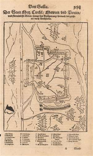
Der Statt Metz circkel, Mauren und porten, und fürnemste baüw, sampt der belaegerung, hienach verzeichnet durch bůchstaben.
$200.00
Acquire
- Digital Map Information
- Suitable for large format printing
- DPI: 600
- File Size: 10.87 MB
- File Type: ZIP / TIFF
- ICC color profile embedded
- Delivered instantly via download link
This fascinating woodcut is a plan of the Habsburg siege of the French city of Metz (October 1552 - January 1553). It appeared in editions of Sebastian Münster's Cosmographia beginning in 1554, added to that work by its publisher Heinrich Petri. The plan illustrates the outline of the walled city, its surrounding rivers and roads, its principal structures (including the great Cathedral,) and the encampments of the besieging Imperial armies. (more details)
Münster's Map of the Upper Rhine.
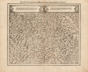
Die erste Tafel innhaltend das Schweytzerlandt/ mit den anstossenden Laendern.
$300.00
Acquire
- Digital Map Information
- Suitable for large format printing
- DPI: 600
- File Size: 36.49 MB
- File Type: ZIP / TIFF
- ICC color profile embedded
- Delivered instantly via download link
This is Sebastian Münster's map of the northern part of Switzerland and the sources of the Rhine, re-engraved for inclusion in the 1588 edition of his Cosmographey. Among the many cities and towns are Berne, Basel, Konstans, Lucerne, and Friburg. (more details)
Striking Woodcut map of Greece.
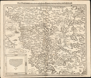
New Griechenlandt mit andern anstossenden Laendern wie es zu unsern zeiten beschriben ist.
$350.00
Acquire
- Digital Map Information
- Suitable for large format printing
- Full resolution TIFF file
- ICC color profile embedded
- Delivered instantly via download link
This evocative map of Greece and the Greek Islands was added to Münster's Cosmographia in 1588 as part of Sebastian Petri's extensive update of the work, presenting a state-of-the-art mapping of the region. (more details)
The second earliest acquirable printed view of Lisbon.
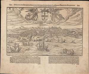
Olisiponis oder Lisbonae der Fuernemmen und wegendes gewaltigen Kauffmanns Gewerb so allda getreiben weitbekandten Statt in Spanien wahre abcontrafactur.
$850.00
Acquire
- Digital Map Information
- Suitable for large format printing
- Full resolution TIFF file
- ICC color profile embedded
- Delivered instantly via download link
This is an attractive 1598 S. Münster woodcut view of the Portuguese city of Lisbon, one of the earliest acquirable. It displays the famous city, emphasizing the busy wharves of this essential port, and many ships coming and going. This is an example of the earliest Münster edition of this view, which is nevertheless among the last views added to Münster's work. It was printed in the 1598 German edition of Cosmographia, consequently it is one of the scarcest views from this work, having only appeared in its last three editions of 1598, 1614 and 1628. (more details)
One of the earliest contemporaneous depictions of Jerusalem.
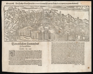
Die heylige Statt Ierusalem / contrafehtet nach Form und Gestallt wie sie zu unsern zeiten erbawen ist.
$750.00
Acquire
- Digital Map Information
- Suitable for large format printing
- Full resolution TIFF file
- ICC color profile embedded
- Delivered instantly via download link
One of the earliest printed views of Jerusalem, executed in woodcut by Jacob Clauser for Sebastian Munster's Cosmographia, from a 1598 German edition. Unlike most early depictions, this bird's-eye view is not a purely retrospective depiction of the ancient city but rather a modern view, showing the city at the time of publication. As explained in the view's title, it is meant to depict the Holy City in the 'form and shape as it was built in our times'. In its initial 1550 printing, this was one of the earliest contemporaneous images of the city. (more details)
Elegant Woodcut Map of Africa.
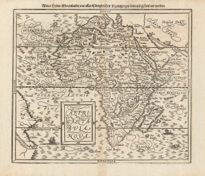
Affricae Tabula Nova. / Africa, Lybia, Morenlandt, mit allen Koenigreichen, so jetziger zeit darumb gefunden werden.
$950.00
Acquire
- Digital Map Information
- Suitable for large format printing
- DPI: 600
- File Size: 31.5 MB
- File Type: ZIP / TIFF
- ICC color profile embedded
- Delivered instantly via download link
This is the second map of Africa to appear in Sebastian Münster's Cosmographia, added to the work in 1588. This beautiful woodcut is cartographically derived from Abraham Ortelius' 1570 map of the continent, the best and most widespread general map of Africa of the 16th century. (more details)
Birthplace of the Renaissance.
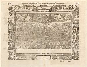
Figur und gelegenheit Edlen und hochberhuempten Statt Floretz.
$350.00
Acquire
- Digital Map Information
- Suitable for large format printing
- Full resolution TIFF file
- ICC color profile embedded
- Delivered instantly via download link
This is a woodcut view of Florence, Italy, included in Sebastian Münster's Cosmographei of 1614. A hub of medieval European trade and finance, Florence was among the wealthiest cities of the fifteenth century and is considered the birthplace of the Renaissance. An architectural and artistic treasure, Florence has been since 1982 a UNESCO World Heritage Site. Consequently, the 16th century city presented here is quite recognizable: the medieval walled city is bisected by the Arno, with four bridges spanning the flood. The Duomo, the baptistery of San Giovanni, and the Campanile are all easily found.
Despite the late date of this example, it was one of the earliest printed views of the city. At the time of its addition to the work in 1572, it was preceded in print only by the view from Hartmann Schedel's 1493 Liber chronicarum and the 1550 view in Münster's Cosmographia which the present work replaced. The same year of 1572 saw the publication of Braun and Hogenberg's city book, which also included a view of Florence - but the two have no resemblance, and one is not a copy of the other. Münster's publishers and heirs, Heinrich and Sebastian Petri, appear to have used the author's original map as the model for this woodcut. The main changes to that view are decorative elements: the ornate border woodcuts, the two winged Victories presenting the city with laurels, and (top and center,) the city coat of arms, flanked by two women with palm branches: also avatars of triumph. (more details)
Despite the late date of this example, it was one of the earliest printed views of the city. At the time of its addition to the work in 1572, it was preceded in print only by the view from Hartmann Schedel's 1493 Liber chronicarum and the 1550 view in Münster's Cosmographia which the present work replaced. The same year of 1572 saw the publication of Braun and Hogenberg's city book, which also included a view of Florence - but the two have no resemblance, and one is not a copy of the other. Münster's publishers and heirs, Heinrich and Sebastian Petri, appear to have used the author's original map as the model for this woodcut. The main changes to that view are decorative elements: the ornate border woodcuts, the two winged Victories presenting the city with laurels, and (top and center,) the city coat of arms, flanked by two women with palm branches: also avatars of triumph. (more details)
One of the scarcest plans of Gdansk.
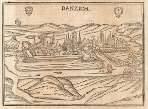
Danzich.
$450.00
Acquire
- Digital Map Information
- Suitable for large format printing
- Full resolution TIFF file
- ICC color profile embedded
- Delivered instantly via download link
This is a very scarce woodcut 1628 Münster/Petri view of Gdansk, Poland's primary seaport. It appeared in only one edition of Münster's Cosmographia and is one of the earliest acquirable views of the city. Only the Braun and Hogenberg view upon which this view is based preceded it, and Braun and Hogenberg's work appears to have survived in much greater numbers. (more details)
Age of Discovery.
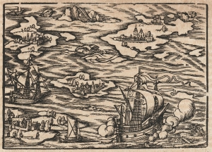
[Archipelago].
$400.00
Acquire
- Digital Map Information
- Suitable for large format printing
- Full resolution TIFF file
- ICC color profile embedded
- Delivered instantly via download link
This is a 1628 Sebastian Münster woodcut illustrating islands, ships, and sea monsters. It appeared in Sebastian Münster's Cosmographia beginning in 1550 and appears here in a late German-text edition. (more details)