
Phinn, Thomas (sold)

Thomas Phinn (March 1728 - 1771) was a Scots engraver and illustrator. He worked for William Jeffrey and produced a number of maps for The Scots Magazine and the Edinburgh Magazine, and a variety of other publications.
Frontier of the French and Indian War.
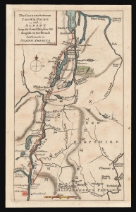
The Country between Crown Point and Albany being the Great Pass from the English to the French Settlements in North America.
sold
- Digital Map Information
- Suitable for large format printing
- DPI: 600
- File Size: 4.83 MB
- File Type: ZIP / TIFF
- ICC color profile embedded
- Delivered instantly via download link
This is a rare 1858 map of a key theatre of the French and Indian War, engraved by Thomas Phinn in Edinburgh to satisfy readers hungry for news. Although of broader scope, it is remarkable in pre-dating the famous Brasier map of Lakes Champlain and George, the earliest separate map specifically of those lakes. The Brasier surveys began after the publication of the present map. (more details)