
Politano, Theodore M. (sold)

Theodore M. Politano (March 26, 1901 - September 18, 1968) was an American draftsman and cartographer. Politano started working as a draftsman in New York in 1915 and 'gradually drifted' into mapmaking. In 1940, Politano worked as a draftsman at the Westchester County Planning Commission in White Plains, New York. Politano moved to Florida in 1947 worked with Frank B. Dolph (October 3, 1897 - November 26, 1975) and the Frank B. Dolph Map Company in Ft. Lauderdale, Florida.
Real Estate in 1950s Fort Lauderdale.
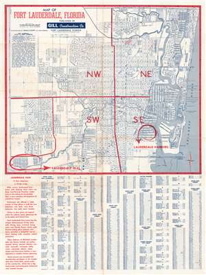
This is a c. 1954 Theodore Politano city plan or map of Fort Lauderdale, Florida. Streets throughout the city are illustrated and labeled. Schools, parks, the city incinerator, City Hall, and the county courthouse are identified. The Lauderdale Drive-In Theatre is also labeled, as are the city ballpark and the city water department. As this map was created to promote Lauderdale Harbors and Lauderdale Isles, two housing developments under construction by the Gill Construction Company, both developments are circled in red and prominently labeled with red block letters. (more details)