
Progressive Map Service (sold)
The Progressive Map Service (fl. c. 1910 - c. 1945) was a American map publishing company active in Fresno, California, during the first half of the 20th century. The firm, which was owned and run by Dan W. Chamberlin, specialized in southern California city and county maps. Most of their maps are a synthesis of government, county and private survey work. Unfortunately, little is known of Chamberlin or the company's operations.
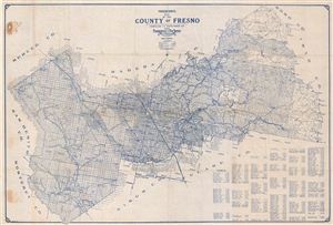
Progressive Map of the County of Fresno.
sold
- Digital Map Information
- Suitable for large format printing
- File Size: 30.62 MB
- File Type: ZIP / TIFF
- ICC color profile embedded
- Delivered instantly via download link
An appealing c. 1920 map of Fresno County, California by the Progressive Map Service. Printed in blue ink, this pocket map covers all of Fresno County broken up into land plats by the state survey. The city of Fresno is located at center. Today, Fresno is ... (more details)