
Rau, Jacob (sold)

Jacob Rau (1821 - ????) was a New York based engraver and lithographer who advertised himself as a 'practical lithographer.' He was born in Holstein, Germany and emigrated to New York between 1848 an 1850, likely fleeting repercussions from involvement in the Revolutions of 1848, making him a 48er. He maintained offices at 333 Broadway and later at 381 Pearl Street, where he published works in association with others from the German-American immigrant community, most prominent among them Gustav Kraetzer (1822 - 1901). Rau published maps, views, advertising, and books. He has some association with the Nicaraguan-German civil engineer Maximilian von Sonnenstern (1819 - 1895), also a 48er from Württemberg, for whom he published several seminal maps. From 1864 he was associated with Edward Valois, also a lithographer, with whom he published under the imprint of 'Valois and Rau.' His production seems to have stopped in the late 1860s.
The first official map of Guatemala! A cornoerstone piece for Central American 'Decolonization'!
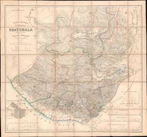
Mapa General de la Republic de Guatemala.
sold
- Digital Map Information
- Suitable for large format printing
- File Size: 79.73 MB
- File Type: ZIP / TIFF
- ICC color profile embedded
- Delivered instantly via download link
A seminal production, this 1959 map by Maximilian von Sonnenstern and August van de Gehüchte is the first official map of Guatemala and a key document associated with Guatemalan independence. The map was commissioned by first president of Guatemala, Rafael Carrera Turcios (1814 - 1865), and is the first broadly accurate meticulously detailed map of that country. The enduring legacy of this map includes its role in establishing and legitimizing Guatemala, as well as its significant evidentiary rule in subsequent Guatemalan boundary disputes and negotiations. In addition, this is the first to accurately map Guatemala's many important Mayan ruins. (more details)
'There is not in the wide world a valley so sweet' - Thomas Moore
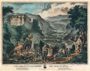
The Meeting of the Waters and Vale of Avoca.
sold
- Digital Map Information
- Suitable for large format printing
- File Size: 51.88 MB
- File Type: ZIP / TIFF
- ICC color profile embedded
- Delivered instantly via download link
This is a scarce 1867 lithograph view illustrating the idyllic 'Meeting of the Waters' in the 'Vale of Avoca', County Wicklow, Ireland. The tranquil and bucolic scene features picknickers and hikers admiring the beautiful flowing waters while women gather buckets of the famously delicious water. Castle Howard's iconic towers rise in the background. The Meeting of the Water is formed by the conjunction of the Avonmore and Avonbeg Rivers - the great and little rivers. Today the Vale remains popular with hikers and outdoor enthusiasts. (more details)