
Roberts, Charles (sold)

Charles Roberts (1739 - 1825) was a British navigator and nautical surveyor active in the late 18th century. Roberts spent most of his life in the British West Indies and along the coasts of South America where is compiled and updated several nautical charts during his long career as a Master in the Royal Navy. He is specifically credited with three scarce charts focusing on various passages in the Greater Antilles. Rogers did most of his observational work among merchant vessels traversing the West Indies and personally records at least 24 such voyages. Roberts died at Leith in 1825 at the age of 86.
Scarce nautical chart of the Windward Passage, a popular hunting ground for Caribbean pirates and privateers.
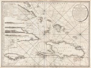
A Chart of the Windward Passage Between the Islands of Jamaica Hispaniola and Cuba with the other Passages to the Northwest of Hispaniola.
sold
- Digital Map Information
- Suitable for large format printing
- DPI: 300
- File Size: 29.95 MB
- File Type: ZIP / TIFF
- ICC color profile embedded
- Delivered instantly via download link
A mesmerizing and extremely scarce 1795 Charles Roberts nautical chart of the Windward Passage, between Cuba and Hispaniola (Santo Domingo), in the Greater Antilles, West Indies. Centered on Great Iguana Island (Le Mornet or Grand Inague) in the modern day ... (more details)