
Robiquet, Aimé (sold)

Aimé Robiquet (18xx - 18xx) was a French hydrographer and publisher of nautical charts active in the middle part of the 19th century. Little is known of his life, but he was most active as a chartmaker between 1851 and 1865, with several of his charts being reprinted well into the 1870s. He may have gone to sea in the 1860s, but his is unclear. Robiquet's privately published charts were considered among the finest of their generation. His greatest work is the Atlas Hydrographique, a 75-chart elephant folio nautical atlas published in Paris between 1856 and 1861. His offices were located at Rue Pavée Saint Andre No.2. Paris 1856.
Finest mid-19th century French charting of the American East Coast.
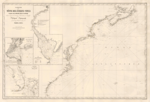
Carte de la Côte des États-Unis Comprise entre la Nouvelle-Ecosse et la Floride.
sold
- Digital Map Information
- Suitable for large format printing
- File Size: 33.22 MB
- File Type: ZIP / TIFF
- ICC color profile embedded
- Delivered instantly via download link
This is Aimé Robiquet's rare 1853 first-edition separately-issued nautical map of the eastern seaboard of the United States, including the Canadian Maritime Provinces. The map captures French interest and trade with the United States, particularly the southern states, in the decade-long lead-up to the American Civil War (1861 - 1865). American raw materials - cotton, tobacco, and grains - were in high demand in France while French luxury goods were de rigour among the Antebellum elite. (more details)
Sailing to Australia for the Victoria Gold Rush!
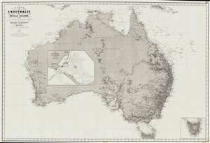
Carte de L'Australie ou Nouvelle Hollande, dressée d'aprés les derniers documents Anglais part Robiquet, Hydrographe, Paris.
sold
- Digital Map Information
- Suitable for large format printing
- File Size: 88.54 MB
- File Type: ZIP / TIFF
- ICC color profile embedded
- Delivered instantly via download link
A fine and exquisitely detailed 1863 first edition of Aimé Robiquet's privately published nautical chart or maritime map of Australia. Covering all of Australia, with Tasmania represented as an inset, this map was published to capitalize on navigation to Melbourne associated with the Victoria Gold Rush - hence the large inset of Port Phillip, the access point to Melbourne and the wealth lying just inland. Robiquet compiled this chart from the most up-to-date English sources, with several modifications and additions of his own to increase accuracy. (more details)