
Sanson, Nicolas
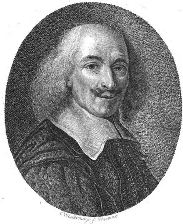
Nicolas Sanson (December 20, 1600 - July 7, 1667) and his descendants were the most influential French cartographers of the 17th century and laid the groundwork for the Golden Age of French Cartography. Sanson was born in Picardy, but his family was of Scottish Descent. He studied with the Jesuit Fathers at Amiens. Sanson started his career as a historian where, it is said, he turned to cartography as a way to illustrate his historical studies. In the course of his research some of his fine maps came to the attention of King Louis XIII who, admiring the quality of his work, appointed Sanson Geographe Ordinaire du Roi. Sanson's duties in this coveted position included advising the king on matters of geography and compiling the royal cartographic archive. In 1644, he partnered with Pierre Mariette, an established print dealer and engraver, whose business savvy and ready capital enabled Sanson to publish an enormous quantity of maps. Sanson's corpus of some three hundred maps initiated the golden age of French mapmaking and he is considered the 'Father of French Cartography.' His work is distinguished as being the first of the 'Positivist Cartographers,' a primarily French school of cartography that valued scientific observation over historical cartographic conventions. The practice result of the is less embellishment of geographical imagery, as was common in the Dutch Golden Age maps of the 16th century, in favor of conventionalized cartographic representational modes. Sanson is most admired for his construction of the magnificent atlas Cartes Generales de Toutes les Parties du Monde. Sanson's maps of North America, Amerique Septentrionale (1650), Le Nouveau Mexique et La Floride (1656), and La Canada ou Nouvelle France (1656) are exceptionally notable for their important contributions to the cartographic perceptions of the New World. Both maps utilize the discoveries of important French missionaries and are among the first published maps to show the Great Lakes in recognizable form. Sanson was also an active proponent of the insular California theory, wherein it was speculated that California was an island rather than a peninsula. After his death, Sanson's maps were frequently republished, without updates, by his sons, Guillaume (1633 - 1703) and Adrien Sanson (1639 - 1718). Even so, Sanson's true cartographic legacy as a 'positivist geographer' was carried on by others, including Alexis-Hubert Jaillot, Guillaume De L'Isle, Gilles Robert de Vaugondy, and Pierre Duval.
Jesuit knowledge of the China and Korea.
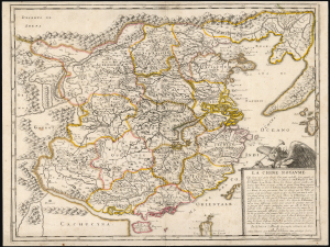
La Chine Royaume.
$2,000.00
Acquire
- Digital Map Information
- Suitable for large format printing
- Full resolution TIFF file
- ICC color profile embedded
- Delivered instantly via download link
This is Nicolas Sanson's 1656 map of China and Korea, here in its 1679 edition published by Sanson’s son, Guillaume Sanson. Although Sanson credits a notional 'Matheo Neroni' as his source, it is almost certainly Matteo Ricci, the Jesuit missionary and cosmographer, who composed an important map in 1588 based on Chinese sources. The map is notable for its unusual, sickle-shaped mapping of Korea, resulting from Ricci’s attempts to reconcile Chinese sources. (more details)
Kyiv after Beauplan's Firsthand Survey. During the Russo-Polish War (1654 - 1667).
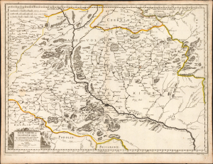
Basse Volhynie, ou Palatinate de Kiow.
$2,000.00
Acquire
- Digital Map Information
- Suitable for large format printing
- Full resolution TIFF file
- ICC color profile embedded
- Delivered instantly via download link
This is a beautifully engraved 1665 map of central Ukraine by Nicolas Sanson. Published during the Russo-Polish War (1654 - 1667), it is the earliest French iteration of the geography of Franco-Polish cartographer, engineer, and architect Guillaume Levasseur de Beauplan. Beauplan produced the best 17th-century survey of the Dniepr and laid the foundation for the modern mapping of Ukraine. (more details)
A Grand North America with California as an island and a speculative Great Lakes.
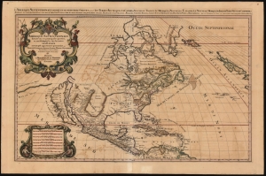
Amerique septentrionale divisée en ses principales parties, ou sont distingués les vns des autres les estats suivant qu'ils appartiennent presentemet aux Francois, Castillans, Anglois, Suedois, Danois, Hollandois, tirée des relations de toutes ces nations par le S. Sanson, geographe ordinaire du roy. 1692.
$3,000.00
Acquire
- Digital Map Information
- Suitable for large format printing
- File Size: 45.47 MB
- File Type: ZIP / TIFF
- ICC color profile embedded
- Delivered instantly via download link
This is Alexis-Hubert Jaillot's impressive and scarce 1692 map of North America. The map offers much of interest, including a bold presentation of California as an Island, evidence of otherwise unpublished preliminary data from the 1673 Marquette-Joliett Expedition of the upper Mississippi watershed, a hopeful open-ended mapping of the western Great Lakes, and a large apocryphal freshwater sea in Appalachia. (more details)
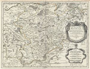
Le Duche de Westphalie ainsi qu'il est presentement possede par L'Eslecteur De Cologne.
$550.00
Acquire
- Digital Map Information
- Suitable for large format printing
- DPI: 300
- File Size: 15.23 MB
- File Type: ZIP / TIFF
- ICC color profile embedded
- Delivered instantly via download link
This is a fine 1681 map of Westphalia, Germany by Alexis-Hubert Jaillot. It covers the Westphalia region in northwest Germany from Hamm south to Ferndorf and from Wipperfurth east as far as Menne. The map renders the entire region in extraordinary detail offering ... (more details)
French Mapping of Morocco for a Dutch Audience.
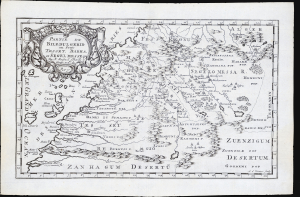
Partie du Biledulgerid ou sont Tesset, Darha, et Segelmesse...
$300.00
Acquire
- Digital Map Information
- Suitable for large format printing
- File Size: 4.67 MB
- File Type: ZIP / TIFF
- ICC color profile embedded
- Delivered instantly via download link
This is Nicolas Sanson's 1656 map of Morocco and its surrounding regions in northwestern Africa, reengraved for its 1683 first Dutch edition. (more details)
French mapping of Siam, Malaya and Cochinchina.
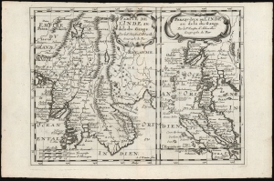
Partie de l'Inde au delà du Gange/ Presqu-Isle de L'Inde au delà du Gange.
$350.00
Acquire
- Digital Map Information
- Suitable for large format printing
- DPI: 600
- File Size: 12.06 MB
- File Type: ZIP / TIFF
- ICC color profile embedded
- Delivered instantly via download link
These, on one sheet, are Nicolas Sanson's 1653 maps of Southeast Asia, here re-engraved for its first Dutch edition of 1683. Coverage includes Siam (Thailand), Vietnam, Cambodia, Laos, Burma, Malaya, and parts of China and Sumatra, a region then generally known as 'India beyond the Ganges. (more details)
French Mapping of Africa for a Dutch Audience.
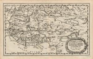
Afrique ou Libie Ulterieure ou sont Le Saara ou Desert. Le Pays des Negres La Guinée, etc. Par N. Sanson Geogr'. ordinaire du Roy.
$300.00
Acquire
- Digital Map Information
- Suitable for large format printing
- DPI: 600
- File Size: 11.35 MB
- File Type: ZIP / TIFF
- ICC color profile embedded
- Delivered instantly via download link
This is Nicolas Sanson's 1656 map of western Africa, reengraved for its first Dutch edition of 1683. (more details)
An Attractive French Map of India.
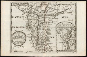
Presqu'Isle de l'Inde deça la Gange, ou sont les Royaumes, de Decan, de Golconde dd Bisnagar, et le Malabar. Par N. Sanson d'Abbeville le Geographe du Roy.
$300.00
Acquire
- Digital Map Information
- Suitable for large format printing
- DPI: 600
- File Size: 11.25 MB
- File Type: ZIP / TIFF
- ICC color profile embedded
- Delivered instantly via download link
This is Nicolas Sanson's 1653 map of the Indian Peninsula, reengraved for its first Dutch edition of 1683. (more details)
French mapping of the Spice Islands.
![1683 Sanson Map of the East Indies w/ the Spice Islands [Maluku Islands, Indonesia]](/mm5/graphics/00000001/M/Moluccas-sanson-1683-M.jpg "1683 Sanson Map of the East Indies w/ the Spice Islands [Maluku Islands, Indonesia]")
Les Isles Molucques; Celebes, Gilolo etc. Par le Sr. Sanson d'Abbeville, Geogr. du Roy.
$400.00
Acquire
- Digital Map Information
- Suitable for large format printing
- DPI: 600
- File Size: 3.9 MB
- File Type: ZIP / TIFF
- ICC color profile embedded
- Delivered instantly via download link
This is Nicolas Sanson's 1653 map of the East Indies, and specifically of the Maluku Islands, known then as the Moluccas or Spice Islands, here in its 1683 first Dutch edition. It covers the islands between Borneo and New Guinea, and includes inset maps of the Molucca Islands, Bachian Island, and Banda Island. (more details)
Classic Dutch World, updated French Cartography.
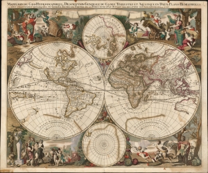
Mappe-Monde Geo-Hydrographique, ou Description Generale Du Globe Terrestre et Aquatique En Deux-Plans-Hemispheres
$6,500.00
Acquire
- Digital Map Information
- Suitable for large format printing
- File Size: 28.15 MB
- File Type: ZIP / TIFF
- ICC color profile embedded
- Delivered instantly via download link
This is a striking, original color example of Gerard Valk's classic 1686 double hemisphere map of the world. The map combines the aesthetics of the Dutch Golden Age with the superior French cartography of Nicolas Sanson. (more details)
Magnificent Seventeenth-Century Asia.
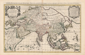
L'Asie diviseé en ses Principales Regions, et ou se peut voir l'estendue Des Empires, Monarchies, Royaumes et Estats qui partagent présentement L'Asie.
$1,500.00
Acquire
- Digital Map Information
- Suitable for large format printing
- DPI: 600
- File Size: 112.68 MB
- File Type: ZIP / TIFF
- ICC color profile embedded
- Delivered instantly via download link
This is a beautiful example of Hubert Jaillot's two-sheet map of Asia in its 1696 Mortier issue. While fundamentally based on Nicolas Sanson's mapping of the continent, the map has been updated to reflect advances in European knowledge of the Far East. Moreover, Jaillot's background as a sculptor has resulted in the artfully engraved cartouches which grace this work. (more details)
French Cartography and Dutch Decorative Engraving.
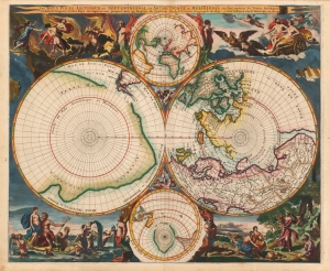
Les Deux Poles Arctique ou Septentrional, et Antarctique ou Meridional, ou Description des Terres Arctiques et Antarctiques ; et des Pays circomvoisins jusques aux 45. Degres de Latitude.
$4,000.00
Acquire
- Digital Map Information
- Suitable for large format printing
- Full resolution TIFF file
- ICC color profile embedded
- Delivered instantly via download link
This is a beautiful example of Peter Mortier's 1696 double-hemisphere map of the northern and southern hemispheres. The primary hemispheres focus on the northern and southern thirds of the world. The secondary hemispheres show the entire world, centered respectively on Paris and its antipodes. (more details)
Italian Edition of a Seminal Map of America.
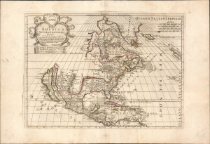
America Settentrionale.
$4,500.00
Acquire
- Digital Map Information
- Suitable for large format printing
- Full resolution TIFF file
- ICC color profile embedded
- Delivered instantly via download link
This is the rare, 1700 first state of Paolo Petrini's map of North America, produced by the Neopolitan map publisher for inclusion in his Atlante Partenopeo. It presents North America, including the Maritimes, the West Indies, and Central America. The work was derived from the authoritative cartography of the French mapmaker Nicolas Sanson, whose 1669 map of North America provided the basis for this Italian edition. (more details)