
Sanson, Nicolas (sold)
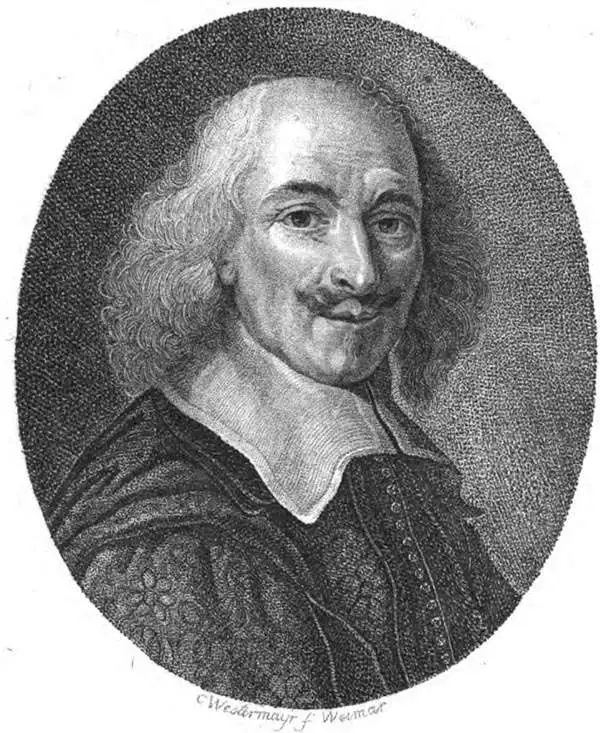
Nicolas Sanson (December 20, 1600 - July 7, 1667) and his descendants were the most influential French cartographers of the 17th century and laid the groundwork for the Golden Age of French Cartography. Sanson was born in Picardy, but his family was of Scottish Descent. He studied with the Jesuit Fathers at Amiens. Sanson started his career as a historian where, it is said, he turned to cartography as a way to illustrate his historical studies. In the course of his research some of his fine maps came to the attention of King Louis XIII who, admiring the quality of his work, appointed Sanson Geographe Ordinaire du Roi. Sanson's duties in this coveted position included advising the king on matters of geography and compiling the royal cartographic archive. In 1644, he partnered with Pierre Mariette, an established print dealer and engraver, whose business savvy and ready capital enabled Sanson to publish an enormous quantity of maps. Sanson's corpus of some three hundred maps initiated the golden age of French mapmaking and he is considered the 'Father of French Cartography.' His work is distinguished as being the first of the 'Positivist Cartographers,' a primarily French school of cartography that valued scientific observation over historical cartographic conventions. The practice result of the is less embellishment of geographical imagery, as was common in the Dutch Golden Age maps of the 16th century, in favor of conventionalized cartographic representational modes. Sanson is most admired for his construction of the magnificent atlas Cartes Generales de Toutes les Parties du Monde. Sanson's maps of North America, Amerique Septentrionale (1650), Le Nouveau Mexique et La Floride (1656), and La Canada ou Nouvelle France (1656) are exceptionally notable for their important contributions to the cartographic perceptions of the New World. Both maps utilize the discoveries of important French missionaries and are among the first published maps to show the Great Lakes in recognizable form. Sanson was also an active proponent of the insular California theory, wherein it was speculated that California was an island rather than a peninsula. After his death, Sanson's maps were frequently republished, without updates, by his sons, Guillaume (1633 - 1703) and Adrien Sanson (1639 - 1718). Even so, Sanson's true cartographic legacy as a 'positivist geographer' was carried on by others, including Alexis-Hubert Jaillot, Guillaume De L'Isle, Gilles Robert de Vaugondy, and Pierre Duval.
Rise of French cartography.
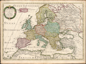
L'Europe par le Sr. Sanson d'Abbeville Geographe du Roy A Paris Chez l'Autheur et Chez Pierre Mariette Rue St. Iacques a L'Esperamnce Avec privil. du Roy Pour 20 Ans.
sold
- Digital Map Information
- Suitable for large format printing
- File Size: 25.15 MB
- File Type: ZIP / TIFF
- ICC color profile embedded
- Delivered instantly via download link
This is Nicolas Sanson's 1650 map of Europe, in a beautiful original color example. Sanson's maps signaled the development of a French positivist tradition in cartography. (more details)
Early map of the British Isles noting Hadrian's Wall.
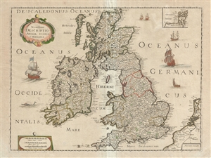
Novissima Descriptio Angliae, Scotiae et Hiberniae.
sold
- Digital Map Information
- Suitable for large format printing
- DPI: 300
- File Size: 13.43 MB
- File Type: ZIP / TIFF
- ICC color profile embedded
- Delivered instantly via download link
This is a beautiful c. 1650 map of the British Isles by Pierre Mariette and Nicolas Sanson. Covers all of England, Scotland, Wales and Ireland. Includes a small inset of the Orkney Islands in the top right quadrant. Beautifully detailed, it notes important cities, ... (more details)
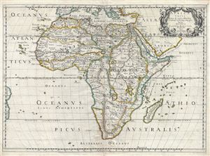
Africa Vetus.
sold
- Digital Map Information
- Suitable for large format printing
- DPI: 300
- File Size: 13.94 MB
- File Type: ZIP / TIFF
- ICC color profile embedded
- Delivered instantly via download link
An uncommon old color first edition example of Nicolas Sanson's map of Africa, prepared an issued separately in 1650. Sanson's map covers Africa in full with adjacent parts of Europe and Arabia represented in part. Sanson, a historian as well as a cartographer, ... (more details)
The Leading Light of French Mapmaking Applies the Ancients to Modern Geography
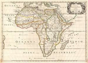
Africa Vetus.
sold
- Digital Map Information
- Suitable for large format printing
- DPI: 600
- File Size: 19.05 MB
- File Type: ZIP / TIFF
- ICC color profile embedded
- Delivered instantly via download link
Nicolas Sanson's 1650 map of Africa, in a very attractive contemporary color example. The map combines modern topography with toponymy drawn from classical geographers. Sanson, a historian as well as a cartographer, intended this map to illustrate Africa as it may have appeared prior to European discovery and exploration. Although the general shape of the continent as well as the surrounding islands and oceans reflect European cartography of the era, Sanson has turned to the Alexandrian cartographer of antiquity, Claudius Ptolemy, to fill in the interior. The southernmost labeled place on the coast is Prassum Promont, a location identified by Ptolemy as the southernmost limit of geographical knowledge. He also follows Ptolemy in his depiction of the White Nile River and its dual lake sources at the base of the Maintains of the Moon. The Ptolemaic mapping of the Nile remained a common feature of Africa maps well into the early 19th century when the explorations of Livingstone and Speake provided new and reliable reconnaissance. The southernmost extreme of Africa he as identified as Anthropophagi Aethiopes (Cannibals). (more details)
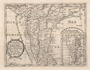
Presqu'Isle de L'Inde deca le Gange, ou sont les Royaumes de Decan, de Golconde, de Bisnagar, et le Malabar.
sold
- Digital Map Information
- Suitable for large format printing
- DPI: 300
- File Size: 3.14 MB
- File Type: ZIP / TIFF
- ICC color profile embedded
- Delivered instantly via download link
A small but attractive 1652 map of India by the French cartographer Nicholas Sanson. Covers the subcontinent From the Bay of Bengal and the Gulf of Cambay to Ceylon (Sri Lanka). Offers impressive detail given that the interior of India was largely unknown to the ... (more details)
Earliest Printed Map to show the Hajj.
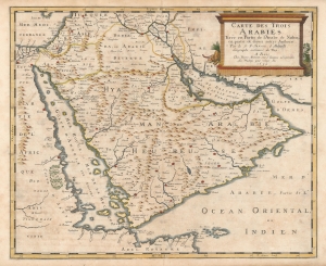
Carte des Trois Arabies Tirée en Parte de l'Arabe de Nubie, en partie de divers autres Autheurs, Par le S. N. Sanson d'Abbeville, Geographe ordinaire du Roy, A Paris.
sold
- Digital Map Information
- Suitable for large format printing
- Full resolution TIFF file
- ICC color profile embedded
- Delivered instantly via download link
This is an attractive example of Nicolas Sanson's scarce 1654 map of the Arabian Peninsula. As indicated in the title, it depicts the three Arabias: Arabie Petree, Arabie Deserte, and Arabia Heureuse; that is, Stony Arabia, Desert Arabia, and 'Happy' Arabia. The map depicts both shores of the Red Sea and the Persian Gulf, and the Indian Ocean island of Zocotora off the horn of Africa. The map includes Mecca and Medina, and the pattern of named settlements describes the Hajj routes: along the Red Sea coast, the overland routes across the peninsula from Basra, and the route to Mecca from Damascus. The Kingdom of Bahrain (Bahraim) appears as well. The largest portion of the Arabian Peninsula is here named Hyaman, ou Arabie Heureuse: 'Yemen, or Happy Arabia.' (more details)
Updating Baffin's Mughal Empire.
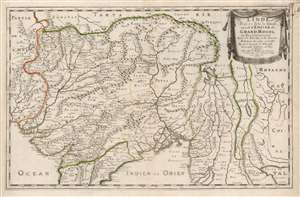
L'Inde deçà et de là Gange, ou est L'Empire do Grand Mogol et Pays Circonvoisins Tirée de Purchas, et de diverses Relations les plus nouvelles.
sold
- Digital Map Information
- Suitable for large format printing
- DPI: 600
- File Size: 44.55 MB
- File Type: ZIP / TIFF
- ICC color profile embedded
- Delivered instantly via download link
This is an attractive example of Nicolas Sanson's 1654 map of the Mughal Empire of Northern India. It is a significant illustration of the early Silk Route trade networks between India and Kabul. The map thus embraces the northern parts of modern India, Pakistan, Afghanistan, Bangladesh, and Burma, as well as parts of Thailand, Laos, and Vietnam. (more details)
A must-have for the early mapping of the American west.
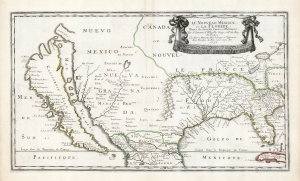
Le Nouveau Mexique, et la Floride: Tirées de diverses Cartes, et Relations. Par N. Sanson d'Abbeville Geogr ordre du Roy. A Paris. Chez Pierre Mariette, Rue S. Jacque a l'Esperance Avec Privilege du Roy, pour vingt Ans. 1656.
sold
- Digital Map Information
- Suitable for large format printing
- DPI: 600
- File Size: 36.2 MB
- File Type: ZIP / TIFF
- ICC color profile embedded
- Delivered instantly via download link
This is a beautiful example of Nicolas Sanson's 1656 map of New Mexico and Florida: the first atlas map to emphasize this geographical focus. It also presented arguably the most influential depiction of California-as-an-island, providing the dominant model of that cartography for the remainder of the seventeenth century, reaching into the eighteenth. (more details)
Sanson’s 1650 map of North America and 1656 map of New Mexico seem to the present writer by far the most interesting and important maps … - C. Wheat
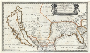
Le Nouveau Mexique, et la Floride: Tirées de diverses Cartes, et Relations. Par N. Sanson d'Abbeville Geogr ordre du Roy. A Paris. Chez Pierre Mariette, Rue S. Iacque a l'Esperance Avec Privilege du Roy, pour vingt Ans. 1656.
sold
- Digital Map Information
- Suitable for large format printing
- DPI: 300
- File Size: 11.08 MB
- File Type: ZIP / TIFF
- ICC color profile embedded
- Delivered instantly via download link
Sanson and Mariette's 1656 first edition map of the central and western part of North America is one of the most important maps ever published pertaining to the American west. This map represents the first time this region has been presented on such a scale and, ... (more details)
Essential Canadianum: 'The primary map of this period... influenced the cartography of Canada for the next fifty years.' - Kershaw
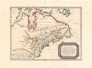
Le Canada, ou Nouvelle France...
sold
- Digital Map Information
- Suitable for large format printing
- DPI: 600
- File Size: 26.16 MB
- File Type: ZIP / TIFF
- ICC color profile embedded
- Delivered instantly via download link
This is Nicolas Sanson's 1656 map of Canada, the Northeast and the Great Lakes, in a superb, untrimmed example. It was among the most influential and important maps of the north part of the Americas to be printed in the 17th century - its depiction of Canada was not superseded until De l'Isle's 1703 Carte du Canada, and it featured the finest depiction of the Great Lakes until the 1687 Coronelli-Nolin. It is among the first printed maps to be informed by the reports of French Jesuit explorers, whose exploration of the Great Lakes region after Champlain's initial explorations was stalled by the 1648 escalation of the Beaver Wars (1603 - 1701) with the Iroquois Confederacy. Following the 1653 pause in the war, Jesuit and French fur traders resumed their push west, gradually revealing the form of the Great Lakes.
The map's treatment of the Arctic waters and Maritime Canada builds on Champlain's basic model, adding place names derived from Dutch and English exploration and preserving Button's explicit northwest passage leading from Button's Bay. (more details)
The map's treatment of the Arctic waters and Maritime Canada builds on Champlain's basic model, adding place names derived from Dutch and English exploration and preserving Button's explicit northwest passage leading from Button's Bay. (more details)
'The primary map of this period... influenced the cartography of Canada for the next fifty years.' - Kershaw

Le Canada, ou Nouvelle France...
sold
- Digital Map Information
- Suitable for large format printing
- Full resolution TIFF file
- ICC color profile embedded
- Delivered instantly via download link
This is Nicolas Sanson's 1656 map of Canada, the Northeast, and the Great Lakes, in an attractive, untrimmed example. It ranks among the most influential and important maps of the north part of the Americas to be printed in the 17th century - its depiction of Canada was not superseded until De l'Isle's 1703 Carte du Canada, and it features the finest depiction of the Great Lakes until the 1687 Coronelli-Nolin. It is among the first printed maps to be informed by the reports of French Jesuit explorers, whose exploration of the Great Lakes region after Champlain's initial explorations was stalled by the 1648 escalation of the Beaver Wars (1603 - 1701) with the Iroquois Confederacy. Following the 1653 pause in the war, Jesuit and French fur traders resumed their push west, gradually revealing the form of the Great Lakes. (more details)
Jesuit knowledge of the Chinese Interior.
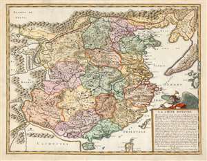
La Chine Royaume.
sold
- Digital Map Information
- Suitable for large format printing
- DPI: 600
- File Size: 20.81 MB
- File Type: ZIP / TIFF
- ICC color profile embedded
- Delivered instantly via download link
This is an attractive example of Nicolas Sanson's scarce and important map of China and Korea, here in its 1656 first state. Although Sanson credits a notional 'Matheo Neroni' as his source, it is almost certainly actually the Jesuit missionary and cosmographer Matteo Ricci, who composed an important map in 1588 based on Chinese sources. The Great Wall appears prominently. The map extends to show part of the Philippines, including Luzon, and a remarkable, sickle-shaped Korean Peninsula. Taiwan is shown and named 'I. Hermosa,' an early form of 'Formosa'. The southern coast of China looks across a bizarrely-narrow South China Sea to a massively-protruding 'Cachucyna' nearly reaching Hainan Island. (more details)
Rare 17th century map showing the route to El Dorado and one of the first maps to show definate political borders in this region.
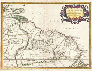
Partie de Terre Ferme ou sont Guiane et Caribane, augmentée et corrigée suivant les dernières relations.
sold
- Digital Map Information
- Suitable for large format printing
- DPI: 300
- File Size: 12.15 MB
- File Type: ZIP / TIFF
- ICC color profile embedded
- Delivered instantly via download link
This is N. Sanson's remarkable 1656 map of the northwestern parts of South America , Lake Parima (Parime), and the route to El Dorado. Cartographically this map is loosely based upon cartographic conventions established by De Laet, however, Sanson introduced ... (more details)
Singapore is criiously attached to the Malay Peninsula.
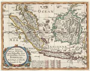
Les Isles de la Sonde entre lesquelles sont Sumatra, Java, Borneo, etc.
sold
- Digital Map Information
- Suitable for large format printing
- DPI: 300
- File Size: 2.03 MB
- File Type: ZIP / TIFF
- ICC color profile embedded
- Delivered instantly via download link
This is a 1657 Nicolas Sanson D'Abbeville map of the East Indies. The map depicts the region from the Indian Ocean to Celebes and from Malay Peninsula to Java. Highly detailed, myriad locations throughout the region are labeled, including Malacca and Jakarta. ... (more details)
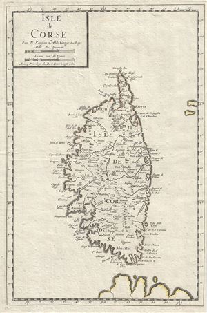
Isle de Corse.
sold
- Digital Map Information
- Suitable for large format printing
- Full resolution TIFF file
- ICC color profile embedded
- Delivered instantly via download link
A beautiful map of the Island of Corsica, France by Nicholas Sanson dating to 1658. Covers the entire island in extraordinary detail offering both topographical and political information with mountains beautifully rendered in profile. With its unique blend ... (more details)
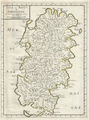
Isle et Royme de Sardaigne.
sold
- Digital Map Information
- Suitable for large format printing
- Full resolution TIFF file
- ICC color profile embedded
- Delivered instantly via download link
This is an attractive map of the island of Sardinia, Italy by Nicholas Sanson dating to 1658. It covers the entire island in extraordinary detail offering both topographical and political information with mountains beautifully rendered in profile. At the ... (more details)
Pivotal map of North America.
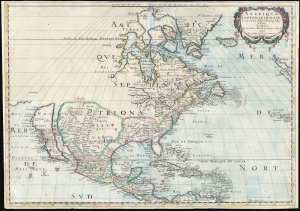
Amerique Septentrionale Par N. Sanson d'Abbeville Geog. du Roy A Paris Chez l'Auteur Et chez Pierre Mariette rue S. Jacques a lEsperāce 1650. Avec privilege du Roy pour vingt Ans.
sold
- Digital Map Information
- Suitable for large format printing
- DPI: 600
- File Size: 46.63 MB
- File Type: ZIP / TIFF
- ICC color profile embedded
- Delivered instantly via download link
This is Sanson's map of North America, in its 1659 third state. Sanson’s was one of the first maps to reflect the increasing dominance of French exploration and cartography in the New World. It is among the earliest maps to show all five Great Lakes recognizably, and the first to name Superior and Ontario. It is also significant for being the first map to locate Santa Fe, and to note the existence and location of the Apache and Navajo tribes in the American southwest. (more details)
Elegant Edition of the First French Atlas of Asia.
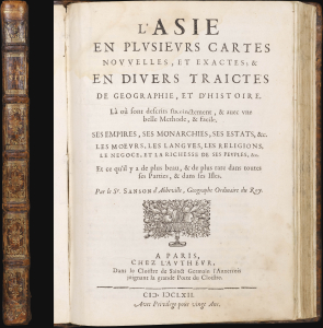
L'Asie en Plusiers Cartes Novelles, et Exactes; et en Divers Traictes de Geographie, et D'Histoire....
sold
This is a handsome example of the first French atlas of Asia, printed in 1662 by Nicolas Sanson, the father of French mapmaking. An encyclopedic atlas, the work contains 17 maps and 100 pages of historical and descriptive text. It was intended to educate the curious reader about the wonders of parts of the world they would likely never see themselves. (more details)
Uncommon map of North America showing California as an Island.
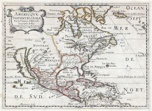
Americque Septentrionale. Par le Sr. Sanson d'Abbeville Geograph du Roy.
sold
- Digital Map Information
- Suitable for large format printing
- DPI: 300
- File Size: 12.05 MB
- File Type: ZIP / TIFF
- ICC color profile embedded
- Delivered instantly via download link
A very attractive 1662 Nicolas Sanson map of North America. Sanson's map covers all of North America from Baffin Bay and Greenland, south to include all of Central America, the West Indies, and parts of the Spanish Main, it similarly extends from ... (more details)
Rare Mapping of Islands of the North Atlantic.
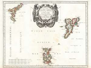
Les Isles Orcadney, ou Orkney; Schetland, ou Hetland; et de Fero, ou Farre, tirées de divers memoires.
sold
- Digital Map Information
- Suitable for large format printing
- DPI: 600
- File Size: 30.27 MB
- File Type: ZIP / TIFF
- ICC color profile embedded
- Delivered instantly via download link
This is a scarce, beautifully engraved 1655 map of the Orkney, Shetland and Faroe Islands, produced by Nicolas Sanson, the preeminent French mapmaker of the 17th century. While the detail of the Orkneys and the Shetlands derives from contemporaneous Dutch sources, Sanson's map is the first to focus on the Faroe Islands, and place them in reasonably accurate context with the other two archipelagos. (more details)
Magnificently Detailed Madagascar.
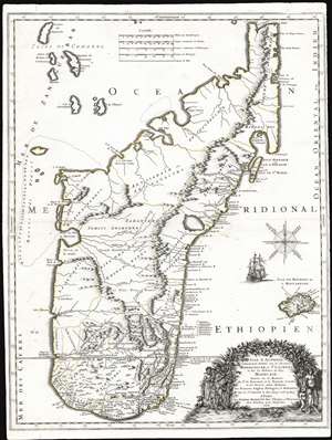
Isle d'Auphine, Communement Nommée par les Europeens Madagascar, et St. Laurens, et par les Habitans du Pays Madecase: Dressée Sur les Memoires du Sr. de Flacourt, et de François Cauche; et Sur Diverses autres Relations des François, Anglois, Portugais et Hollandois. Par le Sr. Sanson le Fils Geogr.' ordre. du Roy. A Paris. Chez Pierre Mariette Rue St. Jacques a l'Esperance Avec Privilege pour Vingt Ans. 1667.
sold
- Digital Map Information
- Suitable for large format printing
- Full resolution TIFF file
- ICC color profile embedded
- Delivered instantly via download link
This is the first edition of Nicolas Sanson's 1667 new map of Madagascar. This map represents the most significant advancement of Madagascar cartography since the map of Étienne de Flacourt (1607 - 1660), who from 1648 to 1653 was French East India’s Governor of Madagascar, and who in 1658 published the first natural history of the island,Histoire de la grande isle Madagascar. (more details)
Europe of the Roman Empire.
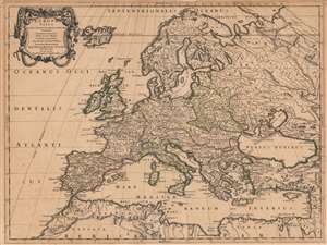
Europa Vetus Nicolai Sanson Christianiss. Galliar. Regis Geographi..
sold
- Digital Map Information
- Suitable for large format printing
- DPI: 600
- File Size: 65.45 MB
- File Type: ZIP / TIFF
- ICC color profile embedded
- Delivered instantly via download link
This is Nicolas Sanson's 1668 map of Europe, in a very attractive contemporary color example. The map combines modern topography with toponymy drawn from classical geographers. Sanson, a historian as well as a cartographer, intended this map to illustrate Europe as it was understood in the days of Imperial Rome. Thus the topography of the map reflects seventeenth-century cartography, while the political divisions and place names are drawn from the cartographers of antiquity: Claudius Ptolemy, Pomponius Mela, and Solinus, among others. The northern limits of the Roman Empire, along the Danube River and the Rhine, are marked with a dotted line and emphasized with outline color. (more details)
Definitive 17th-Century French Map of North America. Rare state.
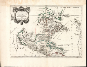
Amerique Septentrionale par N. Sanson Geographe du Roy.
sold
- Digital Map Information
- Suitable for large format printing
- File Size: 23.54 MB
- File Type: ZIP / TIFF
- ICC color profile embedded
- Delivered instantly via download link
This is Guillaume Sanson's 1669 map of North America, in its scarce second state of 1690. It is one of the most elegant expressions of 17th-century French cartography, presenting the dominant geographical model of the Americas of the period. The work was derived from the authoritative cartography of the French mapmaker Nicolas Sanson, whose authorship his son Guillaume emphasized in the cartouche. (more details)
Lost Continent of Atlantis: Found?
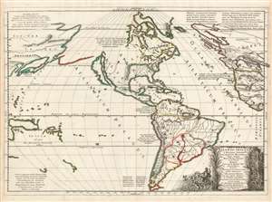
Nicolao Sanson antiquitati restituta ; nunc demum majori forma delineata, et in decem regna, iuxta decem Neptuni filios distributa : Praeterea insualae, nostraeqr. contenentis regiones quibus imperavere Atlantici reges ; aut quas armis tentavere ex conatibus geographicus.
sold
- Digital Map Information
- Suitable for large format printing
- DPI: 600
- File Size: 55.65 MB
- File Type: ZIP / TIFF
- ICC color profile embedded
- Delivered instantly via download link
This is a beautiful, first state example of Nicolas and Guillaume Sanson's map of America, proposing that the continent and the legendary lost continent of Atlantis were one and the same. (more details)
An important map of Asia illustrating several aspects of classic speculative European cartography of Asia.
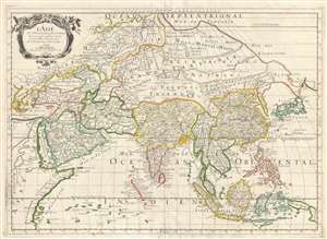
L'Asie.
sold
- Digital Map Information
- Suitable for large format printing
- DPI: 300
- File Size: 10.41 MB
- File Type: ZIP / TIFF
- ICC color profile embedded
- Delivered instantly via download link
This is a 1669 Nicolas and Guillaume Sanson map of Asia. Overall an unusual projection and centered on Tibet, the map depicts the entire continent of Asia from Greece to the Kurile Islands and from the Arctic Ocean to New Guinea, including parts of Europe and Africa. This represents the second edition of the Sanson map of Asia, with one notable difference being the depiction of Korea as an elongated peninsula, whereas in the first edition Korea was shown as an island. Other aspects of East Asian geography, however, remain fairly speculative. Hokkaido is illustrated as being attached to the mainland as part of a vast peninsula called Yupi (Sakhalin). Separated from the landmass by the narrow Strait of St. Vries is a mysterious landmass labeled as Ieco, a name which itself is commonly associated with Hokkaido. Here, Sanson has moved the toponymy further east and attached it to an oversized mapping of the Kuril Islands. It is also important to note the incomplete depiction of New Guinea. (more details)
Greece The Greek Islands during Venice's War with the Ottoman Empire.
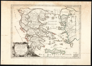
Partie Meridionale de la Turquie en Europe où sont les Beglerbeglicz de Romelie, et de la Mer dans lesquels sont remarquées les residences des Sanglacs qui en dependent: où sont encore l'Isle et la royaume de Candie, et les Isles de Corfou, Cephalonie, Zante, et autres Isles et places sur les Costes qui appartient aux Venetiens par le Sr. Sanson A Paris, chez Pierre Mariette rüe S. Jacques à l'Esperance avec privilége du Roy pur vingt ans. 1670.
sold
- Digital Map Information
- Suitable for large format printing
- Full resolution TIFF file
- ICC color profile embedded
- Delivered instantly via download link
This elegant, rare, French map of Greece, produced by Guillaume Sanson in 1670, presented a French audience with a view of Greece as a possession of the Ottoman Empire, wrestled over by the Venetian Republic - especially in the wake of the Cretan War (1645 - 1669) during which the Ottoman Empire had taken the island kingdom of Crete from Venice. The ongoing state of war is alluded to in the battle scene depicted to the right of the beautifully engraved cartouche, but the Ottoman occupation is indicated more cartographically than pictorially: a characteristic of the more scientific, factually-driven school of French mapmaking. (more details)
The first appearance of the Marquette-Joliet Mississippi River cartography.
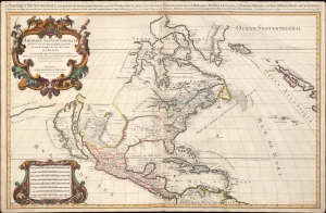
Amerique septentrionale divisée en ses principales parties, ou sont distingués les vns des autres les estats suivant qu'ils appartiennent presentemet aux Francois, Castillans, Anglois, Suedois, Danois, Hollandois, tirée des relations de toutes ces nations par le S. Sanson, geographe ordinaire du roy. 1674.
sold
- Digital Map Information
- Suitable for large format printing
- Full resolution TIFF file
- ICC color profile embedded
- Delivered instantly via download link
An impressive and scarce 1674 map of North America issued by Alexis-Hubert Jaillot, offered here in its first edition, and likely exhibiting preliminary data from the 1673 Marquette-Joliet Expedition. The map covers North America and Central America from Baffin Bay to the Spanish Main. It extends westward past an Insular California to include Terre de Iesso (a speculative mapping of Hokkaido) and eastwards past the Azores to include the British Isles. It includes a striking mapping the Mississippi (Chucagua), that while inaccurate in the southernmost regions, likely reflects Joliet's verbal reports from the seminal 1673 Marquette-Joliet Expedition. (more details)
Remarkable first editon of Jaillot's important map of America showing California as an Island.
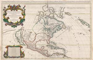
Amerique septentrionale divisee en ses principales parties, ou sont distingues les vns des autres les estats suivant qu'ils appartiennent presentemet aux Francois, Castillans, Anglois, Suedois, Danois, Hollandois, tiree des relations de toutes ces nations par le S. Sanson, geographe ordinaire du roy. 1674.
sold
- Digital Map Information
- Suitable for large format printing
- Full resolution TIFF file
- ICC color profile embedded
- Delivered instantly via download link
A large, impressive, and scarce 1674 map of North America issued by Alexis-Hubert Jaillot offered here in its first edition. The map covers all of North America and Central America from Baffin Bay to the Spanish Main. The map extends westward to ... (more details)
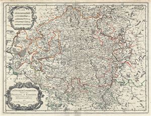
Le Duche de Luxembourg, divise en Francois, et Espagnol.
sold
- Digital Map Information
- Suitable for large format printing
- DPI: 300
- File Size: 17.83 MB
- File Type: ZIP / TIFF
- ICC color profile embedded
- Delivered instantly via download link
This is a scarce 1674 map of the Duchy of Luxembourg by Alexis-Hubert Jaillot. It covers Luxembourg along with parts of neighboring Belgium, France and Germany from Revin in France east to Blankenheim in Germany and from Spa in Belgium, south as ... (more details)
An Attractive Italian Edition of a Seminal Map of America.
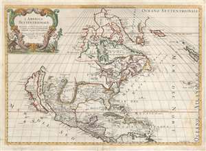
L'America Settentrionale.
sold
- Digital Map Information
- Suitable for large format printing
- DPI: 600
- File Size: 18.3 MB
- File Type: ZIP / TIFF
- ICC color profile embedded
- Delivered instantly via download link
First state of Giovanni Giacomo de Rossi's scarce map of North America, based upon the 1669 issue of Nicolas Sanson's groundbreaking map. De Rossi's map hews faithfully to its source but is translated from the French to Italian. The map covers all of North America from Baffin Bay and Greenland, south to include all of Central America, the West Indies, and parts of the Spanish Main. It similarly extends from California eastwards to the Azores and the British Isles. (more details)
France's Winnings from the Treaty of Westphalia.
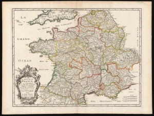
Le Royaume De France et ses Acquisitions vers les Pays Bas, L'Allemagne, L'Italie, et L'Espagne. Avec les Pays Circomvoisins etc. Nouvellement Revue, et Corrigee Par le Sr. Sanson d'Abbeville Geogr. Ordre. de sa Majesté A Paris.
sold
- Digital Map Information
- Suitable for large format printing
- DPI: 600
- File Size: 51.85 MB
- File Type: ZIP / TIFF
- ICC color profile embedded
- Delivered instantly via download link
This is a beautiful, original-color example of Nicolas Sanson's 1678 folio map of the Kingdom of France. Sanson was the preeminent French geographer of the 17th century, and his austere, elegant aesthetic set the standard for French mapmakers into the next century - easily distinguishing the works of French mapmakers from the florid work produced at the same time in the Netherlands. (more details)
European Colonies of North America.
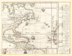
La Mer De Nort où sont la Nle. France, La Floride, La Nle. Espagne, Les Isles et La Terre-Ferme d'Amerique, Par P. Du-val Geographe Ordinaire du Roy 1679.
sold
- Digital Map Information
- Suitable for large format printing
- Full resolution TIFF file
- ICC color profile embedded
- Delivered instantly via download link
This is the rare, first state of Pierre DuVal's 1679 map of eastern North America, the Caribbean, and the Atlantic Ocean. DuVal's map significantly updates the earlier efforts of Nicolas Sanson, his uncle and teacher, and includes notations reflective of a new wave of exploration. Its eastern limits include the Atlantic coast of the Iberian Peninsula, the Azores, the Canary Islands and the Cap Verde Islands, and the coast of Africa from Morocco to the Guinea coast. (more details)
Highlights the 'inland sea' of Lake Parima and El Dorado!
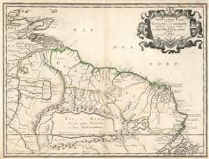
Partie de Terre Ferme ou sont Guiane et Caribane.
sold
- Digital Map Information
- Suitable for large format printing
- DPI: 600
- File Size: 18.29 MB
- File Type: ZIP / TIFF
- ICC color profile embedded
- Delivered instantly via download link
This is a remarkable 1679 Nicolas Sanson map of the northwestern parts of South America, including Lake Parima (Parime), and the route to El Dorado. Cartographically, this map is loosely based upon cartographic conventions established by Johannes De Laet. However, Sanson introduced some exciting new ideas, including some of the first fixed political borders in Guiana. The map depicts from Isla Margarita and the Orinoco Delta eastward as far as Tampico and southwards as far as the mouth of the Amazon River. (more details)
Remarkable edition of Jaillot's important map of America showing California as an Island.
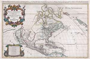
Amerique septentrionale divisee en ses principales parties, ou sont distingues les vns des autres les estats suivant qu'ils appartiennent presentemet aux Francois, Castillans, Anglois, Suedois, Danois, Hollandois, tiree des relations de toutes ces nations par le S. Sanson, geographe ordinaire du roy. 1674.
sold
- Digital Map Information
- Suitable for large format printing
- DPI: 300
- File Size: 23.77 MB
- File Type: ZIP / TIFF
- ICC color profile embedded
- Delivered instantly via download link
An impressive and scarce 1696 elephant-folio map of North America issued by Alexis-Hubert Jaillot on a massive scale. The map covers all of North America and Central America from Baffin Bay to the Spanish Main. It extends westward to past an Insular California to include Terre de Iesso (a speculative mapping of Hokkaido) and eastwards past the Azores to include the British Isles. (more details)
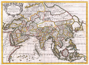
L'Asia Nuovamente Corretta, et Accresiuta, Secondo le Relationi piu Moderne du Guglielmo Sansone…
sold
- Digital Map Information
- Suitable for large format printing
- DPI: 300
- File Size: 20.58 MB
- File Type: ZIP / TIFF
- ICC color profile embedded
- Delivered instantly via download link
A spectacular 1687 map of Asia by the important Italian cartographer Giovanni Giacomo De Rossi. Depicts the entire continent as well as parts of Europe, Africa, and the East Indies. In drawing this map Rossi drew heavily upon Nicholas Sanson's ... (more details)
The Polish Lithuanian Commonwealth.
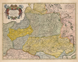
Tabula nova totius Regni Poloniae in quo sunt Ducatus et Provinicae Prussia, Cujavia, Mazovia, Russia Nigra etc. in qua Volhynia, et Podolia cum suis Palatinatibus ac Confinys.
sold
- Digital Map Information
- Suitable for large format printing
- DPI: 600
- File Size: 58.44 MB
- File Type: ZIP / TIFF
- ICC color profile embedded
- Delivered instantly via download link
This is Nicolas Visscher II's beautiful 1690 map of the Polish Lithuanian Commonwealth, in a handsomely colored example. (more details)
Richly-Decorative Double-Hemisphere World Map.
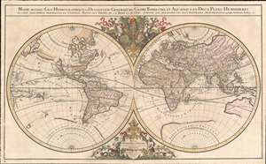
Mappe-monde Geo-Hydrographique ou Description Generale du Globe Terrestre et Aquatique en Deux-Plans-Hemipsheres ou son Exactement Remarquees en General Toutes les Parties de la Terre et de L'Eau, suivant les Relations les plus Nouvelles, par le S. Sanson Geographe Ordinaire du Roy.
sold
- Digital Map Information
- Suitable for large format printing
- DPI: 600
- File Size: 42.4 MB
- File Type: ZIP / TIFF
- ICC color profile embedded
- Delivered instantly via download link
One of the most beautiful, large - format maps of the 17th century, this is Alexis-Hubert Jaillot's 1691 map of the world on a double hemisphere projection. It is an enlarged, richly decorative depiction of the world according to Nicolas Sanson, the great French geographical authority of the 17th century. The map is dedicated to the Dauphin (the eldest son of the King of France;) the dedicatory cartouche at the bottom center is surmounted by a beautiful, gilded Fleur-de-lis and flanked by two mer-men; opposite the dedicatory above the two hemispheres the Dauphin's arms are displayed, flanked by two putti riding stylized dolphins. (more details)
Monumental world map showing California as an Island.
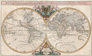
Mappe-monde Geo-Hydrographique ou Description Generale du Globe Terrestre et Aquatique en Deux-Plans-Hemipsheres ou son Exactement Remarquees en General Toutes les Parties de la Terre et de L'Eau, suivant les Relations les plus Nouvelles, par le S. Sanson Geographe Ordinaire du Roy.
sold
- Digital Map Information
- Suitable for large format printing
- DPI: 300
- File Size: 26.26 MB
- File Type: ZIP / TIFF
- ICC color profile embedded
- Delivered instantly via download link
An extraordinary map of monumental proportions, this Sanson and Jaillot's c.1691 decorative map of the world on a double hemisphere projection. Covers the entire world according to its 17th century conception of Nicolas Sanson. Elaborate ... (more details)
Monumental world map showing California as an Island.
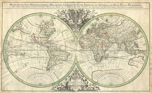
Mappe-monde Geo-Hydrographique ou Description Generale du Globe Terrestre et Aquatique en Deux-Plans-Hemipsheres ou son Exactement Remarquees en General Toutes les Parties de la Terre et de L'Eau, suivant les Relations les plus Nouvelles, par le S. Sanson Geographe Ordinaire du Roy.
sold
- Digital Map Information
- Suitable for large format printing
- DPI: 300
- File Size: 27.92 MB
- File Type: ZIP / TIFF
- ICC color profile embedded
- Delivered instantly via download link
An extraordinary map of monumental proportions, this Sanson and Jaillot's c.1691 decorative map of the world on a double hemisphere projection. Covers the entire world according to its 17th century conception. Elaborate allegorical ... (more details)
A stunning map with gold foiling. Made for kings.
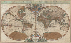
Mappe-monde Geo-Hydrographique ou Description Generale du Globe Terrestre et Aquatique en Deux-Plans-Hemipsheres ou son Exactement Remarquees en General Toutes les Parties de la Terre et de L'Eau, suivant les Relations les plus Nouvelles, par le S. Sanson Geographe Ordinaire du Roy 1691.
sold
- Digital Map Information
- Suitable for large format printing
- DPI: 300
- File Size: 30.64 MB
- File Type: ZIP / TIFF
- ICC color profile embedded
- Delivered instantly via download link
An extraordinary map of monumental proportions, this Sanson and Jaillot's 1691 decorative map of the world on a double hemisphere projection. This is the first state of the fourth plate of this map. Covers the entire world ... (more details)
Monumental North America maps with incomplete Great Lake and Califorina as an Island.
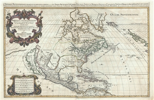
Amerique septentrionale divisee en ses principales parties, ou sont distingues les vns des autres les estats suivant qu'ils appartiennent presentemet aux Francois, Castillans, Anglois, Suedois, Danois, Hollandois, tiree des relations de toutes ces nations par le S. Sanson, geographe ordinaire du roy. 1692.
sold
- Digital Map Information
- Suitable for large format printing
- DPI: 300
- File Size: 23.55 MB
- File Type: ZIP / TIFF
- ICC color profile embedded
- Delivered instantly via download link
An impressive and scarce 1692 map of North America issued by Alexis-Hubert Jaillot on a massive scale. The map covers all of North America and Central America from Baffin Bay to the Spanish Main. The map extends westward ... (more details)
Lost Continent of Atlantis: Found?
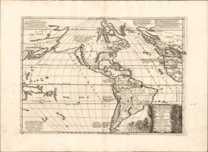
Atlantis Insula a Nicolao Sanson antiquitati restituta nunc demum majori forma delineata et in decem regna iuxta decem Neptuni filios distributa Praeterea insualae. nostraeqr contenentis regiones quibus imperavere Atlantici reges aut quas armis tentavere ex conatibus geographicus.
sold
- Digital Map Information
- Suitable for large format printing
- Full resolution TIFF file
- ICC color profile embedded
- Delivered instantly via download link
This is a beautiful example of Nicolas and Guillaume Sanson's map of America as the lost continent of Atlantis. The present examples is a scarce 1694 Italian edition, finely engraved and printed with strong inks on beautiful Italian paper - à la Coronelli. It is visually and physically superior to Sanson's own earlier editions. (more details)
A most decorative early Map of Ireland.
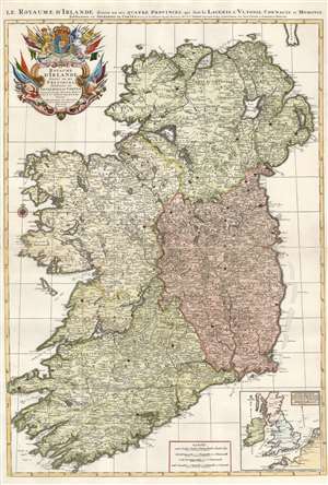
Le Royaume d'Irlande divisé en ses provinces, subdivisé en Shireries ou Comtes...
sold
- Digital Map Information
- Suitable for large format printing
- Full resolution TIFF file
- ICC color profile embedded
- Delivered instantly via download link
Hubert Jaillot's 1693 map of Ireland is among the largest and most beautiful atlas maps of Ireland produced in the 17th century. A sculptor-turned-mapmaker, Jaillot's maps were mostly based on geographical scholarship of the great French mapmaker Nicolas Sanson. Where Sanson's maps tended to be Spartan academic works, Jaillot intended his maps to be 'Bel et Utilite', beautiful as well as informative. Also, while Sanson's maps were printed to single folio sheets or smaller formats, Jaillot printed his maps to two folio sheets, meant to be joined into impressive large-scale maps. The map is superbly detailed, with towns, cities, and roads plainly visible. Topography is shown pictorially. An inset map in the lower right situates Ireland in relation to England, France, and the Netherlands, placing the island in the context of the greater conflict. (more details)
First editon of Pierre Mortier's fascinating world map based upon Sanson.
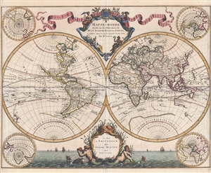
Mappe-Monde Dresse sur les Observations de Mrs. De L'Academie Royale des Sciences et quelques autres et sur les memories les plus recens.
sold
- Digital Map Information
- Suitable for large format printing
- DPI: 300
- File Size: 13.15 MB
- File Type: ZIP / TIFF
- ICC color profile embedded
- Delivered instantly via download link
Published by Pierre Mortier and attributed to the venerable Nicolas Sanson, this scarce first edition is a beautiful 1696 map of the world in two hemispheres. The map consists of two central hemispheres, eastern and ... (more details)
Extremely Rare Sanson Family Map of Africa, Updated.
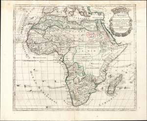
L'Afrique divisée en ses Principales Parties ou les Empires les Monarchies les Royaumes les Etats et les Peuples sont distingues les uns des autres Par les Srs. Sanson Geographes ordinres. du Roi.
sold
- Digital Map Information
- Suitable for large format printing
- Full resolution TIFF file
- ICC color profile embedded
- Delivered instantly via download link
This large, rare map is the 1705 map of Africa by Pierre Moulart-Sanson, Nicolas Sanson's grandson and cousin of Guillaume Sanson. While one of the family's last folio maps, it is among the most distinctive for its incorporation of contemporary developments in African geography, making it the first new mapping of Africa embraced by the Sansons since the mid-17th century. (more details)
Uncommon early map of Crimea and the Kerch Strait.
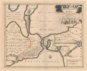
Bosphorus Cimmerius et Regnum Bosphoranum.
sold
- Digital Map Information
- Suitable for large format printing
- DPI: 300
- File Size: 10.5 MB
- File Type: ZIP / TIFF
- ICC color profile embedded
- Delivered instantly via download link
This is a beautiful 1705 of the Kerch Strait issued by Pierre Mortier. The map covers the Kerch Strait between the Sea of Azov and the Black Sea, including the regions of southern Ukraine and the Crimean Peninsula ... (more details)
Magnificent Brittany.
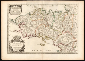
La Bretagne Divisée en ses neuf Eveschés qui font aussi l'estendue des Receptes de la Generalité de Nantes.
sold
- Digital Map Information
- Suitable for large format printing
- DPI: 600
- File Size: 82.82 MB
- File Type: ZIP / TIFF
- ICC color profile embedded
- Delivered instantly via download link
This is Alexis-Hubert Jaillot's map of Brittany, France, in its 1706 edition. It is among the largest atlas maps of the region, here in a superb example with bright original outline color. (more details)
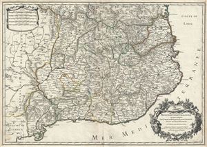
Principaute de Catalogne ou sont compris les Comtes de Roussillon, et de Cerdagne, divisees en leurs Vigueries.
sold
- Digital Map Information
- Suitable for large format printing
- DPI: 300
- File Size: 19.84 MB
- File Type: ZIP / TIFF
- ICC color profile embedded
- Delivered instantly via download link
This is a scarce 1706 map of Catalonia, Spain by Alexis-Hubert Jaillot. It covers the northeastern Iberian Peninsula from Sigean in France to Peniscola on the Mediterranean coast. The principality of Catalonia ... (more details)
Beautiful and rare map of the British Isles.
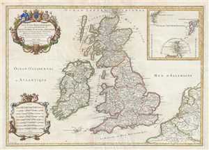
Les Isles Britanniques qui contiennent les Royaumes d'Angleterre, Escosse, et Irlande distingués en leurs principales Provinces : subdivisées en leurs Shireries ou Comtés.
sold
- Digital Map Information
- Suitable for large format printing
- DPI: 300
- File Size: 14.68 MB
- File Type: ZIP / TIFF
- ICC color profile embedded
- Delivered instantly via download link
This is a rare 1709 Hubert Jaillot map of the British Isles. The map depicts the region from the Atlantic Ocean to the North Sea and from the Orkney Islands to the Pas de Calais and Normandy in northern France. ... (more details)
Twelve Tribes of Israel, with Exodus vignettes.

Judaea seu Palæstina ob Sacratissima Redemtoris vestigia hodie dicta Terra Sancta prout olim in duodecim tribus divisa, seperatis ab invicem Regnis Iuda et Israel expressis in super VI. ultimi temporis ejusdem Terræ Provinciis.
sold
- Digital Map Information
- Suitable for large format printing
- File Size: 24.11 MB
- File Type: ZIP / TIFF
- ICC color profile embedded
- Delivered instantly via download link
This is a beautiful example of J. B. Homann's 1707 map of the Holy Land. As Homann noted in the map's title, it is derived from the work of the French mapmaker Guillaume Sanson (1633 - 1703). (more details)