
Schrader, Franz (sold)
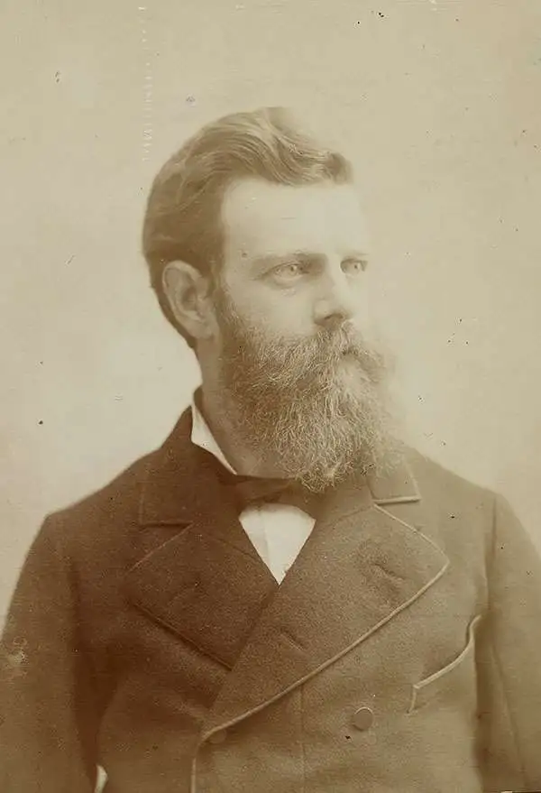
Jean Daniel François Schrader, or Franz Schrader (January 11, 1844 – October 18, 1924),Was a French mountaineer, geographer, cartographer and landscape painter. He was born in Bordeaux. His father was Prussian emigré Ferdinand Schrader, and his mother was Marie-Louise Ducos, cousin of geographers Élisée and Onésime Reclus. Despite early aptitude as an artist, his strict father refused him higher education, instead securing him employment with a tax collector, later moving to employment that would at least offer time for broadening his literary and scientific knowledge. In his twenties, he became enamored of the beauty of the Pyrenees mountains, and began to spend most of his free time hiking the mountain - but not without recording topographical observations, painting panoramic views, and developing an understanding of the science of topography. Through this activity he became a strong cartographer, with the intention of creating a large-scale map of his beloved Pyrenees. He went so far as to invent an instrument, the orograph, a machine designed to take precise measurements of mountains.
His 1874 map of the massif of Gavarnie-Mont-Perdu at a scale of 1:40 000 immediately commanded the attention of the Société des Sciences Physiques et Naturelles of Bordeaux, and he would become a founder and the first president of the Bordeaux section of the Club Alpin Français. In 1877 he was employed as a geographer by Librairie Hachette a profession that allowed him to continue his passion for mountaineering. By 1880, he would become Hachette's director of cartography for Hachette, where he would produce dozens of works, including mountaineering guides as well as traditional atlases such as his continuation of Vivien de Saint-Martin's Atlas de géographie universelle.
His 1874 map of the massif of Gavarnie-Mont-Perdu at a scale of 1:40 000 immediately commanded the attention of the Société des Sciences Physiques et Naturelles of Bordeaux, and he would become a founder and the first president of the Bordeaux section of the Club Alpin Français. In 1877 he was employed as a geographer by Librairie Hachette a profession that allowed him to continue his passion for mountaineering. By 1880, he would become Hachette's director of cartography for Hachette, where he would produce dozens of works, including mountaineering guides as well as traditional atlases such as his continuation of Vivien de Saint-Martin's Atlas de géographie universelle.
Scarce, Large-format map of China.
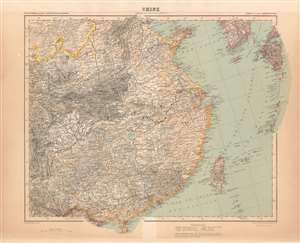
Chine / Asie en Dix Feuilles _ Feuille VIII.
sold
- Digital Map Information
- Suitable for large format printing
- File Size: 45.21 MB
- File Type: ZIP / TIFF
- ICC color profile embedded
- Delivered instantly via download link
This map of China was printed in 1911 as part of Schrader's ten sheet supplement on Asia, published by the French firm Hachette in the beginning of the 20th century to extend that firm's Atlas Universel originally under the direction of Louis Vivien de Saint - Martin. The other maps of the series are:
- 1. Asia Minor and the Caucasus
- 2. Turkestan
- 3. Mongolia
- 4. Japan, Korea and Manchuria
- 5. Arabia
- 6. Persia, Afghanistan and northwest India
- 7. Northeast India and Tibet
- 9. South India
- 10. India