
Service Geográfico del Ejército (sold)

The Service Geográfico del Ejército (1939 - 1998) was established in 1939 after the Spanish Civil War. It took over the geographical and cartographical functions of the Spanish Army from the Depósito de la Guerra, which was founded in 1838 as part of the General Directorate of the General Staff Corps. The Army School of Geodesy and Topography was founded in 1941. In 1998, the Centro Geográfico del Ejército was founded and took over all the functions of the Service Geográfico.
Morocco and Spanish Sahara just after the Ifni War and highlighted oil production.
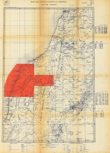
This is a 1958 Spanish Servicio Geográfico de Ejército map of Morocco and the Spanish Sahara. Published either during or just after the end of the Ifni War, the map highlights the oil-producing region in the Spanish Sahara. It includes a small part of the region ceded to Morocco along the top. (more details)