
Shihei Hayashi (sold) (林子平)
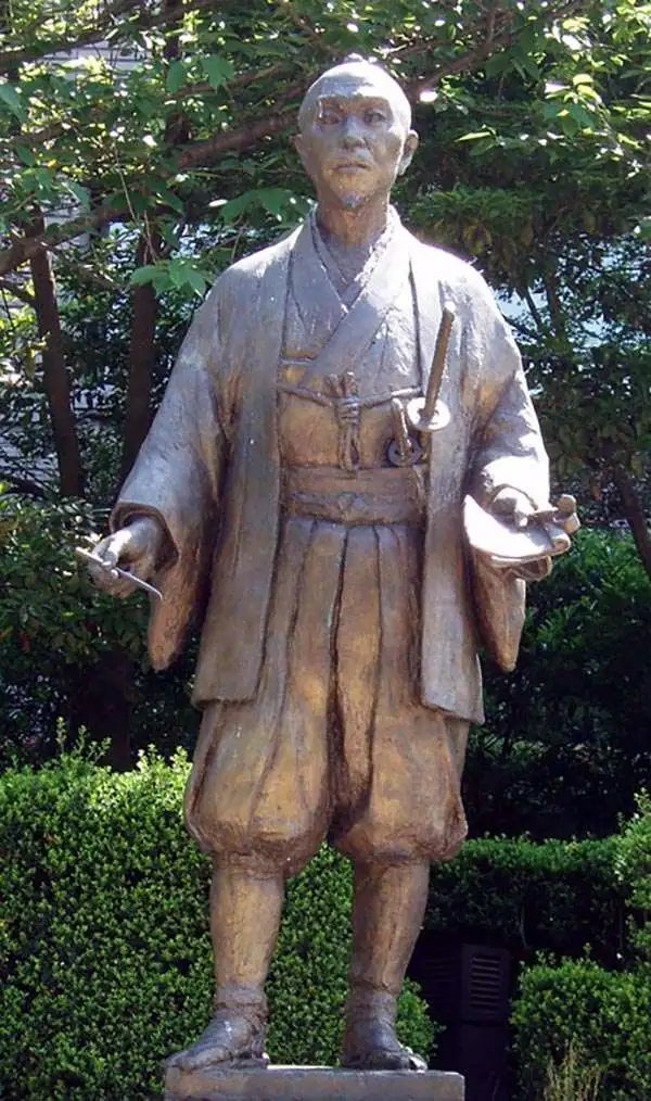
Hayashi Shihei (林 子平; August 6, 1738 - July 28, 1793) was a Japanese military scholar, political theorist, and retainer of the Sendai Domain. His name is sometimes read (according to the Sino-Japanese reading) as Rin Shihei. Shihei was deeply concerned with the rise of western military and naval power. In particular he saw Russia's expansion into East Asia as a long term threat to Japanese sovereignty. He lobbied the Tokugawa Shogunate for a strengthening of Japan's defenses and advocated supplementing traditional Samurai training with courses in Western military science. In particular he expressed concerns with the traditional role of the samurai as an independent warrior and stressed teamwork exercises, or choren. He published several important books, including the 1791 Kaikoku Heidan (i.e. Discussion concerning military matters of a maritime nation and the 1786 Sangoku Tsuran Zusetsu (Illustrated Description of Three Countries). This later work included five important maps illustrating Japan, Korea, and the Ryukyu Islands, including Taiwan. Since his work was published without authorization from the bakufu (government), and criticized the Shogun's commerce with foreign powers, Hayashi fell out of favor. Most of his works were subsequently seized and, along with their original woodblock printing plates, destroyed. Consequently, most surviving examples of the five Hayashi Maps are manuscript, copied by hand and handed down in secret from generation to generation. Eventually a copy of Sangoku Tsuran Zusetsu was taken to Siberia, translated into French, and published in Paris in 1832. Hayashi's legacy was thus preserved and, together with Takayama Hikokuro and Gamo Sanbei, he is remembered as one of the "Three Excelling Men of the Kansei Period" (Kansei no san-kijin).
AKA: 林子平
18th century manuscript map of Korea!
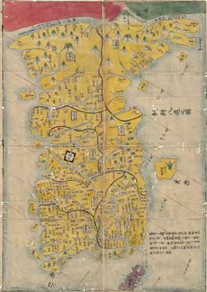
Chosen Hachido no Zu (or) Chosen Koko Zenzu (General Map of Korea)
sold
- Digital Map Information
- Suitable for large format printing
- DPI: 300
- File Size: 2.83 MB
- File Type: ZIP / TIFF
- ICC color profile embedded
- Delivered instantly via download link
A beautiful c. 1786 manuscript map of Korea prepared by Hayashi Shihei. This map was drawn to illustrate Shihei's Sangoku Tsuran Zusetsu (Illustrated General Survey of the Three Countries). It covers all of Korea as well as the adjacent islands (including the ... (more details)
A Banned Map! Raremanuscript map of Haishi Shihei's important map of Korea.
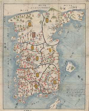
Chosen Hachido no Zu (or) Chosen Koko Zenzu (General Map of Korea).
sold
- Digital Map Information
- Suitable for large format printing
- DPI: 600
- File Size: 30.63 MB
- File Type: ZIP / TIFF
- ICC color profile embedded
- Delivered instantly via download link
A banned map! This very rare c. 1785 manuscript map of Korea prepared by Hayashi Shihei. This map was drawn to illustrate Shihei's Sangoku Tsuran Zusetsu (Illustrated General Survey of the Three Countries). It covers all of Korea as well as the adjacent ... (more details)
A Banned Map! Rare woodblock printing of Haishi Shihei's important map of Korea.
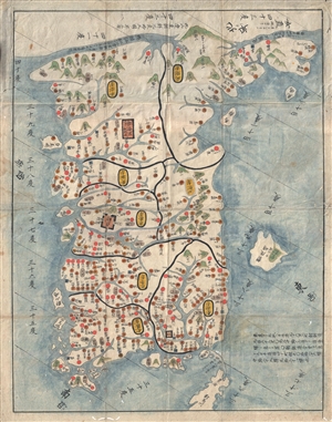
Chosen Hachido no Zu (or) Chosen Koko Zenzu (General Map of Korea).
sold
- Digital Map Information
- Suitable for large format printing
- DPI: 300
- File Size: 14.56 MB
- File Type: ZIP / TIFF
- ICC color profile embedded
- Delivered instantly via download link
A banned map! This very rare c. 1785 woodblock map of Korea prepared by Hayashi Shihei. This map was drawn to illustrate Shihei's Sangoku Tsuran Zusetsu (Illustrated General Survey of the Three Countries). It covers all of Korea as well as the adjacent ... (more details)
Controversial and consequential.
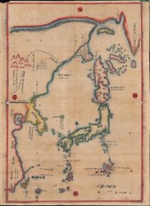
三國通覽圖 / [Overview Map of the Three Kingdoms].
sold
- Digital Map Information
- Suitable for large format printing
- DPI: 600
- File Size: 51.75 MB
- File Type: ZIP / TIFF
- ICC color profile embedded
- Delivered instantly via download link
A banned and controversial map, this is the is the rarest and most important of the five c. 1785 maps issued by Hayashi Shihei (林子平) in his work Sangoku Tsūran Zusetsu (三国通覧図說). The present map is a separate issue manuscript of Hayashi's 1785 map, with some minor changes. This example is significant as, despite being an inherently Japanese production, it unambiguously grants the both the disputed Dokdo Islands (Takeshima / Liancourt Rocks) to Korea, and the disputed Diaoyu (Senkaku Islands) to China. (more details)
Controversial Japanese manuscript map identifying Dodko / Takeshima / Liancourt Islands as Korean territory

三国通覧輿地路程全図 / Sangoku tsūran yochi rotei zenzu. / Illustrated General Route Map of the Three Countries.
sold
- Digital Map Information
- Suitable for large format printing
- Full resolution TIFF file
- ICC color profile embedded
- Delivered instantly via download link
A banned and controversial map, this is the is the rarest and most important of the five c. 1785 maps issued by Hayashi Shihei. The map's title roughly translates to 'Illustrated General Route Map of the Three Countries.' The three countries, in this ... (more details)
A remarkable early manuscript of Hokkaido predating the official 1785-6 Ezochi expedition. An example of early Japanese censorship.
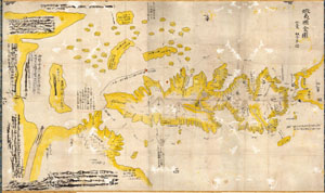
Ezo No Kuni Zenzu (Map of the Ezo Region)
sold
- Digital Map Information
- Suitable for large format printing
- Full resolution TIFF file
- ICC color profile embedded
- Delivered instantly via download link
This is an unusual 1785 manuscript map of the island of Hokkaido by the Japanese cartographer Hayashi Shihei. Oriented to the east, Shiehi has drawn Hokkaido in an unusual form, elongated on the north-south axis, such that it is barely recognizable to ... (more details)
Unusual woodblock map of Korea w/history.
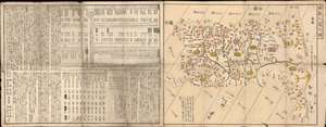
[Eight Counties of Korea] / 朝鮮八道之圖
sold
- Digital Map Information
- Suitable for large format printing
- Full resolution TIFF file
- ICC color profile embedded
- Delivered instantly via download link
This is a rare Tamiya Kitsuan / Hayashi Shihei xylographic or woodblock map of Korea, with accompanying tables, and a history of Korea, dating to 1806. The map is a stand-alone piece, divorced from Shihei's earlier work, and covers all of Korea as well as the adjacent islands, including the disputed Dokdo and a vastly oversized Ulleungdo. Jeju is not present. Cartographically the map is derived from the work Hayashi Shihei (林子平), but has here been revised with additional historical information on Korea and tables comparing Korea, China, and Japan, compiled by Tamiya Kitsuan (田宮橘菴). (more details)
Ships from Distant Ports.
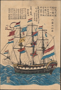
阿蘭陀船圖 / [Drawing of a Dutch Ship].
sold
- Digital Map Information
- Suitable for large format printing
- Full resolution TIFF file
- ICC color profile embedded
- Delivered instantly via download link
A captivating c. 1810 ukiyo-e woodblock depiction of a Dutch ship of the sort that traded at Nagasaki during the Tokugawa Era policy of isolation (sakoku), a classic theme in the Nagasaki-e genre of woodblock prints. Although strictly closed to traders from most countries, Japan did conduct some (strictly controlled) foreign trade with Dutch and Chinese merchants at Nagasaki, which permitted a degree of foreign interaction and exchange, as evidenced by this work. (more details)