
Shyrma, Alexander F. (sold)

Alexander F. Shyrma (1842 - ????) was a Polish-American New York City based civil engineer, inventor, and surveyor active in the late 19th century. In 1873 Shyrma invented and patented a technique for layout cement pavement. He married Elizabeth Jane Wingrove in 1868. In the early 1870s he was a Map Clerk at the New York City Department of Public Works.
The best map of the Union Square area published in the 19th century.
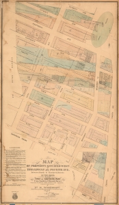
Map of Property Situated West of Broadway and Fourth Ave. Between Fourth and Thitieth Streets in Two Parts. / First or Southern Part From Fourth to Fifteenth Street.
sold
- Digital Map Information
- Suitable for large format printing
- File Size: 54.06 MB
- File Type: ZIP / TIFF
- ICC color profile embedded
- Delivered instantly via download link
A scarce c. 1875 Heinrich Windwart cadastral map of parts of Union Square and Greenwich Village, New York City. This map was issued to facilitate and profit on the implementation of the 1811 Commissioner's Plan and lotting of old New York estates. It is one of the earliest large-scale maps to specifically illustrate the Union Square area. (more details)