
Sonnet, L. (sold)

L. Sonnet (18xx - 19xx) was a French engraver active in Paris during the late 18th century and early 19th century. His works include plans of Paris and Versailles and an important map of Paraguay.
Best 19th century map of Paraguay.
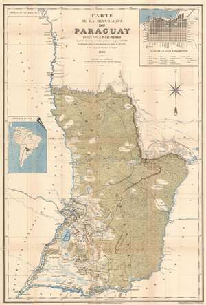
Carte de la République du Paraguay.
sold
- Digital Map Information
- Suitable for large format printing
- File Size: 45.4 MB
- File Type: ZIP / TIFF
- ICC color profile embedded
- Delivered instantly via download link
This is an 1889 Emmanuel de Bourgade La Dardye map of Paraguay. The map depicts the country after the Paraguayan War, which resulted in Paraguay forfeiting massive amounts of territory to both Argentina and Brazil. After suffering a devastating defeat in the war, these annexations forced Paraguay into the boundaries presented here, bounded by the Parana and Paraguay Rivers. (more details)