
Thornton, Samuel (sold)

Samuel Thornton (1665 - October, 1715) was an English map publisher active in the late 17th and early 18th centuries. Samuel was the son of John Thornton (1641 - 1708), the second major publisher of the English Pilot. Samuel inherited his father's business and the English Pilot plates in 1708, publishing revised edition of the English Pilot, The Third Book in 1711, and The English Pilot, the Fourth Book. Describing the West-Indian Navigation in 1713. Like his father, Thornton enjoyed a mandate from the British East Indian Company and was their primary chart provider. His name is attached to several charts of the India coast that he added to the English Pilot, The Third Book, 1703. When he died, publication of the English Pilot was taken over by Richard Mount and Thomas Page. They, unlike their predecessors, were not mandated by the British East India Company.
Very rare early map of the waters around Bombay (Mumbai).
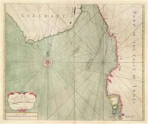
A large chart of part of the coast of GUZARATT and INDIA from Diu head to Bombay.
sold
- Digital Map Information
- Suitable for large format printing
- DPI: 600
- File Size: 19.99 MB
- File Type: ZIP / TIFF
- ICC color profile embedded
- Delivered instantly via download link
An extremely rare c. 1716 nautical chart or maritime map illustrating the Gujarat coast of India and the Gulf of Khambhat in the vicinity of Bombay or Mumbai. The map covers the coastline from, roughly Somnath and Diu to Vadodara, and south to Mumbai. The area now occupied by the Mumbai Peninsula is here divided into three islands, Tarma, Salset, and Bombay. Only one of these islands, Tarma, is connected to the mainland via a narrow bridge. On the southernmost island, Bombay is identified with the British flag, making this one of the earliest maps to illustrate Bombay following the 1661 British takeover. At sea, there are tenuous soundings and shadings around the shoals in the Gulf of Khambhat, also known as the Gulf of Cambay, and around Bombay itself. (more details)