
Trần Lưu Huệ (sold) (陳劉惠)

Trần Lưu Huệ (陳劉惠; 1832 - 1907) also known as Trần Lưu Tuệ (陳劉慧) was a Vietnamese official of the Nguyễn Dynasty. Born in Thừa Thiên in central Vietnam, Trần showed aptitude from a young age and passed a series of imperial exams, allowing him to take a position in the prestigious Viện Cơ mật (機密院, Privy Council). His skills being in demand, he moved around frequently in the Nguyễn bureaucracy, eventually becoming governor of several provinces. Along the way, he developed a special interest, among others, in surveying, cartography, and border demarcation. Trần's life overlapped with Vietnam's loss of sovereignty, and the latter portion of his career was in service to Nguyễn emperors who were effectively subordinated to the French, to the extent that he was granted chevalier rank in the légion d'honneur for his government service.
AKA: 陳劉惠
A stunning late 19th century Vietnamese manuscript map.
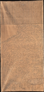
清化省圖本 / [Map of Thanh Hóa Province].
sold
- Digital Map Information
- Suitable for large format printing
- Full resolution TIFF file
- ICC color profile embedded
- Delivered instantly via download link
An incredible, one-of-a-kind large-format 1878 manuscript map depicting Thanh Hóa Province (清化省) in north-central Vietnam by Trần Lưu Huệ, an official at the court of the Nguyễn Dynasty. It is one of only a few examples of traditional Chinese-influenced Vietnamese cartography in private hands and outside of Vietnam. The area here covered was significant for the Nguyễn emperors, who had risen to prominence from Thanh Hóa in the early Lê Dynasty (r. 1428 - 1789). This, nonetheless, captures the Nguyễn Empire in decline as French Indochina began its push into the region. (more details)