
Waghenaer, Lucas Janszoon (sold)

Lucas Janszoon Waghenaer (c. 1533 - 1606) was a Dutch cartographer born in Enkhuizen. He was one of the founding members of the North Holland school of cartography, as well as one of its most famous proponents. The North Holland school played a major role in the early development of Dutch nautical chart-making.
Rare chart from first published nautical atlas.
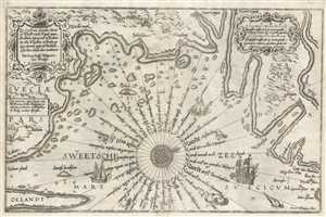
Zee Custe van Sweeden, otrent de Westernÿck en tgatt vann Stockholm, beginnende va Kalmar tot den Wigsteen en Rookoe gelegen bynnenn tgatt va Stockholm alfoe hem tlandt daer verthoont
sold
- Digital Map Information
- Suitable for large format printing
- Full resolution TIFF file
- ICC color profile embedded
- Delivered instantly via download link
This 1583 nautical chart or maritime map of Sweden along the Swedish Sea was produced by Lucas Janszoon Waghenaer. This chart is oriented to the west-northwest and depicts the coastline from Kalmar and Öland (Oelandt) in the southwest to the route to Stockholm in ... (more details)
Rare chart from first published nautical atlas.
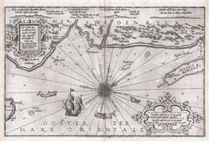
De Custen van een deel van Denemarken en Swederÿck, beginnede va Uuytste tot Calmer Toe…
sold
- Digital Map Information
- Suitable for large format printing
- DPI: 300
- File Size: 9.01 MB
- File Type: ZIP / TIFF
- ICC color profile embedded
- Delivered instantly via download link
This 1586 nautical chart or maritime map of Sweden and Denmark along the North Sea was produced by Lucas Janszoon Waghenaer for his 1586 Spieghel Der Zeevaerdt , a chart book of European coastlines. This nautical chart is oriented to the northeast and covers the ... (more details)