
Winkles, Henry (sold)

Henry Winkles (1801 – 1860) was an English illustrator, engraver, and printer, and a pioneer in the use of steel engraving. He was well-known for his prints of buildings, particularly a three-volume series on the cathedrals of England and Wales.
The not-so-Chinese Chinese Empire.
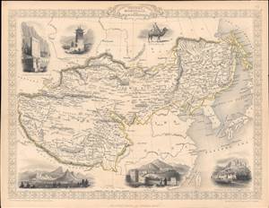
Thibet, Mongolia, and Mandchouria.
sold
- Digital Map Information
- Suitable for large format printing
- Full resolution TIFF file
- ICC color profile embedded
- Delivered instantly via download link
This is an 1851 map of Tibet, Mongolia, Manchuria, and neighboring regions belonging to the Qing Empire that appeared in the Tallis's Illustrated Atlas and Modern History of the World. It shows the immensity of territory under Qing rule, or at least Qing suzerainty, and how much of the 'Chinese Empire' was in fact outside of China. (more details)