
Xie Zuantai (sold) (謝纘泰)
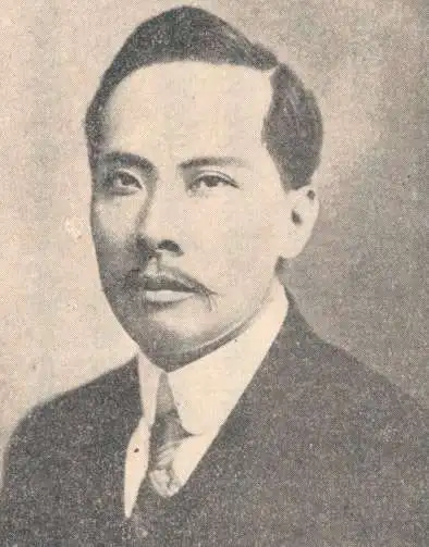
Xie Zuantai (謝纘泰, 1872 - 1939) was a Chinese artist, publisher, and revolutionary active in the late 19th century and early 20th century. He was born in Guangdong but raised in Australia where he received a western education. His father, Xie Richang, was a prominent Chinese businessman in Australia and ardently anti-Qing. The Xie family relocated to Hong Kong in 1887 to accept a position with the Works Bureau. In 1892, Zuantai, along with Fujian English instructor, Yang Quyn, founded the Furen Literary Society to support pro-Chinese anti-Qing nationalism. He soon became involved with Sun Yat-sen's Kuomintang (KMT) Nationalist Party, producing and publishing English-language propaganda in Hong Kong. He was a founding member of the Revive China Society. He prepared one map, a serio-comic pro-China criticism of the Qing and of foreign influence. The map is considered to be the first cartoon created by a Chinese artist in Hong Kong. Zuantai was also, bizarrely, is credited with inventing the 'Chinese Airship', but of course, the hot air balloon was hardly a new invention.
AKA: 謝纘泰
Chinese Communist Serio-Comic Propaganda!
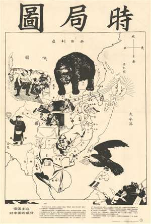
Map of Current Situation in East Asia. / 时局图
sold
- Digital Map Information
- Suitable for large format printing
- File Size: 23.96 MB
- File Type: ZIP / TIFF
- ICC color profile embedded
- Delivered instantly via download link
This is an uncommon c. 1950 serio-comic propaganda map issued by the Chinese Communist Party during or just before the Cultural Revolution. The map co-opts an earlier pro-Chinese anti-colonial serio-comic map prepared in the late 19th century. Coverage includes all of China, as well as some of the surrounding territories in Southeast Asia, Japan, Korea, and Central Asia. Zoomorphic figures stand astride the cartography - each with a political message. Most of these are expounded upon in the Chinese text below the map proper. (more details)