
Zeno, Nicolo and Antonio (sold)
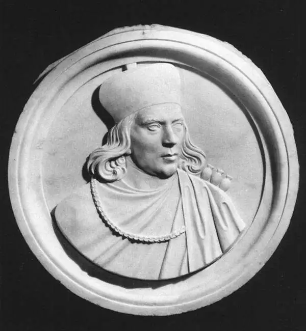
NICOLÒ Zeno (1326-1402) and ANTONIO Zeno (d.1403) were two Venetian brothers whose supposed voyage to the north Atlantic and Nova Scotia - invented and publicized by a descendant in 1558 - provided the basis for a map whose fraudulent data was considered genuine for more than fifty years. The 1558 Zeno map's mythical islands and place names were propagated not only on maps produced by Mercator and Ortelius in the 16th century but even on the maps of Blaeu and other preeminent mapmakers well into the 17th century. Among the blatant lies to appear on the map is the utterly imaginary island of Frisland, shown with greater detail than Iceland, an island widely reputed to actually exist.
First Map of Iceland to Improve on Olaus Magnus
Islanda.
sold
- Digital Map Information
- Suitable for large format printing
- Full resolution TIFF file
- ICC color profile embedded
- Delivered instantly via download link
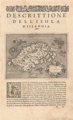
Tommaso Porcacchi's 1572 map of Iceland, in a beautiful early issue with a bold, sharp strike. It is the first separate map of Iceland to improve upon the cartography handed down from the venerable 1539 Olaus Magnus Carta Marina, whose Iceland data was reproduced by several mapmakers of the La Freri school without improvement. This map - elegantly engraved by Girolamo Porro for Porcacchi's isolario - starts with the Iceland of Magnus' Carta Marina but corrects the locations of many features. For example, the see of Hólar (Holensis) has been moved to its right place in the north, and Skálholt (Scalholdin) is correctly located in the south. Both of these locations were important in recent Icelandic history: Hólar had been the see of Jón Arason, the last Catholic bishop of Iceland. During the Reformation, it was to Skálholt that Arason and his two sons were taken and beheaded. Not all of Porcacchi's additions were well-advised; a few items have been taken from the wildly inventive Zeno map, including the seven islands appearing off the east coast. (more details)
One of the Earliest Separate Maps of Iceland.
Islanda.
sold
- Digital Map Information
- Suitable for large format printing
- DPI: 600
- File Size: 4.98 MB
- File Type: ZIP / TIFF
- ICC color profile embedded
- Delivered instantly via download link
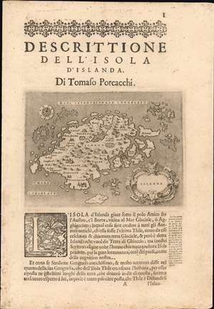
Tommaso Porcacchi's 1572 map of Iceland, in a beautiful early issue with a bold, sharp strike. It is the first separate map of Iceland to improve upon the cartography handed down from the venerable 1539 Olaus Magnus Carta Marina, whose Iceland data was reproduced by several mapmakers of the La Freri school without improvement. This map - elegantly engraved by Girolamo Porro for Porcacchi's isolario - starts with the Iceland of Magnus' Carta Marina but corrects the locations of many features. For example, the see of Hólar (Holensis) has been moved to its right place in the north, and Skálholt (Scalholdin) is correctly located in the south. Both of these locations were important in recent Icelandic history: Hólar had been the see of Jón Arason, the last Catholic bishop of Iceland. During the Reformation, it was to Skálholt that Arason and his two sons were taken and beheaded. Not all of Porcacchi's additions were well-advised; a few items have been taken from the wildly inventive Zeno map, including the seven islands appearing off the east coast. (more details)