
Map of France's Camembert cheese region.
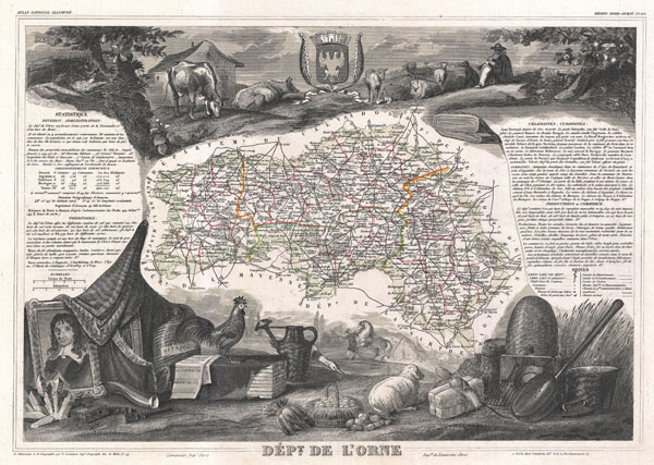
Dept. de l'Orne.
sold
- Digital Map Information
- Suitable for large format printing
- File Size: 9.73 MB
- File Type: ZIP / TIFF
- ICC color profile embedded
- Delivered instantly via download link
This is a fascinating 1852 map of the French department of Orne, France. This area, part of Normandy, includes the village of Camembert, where the famous Camembert cheese was first developed. Camembert is a soft, creamy, surface-ripened cow's milk cheese, similar ... (more details)
Part of France's premier Burgundy Wine Region.

Dept. de la Nievre.
sold
- Digital Map Information
- Suitable for large format printing
- Full resolution TIFF file
- ICC color profile embedded
- Delivered instantly via download link
This is a fascinating 1852 map of the French department of Nievre, France. Part of the prestiegous Burgundy or Bourgogne wine region this area is known for its production of Pouilly Fumé, a white wine. The word 'fumé' is French for 'smoke,' and it is said the ... (more details)

Dept. du Morbihan.
sold
- Digital Map Information
- Suitable for large format printing
- File Size: 9.24 MB
- File Type: ZIP / TIFF
- ICC color profile embedded
- Delivered instantly via download link
This is a fascinating 1852 map of the French department of Morbihan, France. The map proper is surrounded by elaborate decorative engravings designed to illustrate both the natural beauty and trade richness of the land. There is a short textual history of the ... (more details)
Map of France's Brie de Meaux cheese region. (Alcase-Lorraine)

Dept. de la Meuse.
sold
- Digital Map Information
- Suitable for large format printing
- File Size: 9.55 MB
- File Type: ZIP / TIFF
- ICC color profile embedded
- Delivered instantly via download link
This is a fascinating 1852 map of the French department of Meuse, France. This area part of the Lorraine or Alsace-Lorraine wine regions. It is also known for its production of Brie de Meaux cheeses. In fact, more than 60% of Brie de Meaux production takes ... (more details)

Dept. de la Haute Marne.
sold
- Digital Map Information
- Suitable for large format printing
- File Size: 3.85 MB
- File Type: ZIP / TIFF
- ICC color profile embedded
- Delivered instantly via download link
This is a fascinating 1852 map of the French department of Haute Marne, France. This department is part of the Champagne region, where the world-famous sparkling wine of the same name is produced. This area is known for a variety of wines from the ... (more details)
Map of France's Champagne wine region.

Dept. de la Marne.
sold
- Digital Map Information
- Suitable for large format printing
- File Size: 3.53 MB
- File Type: ZIP / TIFF
- ICC color profile embedded
- Delivered instantly via download link
This is a fascinating 1852 map of the French department of Marne, France. This department is home to the Champagne region where the world's finest sparkling wine is produced. The map proper is surrounded by elaborate decorative engravings designed ... (more details)
Loire Valley Wine Region.

Dept. de Maine et Loire.
sold
- Digital Map Information
- Suitable for large format printing
- File Size: 10.07 MB
- File Type: ZIP / TIFF
- ICC color profile embedded
- Delivered instantly via download link
This is a fascinating 1852 map of the French department of Maine et Loire, France. This area of France is part of the Loire Valley wine region, where nearly every wine imaginable is produced. Maine et Loire itself is home to the largest vineyard ... (more details)

Dept. de la Lozere.
sold
- Digital Map Information
- Suitable for large format printing
- File Size: 9.33 MB
- File Type: ZIP / TIFF
- ICC color profile embedded
- Delivered instantly via download link
This is a fascinating 1852 map of the French department of Lozere, France. This remote mountainous part of Languedoc is rural, sparcely populated, and extremely beautiful. This area of France is famous for its cheese production. Their ... (more details)

Dept. de Lot et Garonne.
sold
- Digital Map Information
- Suitable for large format printing
- File Size: 9.63 MB
- File Type: ZIP / TIFF
- ICC color profile embedded
- Delivered instantly via download link
This is a fascinating 1852 map of the French department of Lot et Garonne, France. This area of France is known for its production of Buzet wines and Cabécou d'Antan, small round goat cheese with a fine, creamy texture. The Pilgrimage ... (more details)
Map of France's Cahors wine region.

Dept. du Lot.
sold
- Digital Map Information
- Suitable for large format printing
- File Size: 10.3 MB
- File Type: ZIP / TIFF
- ICC color profile embedded
- Delivered instantly via download link
This is a fascinating 1852 map of the French department of Lot, France. This area of France is known for its production of Cahors wine, a powerful red wine, often 'harsh when young, but remarkable after a few years in bottle.' The ... (more details)
Loire Valley Wine Region.

Dept. du Loiret.
sold
- Digital Map Information
- Suitable for large format printing
- File Size: 9.74 MB
- File Type: ZIP / TIFF
- ICC color profile embedded
- Delivered instantly via download link
This is a fascinating 1852 map of the French department of Loiret, France. Surrounding the city of Orleans, Loiret is considered the heart of France and is a registered Unesco World Heritage Site. This area of France is also part ... (more details)
An important and significant advancement in Japanese globular cartography.
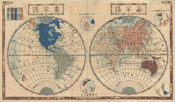
Shinsei yochi zenzu (ALT: Kaei kotei tozai chikyu bankoku zenzu )
sold
- Digital Map Information
- Suitable for large format printing
- DPI: 300
- File Size: 14.63 MB
- File Type: ZIP / TIFF
- ICC color profile embedded
- Delivered instantly via download link
An extraordinary Japanese woodblock map of the world dating to 1848 by Shincho Kurihara and Heibe Chojiya. This map, whose title literally translates as 'Newly Made Map of the Earth' represents an important advancement in Japanese ... (more details)
Unusual German comparative mountains chart incorporating a transparent theme.
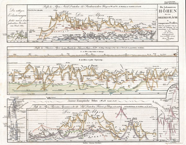
Die becannteren Hoehen uber der Meeres Flache in Transparenten Profilen.
sold
- Digital Map Information
- Suitable for large format printing
- File Size: 4.79 MB
- File Type: ZIP / TIFF
- ICC color profile embedded
- Delivered instantly via download link
This German comparative mountains chart or map was issued by publisher Justus Perthes in 1864 and represents a style that evolved independently in Germany between 1840 and 1870. In this example mountains are shown in a transparent ... (more details)
Unusual circular themed comparative rivers chart.
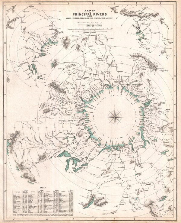
A Map of the Principal Rivers shewing their Courses, Countries, and Comparative Lengths.
sold
- Digital Map Information
- Suitable for large format printing
- Full resolution TIFF file
- ICC color profile embedded
- Delivered instantly via download link
This curious comparative rivers chart published in 1834 by the Society for the Diffusion of Useful Knowledge is somewhat unique in that it imagines all of the great rivers of the world letting out into a circular inland sea. ... (more details)
Important c. 1840 Japanese Map of the World on a double hemisphere projection.
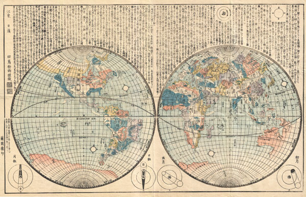
Oranda Chikyu Zenzu
sold
- Digital Map Information
- Suitable for large format printing
- DPI: 300
- File Size: 18.45 MB
- File Type: ZIP / TIFF
- ICC color profile embedded
- Delivered instantly via download link
An extraordinary Japanese woodblock map of the world dating to 1840 by Ryukei Tajima. A brief overview of this remarkable map reveals just how isolated Japan really was prior to the arrival of Commodore Perry in 1850. ... (more details)
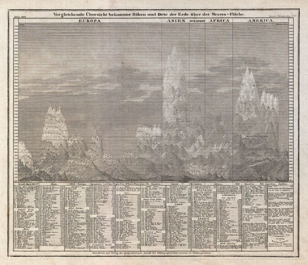
Vergleichende Übersicht bekannter Höhen und Orte der Erde über der Meeres-Fläche
sold
- Digital Map Information
- Suitable for large format printing
- DPI: 300
- File Size: 5.16 MB
- File Type: ZIP / TIFF
- ICC color profile embedded
- Delivered instantly via download link
An interesting c. 1850 German take on the comparative mountains chart by Joseph Meyer. Identifies some 400 mountains drawn in proximity to one another and subdivided by continent. Dhaulagiri, in the Nepali Himalayas ... (more details)
Colton's first atlas map of New York City to be oriented to the north.

Colton's New York City, Brooklyn, Jersey City, Hoboken, Etc.
sold
- Digital Map Information
- Suitable for large format printing
- File Size: 17.08 MB
- File Type: ZIP / TIFF
- ICC color profile embedded
- Delivered instantly via download link
An extremely rare example of G. Woolworth Colton's 1866 vertical map of New York. This important map, based on a pocket map of the same area issued in 1865, marks a significant rethinking of the standard Manhattan ... (more details)
One of the finest mid 19th century comparative mountains charts.
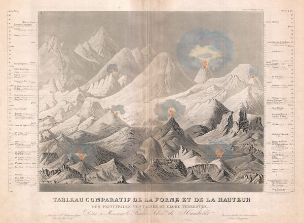
Tableau comparatif de la forme et de la hauteur des principales montagnes du globe terrestre, dedie a Monsieur le Baron, Alexdre. de Humboldt.
sold
- Digital Map Information
- Suitable for large format printing
- Full resolution TIFF file
- ICC color profile embedded
- Delivered instantly via download link
An exceptionally attractive and unusual 1850 comparative mountains chart by Andriveau-Goujon. A fine mid-century example of the comparative chart convention. Shows many of the world's greatest mountains and ... (more details)
Magnificent decorative map of the Holy Land showing the Exodus.

Perigrinatie ofte Veertich-Iarige Reyse der Kinderen Israels
sold
- Digital Map Information
- Suitable for large format printing
- DPI: 300
- File Size: 10.9 MB
- File Type: ZIP / TIFF
- ICC color profile embedded
- Delivered instantly via download link
An absolutely stunning 1702 map of the Holy Land, Israel, or Palestine by N. Visscher and D. Stoopendaal. This map, from Keur's important Dutch Bible of 1702, is oriented to west and covers from the Nile ... (more details)
Bradford's finest map of Manhattan.

New York.
sold
- Digital Map Information
- Suitable for large format printing
- DPI: 300
- File Size: 7.09 MB
- File Type: ZIP / TIFF
- ICC color profile embedded
- Delivered instantly via download link
This is Thomas Bradford's important 1839 map of New York City. Bradford's plan covers Manhattan from 53rd Street to the Battery, with parts of adjacent Brooklyn, Hoboken, and Jersey City. The whole is ... (more details)