
Boynton, George Washington

George Washington Boynton (fl. c. 1830 - 1850) was a Boston based cartographer and map engraver active in the first half of the 19th century. Boynton engraved and compiled maps for numerous publishers including Thomas Bradford, Nathaniel Dearborn, Daniel Adams, and S. G. Goodrich. His most significant work is most likely his engraving of various maps for Bradford's Illustrated Atlas, Geographical, Statistical, and Historical, of the United States and the Adjacent Countries and Universal Illustrated Atlas. He also engraved for the Boston Almanac. In 1835, Boynton is listed as an employee of the Boston Bewick Company, an engraving, stereotype, and printing concern based at no. 47 Court Street, Boston. Little else is known of his life.
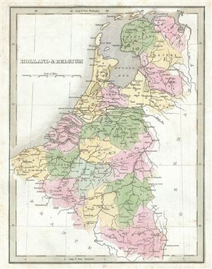
Holland and Belgium.
$100.00
Acquire
- Digital Map Information
- Suitable for large format printing
- Full resolution TIFF file
- ICC color profile embedded
- Delivered instantly via download link
This is a beautiful 1835 map of Holland (the Netherlands) and Belgium by the important American mapmaker T. G. Bradford. It covers from the North Sea to Luxembourg. Towns, rivers, mountains, canals and various other important topographical details are noted. ... (more details)
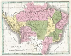
Brazil, Bolivia and Peru.
$100.00
Acquire
- Digital Map Information
- Suitable for large format printing
- DPI: 300
- File Size: 2.66 MB
- File Type: ZIP / TIFF
- ICC color profile embedded
- Delivered instantly via download link
This is a fine 1835 map of Brazil, Bolivia and Peru by the important American mapmaker T. G. Bradford. It covers all of modern day Brazil from Guyana and Colombia in the north to Uruguay in the south and from Bolivia in the west to the Atlantic. Bolivia's ... (more details)
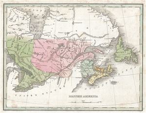
British America.
$100.00
Acquire
- Digital Map Information
- Suitable for large format printing
- DPI: 300
- File Size: 2.32 MB
- File Type: ZIP / TIFF
- ICC color profile embedded
- Delivered instantly via download link
This is a fine 1835 map of Canada or British America by the important American mapmaker T. G. Bradford. It covers Upper Canada (Ontario), Lower Canada (Quebec), Nova Scotia, New Brunswick and Newfoundland and Prince Edwards Island. It also shows the five ... (more details)
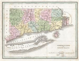
Connecticut and Rhode Island.
$200.00
Acquire
- Digital Map Information
- Suitable for large format printing
- DPI: 300
- File Size: 3.12 MB
- File Type: ZIP / TIFF
- ICC color profile embedded
- Delivered instantly via download link
This is a fine example of T. G. Bradford's 1835 map of Connecticut and Rhode Island. It covers the two states in detail along with parts of Long Island. Block Island is also included. The map notes rivers, towns, cities, roads, proposed railroads and ... (more details)
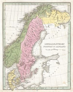
Denmark, Sweden, Norway and Lapland.
$150.00
Acquire
- Digital Map Information
- Suitable for large format printing
- Full resolution TIFF file
- ICC color profile embedded
- Delivered instantly via download link
This is affine example of T. G. Bradford's 1835 map of Sweden, Norway, Denmark and Lapland. Centered on the Gulf of Bothnia, it covers all of Scandinavia, from Finmark to Denmark. Towns, rivers, mountains, lakes, and various other important ... (more details)
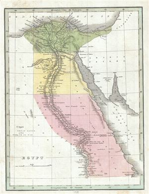
Egypt.
$150.00
Acquire
- Digital Map Information
- Suitable for large format printing
- Full resolution TIFF file
- ICC color profile embedded
- Delivered instantly via download link
This fine map of Egypt was printed by the important American mapmaker T. G. Bradford in 1835. It depicts Egypt, centered on the Nile River from its delta on the Mediterranean south as far as Aswan. Egypt is here divided in to Mamluk ... (more details)
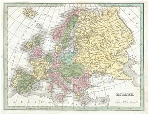
Europe.
$125.00
Acquire
- Digital Map Information
- Suitable for large format printing
- Full resolution TIFF file
- ICC color profile embedded
- Delivered instantly via download link
This is a fine 1835 map of Europe by the important American mapmaker T. G. Bradford. It covers the entire European continent and covers from the Atlantic to the Ural Mountains and from the Arctic Circle south to the Mediterranean ... (more details)
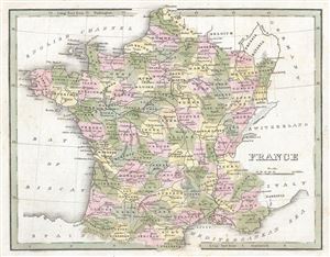
France.
$100.00
Acquire
- Digital Map Information
- Suitable for large format printing
- DPI: 300
- File Size: 2.58 MB
- File Type: ZIP / TIFF
- ICC color profile embedded
- Delivered instantly via download link
This beautiful map of France was printed by the important American mapmaker T. G. Bradford in 1835. It depicts the Kingdom of France showing its various departments, and covers from the Nord in the north to eastern Pyrenees in ... (more details)
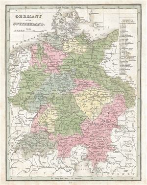
Germany and Switzerland.
$150.00
Acquire
- Digital Map Information
- Suitable for large format printing
- Full resolution TIFF file
- ICC color profile embedded
- Delivered instantly via download link
This is a fine 1835 map of Germany and Switzerland by the important American mapmaker T. G. Bradford. It covers the Germanic Confederation from the Baltic Sea and Holstein south to the Gulf of Venice and includes the modern ... (more details)
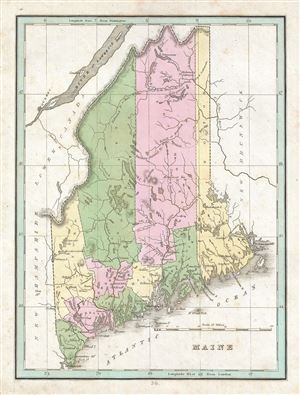
Maine.
$250.00
Acquire
- Digital Map Information
- Suitable for large format printing
- DPI: 300
- File Size: 2.45 MB
- File Type: ZIP / TIFF
- ICC color profile embedded
- Delivered instantly via download link
This is a beautiful example of T. G. Bradford's 1835 map of Maine. The map covers the state of Maine in superb detail, noting towns, cities, bays, islands, rivers, inlets and a host of other topographical features, with ... (more details)
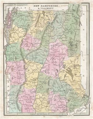
New Hampshire and Vermont.
$150.00
Acquire
- Digital Map Information
- Suitable for large format printing
- DPI: 300
- File Size: 2.74 MB
- File Type: ZIP / TIFF
- ICC color profile embedded
- Delivered instantly via download link
An attractive 1835 map of New Hampshire and Vermont by T. G. Bradford. It cover the two states in detail, noting towns, cities, lakes and other important topographical features, with elevation rendered by hachure. ... (more details)
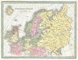
Northern Europe.
$100.00
Acquire
- Digital Map Information
- Suitable for large format printing
- Full resolution TIFF file
- ICC color profile embedded
- Delivered instantly via download link
This is an unusual 1835 map of Northern Europe by the important American mapmaker T. G. Bradford. It covers the southern portion of the European continent and includes Norway, Sweden, Russia, Finland, Denmark, ... (more details)
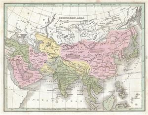
Southern Asia.
$175.00
Acquire
- Digital Map Information
- Suitable for large format printing
- Full resolution TIFF file
- ICC color profile embedded
- Delivered instantly via download link
This is a scarce 1835 map of southern Asia by the important American mapmaker T. G. Bradford. The map covers the continent from Chinese Tartary south as far as the Indian Ocean and Sumatra and from the Red Sea ... (more details)
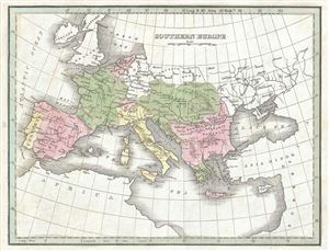
Southern Europe.
$100.00
Acquire
- Digital Map Information
- Suitable for large format printing
- Full resolution TIFF file
- ICC color profile embedded
- Delivered instantly via download link
This is an unusual 1835 map of Southern Europe by the important American mapmaker T. G. Bradford. It covers the southern portion of the European continent and includes Spain, Portugal, France, Belgium, the ... (more details)
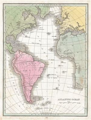
Atlantic Ocean.
$100.00
Acquire
- Digital Map Information
- Suitable for large format printing
- DPI: 300
- File Size: 2.5 MB
- File Type: ZIP / TIFF
- ICC color profile embedded
- Delivered instantly via download link
This is a fine 1835 map of the Atlantic Ocean by the important American mapmaker T. G. Bradford. It covers the Atlantic Ocean from the Baffin Bay south as far as the Antarctic Circle and from the Gulf of ... (more details)
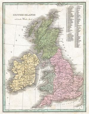
British Islands.
$100.00
Acquire
- Digital Map Information
- Suitable for large format printing
- DPI: 300
- File Size: 2.74 MB
- File Type: ZIP / TIFF
- ICC color profile embedded
- Delivered instantly via download link
This is a beautiful 1835 map of the British Islands by the important American mapmaker T. G. Bradford. It includes England, Scotland, Wales and Ireland and covers from the southern tip of the Shetland ... (more details)
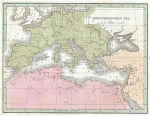
Mediterranean Sea.
$150.00
Acquire
- Digital Map Information
- Suitable for large format printing
- Full resolution TIFF file
- ICC color profile embedded
- Delivered instantly via download link
This is a fine 1835 map of the Mediterranean Sea and vicinity by the important American mapmaker T. G. Bradford. Centered on the Mediterranean Sea, it covers from Denmark south to the Sahara Desert ... (more details)
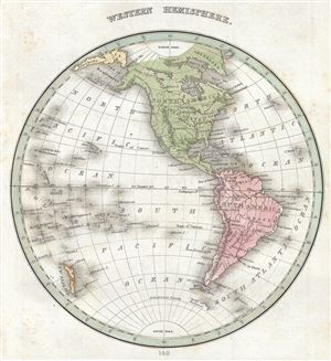
Western Hemisphere.
$200.00
Acquire
- Digital Map Information
- Suitable for large format printing
- Full resolution TIFF file
- ICC color profile embedded
- Delivered instantly via download link
This is a fine 1835 map of the western hemisphere by the important American mapmaker T. G. Bradford. It covers North America, South America, West Indies and most of Polynesia including New Zealand ... (more details)
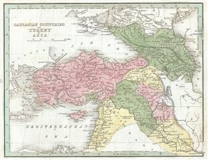
Caucasian Countries and Turkey in Asia.
$175.00
Acquire
- Digital Map Information
- Suitable for large format printing
- Full resolution TIFF file
- ICC color profile embedded
- Delivered instantly via download link
This is an unusual 1835 map of the Asian Turkey and the Caucuses by the important American mapmaker T. G. Bradford. It depicts the modern day Turkey, Israel/Palestine, Jordan, Syria, Lebanon, ... (more details)
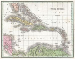
West Indies.
$175.00
Acquire
- Digital Map Information
- Suitable for large format printing
- DPI: 300
- File Size: 2.58 MB
- File Type: ZIP / TIFF
- ICC color profile embedded
- Delivered instantly via download link
This beautiful map of the West Indies was printed in 1835 by the important American mapmaker T. G. Bradford. Centered on the island of Hispaniola (Santo Domingo), it covers the Caribbean from ... (more details)
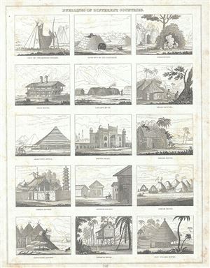
Dwellings of Different Countries.
$75.00
Acquire
- Digital Map Information
- Suitable for large format printing
- Full resolution TIFF file
- ICC color profile embedded
- Delivered instantly via download link
This is a fine example of the 1835 chart illustrating the different dwellings of different countries by the important American mapmaker T. G. Bradford. The chart includes fifteen views, ... (more details)
Before the Back Bay.
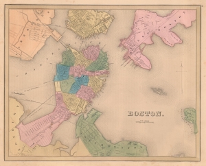
Boston.
$500.00
Acquire
- Digital Map Information
- Suitable for large format printing
- DPI: 600
- File Size: 19.7 MB
- File Type: ZIP / TIFF
- ICC color profile embedded
- Delivered instantly via download link
This is an 1838 Thomas G. Bradford map of Boston on the cusp of its transformation, via landfills and railroads, from a colonial port to a major metropolitan center. (more details)
Canals vs. Railroads.
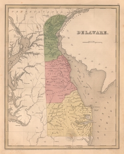
Delaware.
$400.00
Acquire
- Digital Map Information
- Suitable for large format printing
- DPI: 600
- File Size: 18.3 MB
- File Type: ZIP / TIFF
- ICC color profile embedded
- Delivered instantly via download link
This is an 1838 Thomas G. Bradford map of Delaware. It is one of the few American atlas maps specifically of Delaware - most bundle it with either Maryland or New Jersey. Coverage embraces from the Susquehanna River and Chesapeake Bay to New Jersey and from Pennsylvania and New Jersey to Maryland and the Atlantic Ocean. (more details)
Early railroads in Georgia.
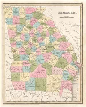
Georgia.
$350.00
Acquire
- Digital Map Information
- Suitable for large format printing
- Full resolution TIFF file
- ICC color profile embedded
- Delivered instantly via download link
This is an 1838 Thomas G. Bradford map of Georgia. Numerous cities and towns are labeled, including Savannah, Augusta, Athens, Marietta, and Decatur. Atlanta was not incorporated until 1847. Railroads played an important role in Georgia's history in the late 1830s and 1840s, with several major railroad lines operating within the state. The Central of Georgia Railway operated between Savannah and Macon, the Macon and Western Railroad ran between Decatur (Decatur becomes Atlanta) and Macon, and the Georgia Railroad operated between Athens and Augusta. (more details)
Early territorial configuration of Iowa and Wisconsin.
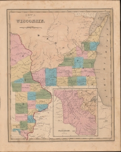
Iowa and Wisconsin.
$550.00
Acquire
- Digital Map Information
- Suitable for large format printing
- DPI: 600
- File Size: 20.18 MB
- File Type: ZIP / TIFF
- ICC color profile embedded
- Delivered instantly via download link
This is an 1838 Thomas G. Bradford map of Wisconsin and Iowa territories. (more details)
A beacon of industrialization and progressive thought.
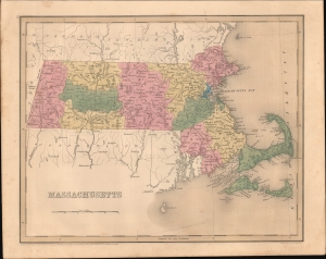
Massachusetts.
$300.00
Acquire
- Digital Map Information
- Suitable for large format printing
- DPI: 600
- File Size: 244.75 MB
- File Type: ZIP / TIFF
- ICC color profile embedded
- Delivered instantly via download link
This is an 1838 Thomas G. Bradford map of Massachusetts. (more details)
Railroad expansion fuels economic boom.
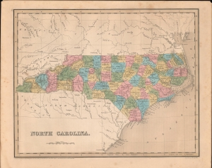
North Carolina.
$300.00
Acquire
- Digital Map Information
- Suitable for large format printing
- DPI: 600
- File Size: 245.7 MB
- File Type: ZIP / TIFF
- ICC color profile embedded
- Delivered instantly via download link
This is an 1838 Thomas G. Bradford map of North Carolina. The state illustrated here was undergoing an economic boom driven by growth in the textile industry and expanding transportation infrastructure, such as railroads and canals. (more details)
Before the Dorr Rebellion.
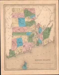
Rhode Island.
$300.00
Acquire
- Digital Map Information
- Suitable for large format printing
- DPI: 600
- File Size: 250.34 MB
- File Type: ZIP / TIFF
- ICC color profile embedded
- Delivered instantly via download link
This is an 1838 Thomas G. Bradford map of Rhode Island. (more details)
A tumultuous period for the the heart of the antebellum South.
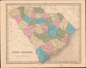
South Carolina.
$350.00
Acquire
- Digital Map Information
- Suitable for large format printing
- DPI: 600
- File Size: 240.72 MB
- File Type: ZIP / TIFF
- ICC color profile embedded
- Delivered instantly via download link
This is an 1838 Thomas G. Bradford map of South Carolina. (more details)
Filling in the Geography of the Pacific.
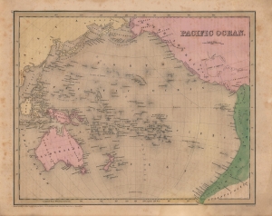
Pacific Ocean.
$250.00
Acquire
- Digital Map Information
- Suitable for large format printing
- Full resolution TIFF file
- ICC color profile embedded
- Delivered instantly via download link
A beautiful 1842 map of the Pacific Ocean, Australia, and Polynesia by the important American mapmaker T. G. Bradford. Centered on the Sandwich or Hawaiian Islands, it depicts the entirety of the Pacific Basin along with portions of the surrounding continents. (more details)
Charm City.
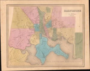
Baltimore.
$350.00
Acquire
- Digital Map Information
- Suitable for large format printing
- DPI: 600
- File Size: 24.19 MB
- File Type: ZIP / TIFF
- ICC color profile embedded
- Delivered instantly via download link
This is Thomas Bradford's 1846 city plan or map of Baltimore, Maryland, as it appeared in his Universal Illustrated Atlas. The map captures Baltimore at the height of its mid-19th-century growth spurt. (more details)
Published only ten years after Arkansas became a state.
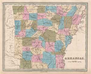
Arkansas.
$300.00
Acquire
- Digital Map Information
- Suitable for large format printing
- DPI: 300
- File Size: 4.66 MB
- File Type: ZIP / TIFF
- ICC color profile embedded
- Delivered instantly via download link
This is an 1846 Thomas G. Bradford map of Arkansas. The map depicts the region from Oklahoma, labeled here as the 'Missouri Territory', to the Mississippi River, Tennessee, and an ... (more details)
Depicts the numerous railroad lines built in Connecticut in the 1830s and 1840s.
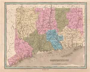
Connecticut.
$250.00
Acquire
- Digital Map Information
- Suitable for large format printing
- DPI: 300
- File Size: 5.26 MB
- File Type: ZIP / TIFF
- ICC color profile embedded
- Delivered instantly via download link
This is an 1846 Thomas G. Bradford map of Connecticut. The map depicts the region from New York to Rhode Island and from Massachusetts to Long Island Sound. As is the case among ... (more details)
Depicts the Illinois and Michigan Canal which helped establish Chicago as a transportation hub before railroads became the dominant form of transportation.
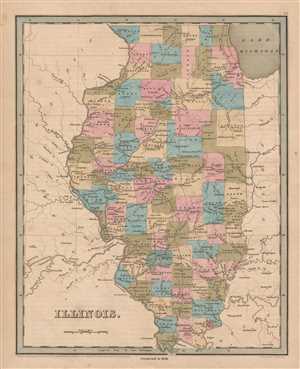
Illinois.
$350.00
Acquire
- Digital Map Information
- Suitable for large format printing
- DPI: 300
- File Size: 4.09 MB
- File Type: ZIP / TIFF
- ICC color profile embedded
- Delivered instantly via download link
This is an 1846 Thomas G. Bradford map of Illinois. The map depicts the region from Iowa (labeled Wisconsin) and Missouri to Indiana and Kentucky and from Lake Michigan and ... (more details)
The year of Iowa's Statehood.
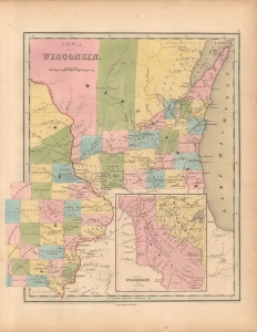
Iowa and Wisconsin.
$450.00
Acquire
- Digital Map Information
- Suitable for large format printing
- File Size: 9.19 MB
- File Type: ZIP / TIFF
- ICC color profile embedded
- Delivered instantly via download link
This is an 1846 Thomas G. Bradford map of Wisconsin and Iowa. It appeared in the year of Iowa's statehood and illustrates an early political configuration predating the development of a road or railroad network. (more details)
Illustrates the route of the Lexington and Ohio Railroad - the only railroad in operation in Kentucky until 1859.
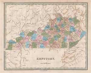
Kentucky.
$250.00
Acquire
- Digital Map Information
- Suitable for large format printing
- DPI: 300
- File Size: 4.37 MB
- File Type: ZIP / TIFF
- ICC color profile embedded
- Delivered instantly via download link
This is an 1846 Thomas G. Bradford map of Kentucky. The map depicts the region from Illinois and Missouri to North Carolina, Virginia, and Ohio and from Illinois, Indiana, ... (more details)
Several small railroads are illustrated - constructed to convey cotton to market.
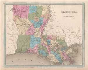
Louisiana.
$400.00
Acquire
- Digital Map Information
- Suitable for large format printing
- DPI: 300
- File Size: 4.36 MB
- File Type: ZIP / TIFF
- ICC color profile embedded
- Delivered instantly via download link
This is an 1846 Thomas G. Bradford map of Louisiana. The map depicts the region from Texas to Mississippi and from Arkansas to the Gulf of Mexico. As is the case with the ... (more details)
Quieting Quebec.
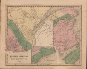
Lower Canada and New Brunswick.
$275.00
Acquire
- Digital Map Information
- Suitable for large format printing
- DPI: 600
- File Size: 25.65 MB
- File Type: ZIP / TIFF
- ICC color profile embedded
- Delivered instantly via download link
A nice example of Thomas Bradford's 1846 map of Lower Canada (Quebec), New Brunswick, and Nova Scotia, that appeared in his Universal Illustrated Atlas. (more details)
At Loggerheads over Logging Rights.
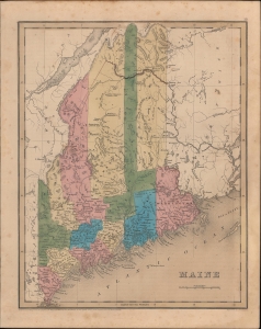
Maine.
$350.00
Acquire
- Digital Map Information
- Suitable for large format printing
- DPI: 600
- File Size: 20.67 MB
- File Type: ZIP / TIFF
- ICC color profile embedded
- Delivered instantly via download link
An example of Thomas Bradford's 1846 map of Maine, published in his Universal Illustrated Atlas. (more details)
Early railroad infrastructure.
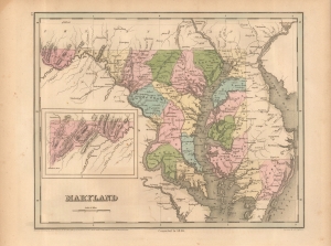
Maryland.
$400.00
Acquire
- Digital Map Information
- Suitable for large format printing
- File Size: 10.38 MB
- File Type: ZIP / TIFF
- ICC color profile embedded
- Delivered instantly via download link
This is Thomas G. Bradford's 1846 map of Maryland. It presents the state at a time when multiple transportation infrastructure projects (canals and railroads) were underway, linking the state (especially Baltimore) more closely with other coastal cities and the Appalachian region. (more details)
New Hampshire's first railroads.
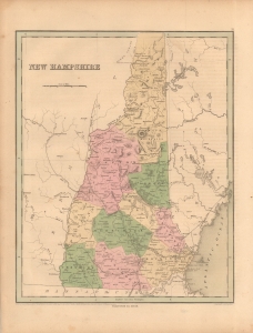
New Hampshire.
$350.00
Acquire
- Digital Map Information
- Suitable for large format printing
- File Size: 8.73 MB
- File Type: ZIP / TIFF
- ICC color profile embedded
- Delivered instantly via download link
This is an 1846 Thomas G. Bradford map of New Hampshire. This map is significant for its illustration of New Hampshire's existing and emerging railroad network. (more details)
Illustrates the Erie Canal, the Long Island Railroad, and the New York and Harlem Railroad - one of the first railroads in the United States.
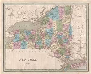
New York.
$250.00
Acquire
- Digital Map Information
- Suitable for large format printing
- DPI: 300
- File Size: 4.62 MB
- File Type: ZIP / TIFF
- ICC color profile embedded
- Delivered instantly via download link
This is an 1846 Thomas G. Bradford map of New York. The map depicts the region from Lake Erie and Ontario, Canada to Vermont and from Canada to Pennsylvania and New Jersey. As is prevalent among many maps from Bradford's A Universal Illustrated Atlas, the transportation network in New York is prominently featured, especially the network of canals and the newly-constructed railroads.
Canals in New York
The centerpiece of transportation in New York during this time in American history was the Erie Canal. Completed in 1825, the Canal connected the Hudson River at Albany to Lake Erie and Buffalo. At the time, the Erie Canal was the longest canal in the world. Upon its completion, goods could be transported by water from New York City to Chicago, a much less hazardous and time-consuming voyage than overland treks. Numerous other canals are illustrated, although they are not labeled. These include the Erie and Champlain Canal which connected the Erie Canal with Lake Champlain at Whitehall, the Oswego Canal between Syracuse and Oswego, the Chenango Canal between the Erie Canal at Utica to Binghampton, and several others. The construction of this extensive canal system led officials in New York to try and protect their investment by seriously restricting the construction of railroads within the state. In doing so, that would, theoretically, guarantee that the transport of goods would be carried out using the canals. (more details)
Illustrates the network of railroads and canals connecting Philadelphia and Pittsburgh.
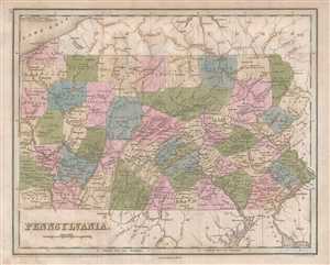
Pennsylvania.
$250.00
Acquire
- Digital Map Information
- Suitable for large format printing
- DPI: 300
- File Size: 4.94 MB
- File Type: ZIP / TIFF
- ICC color profile embedded
- Delivered instantly via download link
This is an 1846 Thomas G. Bradford map of Pennsylvania. The map depicts the region fromOhio to New Jersey and from Lake Erie and New York to Virginia. As is the case with ... (more details)
Created during the political unrest rampant in 19th century South America.
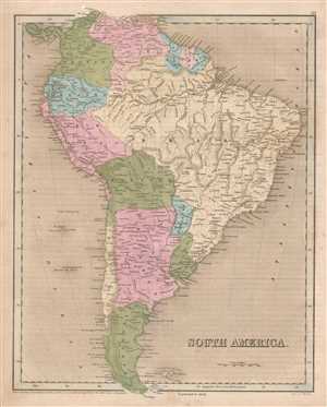
South America.
$175.00
Acquire
- Digital Map Information
- Suitable for large format printing
- DPI: 300
- File Size: 4.86 MB
- File Type: ZIP / TIFF
- ICC color profile embedded
- Delivered instantly via download link
This is an 1846 Thomas G. Bradford map of South America. The map depicts the continent from Panama to Tierra del Fuego and from the Pacific Ocean to the Atlantic Ocean. ... (more details)
Proposed early Tennessee Railroads.
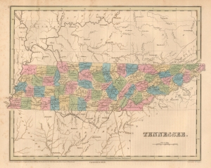
Tennessee.
$300.00
Acquire
- Digital Map Information
- Suitable for large format printing
- File Size: 7.37 MB
- File Type: ZIP / TIFF
- ICC color profile embedded
- Delivered instantly via download link
This is an 1846 Thomas G. Bradford map of Tennessee. Coverage embraces Tennessee in full, with significant parts of adjacent Kentucky, Georgia, Alabama, and Mississippi. (more details)
Rearranging Canada.
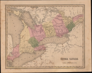
Upper Canada.
$275.00
Acquire
- Digital Map Information
- Suitable for large format printing
- Full resolution TIFF file
- ICC color profile embedded
- Delivered instantly via download link
A nice example of Thomas Bradford's 1846 map of Upper Canada, concurrent with much of today's Ontario Province. (more details)
Brilliantly illustrates Vermont's early railroad history.
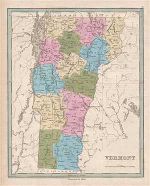
Vermont.
$350.00
Acquire
- Digital Map Information
- Suitable for large format printing
- DPI: 300
- File Size: 4.53 MB
- File Type: ZIP / TIFF
- ICC color profile embedded
- Delivered instantly via download link
This is an 1846 Thomas G. Bradford map of Vermont. The map depicts the region from New York to New Hampshire and from Quebec to Massachusetts. As is prevalent among ... (more details)
The 'Mother of States'.
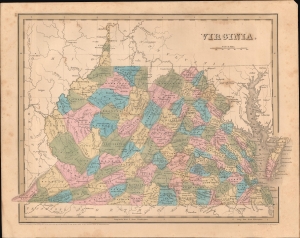
Virginia.
$400.00
Acquire
- Digital Map Information
- Suitable for large format printing
- DPI: 600
- File Size: 23.43 MB
- File Type: ZIP / TIFF
- ICC color profile embedded
- Delivered instantly via download link
An example of Thomas G. Bradford's 1846 map of Virginia (with West Virginia), published in his A Universal Illustrated Atlas. (more details)