

Europe Divided into its Empires, Kingdoms, States Republics, & c.
sold
- Digital Map Information
- Suitable for large format printing
- DPI: 300
- File Size: 78.51 MB
- File Type: ZIP / TIFF
- ICC color profile embedded
- Delivered instantly via download link
A large and dramatic 1794 wall map of Europe on two panels. Published by Laurie and Whittle based the work of the important cartographer J. B. B. D'Anville. Upper sheet covers from Iceland to Russia and from the Arctic to Calais and Astrakhan. The southern ... (more details)
The Eddy Map.' One of the most important early maps of New York City ever printed.
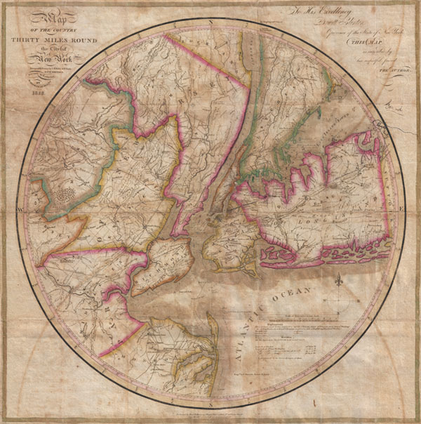
Map of the country Thirty Miles Round the City of New York.
sold
- Digital Map Information
- Suitable for large format printing
- DPI: 300
- File Size: 15.89 MB
- File Type: ZIP / TIFF
- ICC color profile embedded
- Delivered instantly via download link
Known as 'The Eddy Map,' this is an extremely rare and important circular map of New York City and vicinity, dated 1823. Covers the New York City area in roughly a thirty mile radius of Manhattan, extending north to Tarrytown, south to Monmouth, west to ... (more details)
Staggering wall map of India.
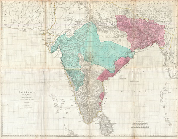
The East Indies, with the Roads.
sold
- Digital Map Information
- Suitable for large format printing
- DPI: 300
- File Size: 71.28 MB
- File Type: ZIP / TIFF
- ICC color profile embedded
- Delivered instantly via download link
This is a staggering wall size map of India and Ceylon issued in 1768 by Thomas Jeffreys. Covers the Indian subcontinent from Mekran in the west to Assam and Aracan in the east, and from Bhutan in the north, south to Ceylon and the Maldives. Offers ... (more details)
Important decorative wall map of South America. Identifies Manoa or El Dorado.
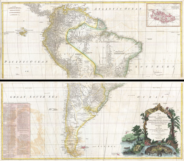
A Map of South America containing Tierra-Firma, Guayana, New Granada, Amazonia, Brasil, Peru, Paraguay, Chaco, Tucuman, Chili and Patagonia from M. d'Anville with Several Imporvements and Additions, and The Newest Discoveries.
sold
- Digital Map Information
- Suitable for large format printing
- DPI: 300
- File Size: 61.87 MB
- File Type: ZIP / TIFF
- ICC color profile embedded
- Delivered instantly via download link
This is probably the most important two panel wall map of South America produced in the 18th century. Largely based upon the earlier D'Anville map, this map has been enlarged and expanded by the English publishing house of Laurie and Whittle. ... (more details)
Marks the end of Spanish dominance in the 18th century Pacific.

A Chart of the Pacific Ocean from the Equinoctial to the Latitude fo 39 1/2 d. No.
sold
- Digital Map Information
- Suitable for large format printing
- DPI: 300
- File Size: 9.89 MB
- File Type: ZIP / TIFF
- ICC color profile embedded
- Delivered instantly via download link
This is a rare 1748 nautical chart of the Pacific Ocean by George Anson and R. W. Seale. Chart depicts the trade routes used by Spanish Galleons from Acapulco, Mexico heading towards Manila in the Philippines. In particular, this chart depicts ... (more details)
Shows early state of exploration.

Patagonia. South Georgia Island. South Orkney or Powell's Group. Falkland Islands.
sold
- Digital Map Information
- Suitable for large format printing
- File Size: 7.47 MB
- File Type: ZIP / TIFF
- ICC color profile embedded
- Delivered instantly via download link
An excellent first edition example of Colton's rare 1855 Patagonia, the Falkland Islands, South Georgia Islands, and the Powell Group. Divided into four maps. Left hand map covers Patagonia, which, when this map was made, remained largely ... (more details)

South America.
sold
- Digital Map Information
- Suitable for large format printing
- File Size: 5.25 MB
- File Type: ZIP / TIFF
- ICC color profile embedded
- Delivered instantly via download link
An excellent first edition example of Colton's rare 1855 map South America. Covers the entire continent from the Caribbean to Tierra del Fuego and from the Pacific to the Atlantic. Includes the Galapagos, Juan Fernandez, Falkland and ... (more details)

Venezuela, New Granada and Ecuador.
sold
- Digital Map Information
- Suitable for large format printing
- File Size: 7.69 MB
- File Type: ZIP / TIFF
- ICC color profile embedded
- Delivered instantly via download link
An excellent first edition example of Colton's rare 1855 map Venezuela, New Granada (Columbia), and Ecuador. Covers from the Pacific to Guyana and from Peru to the Caribbean. Includes Panama. Offers notes an various indigenous ... (more details)

Brazil and Guayana.
sold
- Digital Map Information
- Suitable for large format printing
- File Size: 8.36 MB
- File Type: ZIP / TIFF
- ICC color profile embedded
- Delivered instantly via download link
An excellent first edition example of Colton's rare 1855 map Brazil, British Guyana, French Guyana (Cayenne), and Dutch Guyana (Surinam). Covers from Venezuela to Uruguay and from the Amazon basin to the Atlantic. Insets detail ... (more details)

Argentine Republic, Chili, Uruguay and Paraguay.
sold
- Digital Map Information
- Suitable for large format printing
- File Size: 7.54 MB
- File Type: ZIP / TIFF
- ICC color profile embedded
- Delivered instantly via download link
An excellent first edition example of Colton's rare 1855 map Chile, Argentina, Paraguay and Uruguay. Covers from Bolivia to Patagonia and from the Pacific to the Atlantic. Shows Bolivia's claims to the Atacama Desert which is ... (more details)

Peru and Bolivia.
sold
- Digital Map Information
- Suitable for large format printing
- File Size: 7.53 MB
- File Type: ZIP / TIFF
- ICC color profile embedded
- Delivered instantly via download link
An excellent first edition example of Colton's rare 1855 map Peru and Bolivia. Covers from Ecuador to the Argentine Republic and from the Pacific to Brazil. Shows Bolivia's claims to the Atacama desert and Peru's claims to ... (more details)

New Brunswick, Nova Scotia, Newfoundland, and Price Edward Id.
sold
- Digital Map Information
- Suitable for large format printing
- File Size: 7.85 MB
- File Type: ZIP / TIFF
- ICC color profile embedded
- Delivered instantly via download link
An excellent first edition example of Colton's rare 1855 map of the Maritime Provinces of New Brunswick, Nova Scotia, Newfoundland and Prince Edward Island. Throughout the map Colton identifies various cities, towns, ... (more details)

Canada West or Upper Canada.
sold
- Digital Map Information
- Suitable for large format printing
- File Size: 8.99 MB
- File Type: ZIP / TIFF
- ICC color profile embedded
- Delivered instantly via download link
An excellent first edition example of Colton's rare 1855 map of Ontario. Covers what at the time was called Upper or West Canada from Michigan to Montreal. Includes Lake Erie, Lake Ontario, and part of Lake Huron. ... (more details)

Canada East or Lower Canada and New Brunswick.
sold
- Digital Map Information
- Suitable for large format printing
- File Size: 8.26 MB
- File Type: ZIP / TIFF
- ICC color profile embedded
- Delivered instantly via download link
An excellent first edition example of Colton's rare map of Quebec and New Brunswick. Covers what at the time was called Lower or East Canada from Montreal in the southwest to the mouth of the St. Lawrence River in ... (more details)

British, Russian and Danish Possessionsin North America.
sold
- Digital Map Information
- Suitable for large format printing
- File Size: 8.54 MB
- File Type: ZIP / TIFF
- ICC color profile embedded
- Delivered instantly via download link
An excellent first edition example of Colton's rare map documenting Canada, or more specifically, British, Russian, and Danish holdings in North America. Covers the continent from modern day Alaska (Russian ... (more details)
Shows early statehood configuration.

North America.
sold
- Digital Map Information
- Suitable for large format printing
- File Size: 5.43 MB
- File Type: ZIP / TIFF
- ICC color profile embedded
- Delivered instantly via download link
An excellent first edition example of Colton's rare map of North America. Covers the continent from South America to the Arctic, inclusive of the United States, Canada, Mexico, Central America and the West ... (more details)

Central America.
sold
- Digital Map Information
- Suitable for large format printing
- File Size: 8.72 MB
- File Type: ZIP / TIFF
- ICC color profile embedded
- Delivered instantly via download link
A beautiful 1855 first edition example of Colton's map of the Central America and Jamaica. Covers from the Yucatan southeast as far as Panama and north as far as Jamaica. Like most of Colton's North ... (more details)

Mexico.
sold
- Digital Map Information
- Suitable for large format printing
- File Size: 8.06 MB
- File Type: ZIP / TIFF
- ICC color profile embedded
- Delivered instantly via download link
A beautiful 1855 first edition example of Colton's map of the Mexico. Includes all of modern day Mexico as well as most of Texas, Guatemala, Belize, and adjacent regions. Like most of Colton's North ... (more details)

West Indies.
sold
- Digital Map Information
- Suitable for large format printing
- File Size: 8.49 MB
- File Type: ZIP / TIFF
- ICC color profile embedded
- Delivered instantly via download link
A beautiful 1855 first edition example of Colton's map of the West Indies. Centered on Santo Domingo (Hispaniola), this map extends north to include the to cover all of Florida, south as far as ... (more details)
One of the most attractive American atlas maps of Cuba to appear in the 19th century.

Cuba Jamaica and Porto Rico.
sold
- Digital Map Information
- Suitable for large format printing
- File Size: 8.33 MB
- File Type: ZIP / TIFF
- ICC color profile embedded
- Delivered instantly via download link
A beautiful 1855 first edition example of Colton's map of Cuba, Jamaica, Porto Rico and the Bahamas. Centered on Cuba, this map extends north to include the Florida Coast and New Providence ... (more details)