
Laurie and Whittle
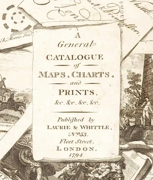
Laurie and Whittle (fl. 1794 - 1858) were London, England, based map and atlas publishers active in the late 18th and early 19th century. Generally considered to be the successors to the Robert Sayer firm, Laurie and Whittle was founded by Robert Laurie (c. 1755 - 1836) and James Whittle (1757-1818). Robert Laurie was a skilled mezzotint engraver and is known to have worked with Robert Sayer on numerous projects. James Whittle was a well-known London socialite and print seller whose Fleet Street shop was a popular haunt for intellectual luminaries. The partnership began taking over the general management of Sayer's firm around 1787; however, they did not alter the Sayer imprint until after Sayer's death in 1794. Apparently Laurie did most of the work in managing the firm and hence his name appeared first in the "Laurie and Whittle" imprint. Together Laurie and Whittle published numerous maps and atlases, often bringing in other important cartographers of the day, including Kitchin, Faden, Jefferys and others to update and modify their existing Sayer plates. Robert Laurie retired in 1812, leaving the day to day management of the firm to his son, Richard Holmes Laurie (1777 - 1858). Under R. H. Laurie and James Whittle, the firm renamed itself "Whittle and Laurie". Whittle himself died six years later in 1818, and thereafter the firm continued under the imprint of "R. H. Laurie". After R. H. Laurie's death the publishing house and its printing stock came under control of Alexander George Findlay, who had long been associated with Laurie and Whittle. Since, Laurie and Whittle has passed through numerous permeations, with part of the firm still extant as an English publisher of maritime or nautical charts, 'Imray, Laurie, Norie and Wilson Ltd.' The firm remains the oldest surviving chart publisher in Europe.
Best 18th century map of the Ohio River Valley.
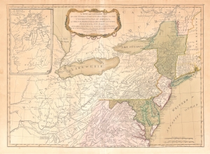
A New and General Map of the Middle Dominions Belonging to the United States of America, viz. Virginia, Maryland, the Delaware-Counties, Pennsylvania, New Jersey etc…
$1,850.00
Acquire
- Digital Map Information
- Suitable for large format printing
- DPI: 600
- File Size: 27.56 MB
- File Type: ZIP / TIFF
- ICC color profile embedded
- Delivered instantly via download link
This is the Laurie and Whittle 1794 updated edition of Lewis Evans' foundational 1755 map of the middle part of the British Colonies in North America. Evans' map was the earliest to accurately detail the American frontier at the time of its original publication. It exhibits superb detail in the northern Appalachian Mountains and the Ohio River Valley, providing information about Native American tribes and transport, French and English forts, and other details pertinent to the frontiersman, including sources of salt, roads, and trails. It was hailed by Schwartz and Ehrenberg as 'the most ambitious performance of its kind undertaken in America up to that time.' So widely was the excellence of Evans' map recognized that he was unable to make any money on it at all, as it was promptly pirated by Jefferys, Sayer, Kitchen, Bowles, Crevecoeur, and, as here, Laurie and Whittle. This 1794 edition, at least, updates the map to indicate the outcome of the American Revolution - it names the United States and includes the boundary line between the United States and Canada as determined by the 1783 Treaty of Paris. This is also the first edition of the Evans map to include the new state of Kentucky - although erroneously positioned north of the Ohio River. (more details)
Sea of Korea and the Pratas Islands.
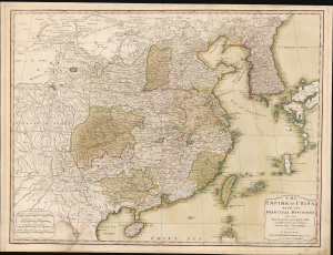
The Empire of China, with its Principal Divisions; Drawn from the Surveys mad by the Jesuits: with Improvements and Additions, from the Maps of Monsr. D'Anville.
$800.00
Acquire
- Digital Map Information
- Suitable for large format printing
- Full resolution TIFF file
- ICC color profile embedded
- Delivered instantly via download link
This is a large, elegant 1823 map of China and Korea, produced by Robert Laurie. Initially published in 1775, the map features updates executed over the course of the subsequent decades. Among its notable features is the naming of the body of water between Korea and Japan as the 'Corean Sea'. (more details)
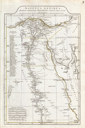
Aegyptus Antiqua Mandato Serenissimi Delphini Publici Juris Facta.
$300.00
Acquire
- Digital Map Information
- Suitable for large format printing
- Full resolution TIFF file
- ICC color profile embedded
- Delivered instantly via download link
A large and dramatic 1794 J. B. B. D'Anville map of Ancient Egypt Covers from the Nile Delta and Gaza south as far as Aswan. Details mountains, rivers, cities, roadways, and lakes with political divisions highlighted in outline color. Features both ancient and ... (more details)
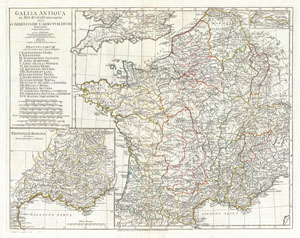
Gallia Antiqua ex Aevi Romani Monumentis eruta et Serenissimi Carnutum Ducis Munificentia Publicijuris Facta.
$350.00
Acquire
- Digital Map Information
- Suitable for large format printing
- DPI: 300
- File Size: 16.79 MB
- File Type: ZIP / TIFF
- ICC color profile embedded
- Delivered instantly via download link
A large and dramatic J. B. B. D'Anville map of Gallia or France in ancient Roman times. Covers from the southern part of England (Britannia) to the Pyrenees and the Mediterranean. Details mountains, rivers, cities, roadways, and lakes with political divisions ... (more details)
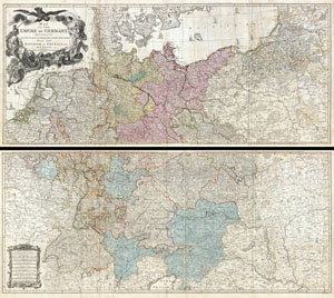
Map of the Empire of Germany, Including All the States Comprehended under that Name: with the Kingdom of Prussia, &c.
$1,850.00
Acquire
- Digital Map Information
- Suitable for large format printing
- DPI: 300
- File Size: 80.78 MB
- File Type: ZIP / TIFF
- ICC color profile embedded
- Delivered instantly via download link
An absolutely stunning and monumental two panel 1794 wall map of Germany, Bohemia, Austria and Prussia by Louis Stanislas d'Arcy Delarochette. Covers Germanic territories in full from the Baltic Sea to the Gulf of Venice. Includes Germany, Austria, Bohemia ... (more details)
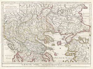
Graeciae Pars Septentrionalis.
$450.00
Acquire
- Digital Map Information
- Suitable for large format printing
- DPI: 300
- File Size: 19.22 MB
- File Type: ZIP / TIFF
- ICC color profile embedded
- Delivered instantly via download link
A large and dramatic Delisle map of the northern Greece, the Balkans, and Macedonia. Covers from Dalmatia east to the Black Sea (Pontus Euxinus) and south as far as Achaia, Cyprus, and Asia Minor. Includes much of the Aegean Sea and parts of the Adriatic ... (more details)
Barbados, the heart of a global sugar empire.
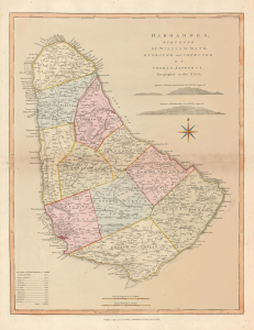
Barbadoes, surveyed by William Mayo, Engraved and Improved by Thomas Jefferys, Geographer to the King.
$1,500.00
Acquire
- Digital Map Information
- Suitable for large format printing
- Full resolution TIFF file
- ICC color profile embedded
- Delivered instantly via download link
A striking 1794 Thomas Jefferys map of Barbados in fine original color, capturing the island at the height of its extraordinary wealth as the powerhouse of Britain's Caribbean sugar empire. Based on the first systematic survey of Barbados, the map reveals a landscape intensively organized around sugar production, with hundreds of plantations, an extensive road network, coastal fortifications, and one of the densest populations in the British West Indies. (more details)
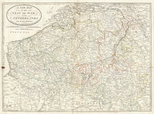
A New Map of the Seat of War, in the Netherlands, from the best Authorities.
$400.00
Acquire
- Digital Map Information
- Suitable for large format printing
- DPI: 300
- File Size: 18.2 MB
- File Type: ZIP / TIFF
- ICC color profile embedded
- Delivered instantly via download link
An very attractive 1794 map of what is today Belgium by Laurie and Whittle. Covers from Zeeland southwards as far as the Picardy (France), and eastwards to Luxembourg. Includes the modern day nation Belgium as well as adjacent parts of Germany, ... (more details)
Rare chart of the Singapore Strait.
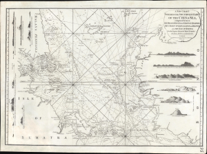
A New Chart Containing the Southwest Part of the China Sea, comprised between The Malaya Peninsula, Straits of Sincapore andc, The Straits of Banca, Gaspar and Billiton, and The Isle of Borneo.
$2,800.00
Acquire
- Digital Map Information
- Suitable for large format printing
- Full resolution TIFF file
- ICC color profile embedded
- Delivered instantly via download link
A scarce 1794 Laurie and Whittle nautical chart or maritime map of the southern tip of the Malay Peninsula, including the island of Singapore (the city had not yet been founded), the Straits of Malacca, and adjacent parts of Sumatra and Borneo. Cartographically, this chart is a vastly updated variant of Jean-Baptiste d'Après de Mannevillette's earlier chart issued in the Neptune Oriental. (more details)
EIC China Trade: Charting a new course.
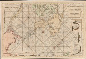
A Chart of the Passages Between the Philippine and The Isles Of Borneo And Mindanao With those to the Southward of the Sooloo Archipelago and the Isle of Mindanao.
$7,000.00
Acquire
- Digital Map Information
- Suitable for large format printing
- Full resolution TIFF file
- ICC color profile embedded
- Delivered instantly via download link
This large, rare nautical chart is Laurie and Whittle's 1794 maritime map of the southern Philippines, particularly Mindanao, Palawan, and the Sulu Sea. It presents improvements resulting from more than three decades of British East India Company voyages through these passages, and is certainly informed by, and possibly the work of, one of the EIC's most successful captains and ship owners, John Pascall Larkins. (more details)
Featuring the Guif of Mexico and Lake Ontario!
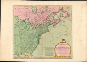
The United States of America with The British Possessions of Canada, Nova Scotia, New Brunswick, and Newfoundland divided with The French, also the Spanish Territories of Louisiana and Florida according to the Preliminary Articles of Peace Signed at Versailles the 20th of Jany. 1783.
$3,500.00
Acquire
- Digital Map Information
- Suitable for large format printing
- Full resolution TIFF file
- ICC color profile embedded
- Delivered instantly via download link
A striking 1794 Laurie and Whittle map of the newly independent United States, capturing North America's transformation in the turbulent decades between the American Revolution (1775 - 1783) and the War of 1812 (1812 - 1815). Most remarkable is its magnificent title cartouche, surmounted by one of the earliest printed representations of the thirteen-star American flag - a bold visual declaration of the new republic's place on the world stage. (more details)
Beautiful maritime map of the eastern coast of India.
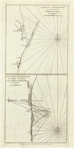
The Road of Palleacate, off the Coast of Coromandell. The Road of Tengepatnam or Fort St. David on the Coast of Coromandel.
$200.00
Acquire
- Digital Map Information
- Suitable for large format printing
- DPI: 300
- File Size: 6.97 MB
- File Type: ZIP / TIFF
- ICC color profile embedded
- Delivered instantly via download link
This is a fine example of Laurie and Whittle's 1794 nautical chart or maritime map of Palleacate (Pulicat) and Tengepatnam or Fort St. David on the Coromandel Coast in the state of Tamil Nadu, India. Essentially two maps on one sheet, the upper ... (more details)
Crossroads of the Spice Trade.
A New Chart of the North Coast of Java, wherein are described The Roads of Bantam and Batavia, from the Manuscript Draught of the Dutch East India Company.
$950.00
Acquire
- Digital Map Information
- Suitable for large format printing
- Full resolution TIFF file
- ICC color profile embedded
- Delivered instantly via download link
A fascinating 1794 Laurie and Whittle nautical chart of northwestern Java, mapping one of the great strategic chokepoints of the spice trade. Extending from Bantam and the Sunda Strait eastward to Batavia (Jakarta), the chart details waters through which the immense wealth of the East Indies flowed. Yet this was more than a navigationally challenging archipelago: for nearly two centuries, it formed an arena of intense commercial and imperial rivalry, where Dutch, British, and Portuguese ambitions collided over access to pepper and the lucrative spice markets of Southeast Asia. Published near the end of the Dutch East India Company's extraordinary two-century existence, the chart captures a landscape transformed by that struggle. (more details)
Best English Wall Map of Asia of the 18th Century.
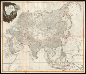
Asia and its Islands According to d'Anville; Divided into Empires, Kingdoms, States, Regions, and ca. with the European possessions and settlements in the East Indies and an exact delineation of all the discoveries made in the eastern parts by the English under Capt. Cook.
$1,500.00
Acquire
- Digital Map Information
- Suitable for large format printing
- Full resolution TIFF file
- ICC color profile embedded
- Delivered instantly via download link
A monumental 1794 wall map of Asia by Laurie and Whittle. Following the cartography of French mapmaker Jean Baptiste Bourguignon d'Anville, this is the best general map of Asia to be issued by a British cartographer in the 18th century. (more details)
Stunning wall map of Ireland!
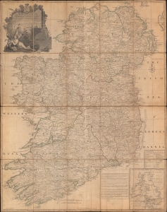
A Map of the Kingdom of Ireland, Divided into Provinces, Counties, and Baronies...
$1,200.00
Acquire
- Digital Map Information
- Suitable for large format printing
- DPI: 600
- File Size: 229.16 MB
- File Type: ZIP / TIFF
- ICC color profile embedded
- Delivered instantly via download link
A stunning 1794 Jean Rocque wall map of Ireland, here dissected on linen in a separate issue. (more details)
'Captain Hook discovered these islands' - no kidding.
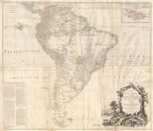
A Map of South America containing Tierra-Firma, Guayana, New Granada, Amazonia, Brasil, Peru, Paraguay, Chaco, Tucuman, Chili and Patagonia from M. D'Anville with Several Improvements and Additions, and The Newest Discoveries.
$1,000.00
Acquire
- Digital Map Information
- Suitable for large format printing
- DPI: 300
- File Size: 56.86 MB
- File Type: ZIP / TIFF
- ICC color profile embedded
- Delivered instantly via download link
This is probably the most important large format wall map of South America produced in the 18th century. Largely based upon the earlier D'Anville map, this map has been enlarged and expanded by the English publishing house of Laurie and Whittle. Depicts the continent in full with an inset of the Falkland Islands. This map is unique in that it is a serious attempt to compile all of the accurate scientific knowledge of the South American continent available at the time, this offering a smorgasbord of factual, speculative, and historical detail. (more details)
Exceptional East India Trade nautical chart.
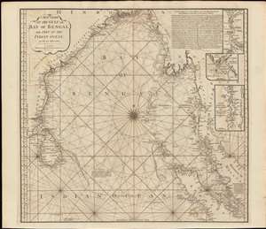
A New Chart of the Gulf or Bay of Bengal with Part of the Indian Ocean, as Far as the Line.
$750.00
Acquire
- Digital Map Information
- Suitable for large format printing
- Full resolution TIFF file
- ICC color profile embedded
- Delivered instantly via download link
This is a fine example of Laurie and Whittle's 1794 nautical chart or maritime map of the Bay of Bengal. The map covers from southeastern India and Ceylon (Sri Lanka) eastward to eastern Malaysia, north as far as the mouth of the Ganges River, and south to central Sumatra. There are three inset maps: The River of Sirian (based on D'Anville), but in fact the modern day Irrawaddy River, Burma / Myanmar; The River Perseen (based on Hayter), in fact the modern day Pathein River, Burma; and the Isle St. Mathew (after Thomas Forrest, 1783), which is probably the modern day Zadetky Island, Burma, but it is not clear. The Andaman and Nicobar Islands are in the center of the Bay, near the wind rose. In the upper right there is a lengthy observational note attributed to Captain Hicks and the ship Bahar on a 1770 voyage from Madras to Bengal in the Monsoon season. (more details)
Early nautical chart identifying the British spice trading colony of Bencoolen and Fort Marlborough, Sumatra.
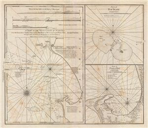
A Chart fo the West Coast of Sumatra from Old Bencoolen to Buffaloe Point containing the Road of Bencoolen and Poolo Bay. Plan of Rat Island. Plan of Poolo Bay.
$1,250.00
Acquire
- Digital Map Information
- Suitable for large format printing
- DPI: 300
- File Size: 22.41 MB
- File Type: ZIP / TIFF
- ICC color profile embedded
- Delivered instantly via download link
This is a fine example of Laurie and Whittle's 1794 nautical chart or maritime map of the west coast of Sumatra in the vicinity of Bencoolen or Fort Marlborough. The map is divided into three sections, the left hand side being a general ... (more details)
An early English chart of the Burma coast.

A Chart of the Coast of Pegu with the Adjacent Coast of Arakan and Tanasserim.
$2,000.00
Acquire
- Digital Map Information
- Suitable for large format printing
- Full resolution TIFF file
- ICC color profile embedded
- Delivered instantly via download link
A fine example of Laurie and Whittle's 1798 nautical chart or map of Burma (Myanmar), or as it was known in the 18th century, Pegu. It reflects the rapid increase in trade relations with and geographical knowledge of Southeast Asia in Europe in the preceding decades. (more details)
Scarce nautical chart of the Thames Entrance.
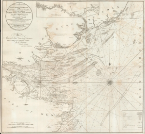
A New and Correct Chart extending from London Bridge to Orford Ness on the Essex and Suffolk coast and from the Nore to the North Foreland, the Downs, and South Foreland on the Kentish coast : comprehending the Swin and King's Channel, with the Wallet, Harwich Harbour, and Horsley Bay, to Aldborough Knapes, also the Five Fathom and South Channels, with the Oaze Deeps, Nubs and Queen's Channel, Kentish Knock etc., etc. By George Burn and several other masters and pilots in the Royal Navy.
$650.00
Acquire
- Digital Map Information
- Suitable for large format printing
- DPI: 600
- File Size: 49.46 MB
- File Type: ZIP / TIFF
- ICC color profile embedded
- Delivered instantly via download link
An impressive 1800 George Burn and Laurie and Whittle large format blueback nautical map of the entrance to the Thames River, England. (more details)
Map used by American politician Samuel Atkins Eliot on his 1821 'Grand Tour' of Europe.
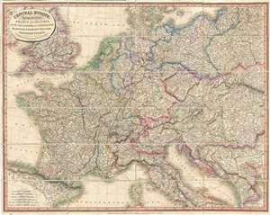
Central Europe: Comprehending France and Austria, with the Kingdom of the Netherlands, Hanover, Germany, Prussia, Northern Italy, and c.
$500.00
Acquire
- Digital Map Information
- Suitable for large format printing
- DPI: 300
- File Size: 31.35 MB
- File Type: ZIP / TIFF
- ICC color profile embedded
- Delivered instantly via download link
A fine example of Laurie and Whittle's 1818 map of central Europe, focusing mainly on France, the Netherland, Belgium, Austria, Hungary, an inset of Transylvania, Prussia, Switzerland, and Germany. Partially included are England, Spain, Italy, Turkey, the Balkans, Poland, and Denmark. All major towns and roads are identified as well as limited topographical features, with elevation rendered in hachure. The cartographers credit the work of French map publisher Pierre M. Lapie as the source for this map. First issued in 1816, this useful map is an example of the second edition published in 1818. Subsequent editions were issued in both atlas format and case, as in the present example. Such maps were popular with American tourists on the 'Grand Tour.' (more details)