
1794 Russel Map of the Middle States of the United States (New York, Ohio, Pennsylvania, New Jersey,
Uncommon American Revolutionary War Map of the Middle Atlantic States, including Ohio.

Map of the Middle States of America. Comprehends New-York, New-Jersey, Pennsylvania, Delaware, and the Territory N.W. of Ohio.
sold
- Digital Map Information
- Suitable for large format printing
- Full resolution TIFF file
- ICC color profile embedded
- Delivered instantly via download link
This is a scarce and beautiful 1794 map of the middle states of the United States, including New York, Ohio, Pennsylvania, New Jersey, Delaware and Virginia by John Russell. This Revolutionary War era map covers from the Hudson River Westward to include Fort Miami ... (more details)
An unusual World War II Era China Trade decorative fan and view of Canton or Guangzhou.

Foreign Trade Zone at the Water Front - Canton, China - in the Early Fifties
sold
- Digital Map Information
- Suitable for large format printing
- File Size: 1.1 MB
- File Type: ZIP / TIFF
- ICC color profile embedded
- Delivered instantly via download link
An unusual discovery, this is a chromolithograph fan illustrating the Foreign Trade Zone in Canton, or Guangzhou, China. The illustration, printed with rich blues and yellows, illustrates the waterfront and harbor, including numerous ships and barges afloat, in ... (more details)
Scarce 1706 Map from American 'captivity narrative'.
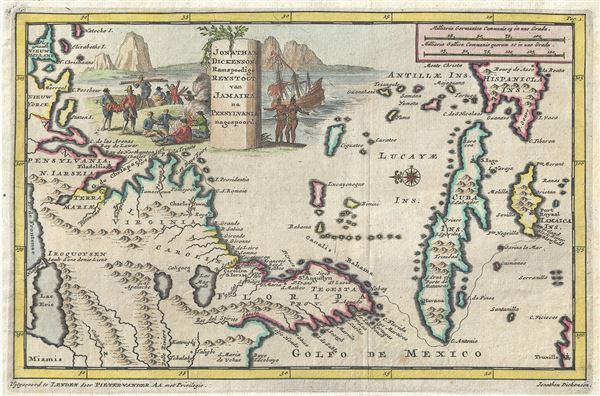
Jonathan Dickensons Ramspoedige Reystogt van Jamaika na Pensylvania nagespoord.
sold
- Digital Map Information
- Suitable for large format printing
- Full resolution TIFF file
- ICC color profile embedded
- Delivered instantly via download link
An exceptionally unusual and very rare 1706 map of the east coast of America prepared by the Dutch cartographer Pieter van der Aa. The map was prepared to illustrate the Dutch edition of journals describing the voyage, shipwreck, capture by Indians, and ... (more details)
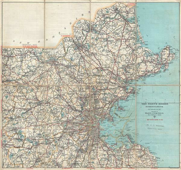
Road Map of the North Shore and part of Middlesex County Massachusetts.
sold
- Digital Map Information
- Suitable for large format printing
- Full resolution TIFF file
- ICC color profile embedded
- Delivered instantly via download link
This is a beautiful c.1902 map of Boston and the north shore of Massachusetts along with parts of Middlesex County by the Walker Lithography and Publishing Company. It covers north east Massachusetts from Salisbury south as far as Scituate and inland as ... (more details)

Provinz Schlesien.
sold
- Digital Map Information
- Suitable for large format printing
- Full resolution TIFF file
- ICC color profile embedded
- Delivered instantly via download link
This is a fine 1849 map of the Province of Silesia by Joseph Meyer. It covers the Prussian province from Bautzen, Germany to Krakow, Poland. Throughout the map identifies various cities, towns, rivers and an assortment of additional topographical ... (more details)

Provinz Pommern.
sold
- Digital Map Information
- Suitable for large format printing
- Full resolution TIFF file
- ICC color profile embedded
- Delivered instantly via download link
This is a scarce 1849 map of the Province of Pomerania by Joseph Meyer. It covers from Stralsund in modern day Germany east as far as Puck Bay and in Poland. Throughout the map identifies various cities, towns, rivers and an assortment of ... (more details)

Provinz Ost-Preussen.
sold
- Digital Map Information
- Suitable for large format printing
- Full resolution TIFF file
- ICC color profile embedded
- Delivered instantly via download link
This is an uncommon example of Joseph Meyer's 1849 map of the province of East-Prussia, Poland. It covers from Klaipeda to Elblag. Throughout the map identifies various cities, towns, rivers and an assortment of additional topographical ... (more details)
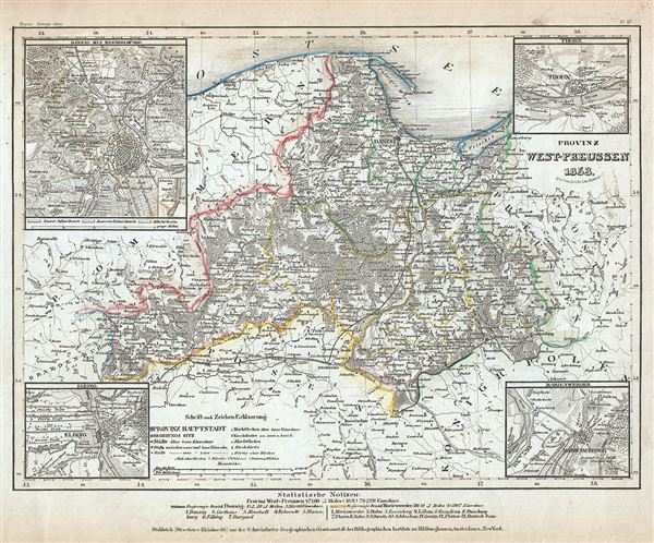
Provinz West-Preussen.
sold
- Digital Map Information
- Suitable for large format printing
- Full resolution TIFF file
- ICC color profile embedded
- Delivered instantly via download link
This is an uncommon example of Joseph Meyer's 1853 map of the province of West-Prussia, Poland. It covers from Gdansk Bay south as far as Torun. Throughout the map identifies various cities, towns, rivers and an assortment of additional ... (more details)

Europ. Turkei: Rumelien, Bulgarien und Walachei.
sold
- Digital Map Information
- Suitable for large format printing
- Full resolution TIFF file
- ICC color profile embedded
- Delivered instantly via download link
This is a scarce 1850 Joseph Meyer map of the Balkan region in Europe. This map, made when the Ottoman Empire controlled much of the region, covers the modern day nations of Romania, Bulgaria, Macedonia, Greece and Turkey. Throughout, ... (more details)
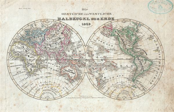
Die Oestliche und Westliche Halbkugel der Erde.
sold
- Digital Map Information
- Suitable for large format printing
- Full resolution TIFF file
- ICC color profile embedded
- Delivered instantly via download link
This is a fine 1849 map of the world depicted in hemispheres by Joseph Meyer. Both the Western and Eastern Hemispheres are drawn and offer a fascinating snapshot of the world during a period of rapid globalization and discovery. ... (more details)
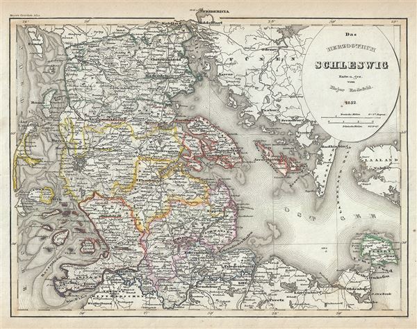
Das Herzogthum Schleswig.
sold
- Digital Map Information
- Suitable for large format printing
- Full resolution TIFF file
- ICC color profile embedded
- Delivered instantly via download link
This is a scarce 1852 map of the Duchy of Schleswig. It covers from Fredericia in modern day Denmark south as far as Preetz in Germany. Includes the Fehmarn and Aero Islands. This extremely detailed map notes important cities, ... (more details)
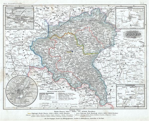
Provinz Posen.
sold
- Digital Map Information
- Suitable for large format printing
- Full resolution TIFF file
- ICC color profile embedded
- Delivered instantly via download link
This is an uncommon 1853 map of the Province of Posen by Joseph Meyer. It covers the province, part of the Prussia and later part of the German Empire, noting important towns, cities, rivers, railways and other topographical ... (more details)

Konigreich Bohem.
sold
- Digital Map Information
- Suitable for large format printing
- Full resolution TIFF file
- ICC color profile embedded
- Delivered instantly via download link
This is a beautiful 1852 map of the Kingdom of Bohemia (Czech Republic) by Joseph Meyer. It covers the territory claimed by the modern day Czech Republic, noting major towns, cities, rivers, mountains and other topographical ... (more details)

Europaeische Turkey Greichenland und die Jonischen Jnseln.
sold
- Digital Map Information
- Suitable for large format printing
- Full resolution TIFF file
- ICC color profile embedded
- Delivered instantly via download link
This is a fine example of Joseph Meyer's 1852 map of European Turkey and Greece. It covers from Moldavia to Candia and from the Gulf of Venice or the Adriatic Sea to the Black Sea including the Ionian Islands and parts of ... (more details)
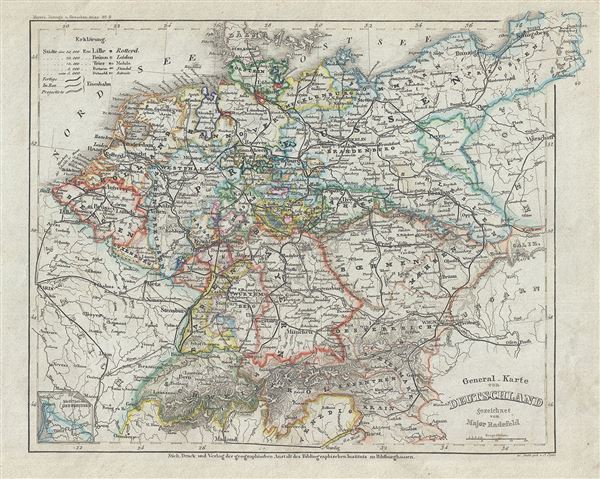
General Karte von Deutschland.
sold
- Digital Map Information
- Suitable for large format printing
- Full resolution TIFF file
- ICC color profile embedded
- Delivered instantly via download link
This is a beautiful 1852 map of Germany and Prussia. It covers Central Europe and the German states including the Holland, Belgium, Prussia, Austria, Switzerland, Germany and Bohemia (Czech Republic). Throughout, the map ... (more details)
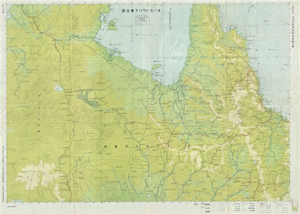
Australia Nort East Aviation Chart
sold
- Digital Map Information
- Suitable for large format printing
- File Size: 31.8 MB
- File Type: ZIP / TIFF
- ICC color profile embedded
- Delivered instantly via download link
This is a scarce and beautiful large format Japanese aviation chart of map of northeast Australia issued by the Japan Army General Staff dating to 1942. This World War II era map covers the northeastern part of Australia ... (more details)

Australia Brisbane-Sydney Aviation Chart
sold
- Digital Map Information
- Suitable for large format printing
- File Size: 28.3 MB
- File Type: ZIP / TIFF
- ICC color profile embedded
- Delivered instantly via download link
This is a scarce and beautiful large format 1942 or Showa 17 World War II era Japanese aviation chart or map of Eastern Australia issued by the Japan Army General Staff. It covers the eastern coast of New South Wales and ... (more details)
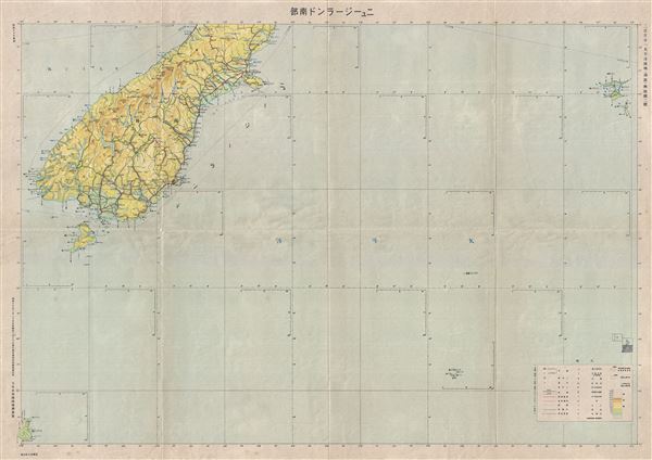
New Zealand South Aviation Chart.
sold
- Digital Map Information
- Suitable for large format printing
- File Size: 30.63 MB
- File Type: ZIP / TIFF
- ICC color profile embedded
- Delivered instantly via download link
This is a scarce 1942 or Showa 177 Japanese map of southern New Zealand issued by the Japan Army General Staff. It covers the southern portion of the South Island, the world's 12th largest island, including Stewart ... (more details)
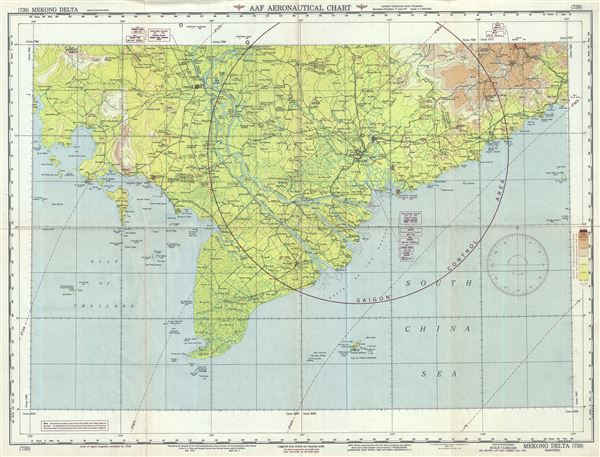
AAF Aeronautical Chart Mekong Delta.
sold
- Digital Map Information
- Suitable for large format printing
- Full resolution TIFF file
- ICC color profile embedded
- Delivered instantly via download link
This is an uncommon 1949 U.S. Army Air Forces aeronautical chart of the Mekong Delta, Vietnam. It covers southwest Vietnam and southern Cambodia from the Island of Koh Rong in the Sihanoukville province of ... (more details)

Warsaw.
sold
- Digital Map Information
- Suitable for large format printing
- Full resolution TIFF file
- ICC color profile embedded
- Delivered instantly via download link
This is a charming 1828 view of Warsaw, Poland. It features the capital city of Poland as viewed from across the Vistula River. Having survived several wars and rebellions, Warsaw is also known as the ... (more details)