

Johnson's Map of New York and the Adjacent Cities.
sold
- Digital Map Information
- Suitable for large format printing
- File Size: 18.34 MB
- File Type: ZIP / TIFF
- ICC color profile embedded
- Delivered instantly via download link
This is a fine hand colored map of New York City and Brooklyn dating to 1863 by Johnson and Ward. This map represents the first state of the Johnson and Ward map of New York City. Prior editions of the Johnson atlas (1860 & 1861), including the Johnson and ... (more details)

Mountains and Rivers.
sold
- Digital Map Information
- Suitable for large format printing
- File Size: 19.1 MB
- File Type: ZIP / TIFF
- ICC color profile embedded
- Delivered instantly via download link
One of the finest Mountains and River's Chart published in the mid-19th century. This is the 1863 edition of Johnson and Ward's chart or map of the relative distances of the world's great rivers and the relative heights of the world's great mountains. ... (more details)

Johnson's Lower Canada and New Brunswick. Johnson's Upper Canada.
sold
- Digital Map Information
- Suitable for large format printing
- File Size: 17.02 MB
- File Type: ZIP / TIFF
- ICC color profile embedded
- Delivered instantly via download link
This is A. J. Johnson and Ward's 1863 map of Upper Canada (Ontario) and Lower Canada (Quebec). Features tow maps within a single border. The upper map consists of the provinces of Quebec and New Brunswick. Features an inset map of the Environs of ... (more details)
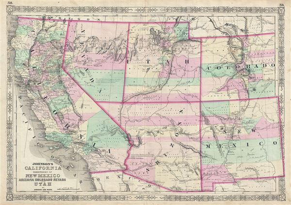
Johnson's California Territories of New Mexico Arizona Colorado Nevada and Utah.
sold
- Digital Map Information
- Suitable for large format printing
- File Size: 16.04 MB
- File Type: ZIP / TIFF
- ICC color profile embedded
- Delivered instantly via download link
One of the scarcest and most historically significant of A. J. Johnson's southwest series. Published in 1863 at the height of the American Civil War, this stunning map depicts the state of California and the territories of Nevada, Utah, Colorado, ... (more details)

Johnson's New York.
sold
- Digital Map Information
- Suitable for large format printing
- File Size: 19.05 MB
- File Type: ZIP / TIFF
- ICC color profile embedded
- Delivered instantly via download link
This is Johnson and Ward's beautifully hand colored 1863 map of New York State. This rare map offers a fascinating snapshot of New York during the American Civil War. It covers New York in full with bold and dramatic color coding according to ... (more details)

Johnson's Pennsylvania Virginia Delaware and Maryland.
sold
- Digital Map Information
- Suitable for large format printing
- File Size: 20.99 MB
- File Type: ZIP / TIFF
- ICC color profile embedded
- Delivered instantly via download link
This is a beautiful example of Johnson and Ward's 1863 hand colored map of the Middle Atlantic States, including Virginia, Maryland, Delaware and Pennsylvania. Offers a fascinating snapshot of these north-south borderlands shortly following ... (more details)

Johnson's South America.
sold
- Digital Map Information
- Suitable for large format printing
- File Size: 14.35 MB
- File Type: ZIP / TIFF
- ICC color profile embedded
- Delivered instantly via download link
This is a beautiful example of Johnson and Ward's 1863 map of South America. This large and detailed map covers the continent from Mexico, Florida and the Caribbean south to include South Shetland and parts of Antarctica. It offers superb ... (more details)

Johnson's Roman Empire, Imperium Romanorum latissime Patens.
sold
- Digital Map Information
- Suitable for large format printing
- File Size: 11.5 MB
- File Type: ZIP / TIFF
- ICC color profile embedded
- Delivered instantly via download link
This is Johnson and Ward's 1863 map of the Roman Empire. The map shows the extent of the Empire at its height, and covers most of Europe, the Middle East, Persia and parts of North Africa. The Roman Empire was established in 27 BC after ... (more details)

Johnson's Northern Italy. Johnson's Southern Italy Kingdom of Naples, I. Sardinia & Malta.
sold
- Digital Map Information
- Suitable for large format printing
- File Size: 17.29 MB
- File Type: ZIP / TIFF
- ICC color profile embedded
- Delivered instantly via download link
This is a marvelous 1863 map of Italy by the American cartographic publisher A. J. Johnson. It divides the region into Northern and Southern parts according to the geographical and political distinctions in 1863, when the Italian ... (more details)

Johnson's Austria Turkey in Europe and Greece.
sold
- Digital Map Information
- Suitable for large format printing
- File Size: 20.69 MB
- File Type: ZIP / TIFF
- ICC color profile embedded
- Delivered instantly via download link
This is a beautiful example of Johnson and Ward's 1863 map of Austria, Turkey in Europe and Greece. It covers from Italy eastward to include all of Austria, Hungary, the Balkans (Bosnia, Serbia, Albania, Croatia, Macedonia, ... (more details)

Johnson's Ireland. Johnson's Scotland.
sold
- Digital Map Information
- Suitable for large format printing
- File Size: 19.52 MB
- File Type: ZIP / TIFF
- ICC color profile embedded
- Delivered instantly via download link
This is a beautiful example of Johnson and Ward's 1863 map of Scotland and Ireland. It contains two separate maps within the same border. The left hand map features Ireland and covers the entire emerald Isle in full from ... (more details)

Johnson's Europe.
sold
- Digital Map Information
- Suitable for large format printing
- File Size: 16.12 MB
- File Type: ZIP / TIFF
- ICC color profile embedded
- Delivered instantly via download link
This is a beautiful example of Johnson and Ward's 1863 map of Europe. It covers the continent in its entirety from the Atlantic to the Caspian Sea and from the Arctic Ocean to the Mediterranean Sea. It also details ... (more details)

Johnson's Africa.
sold
- Digital Map Information
- Suitable for large format printing
- File Size: 17.65 MB
- File Type: ZIP / TIFF
- ICC color profile embedded
- Delivered instantly via download link
An extraordinary and attractive example of Johnson's 1863 map of Africa. This rare map appeared only in the earliest editions of Johnson's Atlas. Includes all of Africa as well as adjacent parts of Europe and Asia. ... (more details)

Johnson's Arkansas, Mississippi, And Louisiana.
sold
- Digital Map Information
- Suitable for large format printing
- File Size: 18.81 MB
- File Type: ZIP / TIFF
- ICC color profile embedded
- Delivered instantly via download link
This is a beautiful example of Johnson and Ward's 1863 map of Arkansas, Mississippi and Louisiana. This rare map offers a fascinating snapshot of these secessionist states during the American Civil War. The map ... (more details)

Johnson’s Map of the Vicinity of Richmond, and Peninsular Campaign in Virginia Showing also the interesting localities along the James, Chickahominy and York Rivers. Compiled from the official maps of the War Department.
sold
- Digital Map Information
- Suitable for large format printing
- File Size: 14.93 MB
- File Type: ZIP / TIFF
- ICC color profile embedded
- Delivered instantly via download link
This is a rare and important 1862 Johnson and Ward map of the vicinity of Richmond, Virginia, during the American Civil War. The map shows the Union advance during the Peninsular Campaign of the American Civil ... (more details)

Map of The World Illustrating the Principal Features of Meteorology. Map of the World Showing the Distributions and Limits of Cultivation of The Principal Plants Useful to Mankind.
sold
- Digital Map Information
- Suitable for large format printing
- File Size: 5.73 MB
- File Type: ZIP / TIFF
- ICC color profile embedded
- Delivered instantly via download link
This is one of thematic world map sets from the rare 1863 edition of Johnson and Ward's New Illustrated Family Atlas . Features two maps within a single border. The upper map depicts the world's ... (more details)

New York.
sold
- Digital Map Information
- Suitable for large format printing
- DPI: 300
- File Size: 3.43 MB
- File Type: ZIP / TIFF
- ICC color profile embedded
- Delivered instantly via download link
A beautiful example of Finley's important 1827 map of New York. Includes Long Island and Lake Ontario. Depicts the state with moderate detail in Finley's classic minimalist style. Shows river ... (more details)

South Carolina.
sold
- Digital Map Information
- Suitable for large format printing
- DPI: 300
- File Size: 3.14 MB
- File Type: ZIP / TIFF
- ICC color profile embedded
- Delivered instantly via download link
This is a beautiful example of Finley's important 1827 map of South Carolina. This rare map plate configuration depicts the state individually rather than bundled with North Carolina - as is ... (more details)

Greece.
sold
- Digital Map Information
- Suitable for large format printing
- DPI: 300
- File Size: 3.86 MB
- File Type: ZIP / TIFF
- ICC color profile embedded
- Delivered instantly via download link
This is a beautiful example of Finley's important 1827 map of Greece. Depicts from Macedonia to Greece and includes many of the Greek Islands. Shows cities, river ways, roads, monasteries, ... (more details)

Asia.
sold
- Digital Map Information
- Suitable for large format printing
- DPI: 300
- File Size: 3.9 MB
- File Type: ZIP / TIFF
- ICC color profile embedded
- Delivered instantly via download link
This is a beautiful example of Finley's important 1827 map of Asia. Depicts from the Black Sea and Arabia eastward to the Behring Strait and Papua New Guinea. Includes Australia (New ... (more details)