
An important Great Lakes Map showing the straits between Lake Superior, Lake Huron, and Lake Michigan.
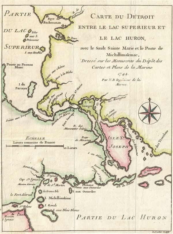
Carte du Detroit entre le Lac Superieur et le Lac Huron, ave le Sault Sainte Marie et la Poste de Michillimakinac, Dresse sur les Manuscrits du Depot des Cartes et Plans de la Marine.
sold
- Digital Map Information
- Suitable for large format printing
- DPI: 300
- File Size: 1.7 MB
- File Type: ZIP / TIFF
- ICC color profile embedded
- Delivered instantly via download link
This is a fine example of Bellin's scarce 1744 map illustrating the straits between Lake Superior, Lake Huron, and Lake Michigan. The map covers from Batchawana Bay (Baye de Bachouanan) south to Whitefish Bay past Ille Parisienne to the St. Mary's River, which it ... (more details)
Among the earliest obtainable specific maps of the Louisiana, Mississippi, Florida coasts.
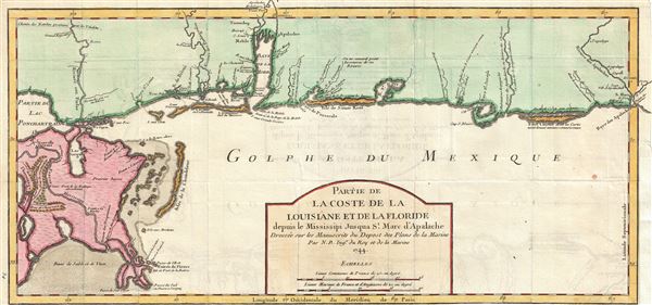
Partie de La Coste de la Louisiane et de La Floride depuis le Mississipi Jusqua St. Marc d'Apalache. Dressee sur les Manuscrits du Depost des Plans de la Marine.
sold
- Digital Map Information
- Suitable for large format printing
- Full resolution TIFF file
- ICC color profile embedded
- Delivered instantly via download link
The extremely scarce first edition first state of Bellin's important 1744 map of the Gulf Coast from New Orleans past Mobile Bay, as far east as Apalachicola Bay and the St. Marks River. Though still quite speculative, Bellin's rendition of this little known ... (more details)
The earliest obtainable map or plan of New Orleans, Louisiana.

Plan de la Nouvelle-Orleans sur les Manuscrits du Depot des Cartes de la Marine.
sold
- Digital Map Information
- Suitable for large format printing
- DPI: 300
- File Size: 3.36 MB
- File Type: ZIP / TIFF
- ICC color profile embedded
- Delivered instantly via download link
This scarce 1744 map by J. N. Bellin is the first edition first state of earliest obtainable map of New Orleans, Louisiana. Oriented to the northwest, Bellin's map covers the original settlement of New Orleans along the Mississippi River and inland as far the ... (more details)

The Tourist Map of Taiwan.
sold
- Digital Map Information
- Suitable for large format printing
- File Size: 22.29 MB
- File Type: ZIP / TIFF
- ICC color profile embedded
- Delivered instantly via download link
This is an uncommon and unusual bi-lingual tourist map of Taiwan or Formosa Island dating from 1952. It covers the entire island in great detail marking various cities, railways, roads, rivers and various other topographical details. Published soon after the ... (more details)
Triangulation chart of Provincetown Harbor, Massachusetts

Provincetown Harbor Massachusetts.
sold
- Digital Map Information
- Suitable for large format printing
- File Size: 5.35 MB
- File Type: ZIP / TIFF
- ICC color profile embedded
- Delivered instantly via download link
A hand colored 1857 costal chart of Provincetown Harbor, at the tip of Cape Cod, Massachusetts. This map offers a wealth of information with regard to both the region’s hydrography and its topography. It locates the Salt Marsh and the Highlands; marshes, ... (more details)
Highly decorative pictorial map of the United States.
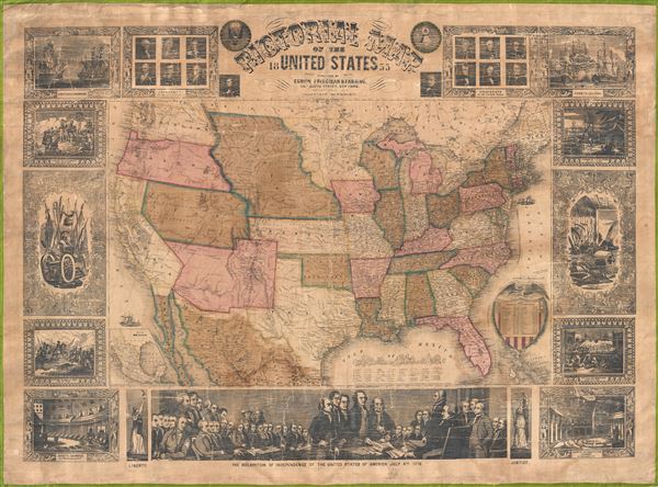
Pictorial Map of the United States.
sold
- Digital Map Information
- Suitable for large format printing
- File Size: 21.19 MB
- File Type: ZIP / TIFF
- ICC color profile embedded
- Delivered instantly via download link
An appealing and decorative 1855 wall map of the United States. Issued by Ensign, Bridgman & Fanning, this map was drawn and engraved by J.M. Atwood and covers the entire United States from Atlantic to Pacific and from Canada to the Gulf of Mexico. ... (more details)
The first comparative chart of the Moon from which the names of many lunar features have been derived.

Tabula Selenographica in qua Lunarium Macularum exacta Descriptio secundum Nomenclaturam Praestantissimorum Astronomorum tam Hevelii quam Riccioli Curiosis Rei Sidereae Cultoribus exhibetur Joh. Babr. Doppelmajero Math. P.P. upera Joh. Baptistae Homanni Norinbergae.
sold
- Digital Map Information
- Suitable for large format printing
- Full resolution TIFF file
- ICC color profile embedded
- Delivered instantly via download link
A stunning full color example of J. B. Homann and Johann Gabriel Doppelmayr's important c. 1742 map of the Moon. Essentially a comparative chart, Doppelmayer constructed this map to illustrate the lunar mapping of Johannes Hevelius (left) and Giovanni ... (more details)

Good Old Shanghai.
sold
- Digital Map Information
- Suitable for large format printing
- File Size: 26.7 MB
- File Type: ZIP / TIFF
- ICC color profile embedded
- Delivered instantly via download link
This is a scarce and desirable tourist pocket map of Shanghai China dating from 1956. Issued after the Chinese Liberation in 1949 and before the chaotic years of the 'Great Leap Forward' and the 'Cultural Revolution,' this map covers the entire city of ... (more details)

The 'Standard Guide' Ready Reference Map of Washington, to accompany the 'Washington Standard Guide'.
sold
- Digital Map Information
- Suitable for large format printing
- File Size: 15.67 MB
- File Type: ZIP / TIFF
- ICC color profile embedded
- Delivered instantly via download link
This is an appealing 1912 map of Washington D.C. by the Foster and Reynolds Company. This map covers Washington D.C. from the Arlington National Cemetery eastward as far as the Anacostia River and from the Soldiers' Home Grounds to the War College ... (more details)
Scarce map showing Insular California.
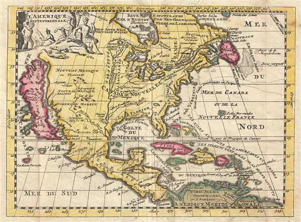
l'Amerique Septentrionale.
sold
- Digital Map Information
- Suitable for large format printing
- DPI: 300
- File Size: 1.71 MB
- File Type: ZIP / TIFF
- ICC color profile embedded
- Delivered instantly via download link
This is a very scarce example of Daniel de La Feuille's 1702 map of North America. It covers all of North America from the Hudson Bay to the Gulf of Panama. The Rio Grande (Rio Bravo ou de Nort) and the Mississippi Rivers are the only two major ... (more details)

State of New York.
sold
- Digital Map Information
- Suitable for large format printing
- File Size: 36.65 MB
- File Type: ZIP / TIFF
- ICC color profile embedded
- Delivered instantly via download link
A highly appealing 1912 large format folio map of the State of New York, issued for the New Century Atlas of Counties of the State of New York . The map covers the entire state from Chautauqua to Washington and from Clinton to Richmond. An ... (more details)

Madison County New York.
sold
- Digital Map Information
- Suitable for large format printing
- File Size: 13.18 MB
- File Type: ZIP / TIFF
- ICC color profile embedded
- Delivered instantly via download link
A highly appealing 1912 large format folio map of Madison County, New York, issued for the New Century Atlas of Counties of the State of New York . The map covers the south side of Lake Oneida from Sullivan to Brookfield, including ... (more details)
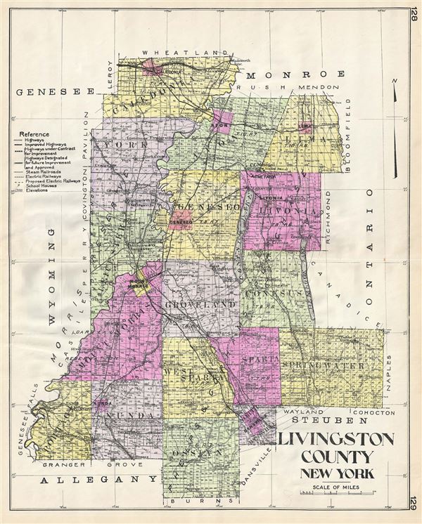
Livingston County New York.
sold
- Digital Map Information
- Suitable for large format printing
- File Size: 12.36 MB
- File Type: ZIP / TIFF
- ICC color profile embedded
- Delivered instantly via download link
A highly appealing 1912 large format folio map of Livingston County, New York, issued for the New Century Atlas of Counties of the State of New York . The map covers from Caledonia to Ossian, including York, Leichester, Mount ... (more details)
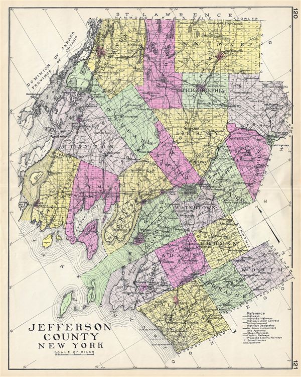
Jefferson County New York.
sold
- Digital Map Information
- Suitable for large format printing
- File Size: 14.38 MB
- File Type: ZIP / TIFF
- ICC color profile embedded
- Delivered instantly via download link
A highly appealing 1912 large format folio map of Jefferson County, New York, issued for the New Century Atlas of Counties of the State of New York . The map covers the east side of Lake Ontario and the St. Lawrence River ... (more details)
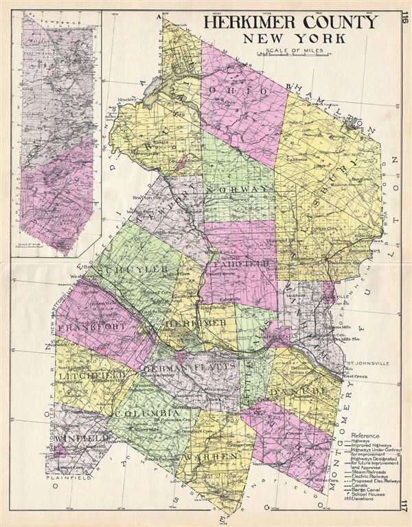
Herkimer County New York.
sold
- Digital Map Information
- Suitable for large format printing
- File Size: 14.48 MB
- File Type: ZIP / TIFF
- ICC color profile embedded
- Delivered instantly via download link
A highly appealing 1912 large format folio map of Herkimer County, New York, issued for the New Century Atlas of Counties of the State of New York . The map covers from Webb to Warren, including Wilmurt, Winfield, ... (more details)
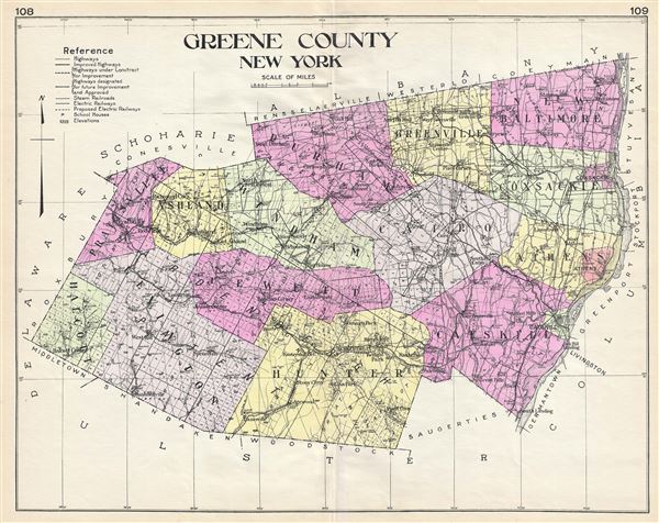
Greene County New York.
sold
- Digital Map Information
- Suitable for large format printing
- File Size: 13.92 MB
- File Type: ZIP / TIFF
- ICC color profile embedded
- Delivered instantly via download link
A highly appealing 1912 large format folio map of Greene County, New York, issued for the New Century Atlas of Counties of the State of New York . The map covers from New Baltimore to Halcott, including Lexington, ... (more details)
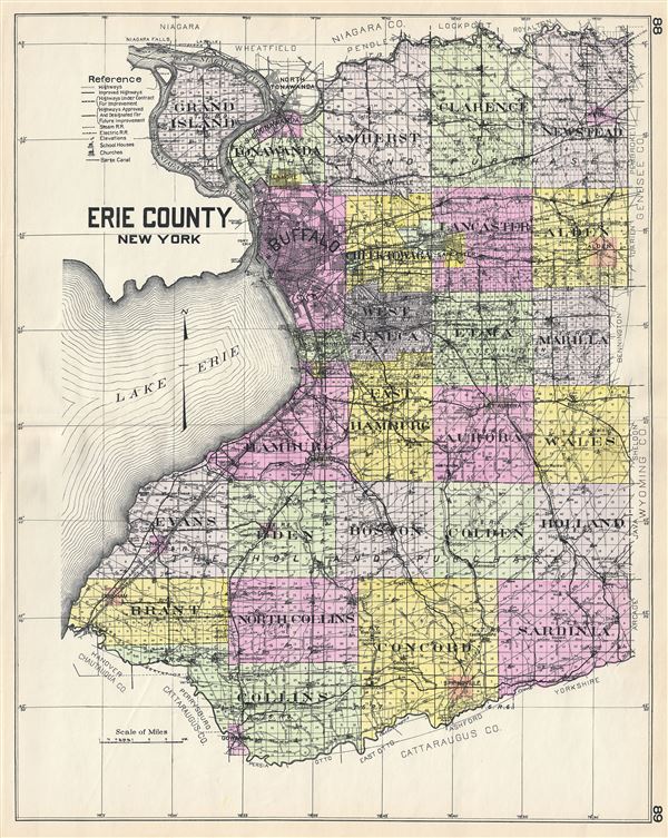
Erie County New York.
sold
- Digital Map Information
- Suitable for large format printing
- File Size: 22.57 MB
- File Type: ZIP / TIFF
- ICC color profile embedded
- Delivered instantly via download link
A highly appealing 1912 large format folio map of Erie County, New York, issued for the New Century Atlas of Counties of the State of New York . The map covers the east side of Lake Erie and the Niagara River from ... (more details)
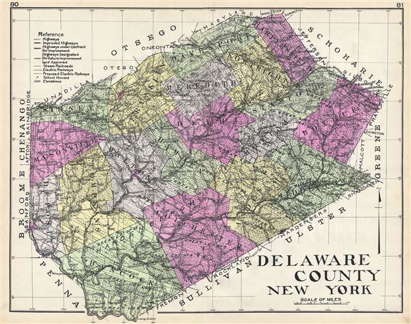
Delaware County New York.
sold
- Digital Map Information
- Suitable for large format printing
- File Size: 27.31 MB
- File Type: ZIP / TIFF
- ICC color profile embedded
- Delivered instantly via download link
A highly appealing 1912 large format folio map of Delaware County, New York, issued for the New Century Atlas of Counties of the State of New York . The map covers from Sidney to Middletown, including Masonville, ... (more details)
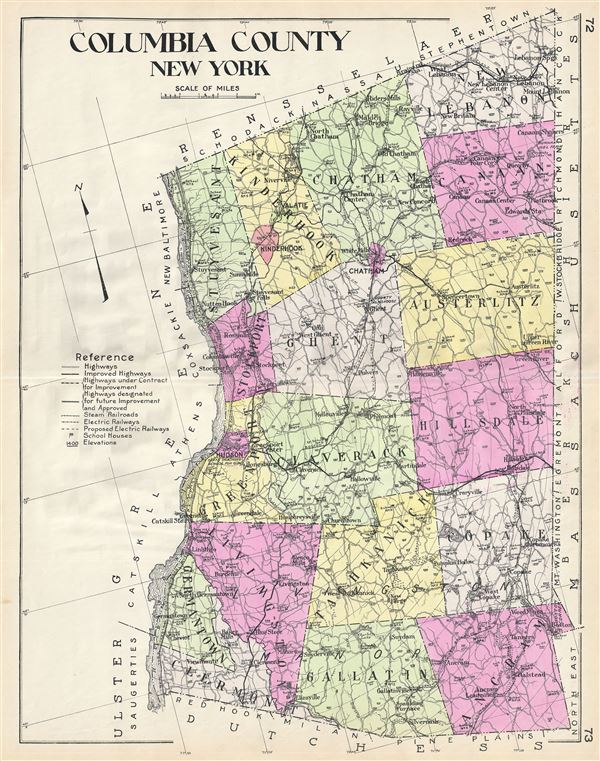
Columbia County New York.
sold
- Digital Map Information
- Suitable for large format printing
- File Size: 22.45 MB
- File Type: ZIP / TIFF
- ICC color profile embedded
- Delivered instantly via download link
A highly appealing 1912 large format folio map of Columbia County, New York, issued for the New Century Atlas of Counties of the State of New York . The map covers the east side of the Hudson River from ... (more details)
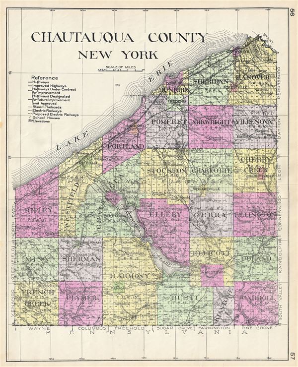
Chautauqua County New York.
sold
- Digital Map Information
- Suitable for large format printing
- File Size: 24.71 MB
- File Type: ZIP / TIFF
- ICC color profile embedded
- Delivered instantly via download link
A highly appealing 1912 large format folio map of Chautauqua County, New York, issued for the New Century Atlas of Counties of the State of New York . Centered on the Chautauqua Lake, the map covers the ... (more details)