
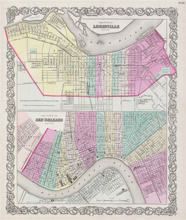
The City of Louisville Kentucky. The City of New Orleans Louisiana.
sold
- Digital Map Information
- Suitable for large format printing
- File Size: 9.92 MB
- File Type: ZIP / TIFF
- ICC color profile embedded
- Delivered instantly via download link
An excellent 1855 first edition example of Colton's rare two part map of New Orleans, Louisiana and Louisville, Kentucky. Map is divided into two sections, both projected on the same scale. The lower map, New Orleans, Louisiana, covers from Jefferson City to ... (more details)

Louisiana.
sold
- Digital Map Information
- Suitable for large format printing
- File Size: 8.48 MB
- File Type: ZIP / TIFF
- ICC color profile embedded
- Delivered instantly via download link
An excellent 1855 first edition example of Colton's map of Louisiana. Like most of Colton's state maps, this map was derived from an earlier wall map of North America produced by Colton and D. Griffing Johnson. Covers the entire state of Louisiana as well ... (more details)

Mississippi.
sold
- Digital Map Information
- Suitable for large format printing
- File Size: 9.52 MB
- File Type: ZIP / TIFF
- ICC color profile embedded
- Delivered instantly via download link
An excellent 1855 first edition example of Colton's map of Mississippi. Like most of Colton's state maps, this map was derived from an earlier wall map of North America produced by Colton and D. Griffing Johnson. The movers the entire state of Mississippi ... (more details)

Alabama.
sold
- Digital Map Information
- Suitable for large format printing
- File Size: 9.22 MB
- File Type: ZIP / TIFF
- ICC color profile embedded
- Delivered instantly via download link
An excellent 1855 first edition example of Colton's map of Alabama. Like most of Colton's state maps, this map was derived from an earlier wall map of North America produced by Colton and D. Griffing Johnson. The map covers the entire state of Alabama as ... (more details)

Georgia.
sold
- Digital Map Information
- Suitable for large format printing
- File Size: 10.05 MB
- File Type: ZIP / TIFF
- ICC color profile embedded
- Delivered instantly via download link
An excellent 1855 first edition example of Colton's map of Georgia. Like most of Colton's state maps, this map was derived from an earlier wall map of North America produced by Colton and D. Griffing Johnson. The map covers the entire state of Georgia as ... (more details)

The City of Savannah Georgia. The City of Charleston South Carolina.
sold
- Digital Map Information
- Suitable for large format printing
- File Size: 8.98 MB
- File Type: ZIP / TIFF
- ICC color profile embedded
- Delivered instantly via download link
An excellent 1855 first edition example of Colton's rare two part map of Savannah, Georgia and Charleston, South Carolina. Map is divided into two sections. Both maps are rendered on a similar scale thus offering a excellent point of comparison between ... (more details)

South Carolina.
sold
- Digital Map Information
- Suitable for large format printing
- File Size: 8.57 MB
- File Type: ZIP / TIFF
- ICC color profile embedded
- Delivered instantly via download link
An excellent 1855 first edition example of Colton's map of South Carolina. Like most of Colton's state maps, this map was derived from an earlier wall map of North America produced by Colton and D. Griffing Johnson. The map covers the entire state as ... (more details)

North Carolina.
sold
- Digital Map Information
- Suitable for large format printing
- File Size: 9.39 MB
- File Type: ZIP / TIFF
- ICC color profile embedded
- Delivered instantly via download link
An excellent 1855 first edition example of Colton's map of North Carolina. Like most of Colton's state maps, this map was derived from an earlier wall map of North America produced by Colton and D. Griffing Johnson. The map covers the entire state as ... (more details)

Virginia.
sold
- Digital Map Information
- Suitable for large format printing
- File Size: 10.37 MB
- File Type: ZIP / TIFF
- ICC color profile embedded
- Delivered instantly via download link
An excellent 1855 first edition example of Colton's map of Virginia. Like most of Colton's state maps, this map was derived from an earlier wall map of North America produced by Colton and D. Griffing Johnson. This map covers Virginia roughly seven ... (more details)

Georgetown and The City of Washington The Capital of The United States of America.
sold
- Digital Map Information
- Suitable for large format printing
- File Size: 9.12 MB
- File Type: ZIP / TIFF
- ICC color profile embedded
- Delivered instantly via download link
A beautiful 1855 first edition example of Colton's map of Washington D.C. and Georgetown. Like most of Colton's state maps, this map was derived from an earlier wall map of North America produced by Colton and D. Griffing Johnson. Covers the city ... (more details)

City of Baltimore Maryland.
sold
- Digital Map Information
- Suitable for large format printing
- File Size: 9.78 MB
- File Type: ZIP / TIFF
- ICC color profile embedded
- Delivered instantly via download link
An excellent 1855 first edition example of Colton's map of Baltimore, Maryland. The map is a lithographic plan covering the city of Baltimore from Gwinns Falls (and Bridge) to Seventh Street and from Green Mount Cemetery to the Patapsco River. ... (more details)

Delaware And Maryland.
sold
- Digital Map Information
- Suitable for large format printing
- File Size: 9 MB
- File Type: ZIP / TIFF
- ICC color profile embedded
- Delivered instantly via download link
An excellent 1855 first edition example of Colton's map of Delaware and Maryland. Like most of Colton's state maps, this map was derived from an earlier wall map of North America produced by Colton and D. Griffing Johnson. The map covers both ... (more details)

Philadelphia.
sold
- Digital Map Information
- Suitable for large format printing
- File Size: 11.74 MB
- File Type: ZIP / TIFF
- ICC color profile embedded
- Delivered instantly via download link
An excellent 1855 first edition example of Colton's map of Philadelphia, Pennsylvania. This city plan covers Philadelphia from the Schuylkill River in the northwest to the Delaware River in the southwest, and from Somerset Street to Mt. Keon ... (more details)
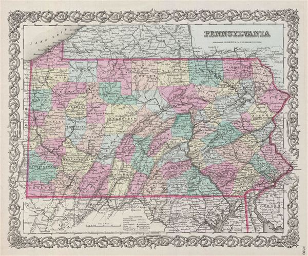
Pennsylvania.
sold
- Digital Map Information
- Suitable for large format printing
- File Size: 9.65 MB
- File Type: ZIP / TIFF
- ICC color profile embedded
- Delivered instantly via download link
A beautiful 1855 first edition example of Colton's map of Pennsylvania. Like most of Colton's state maps, this map was derived from an earlier wall map of North America produced by Colton and D. Griffing Johnson. The map covers the entire ... (more details)

New Jersey.
sold
- Digital Map Information
- Suitable for large format printing
- File Size: 9.51 MB
- File Type: ZIP / TIFF
- ICC color profile embedded
- Delivered instantly via download link
A beautiful 1855 first edition example of Colton's map of New Jersey. Like most of Colton's state maps, this map was derived from an earlier wall map of North America produced by Colton and D. Griffing Johnson. This map covers the entire ... (more details)

New York.
sold
- Digital Map Information
- Suitable for large format printing
- File Size: 9.65 MB
- File Type: ZIP / TIFF
- ICC color profile embedded
- Delivered instantly via download link
A beautiful 1855 first edition example of Colton's map of New York. Like most of Colton's state maps, this map was derived from an earlier wall map of North America produced by Colton and D. Griffing Johnson. Covers the entire state of ... (more details)

Connecticut With Portions Of New York & Rhode Island.
sold
- Digital Map Information
- Suitable for large format printing
- File Size: 10.07 MB
- File Type: ZIP / TIFF
- ICC color profile embedded
- Delivered instantly via download link
An excellent 1855 first edition example of Colton's map of Connecticut and Long Island. Like most of Colton's state maps, this map was derived from an earlier wall map of North America produced by Colton and D. Griffing Johnson. Covers ... (more details)
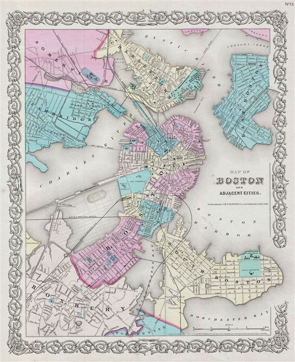
Map of Boston and Adjacent Cities.
sold
- Digital Map Information
- Suitable for large format printing
- File Size: 10.33 MB
- File Type: ZIP / TIFF
- ICC color profile embedded
- Delivered instantly via download link
An excellent 1855 first edition example of Colton's map of Boston, Massachusetts. The map covers the entire city of Boston including the surrounding communities of Cambridge, Summerville, Charleston, east Boston, South Boston and ... (more details)

Massachusetts and Rhode Island.
sold
- Digital Map Information
- Suitable for large format printing
- File Size: 10.1 MB
- File Type: ZIP / TIFF
- ICC color profile embedded
- Delivered instantly via download link
An excellent 1855 first edition example of Colton's map of Massachusetts and Rhode Island. Like most of Colton's state maps, this map was derived from an earlier wall map of North America produced by Colton and D. Griffing ... (more details)

Vermont.
sold
- Digital Map Information
- Suitable for large format printing
- File Size: 8.28 MB
- File Type: ZIP / TIFF
- ICC color profile embedded
- Delivered instantly via download link
An excellent 1855 first edition example of Colton's map of Vermont. Like most of Colton's state maps, this map was derived from an earlier wall map of North America produced by Colton and D. Griffing Johnson. The map ... (more details)