
Africa just prior to Speke, Livingstone, and Stanley.

Africa.
sold
- Digital Map Information
- Suitable for large format printing
- DPI: 300
- File Size: 8.93 MB
- File Type: ZIP / TIFF
- ICC color profile embedded
- Delivered instantly via download link
A fine example of Thomas Cowperthwait and S. A. Mitchell's 1854 map of Africa and Liberia. Details the continent of Africa on the cusp of the great exploratory expeditions of the mid-19th century undertaken by Speke, Livingstone, and Stanley. Much of the ... (more details)

The Pacific Ocean including Oceanica with its several Divisions, Islands, Groups etc.
sold
- Digital Map Information
- Suitable for large format printing
- DPI: 300
- File Size: 8.91 MB
- File Type: ZIP / TIFF
- ICC color profile embedded
- Delivered instantly via download link
This is a fine example of Thomas Cowperthwait and S. A. Mitchell's 1854 map of the Pacific, Polynesia, and Australia. Centered on the Sandwich or Hawaiian Islands, this map covers the entirety of the pacific Basin from the Aleutian Islands to New eland and ... (more details)

China.
sold
- Digital Map Information
- Suitable for large format printing
- DPI: 300
- File Size: 7.77 MB
- File Type: ZIP / TIFF
- ICC color profile embedded
- Delivered instantly via download link
A fine example of Thomas Cowperthwait and S. A. Mitchell's 1854 map of China. Covers the traditional provinces of mainland China as well as parts of adjacent Chinese Tartary, Tonkin (Vietnam), Formosa (Taiwan), and Korea (Corea). Hong Kong is identified ... (more details)
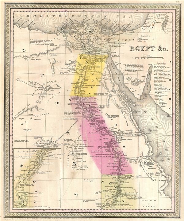
Egypt & C.
sold
- Digital Map Information
- Suitable for large format printing
- DPI: 300
- File Size: 7.82 MB
- File Type: ZIP / TIFF
- ICC color profile embedded
- Delivered instantly via download link
A fine example of Thomas Cowperthwait and S. A. MitchellÂ's 1854 map of Egypt. Centered on the Nile Valley, MitchellÂ's map covers all of Egypt from the Mediterranean to Nubia, as well as the adjacent Sinai, and parts of the Red Sea and Palestine. ... (more details)

Austrian Empire.
sold
- Digital Map Information
- Suitable for large format printing
- DPI: 300
- File Size: 9.37 MB
- File Type: ZIP / TIFF
- ICC color profile embedded
- Delivered instantly via download link
A fine example of Thomas Cowperthwait and S. A. Mitchell's 1854 map of the Austrian Empire. Covers the territories claimed by the once vast Austro-Hungarian Empire, including in whole or part the modern day nations of Austria, Hungary, Germany, Italy, ... (more details)
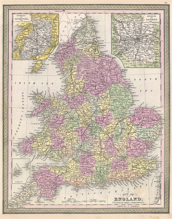
Map of England.
sold
- Digital Map Information
- Suitable for large format printing
- DPI: 300
- File Size: 14.02 MB
- File Type: ZIP / TIFF
- ICC color profile embedded
- Delivered instantly via download link
A fine example of Thomas Cowperthwait and S. A. Mitchell's 1854 map of England. Covers all of England from Northumberland in the north to Cornwall in the south. Two insets in the upper left and right quadrants depict the environs of Liverpool and ... (more details)

Scotland.
sold
- Digital Map Information
- Suitable for large format printing
- DPI: 300
- File Size: 6.07 MB
- File Type: ZIP / TIFF
- ICC color profile embedded
- Delivered instantly via download link
A fine example of Thomas Cowperthwait and S. A. Mitchell's 1854 map of Scotland. Covers all of Scotland includes the nearby islands. An inset in the upper left quadrant depicts the Shetland Isles. The whole is engraved in Mitchell's distinctive ... (more details)

Ireland.
sold
- Digital Map Information
- Suitable for large format printing
- DPI: 300
- File Size: 5.88 MB
- File Type: ZIP / TIFF
- ICC color profile embedded
- Delivered instantly via download link
This is a fine example of Thomas Cowperthwait and S. A. Mitchell's 1854 map of Ireland. Covers all of Ireland including Northern Ireland, and is divided into the traditional 32 counties. The whole is engraved in Mitchell's distinctive style ... (more details)
One of the most attractive American atlas maps of New York City to appear in the mid-19th century.

City of New-York.
sold
- Digital Map Information
- Suitable for large format printing
- DPI: 300
- File Size: 10.01 MB
- File Type: ZIP / TIFF
- ICC color profile embedded
- Delivered instantly via download link
This hand colored map of New York City is a lithograph engraving, dating to 1850 by the American mapmaker S.A. Mitchell Sr. The map epicts the island of Manhattan from 37th street (Kips Bay) south to Battery Park and Brooklyn from ... (more details)
Map showing the British takover of Ceylon in 1801.
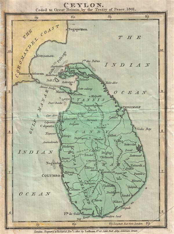
Ceylon. Ceded to Great Britain by the Treaty of Pease, 1801
sold
- Digital Map Information
- Suitable for large format printing
- Full resolution TIFF file
- ICC color profile embedded
- Delivered instantly via download link
This beautiful 1801 map by John Luffman marks an important moment in the history of Ceylon (Sri Lanka), as well as the history of France, the United Kingdom, and the Dutch (then 'Batavian') Republic. In 1795 the Portuguese ... (more details)
Fascinating document illustrating Bruce's rediscovery of the source of the Blue Nile and his travels in the Red Sea.
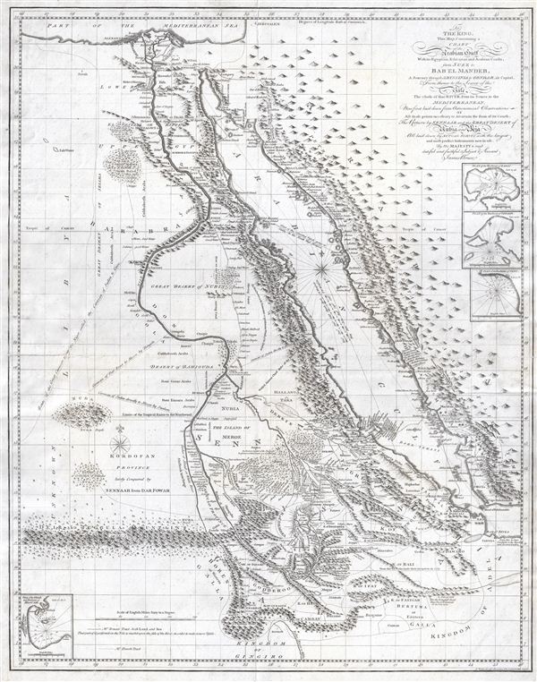
To The King. This map, Containing a Chart of the Arabian Gulf With its Egyptian, Ethiopian and Arabian Coasts, from Suez to Bab el Mandeb, A Journey through Abyssinia to Gondar, its Capital, From thence to the Source of the Nile, The Whole of that River, from its Source to the Mediterranean, Now first laid down from Astronomical Observations of All those points necessary to Aseertain the form of its Course, Teh Return by Sennaar and the Great Desert of Nubia and Beja All laid down by Actual Survey with the largest and most perfect Instruments now in use by His Majesty's most dutiful and faithful Subject & Servant, james Bruce.
sold
- Digital Map Information
- Suitable for large format printing
- DPI: 300
- File Size: 19.84 MB
- File Type: ZIP / TIFF
- ICC color profile embedded
- Delivered instantly via download link
This is a fascinating, significant, beautifully engraved, intricately detailed 1790 map of Egypt, Abyssinia, and the Red Sea by the Scottish adventurer James Bruce. Centered on the Nile Valley, this map covers all of ... (more details)
Identifies the supposed site of El Dorado on the apocryphal Lake Parima.
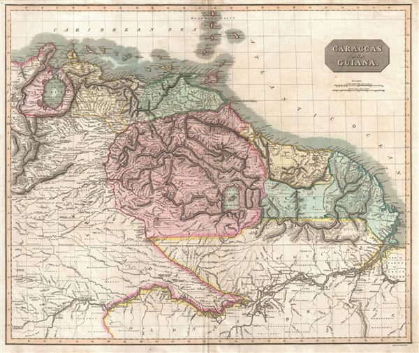
Caraccas and Guiana.
sold
- Digital Map Information
- Suitable for large format printing
- DPI: 300
- File Size: 21.01 MB
- File Type: ZIP / TIFF
- ICC color profile embedded
- Delivered instantly via download link
This is John Thomson's stunning, highly detailed, and extremely interesting 1814 map of northeastern South America. Covers the modern day countries of Venezuela, British Guyana, French Guyana, Surinam and parts of ... (more details)
Reveals the continent on the cusp of its 50 year struggle for independence.
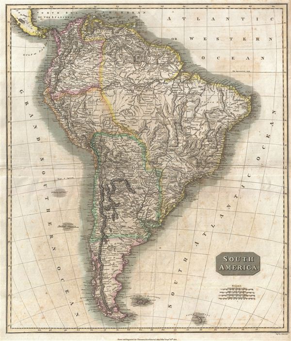
South America.
sold
- Digital Map Information
- Suitable for large format printing
- DPI: 300
- File Size: 21.26 MB
- File Type: ZIP / TIFF
- ICC color profile embedded
- Delivered instantly via download link
This is John Thomson's fascinating 1814 map of South America in its first edition. Covering the entire continent from the Caribbean Sea to Tierra del Fuego and the South Georgia Islands, this map reveals the ... (more details)
Includes the apocryphal Mountains of Kong and Mountains of the Moon.
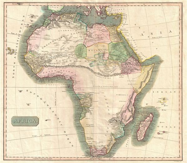
Africa.
sold
- Digital Map Information
- Suitable for large format printing
- DPI: 300
- File Size: 15.04 MB
- File Type: ZIP / TIFF
- ICC color profile embedded
- Delivered instantly via download link
This hand colored map is a steel plate engraving, dating to 1813 by the important English mapmaker John Thomson. It is an early and historically important representation of the continent of Africa. Much of ... (more details)
Identifies the Sea of Japan.
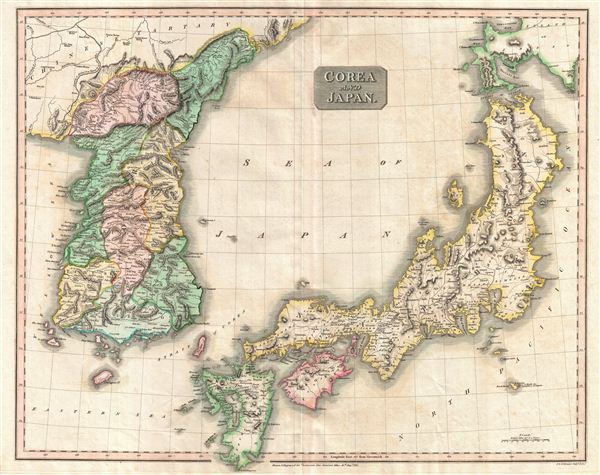
Corea and Japan.
sold
- Digital Map Information
- Suitable for large format printing
- DPI: 300
- File Size: 21.1 MB
- File Type: ZIP / TIFF
- ICC color profile embedded
- Delivered instantly via download link
This fascinating hand colored 1814 map depicts Korea and Japan. Both Korea and Japan are divided according to their constituent provinces with Hokkaido, identified as Jesso (Yesso), partially off the map. ... (more details)
Drawn in the year of Argentina's independence from Spain, 1850.

Chili La Plata and Uruguay.
sold
- Digital Map Information
- Suitable for large format printing
- DPI: 300
- File Size: 9.31 MB
- File Type: ZIP / TIFF
- ICC color profile embedded
- Delivered instantly via download link
A fine example of Thomas Cowperthwait and S. A. Mitchell's 1854 map of Chile, Argentina (La Plata) and Uruguay. The whole is engraved and colored in Mitchell's distinctive style with green border work and ... (more details)

Map of Europe.
sold
- Digital Map Information
- Suitable for large format printing
- Full resolution TIFF file
- ICC color profile embedded
- Delivered instantly via download link
A fine example of Thomas Cowperthwait and S. A. Mitchell's 1854 map of Europe. The whole is engraved in Mitchell's distinctive style with green border work and vivid pastels. Political and topographical ... (more details)

Sweden & Norway.
sold
- Digital Map Information
- Suitable for large format printing
- DPI: 300
- File Size: 6.01 MB
- File Type: ZIP / TIFF
- ICC color profile embedded
- Delivered instantly via download link
A fine example of Thomas Cowperthwait and S. A. Mitchell's 1854 map of Sweden and Norway. The whole is engraved in Mitchell's distinctive style with green border work and vivid pastels. Political and ... (more details)

Holland and Belgium.
sold
- Digital Map Information
- Suitable for large format printing
- DPI: 300
- File Size: 5.74 MB
- File Type: ZIP / TIFF
- ICC color profile embedded
- Delivered instantly via download link
A fine example of Thomas Cowperthwait and S. A. Mitchell's 1854 map of Holland and Belgium. The whole is engraved and colored in Mitchell's distinctive style with green border work and vivid pastels. ... (more details)

Mexico and Guatemala.
sold
- Digital Map Information
- Suitable for large format printing
- DPI: 300
- File Size: 9.95 MB
- File Type: ZIP / TIFF
- ICC color profile embedded
- Delivered instantly via download link
A fine example of Thomas Cowperthwait and S. A. Mitchell's 1854 map of Mexico and Guatemala. The whole is engraved and colored in Mitchell's distinctive style with green border work and vivid pastels. ... (more details)