
Thomson, John

John Thomson (1777 - c. 1841) was a Scottish cartographer, publisher, and bookbinder active in Edinburgh during the early part of the 19th century. Thomson apprenticed under Edinburgh bookbinder Robert Alison. After his apprenticeship, he briefly went into business with Abraham Thomson. Later, the two parted ways, John Thomson segueing into maps and Abraham Thomson taking over the bookbinding portion of the business. Thomson is generally one of the leading publishers in the Edinburgh school of cartography, which flourished from roughly 1800 to 1830. Thomson and his contemporaries (Pinkerton and Cary) redefined European cartography by abandoning typical 18th-century decorative elements such as elaborate title cartouches and fantastic beasts in favor of detail and accuracy. Thomson's principle works include Thomson's New General Atlas, published from 1814 to 1821, the New Classical and Historical Atlas of 1829, and his 1830 Atlas of Scotland. The Atlas of Scotland, a work of groundbreaking detail and dedication, would eventually bankrupt the Thomson firm in 1830, at which time their plates were sequestered by the court. The firm partially recovered in the subsequent year, allowing Thomson to reclaim his printing plates in 1831, but filed again for bankruptcy in 1835, at which time most of his printing plates were sold to A. K. Johnston and Company. There is some suggestion that he continued to work as a bookbinder until 1841. Today, Thomson maps are becoming increasingly rare as they are highly admired for their impressive size, vivid hand coloration, and superb detail.
Before the momentous mid-19th century.
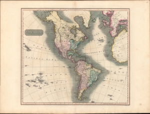
America.
$350.00
Acquire
- Digital Map Information
- Suitable for large format printing
- DPI: 600
- File Size: 709.93 MB
- File Type: ZIP / TIFF
- ICC color profile embedded
- Delivered instantly via download link
A striking example of John Thomson's 1813 map of the Americas. The America presented here predates the momentous events of the mid-19th century: the Mexican American War, the Gold Rush, and the Latin American Wars of Independence. (more details)
Slavery, Resistance, and Revolution.
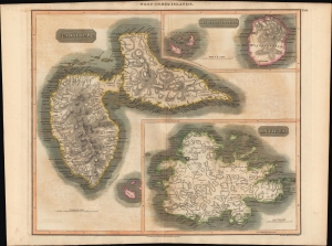
West Indies. Guadaloupe. Antigua. MarieGalante etc.
$250.00
Acquire
- Digital Map Information
- Suitable for large format printing
- Full resolution TIFF file
- ICC color profile embedded
- Delivered instantly via download link
An example of John Thomson's hand-colored 1814 map of the West India islands of Antigua, Guadeloupe, and Marie-Galante. (more details)
Happy Arabia.
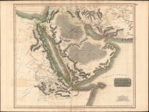
Arabia, Egypt, Abyssinia, Red Sea etc.
$550.00
Acquire
- Digital Map Information
- Suitable for large format printing
- DPI: 600
- File Size: 78.89 MB
- File Type: ZIP / TIFF
- ICC color profile embedded
- Delivered instantly via download link
This is an example of John Thomson's 1814 map of Arabia, Egypt, and Abyssinia. Centered on the Arabian Peninsula, Thomson's map covers from the eastern Mediterranean to the Horn of Africa, and from the Libyan Desert to Persia. The whole of this map is beautifully engraved in the minimalist English style pioneered in the early part of the 19th century. Relief is shown by hachure with towns, caravan routes, cities, and major topographical features identified. (more details)
The Indian Ocean and arteries of trade.
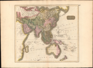
Asia.
$450.00
Acquire
- Digital Map Information
- Suitable for large format printing
- DPI: 600
- File Size: 64.28 MB
- File Type: ZIP / TIFF
- ICC color profile embedded
- Delivered instantly via download link
This is a first edition 1814 John Thomson map of Asia, the Indian Ocean, and Australia. (more details)
Australia with an unknown interior.
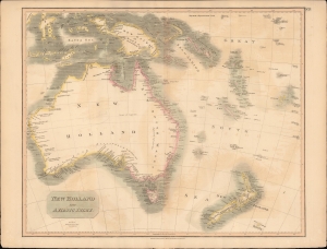
New Holland and Asiatic Isles.
$650.00
Acquire
- Digital Map Information
- Suitable for large format printing
- DPI: 600
- File Size: 707.73 MB
- File Type: ZIP / TIFF
- ICC color profile embedded
- Delivered instantly via download link
This a wonderful example of John Thompson's 1814 Map of Australia, New Zealand, New Guinea, and parts of Polynesia. (more details)
Final days of slavery in the British West Indies.
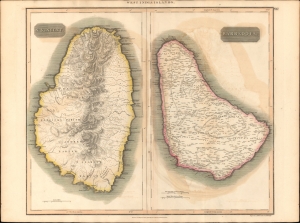
St. Vincent. / Barbadoes. / West India Islands.
$350.00
Acquire
- Digital Map Information
- Suitable for large format printing
- DPI: 600
- File Size: 69.58 MB
- File Type: ZIP / TIFF
- ICC color profile embedded
- Delivered instantly via download link
This is John Thomson's 1814 map of Barbados and St. Vincent, both part of the Lesser Antilles volcanic arc, West Indies. It illustrates the final days of slavery on both islands, and coincides with a period marked by internal strife, social upheaval, economic decline, and rebellion. (more details)
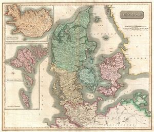
Denmark.
$350.00
Acquire
- Digital Map Information
- Suitable for large format printing
- DPI: 300
- File Size: 16.83 MB
- File Type: ZIP / TIFF
- ICC color profile embedded
- Delivered instantly via download link
This fascinating hand colored 1814 map depicts Denmark, Iceland and the Faeroe Islands. The whole is beautifully engraved in the minimalist English style pioneered in the early part of the 19th century. Thomson maps are known for their stunning color, awe ... (more details)
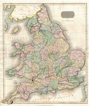
England.
$350.00
Acquire
- Digital Map Information
- Suitable for large format printing
- DPI: 300
- File Size: 19.16 MB
- File Type: ZIP / TIFF
- ICC color profile embedded
- Delivered instantly via download link
This hand colored 1814 map of England and Wales is beautifully engraved in the minimalist English style pioneered in the early part of the 19th century. Thomson maps are known for their stunning color, awe inspiring size, and magnificent detail. ... (more details)
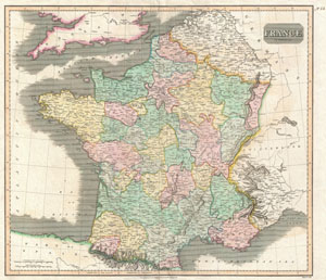
France.
$230.00
Acquire
- Digital Map Information
- Suitable for large format printing
- DPI: 300
- File Size: 8.85 MB
- File Type: ZIP / TIFF
- ICC color profile embedded
- Delivered instantly via download link
This hand colored map is a steel plate engraving, dating to 1814 by the important English mapmaker John Thomson. It depicts France divided into its color coded departments. Thomson maps are known for their stunning color, awe inspiring size, and ... (more details)
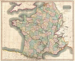
France.
$250.00
Acquire
- Digital Map Information
- Suitable for large format printing
- DPI: 300
- File Size: 19.53 MB
- File Type: ZIP / TIFF
- ICC color profile embedded
- Delivered instantly via download link
This hand-colored 1814 map by John Thomson details France the in year of Napoleon Bonaparte's defeat and subsequent imprisonment at Elba. One year later, Napoleon's escape and final defeat at Waterloo would end 22 years of almost continuous ... (more details)
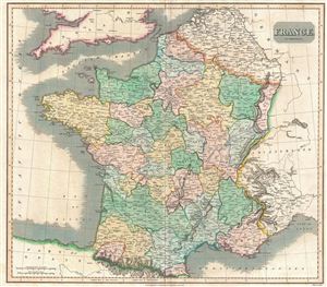
France in provinces.
$250.00
Acquire
- Digital Map Information
- Suitable for large format printing
- DPI: 300
- File Size: 17 MB
- File Type: ZIP / TIFF
- ICC color profile embedded
- Delivered instantly via download link
This hand colored map is a steel plate engraving, dating to 1814 by the important English mapmaker John Thomson. It depicts France divided into its color coded provinces. Until 1790 France was divided into 40 provinces based on local ... (more details)
The height of the British East India Company.
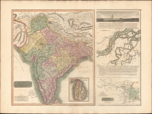
Hindoostan. / A View of the course of the Ganges...
$550.00
Acquire
- Digital Map Information
- Suitable for large format printing
- DPI: 600
- File Size: 77.31 MB
- File Type: ZIP / TIFF
- ICC color profile embedded
- Delivered instantly via download link
This is the 1814 first edition John Thomson map of India with inset maps of the Ganges River. This is the rarest of the Thomson India series, having appeared only in the first edition of his atlas. It is one of the finest atlas maps of India to appear in the early 19th century. (more details)
Before the exploration of the American West.
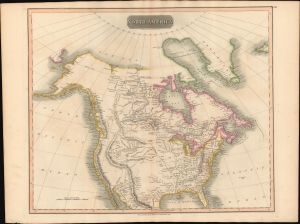
North America.
$500.00
Acquire
- Digital Map Information
- Suitable for large format printing
- DPI: 600
- File Size: 64.65 MB
- File Type: ZIP / TIFF
- ICC color profile embedded
- Delivered instantly via download link
This is John Thomson's 1814 map of North America. It is perhaps the best general atlas map of North America to appear in the 19th century. (more details)
Poland on the eve of Partition.
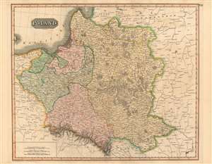
Poland.
$400.00
Acquire
- Digital Map Information
- Suitable for large format printing
- DPI: 600
- File Size: 78.93 MB
- File Type: ZIP / TIFF
- ICC color profile embedded
- Delivered instantly via download link
This is a fine example of John Thomson's 1814 map of Poland. It illustrates the lands of the former Polish-Lithuanian Commonwealth at the end of the Napoleonic Wars and on the cust of its partition betweem Russia, Prussia, and Austria. (more details)
Beautifully detailed map of Scandinavia.
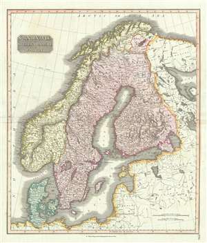
Scandinavia, or Sweden, Denmark and Norway.
$350.00
Acquire
- Digital Map Information
- Suitable for large format printing
- DPI: 300
- File Size: 16.31 MB
- File Type: ZIP / TIFF
- ICC color profile embedded
- Delivered instantly via download link
This fascinating hand colored 1814 map depicts Sweden, Denmark, and Norway. Modern day Finland, though included, was then part of the Kingdom of Sweden. Relief is shown by hachure with towns, cities, and major topographical features ... (more details)
Some 'doubtful' islands.
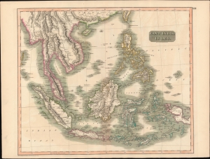
East India Isles.
$450.00
Acquire
- Digital Map Information
- Suitable for large format printing
- DPI: 600
- File Size: 720.5 MB
- File Type: ZIP / TIFF
- ICC color profile embedded
- Delivered instantly via download link
This is John Thomson's 1814 map of Southeast Asia and the East India Islands. (more details)
Some 'doubtful' islands.
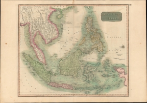
East India Isles.
$400.00
Acquire
- Digital Map Information
- Suitable for large format printing
- DPI: 600
- File Size: 49.65 MB
- File Type: ZIP / TIFF
- ICC color profile embedded
- Delivered instantly via download link
This is the first edition of John Thomson's 1814 map of Southeast Asia and the East India Islands. (more details)
Features a remarkable view of Mont Blanc.
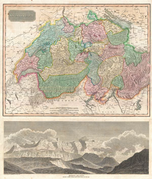
Swisserland. Mont Blanc Nearly Three Miles Above the Level of the Sea.
$300.00
Acquire
- Digital Map Information
- Suitable for large format printing
- DPI: 300
- File Size: 19.67 MB
- File Type: ZIP / TIFF
- ICC color profile embedded
- Delivered instantly via download link
This is an excellent example of John Thomson's 1814 map of Switzerland according to its division into 26 constituent Cantons under the 1648 Treaty of Westphalia. Features a splendid view of Mont Blanc in the lower quadrants. This ... (more details)
Before the Great Game.
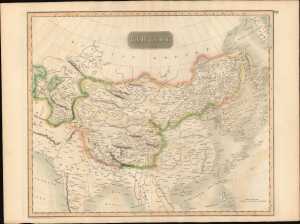
Tartary.
$300.00
Acquire
- Digital Map Information
- Suitable for large format printing
- DPI: 600
- File Size: 719.07 MB
- File Type: ZIP / TIFF
- ICC color profile embedded
- Delivered instantly via download link
A beautiful large format 1814 John Thomson map of Tartary - a nebulous term that referred to all of Central Asia north of China and India, and South of the Russian Empire, and from the Caspian Sea, to Sakhalin. (more details)
Mare Britannicum.
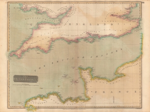
The British Channel.
$250.00
Acquire
- Digital Map Information
- Suitable for large format printing
- Full resolution TIFF file
- ICC color profile embedded
- Delivered instantly via download link
A fine example of John Thomson's 1814 map of the English Channel, published in 1817 in his New General Atlas. (more details)
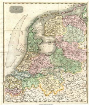
Holland.
$250.00
Acquire
- Digital Map Information
- Suitable for large format printing
- DPI: 300
- File Size: 18.3 MB
- File Type: ZIP / TIFF
- ICC color profile embedded
- Delivered instantly via download link
This beautiful hand colored 1814 map of Holland is beautifully engraved in the minimalist English style pioneered in the early part of the 19th century. The Broad Fourteen sandbar, scene of countless naval battles, is shown here ... (more details)
The Northwest Territory and West Florida.
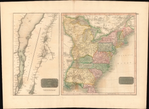
United States of America. / The Course of the River St. Lawrence, from Lake Ontario to Manicouagan Point.
$500.00
Acquire
- Digital Map Information
- Suitable for large format printing
- DPI: 600
- File Size: 66.11 MB
- File Type: ZIP / TIFF
- ICC color profile embedded
- Delivered instantly via download link
This is an example of John Thomson's 1814 map of the United States and the course of the St. Lawrence River. The map offers much of interest, ranging from early state and territorial configurations to rarely seen references to short-lived treaties with American Indians. (more details)
Wonderfully detailed map of the West Indies.
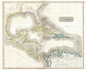
West Indies.
$600.00
Acquire
- Digital Map Information
- Suitable for large format printing
- DPI: 300
- File Size: 14.55 MB
- File Type: ZIP / TIFF
- ICC color profile embedded
- Delivered instantly via download link
This is a fascinating 1814 map of the West Indies and Central America by the Edinburgh cartographer John Thomson. It covers from the Carolinas south through Texas, Mexico and Central America to the northern part of South America ... (more details)
The year St. Lucia became British.
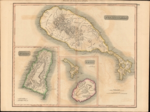
West India Islands. / St. Christoperhs. / St. Lucia. / Nevis.
$300.00
Acquire
- Digital Map Information
- Suitable for large format printing
- DPI: 600
- File Size: 714.5 MB
- File Type: ZIP / TIFF
- ICC color profile embedded
- Delivered instantly via download link
This is John Thomson's 1814 map of the Caribbean Islands of St. Kitts, St. Lucia, and Nevis. This map was issued in the year St. Lucia was ceded to the British Empire. (more details)
The icy northern waters.
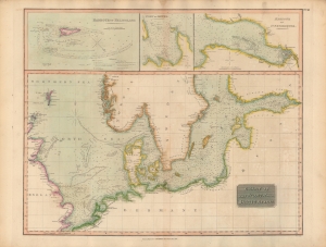
Chart of the North and Baltic Seas, etc.
$300.00
Acquire
- Digital Map Information
- Suitable for large format printing
- DPI: 600
- File Size: 19.01 MB
- File Type: ZIP / TIFF
- ICC color profile embedded
- Delivered instantly via download link
An impressive, hand-colored 1816 chart of the North and Baltic Seas, which appeared in John Thomson's New General Atlas. Remarkable detail is provided on depths, coasts, hazards, and other important navigational information. (more details)
Tracks across the Atlantic.
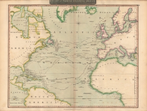
Chart of North Atlantic Ocean : with tracks of the shipping to West Indies, North America etc.
$350.00
Acquire
- Digital Map Information
- Suitable for large format printing
- Full resolution TIFF file
- ICC color profile embedded
- Delivered instantly via download link
A lovely 1815 map of the Atlantic Ocean, including tracks of recent voyages, produced for the first edition of John Thomson's New General Atlas in 1817. It provides considerable useful information for mariners while also including some speculative features. (more details)
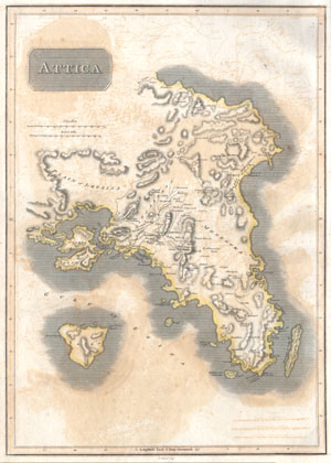
Attica.
$220.00
Acquire
- Digital Map Information
- Suitable for large format printing
- DPI: 300
- File Size: 4.03 MB
- File Type: ZIP / TIFF
- ICC color profile embedded
- Delivered instantly via download link
This is an attractive 1814 John Thomson map of Attica, Greece. Map features many of the important cities and site in early Greek History. Shows Athens, the Plain of Marathon, Salamis, and the sites of numerous historic ruins. ... (more details)
British fascination with China.
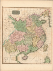
China.
$375.00
Acquire
- Digital Map Information
- Suitable for large format printing
- Full resolution TIFF file
- ICC color profile embedded
- Delivered instantly via download link
This is John Thomson's 1815 map of China with its provinces. (more details)
Settling the Borders of Post-Napoleonic Europe.
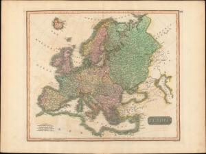
Europe.
$250.00
Acquire
- Digital Map Information
- Suitable for large format printing
- Full resolution TIFF file
- ICC color profile embedded
- Delivered instantly via download link
A lovely example of John Thomson's c. 1815 map of Europe, engraved by John Menzies, for the first edition of Thomson's New General Atlas, published in 1817. Despite the publication date, the map was prepared before the post-Napoleonic order had solidified and reflects a high degree of uncertainty over the borders of Europe emerging from the Congress of Vienna. (more details)
The 'closed' countries of Korea and Japan.
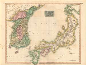
Corea and Japan.
$750.00
Acquire
- Digital Map Information
- Suitable for large format printing
- DPI: 600
- File Size: 84.26 MB
- File Type: ZIP / TIFF
- ICC color profile embedded
- Delivered instantly via download link
This fascinating hand colored 1815 map depicts Joseon Korea and Tokugawa Japan, both of which would be drastically changed by the end of the century. The level of detail attempted here is impressive given the great difficulties faced by foreigners trying to travel to either country at the time. (more details)
Revolutionary South America.
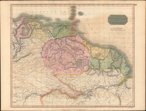
Caraccas and Guiana.
$250.00
Acquire
- Digital Map Information
- Suitable for large format printing
- Full resolution TIFF file
- ICC color profile embedded
- Delivered instantly via download link
A stunning, highly detailed, and extremely interesting c. 1815 map of northeastern South America, which appeared in the 1817 edition of John Thomson's New General Atlas. It reflects both the limited geographical knowledge of the South American interior as well as the shifting borders following the upheaval of the Venezuelan struggle for independence. (more details)
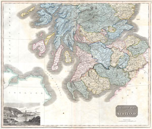
Southern Scotland
$200.00
Acquire
- Digital Map Information
- Suitable for large format printing
- DPI: 300
- File Size: 9 MB
- File Type: ZIP / TIFF
- ICC color profile embedded
- Delivered instantly via download link
This hand colored map is a steel plate engraving, dating to 1815 by the important English map publisher John Thomson. It depicts the southern portion of Scotland from the Island of Mull to the border with England. In the ... (more details)
¡Viva la resistencia!
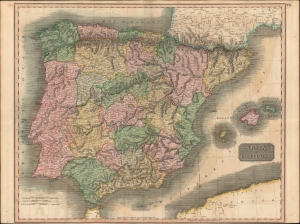
Spain and Portugal.
$300.00
Acquire
- Digital Map Information
- Suitable for large format printing
- Full resolution TIFF file
- ICC color profile embedded
- Delivered instantly via download link
A hand-colored 1815 map of Spain and Portugal by John Thomson, published in his New General Atlas. It depicts the kingdoms at the tail end of the Napoleonic Wars (1803 - 1815), namely the Peninsular War, which was devastating both to Iberia and to both countries' control of their overseas empires. (more details)
Europe after the Congress of Vienna.
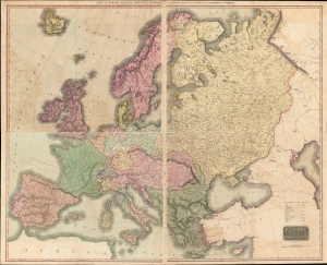
A Map of Europe with the Political Divisions after the Peace of Paris and Congress of Vienna / Europe after the Congress of Vienna.
$500.00
Acquire
- Digital Map Information
- Suitable for large format printing
- Full resolution TIFF file
- ICC color profile embedded
- Delivered instantly via download link
This 1816 map by John Thomson depicts Europe in the wake of the Congress of Vienna. Issued in four sheets, it measures more than three feet tall by four feet wide. The map represents the culmination and apogee of Thomson's cartographic work in his New General Atlas. (more details)
Snapshot of Spain's American Empire at the Moment of Its Demise.
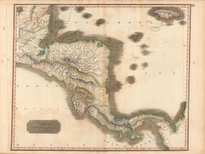
Spanish North America, Southern Part.
$225.00
Acquire
- Digital Map Information
- Suitable for large format printing
- Full resolution TIFF file
- ICC color profile embedded
- Delivered instantly via download link
This is John Thomson's beautifully hand-colored 1816 map of Central America, published in 1817 in his New General Atlas. It depicts the region as Spain's colonial empire in the Americas was unraveling as a result of the Napoleonic Wars. (more details)
Enticing fur traders.
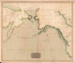
Chart of the Northern Passage Between Asia and America.
$300.00
Acquire
- Digital Map Information
- Suitable for large format printing
- DPI: 600
- File Size: 42.82 MB
- File Type: ZIP / TIFF
- ICC color profile embedded
- Delivered instantly via download link
This is John Thomson's 1816 map of the Bering Strait. It is one of the earliest atlas maps to give attention to the northern Alaskan coastline. (more details)
Waning days of the Transatlantic Slave Trade in British and Spanish West Indian Colonies.
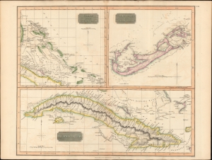
Island of Cuba. / The Bermudas. or Summer Islands. / Chart of the Bahama Islands.
$600.00
Acquire
- Digital Map Information
- Suitable for large format printing
- DPI: 600
- File Size: 63.75 MB
- File Type: ZIP / TIFF
- ICC color profile embedded
- Delivered instantly via download link
This is a striking 1816 map of Cuba, the Bahamas, and Bermuda issued by John Thomson. It captures the islands in the waning days of the Transatlantic slave trade in the British and Spanish West Indies. (more details)
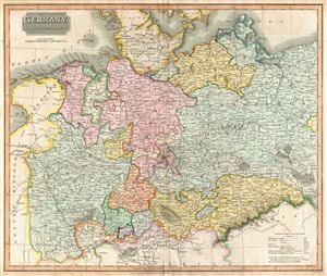
Germany North of the Mayne.
$250.00
Acquire
- Digital Map Information
- Suitable for large format printing
- DPI: 300
- File Size: 18.29 MB
- File Type: ZIP / TIFF
- ICC color profile embedded
- Delivered instantly via download link
This fascinating hand colored 1816 map depicts the semi-autonomous kingdoms, duchies, and Prussian territories of northern Germany. These include Westphalia, Rhineland, Saxony, Brandenburg, Bremen, Munster, Pomerania, and ... (more details)
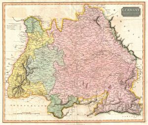
Germany South of the Mayne.
$250.00
Acquire
- Digital Map Information
- Suitable for large format printing
- DPI: 300
- File Size: 15.26 MB
- File Type: ZIP / TIFF
- ICC color profile embedded
- Delivered instantly via download link
This fascinating hand colored 1816 map depicts the semi-autonomous kingdoms, duchies, and Prussian territories in southern Germany. These include Bavaria, Baden, Darmstadt, and Wurttemberg. Following the Napoleonic Wars, ... (more details)
Bargaining Chips of Colonial Competition.
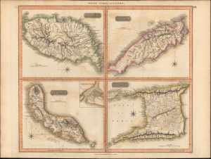
West India Islands.
$250.00
Acquire
- Digital Map Information
- Suitable for large format printing
- DPI: 600
- File Size: 650.17 MB
- File Type: ZIP / TIFF
- ICC color profile embedded
- Delivered instantly via download link
A map of the Caribbean islands of Grenada, Curacao, Trinidad, and Tobago in the Lesser Antilles, prepared by John Thomson and engraved by Samuel Neele for Thomson's New General Atlas. (more details)
After the Maroon Wars.
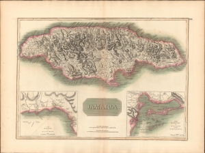
Jamaica.
$300.00
Acquire
- Digital Map Information
- Suitable for large format printing
- DPI: 600
- File Size: 71.09 MB
- File Type: ZIP / TIFF
- ICC color profile embedded
- Delivered instantly via download link
This is a striking 1816 map of Jamaica issued by John Thomson. The map illustrates Jamaica when it was one of Britain's most profitable West Indian colonies, but also suffering island-wide instability as the indigenous and African populations struggled to throw off the yoke of slavery. (more details)
Unusal polar projection.
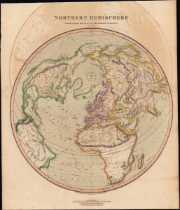
Northern Hemisphere Projected on the Plane of the Horizon of London.
$500.00
Acquire
- Digital Map Information
- Suitable for large format printing
- DPI: 600
- File Size: 581.8 MB
- File Type: ZIP / TIFF
- ICC color profile embedded
- Delivered instantly via download link
A lovely 1816 offset polar projection map of the Northern Hemisphere that appeared in Edinburgh cartographer John Thomson's New General Atlas. (more details)
Rounding out the Geography of the Pacific.
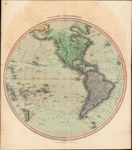
Western Hemisphere.
$350.00
Acquire
- Digital Map Information
- Suitable for large format printing
- DPI: 600
- File Size: 62.92 MB
- File Type: ZIP / TIFF
- ICC color profile embedded
- Delivered instantly via download link
A hand-colored 1815 map of the Western Hemisphere by John Thomson, which appeared in his New General Atlas. It is notable for tracing the routes of late 18th century explorers, including Cook, Vancouver, and La Perouse, that first gave shape, however inchoate, to the shores of northwestern America, Hawaii, New Zealand, and other Pacific coasts on European maps. (more details)
Vying for the Veneto.
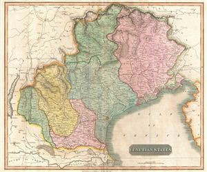
Venetian States.
$250.00
Acquire
- Digital Map Information
- Suitable for large format printing
- DPI: 300
- File Size: 15.79 MB
- File Type: ZIP / TIFF
- ICC color profile embedded
- Delivered instantly via download link
An 1816 map of Venice and environs (the Veneto and Friuli) in northern Italy, published in John Thomson's New General Atlas. It was produced in the immediate wake of the Congress of Vienna at the end of the Napoleonic Wars, which created the Austrian-ruled Kingdom of Lombardy-Venetia. (more details)
The Outer Edge of England.
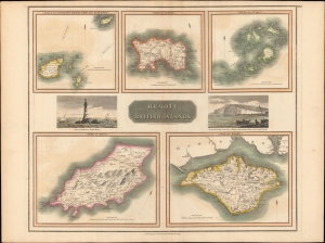
Remote British Islands.
$250.00
Acquire
- Digital Map Information
- Suitable for large format printing
- Full resolution TIFF file
- ICC color profile embedded
- Delivered instantly via download link
A lovely example of John Thomson's 1817 map of remote British islands, including the Isles of Wight, Man, and Jersey, with views of the Eddystone Lighthouse and Freshwater Bay on the Isle of Wight. (more details)
Unknown Parts.
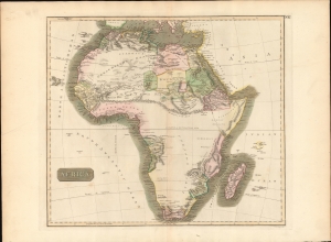
Africa.
$350.00
Acquire
- Digital Map Information
- Suitable for large format printing
- DPI: 600
- File Size: 688.26 MB
- File Type: ZIP / TIFF
- ICC color profile embedded
- Delivered instantly via download link
This is John Thomson's fascinating 1814 map of Africa, here in its first edition. This map is as engrossing as much for what it doesn't show as for what it does. The expansive blank interior, here labeled, 'unknown parts' reveals just how little of the 'Dark Continent' was known in the early 19th century. (more details)
Beautiful map of Belgium and Netherlands depicting the Departments of the First French Republic.
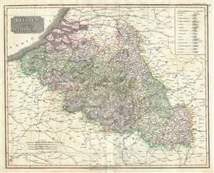
Belgium or the Netherlands.
$200.00
Acquire
- Digital Map Information
- Suitable for large format printing
- DPI: 300
- File Size: 19.37 MB
- File Type: ZIP / TIFF
- ICC color profile embedded
- Delivered instantly via download link
This is a beautiful 1817 map of Belgium and Luxembourg by the Edinburgh cartographer John Thomson. The title ‘The Netherlands’ refers to the old name for Belgium, also called Royal Netherlands and Catholic Netherlands. ... (more details)
The Spoils of Victory.
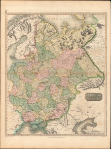
European Russia.
$350.00
Acquire
- Digital Map Information
- Suitable for large format printing
- Full resolution TIFF file
- ICC color profile embedded
- Delivered instantly via download link
An impressive 1815 John Thomson map of the European part of the Russian Empire, beautifully engraved by Moffat. It was produced in the wake of the Napoleonic Wars and the Congress of Vienna, where Russia announced itself as one of the major players in Europe and the political map of Europe was remade. (more details)
Thomson's two panel map of Egypt and Ethiopia.
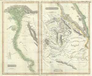
Egypt. Abyssinia.
$250.00
Acquire
- Digital Map Information
- Suitable for large format printing
- DPI: 300
- File Size: 15.81 MB
- File Type: ZIP / TIFF
- ICC color profile embedded
- Delivered instantly via download link
This is a beautiful example of John Thomson’s 1817 map of Egypt and Abyssinia. Essentially two maps on a single sheet, the map on the left represents Egypt while the right hand side of the sheet features a map of ... (more details)
Beautiful Thomson map focusing on the southeastern parts of Europe.
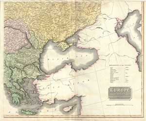
Europe after the Congress of Vienna.
$250.00
Acquire
- Digital Map Information
- Suitable for large format printing
- DPI: 300
- File Size: 16.58 MB
- File Type: ZIP / TIFF
- ICC color profile embedded
- Delivered instantly via download link
This is an attractive 1817 map of Greece, the Balkans and Ukraine by the Edinburgh cartographer John Thomson. It depicts the region from Greece north to include the southern portions of Ukraine, including Crimea. ... (more details)