
CartoCuriosity - Terre Australis, the Great Southern Continent
CartoCuriosity - Terre Australis, the Great Southern Continent
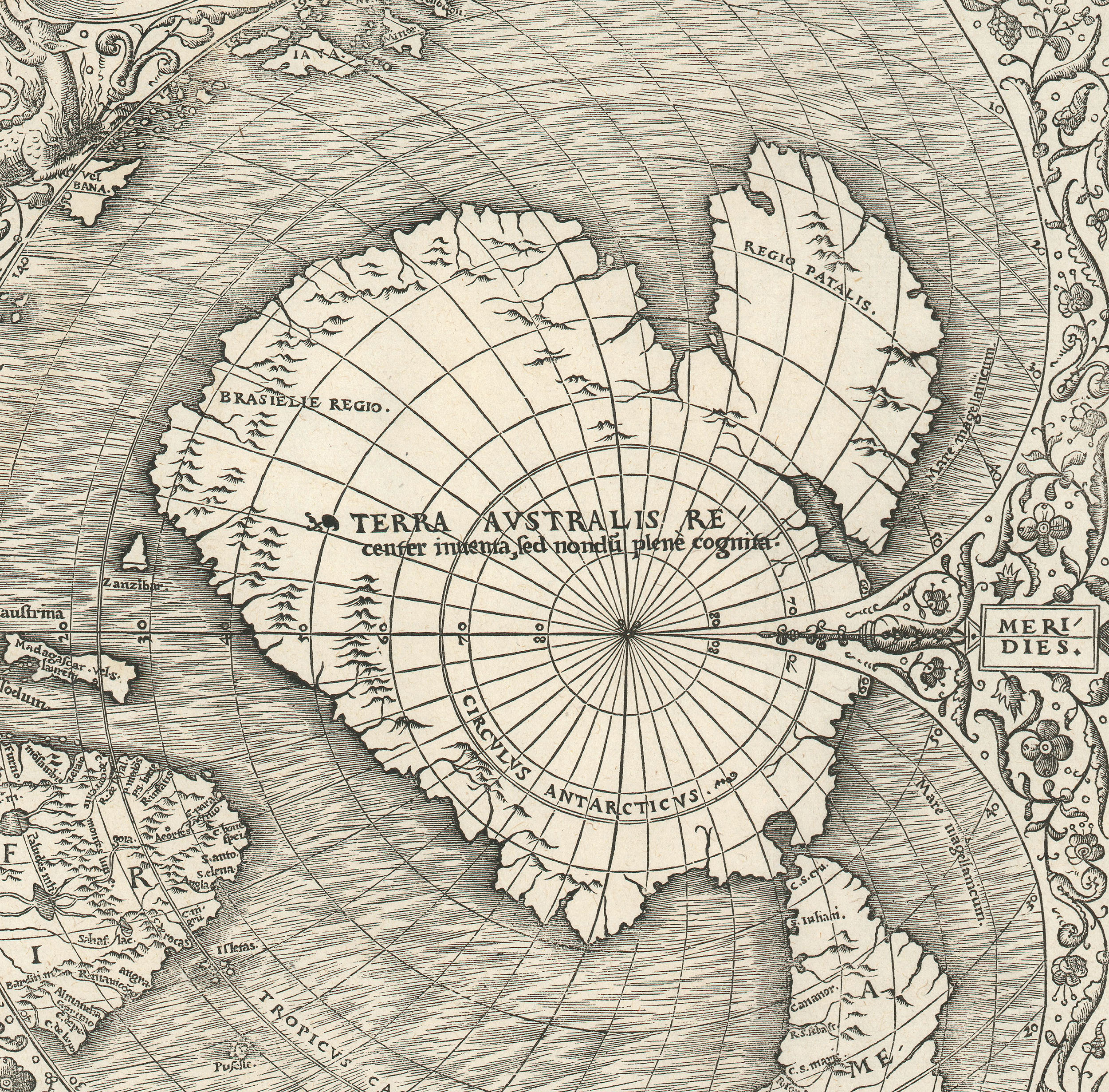
Long before European navigators got even close to Antarctica, cartographers were mapping Terre Australis - a massive apocryphal continent at the base of the Earth.
Centuries before Young John Gore, Captain James Cook’s cabin boy on his second voyage, supposedly climbed the mast and became the first to glimpse Antarctica, mapmakers in Europe were already charting a vast southern continent. But how did they imagine a land no one had seen — and what exactly were they mapping? This episode explores how early European cartographers, drawing on the writings of classical antiquity, constructed and populated the mythic realm of Terra Australis Incognita - a continent born not from discovery, but from belief, speculation, and imagination.
Kevin J. Brown, Cory Choy, Tom Fama, Christian Cuciniello
2025-03-13
A Closer Look at the Maps

Hemispheriū Ab Aequinoctli Linea, Ad Circulū Poli Arctici / Hemispheriū Ad Circulū Poli Ātarctici.
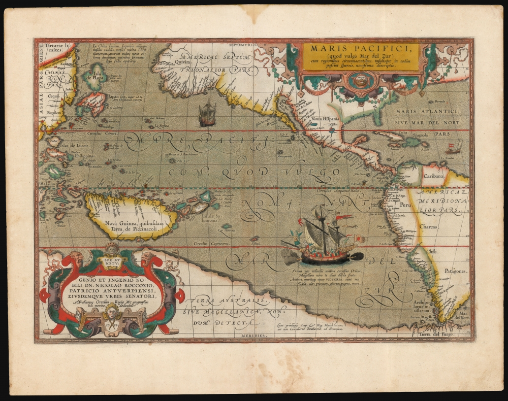
First separate map of the Pacific - in an exceptional old color example.
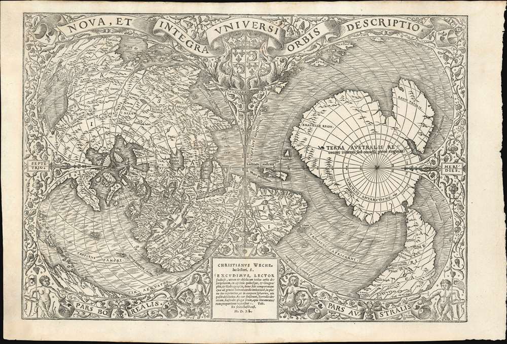
One of the Finest and Most Detailed Woodcut World Maps.
Podcast Summary:
The largest continent that never was
More than one great explorer set out in search of something that did not exist.
In early modern cartography, one of the most persistent and fascinating ideas was Terra Australis Incognita—a vast southern continent believed to balance the known world.
In this episode of CartoCuriosity, Kevin Brown of Geographicus Rare Antique Maps explores the origins, evolution, and eventual disappearance of this imagined landmass.
A Continent of Necessity
Terra Australis first appeared on maps in the late 16th century, but its intellectual roots reach back to antiquity.
The Greek philosopher Aristotle proposed that the Earth must be balanced— that the landmasses of the Northern Hemisphere required a counterweight in the south.
If there was land in the north, there had to be land in the south.
This idea, though speculative, proved remarkably durable.
The Power of Ancient Authority
During the Renaissance and Enlightenment, European scholars held classical knowledge in the highest regard. Their goal was often not to challenge ancient ideas—but to recover and restore them.
The works of Claudius Ptolemy, a 2nd-century geographer, became foundational to European cartography.
Though Ptolemy did not map Terra Australis, his methods and coordinate systems provided the framework through which later cartographers imagined it.
These ideas were preserved and transmitted through the Islamic world, notably by scholars such as al-Idrisi, before returning to Europe and shaping Renaissance mapping traditions.
Mapping the Unknown
By the late 1500s, Terra Australis began appearing prominently on European maps.
Cartographers such as Gerard Mercator, Abraham Ortelius, and later figures like Robert de Vaugondy included it as a vast landmass spanning the southern reaches of the globe.
On some maps, it stretched:
- From the tip of South America across the Pacific
- Up toward New Guinea and Southeast Asia
- Across nearly the entire southern hemisphere
Though cartographers often acknowledged the uncertainty, they nonetheless filled in coastlines, bays, and even place names.
Exploration Meets Expectation
As exploration expanded, the idea of Terra Australis began to influence real voyages.
Early explorers believed they might encounter this continent, not because it had been seen—but because it had been mapped.
Ferdinand Magellan, upon reaching the southern tip of South America, assumed that Tierra del Fuego was part of this great southern landmass.
Later, Francis Drake sailed farther south, demonstrating that Tierra del Fuego was not connected to any such continent.
The Beginning of the End
The most decisive challenge to Terra Australis came in the 18th century.
Captain James Cook, during his voyages in the 1760s and 1770s, was tasked in part with determining whether the continent existed.
Cook’s explorations—particularly around New Zealand—failed to reveal any massive southern landmass.
With each voyage, Terra Australis grew smaller—until it disappeared entirely.
From Myth to Antarctica
By the late 18th century, the concept of Terra Australis had largely been abandoned.
Later 19th-century expeditions, including those led by Charles Wilkes and James Clark Ross, began mapping the actual Antarctic coastline— a far smaller and less hospitable landmass than the imagined southern continent.
Why It Persisted
Terra Australis was not driven by economic or political necessity. It was not known to be resource-rich, nor was it easily accessible.
Instead, it persisted as an intellectual construct— an attempt to impose balance, logic, and completeness on an incomplete understanding of the world.
It was a solution to a problem that existed only in theory.
A Lesson in Cartography
Today, Terra Australis offers an important lesson: maps do not simply record knowledge—they reflect belief.
What appears on a map may be based on observation, but it may also emerge from theory, tradition, or imagination.
Sometimes the most interesting parts of a map are the places that never existed.
Featuring Kevin J. Brown, Geographicus Rare Antique Maps.
Produced by Cory Choy, Christian Cucinello, and Tom Fama.
Music by L. Budu and Luke Allen. Sound by Silver Sound.