
CartoCuriosity: The First Map of the North Pole
CartoCuriosity: The First Map of the North Pole
At the top of the world, Mercator mapped the unknown with science, myth, and imagination.
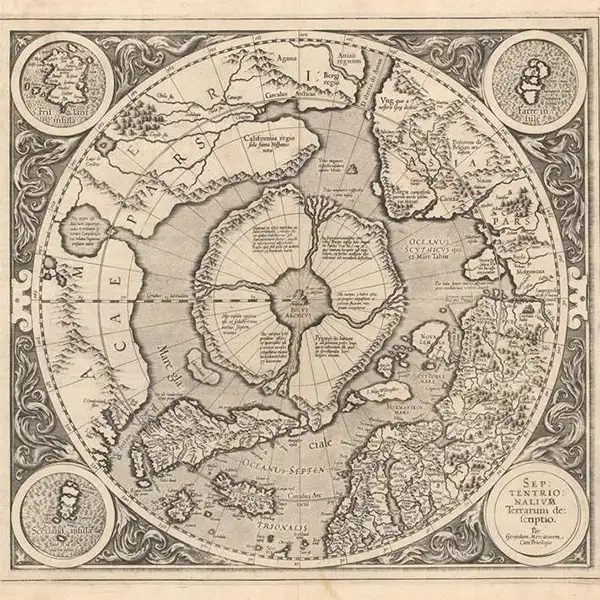
In this episode of CartoCuriosity, Kevin Brown of Geographicus Rare Antique Maps explores Gerard Mercator’s extraordinary first map of the North Pole - a landmark of 16th-century Arctic cartography where geographic knowledge, scientific theory, maritime legend, and pure imagination converge. Discover how the creator of the Mercator projection envisioned a vast polar maelstrom, four mysterious Arctic islands, and a magnetic mountain at the top of the world, drawing upon explorers’ reports, medieval sources, and lost works such as the Inventio Fortunata. Rare, visually striking, and historically influential, Mercator’s speculative map reveals how early cartographers transformed the unknown Arctic into a compelling geography that shaped European thought about the high Arctic for generations.
Featuring Kevin Brown of Geographicus Rare Antique Maps
Produced by Cory Choy, Tom Fama, and Christian Cuciniello
Music by Luke Allen and El Buru. Sound by Silver Sound
2026-09-01
A Closer Look at the Maps
How Mercator mapped a place no one had ever seen.
Gerard Mercator, myth, and the imagined geography of the Arctic
In this episode of CartoCuriosity, Kevin Brown of Geographicus Rare Antique Maps explores Mercator’s remarkable—and deeply speculative—map of the Arctic.
When exploration fails, cartographers turn to speculation.
In the 16th century, vast portions of the globe remained unknown—especially the Arctic. Into that void stepped one of history’s greatest mapmakers, Gerard Mercator, whose vision of the North Pole blended observation, theory, and imagination.
A Cartographic Breakthrough
Mercator, a contemporary of Abraham Ortelius, revolutionized cartography with his introduction of the Mercator projection in 1569.
This mathematical system allowed navigators to plot straight-line courses across the globe— a major advancement for maritime travel.
The Mercator projection transformed navigation by making direction reliable, even if scale was distorted.
However, the projection came with a critical limitation: as one approaches the poles, landmasses become dramatically enlarged and distorted.
The Arctic, in particular, required a different approach.
A Map Beyond Knowledge
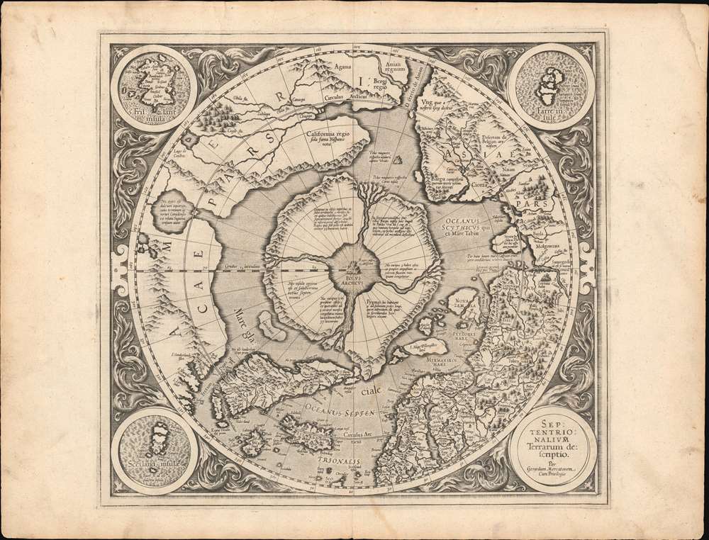
To address this, Mercator created a specialized map of the North Pole, first introduced as an inset on his 1569 world map.
A more detailed version was later prepared for his atlas and published in 1595, shortly after his death, by his son Rummold Mercator.
This map is today considered a “Holy Grail” among collectors— rare, visually striking, and historically significant.
What Mercator Knew
Certain elements of the Arctic map reflect real knowledge:
- Recognizable outlines of Scandinavia
- A reasonably accurate Iceland
- Greenland, though distorted
But beyond these familiar regions, the map becomes increasingly speculative.
What Mercator Imagined
At the center of the map lies one of its most extraordinary features: a massive polar whirlpool surrounded by four large islands.
Mercator theorized that powerful ocean currents must be drawn toward the pole, suggesting the existence of a vast maelstrom.
At the center of this system, he placed a magnetic mountain— a feature intended to explain variations in compass readings.
Mercator was not merely guessing—he was attempting to reconcile observed phenomena with theoretical geography.
Sources: Fact, Fiction, and Legend
Lacking direct exploration, Mercator drew from a wide range of sources:
- Mariners’ reports
- Classical and medieval texts
- Now-lost works, including the Inventio Fortunata
These sources introduced elements of myth into the map, including references to exotic peoples and imagined lands.
Even the idea of a northern passage between Asia and America—the Strait of Anian— appears in speculative form, predating the confirmed discovery of the Bering Strait.
Influence on Exploration
Mercator’s Arctic geography was not merely theoretical—it influenced real-world exploration.
Explorers ventured north expecting to find the features depicted on his maps, including the four polar islands.
In this way, cartography shaped exploration just as much as exploration shaped cartography.
Correction Through Discovery
In the early 17th century, new expeditions began to reveal the true nature of the Arctic.
The discovery of Spitsbergen forced cartographers to revise Mercator’s model. Later publishers, such as Jodocus Hondius, modified Mercator’s plates to incorporate new geographic knowledge.
Gradually, observation replaced speculation.
A Map Between Worlds
Mercator’s Arctic map occupies a unique place in the history of cartography.
It is neither wholly accurate nor purely fictional, but rather a synthesis of knowledge, theory, and imagination.
It reflects a moment when the boundaries between science and storytelling were still fluid, and when maps served as tools not only of navigation—but of intellectual exploration.
Mercator had ideas about the world—and built a geography to support them.
Legacy
While Mercator’s Arctic geography was eventually replaced, his projection remains in use to this day.
The map stands as a testament to a transitional era— when the unknown invited imagination, and cartographers worked at the edge of both knowledge and belief.
Featuring Kevin Brown, Geographicus Rare Antique Maps.
Produced by Cory Choy, Tom Fama, and Christian Cucinello.
Music by L. Budu and Luke Allen. Sound by Silver Sound.