
Ichijo, Bungo (sold)
Big Island on the Eve of Statehood.
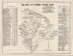
Island of Hawaii Road Map / City of Hilo.
sold
- Digital Map Information
- Suitable for large format printing
- Full resolution TIFF file
- ICC color profile embedded
- Delivered instantly via download link
This is a 1952 Bungo Ichijo double-sided road map of Hawaii's Big Island and street plan of Hilo, issued for motorists through a collaboration of local civic promotion and commercial tourism. It serves as an early example of tourist potential amid a stunning and potentially hazardous landscape defined by active volcanoes. As a case in point, the map preserves the roads and visitor attractions of Kapoho and Kalapana before their destruction by later eruptions. (more details)