Digital Image: 1790 Liesganig Massive Case Map of Galicia (Poland / Ukraine)
Galicia-liesganig-1790_d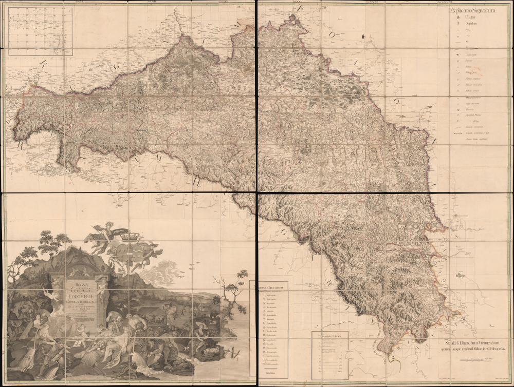
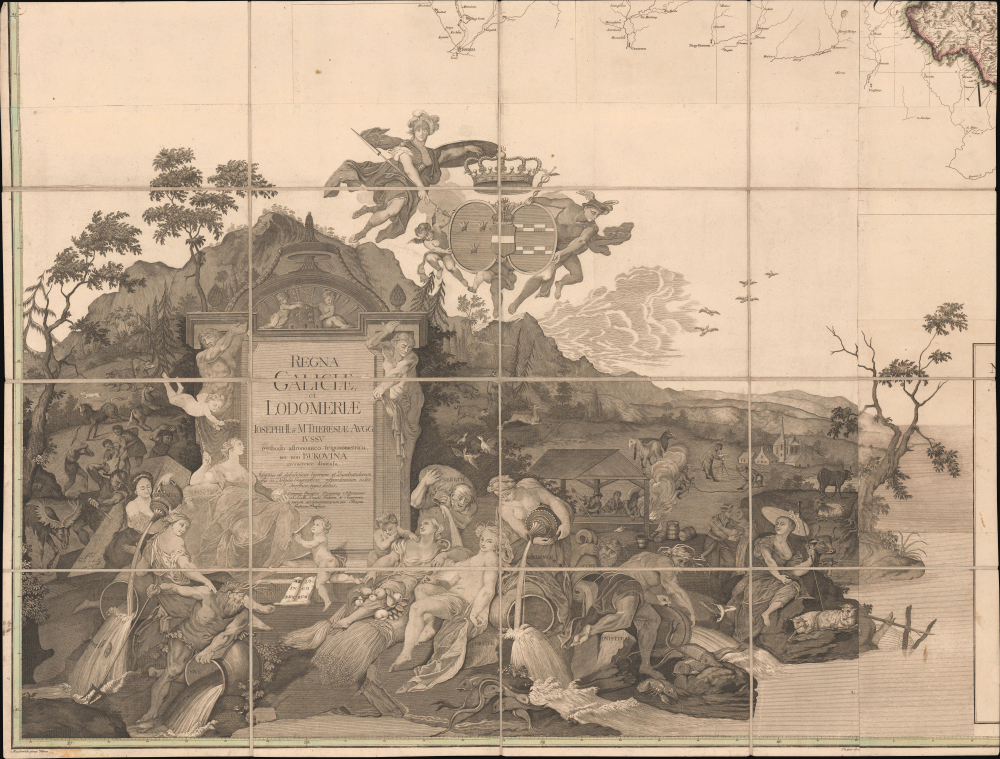
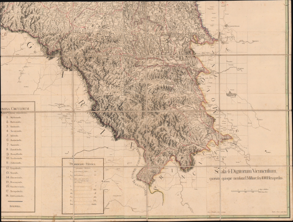


Title
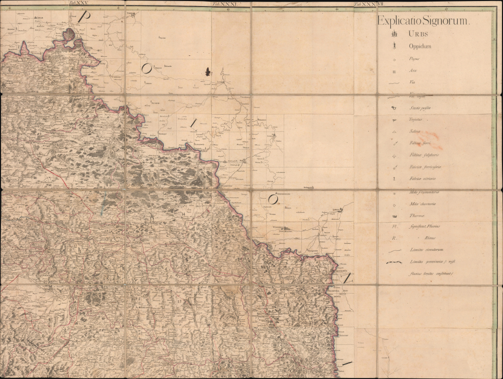
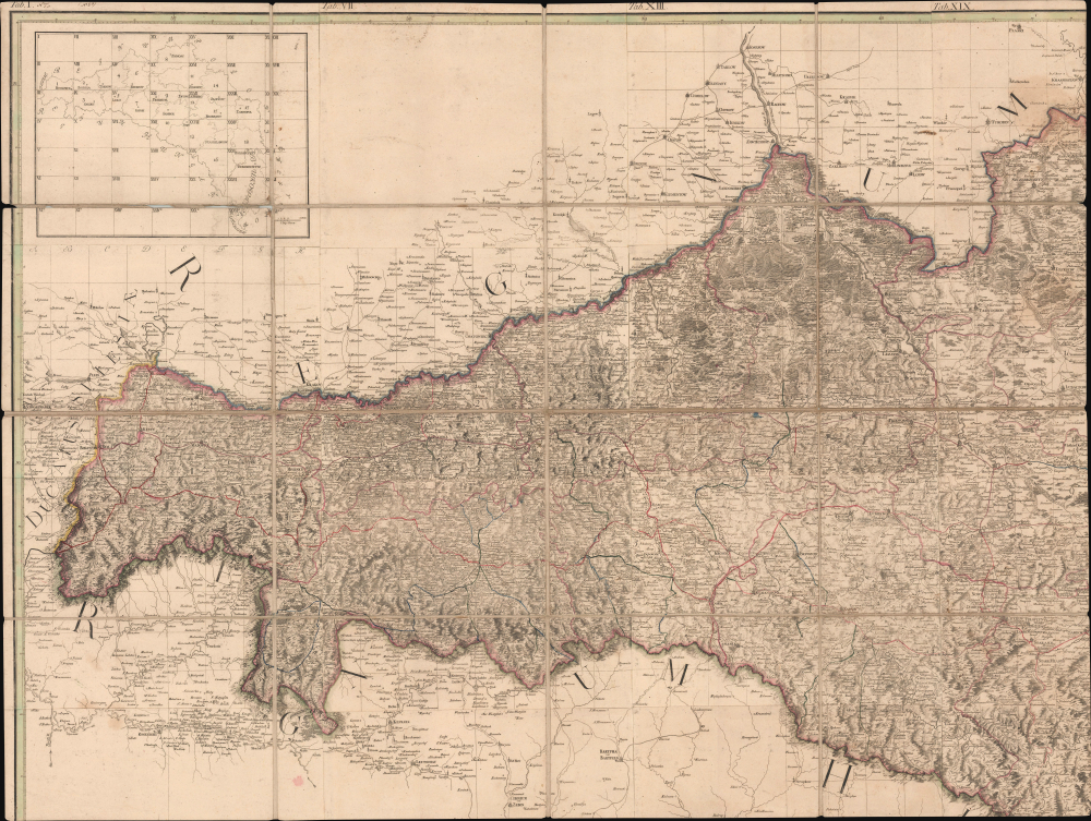
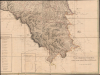
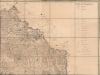
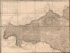
Regna Galicia, et Lodomeriae Josephi II et M. Theresiae Augg. iussu methodo astronomico-trigonometrica, nec non Bukovina geometrice dimensa...
1790 (dated) 65.5 x 87 in (166.37 x 220.98 cm) 1 : 288000
1790 (dated) 65.5 x 87 in (166.37 x 220.98 cm) 1 : 288000
Description
FOR THE ORIGINAL ANTIQUE MAP, WITH HISTORICAL ANALYSIS, CLICK HERE.
Digital Map Information
Geographicus maintains an archive of high-resolution rare map scans. We scan our maps at 300 DPI or higher, with newer images being 600 DPI, (either TIFF or JPEG, depending on when the scan was done) which is most cases in suitable for enlargement and printing.
Delivery
Once you purchase our digital scan service, you will receive a download link via email - usually within seconds. Digital orders are delivered as ZIP files, an industry standard file compression protocol that any computer should be able to unpack. Some of our files are very large, and can take some time to download. Most files are saved into your computer's 'Downloads' folder. All delivery is electronic. No physical product is shipped.
Credit and Scope of Use
You can use your digial image any way you want! Our digital images are unrestricted by copyright and can be used, modified, and published freely. The textual description that accompanies the original antique map is not included in the sale of digital images and remains protected by copyright. That said, we put significant care and effort into scanning and editing these maps, and we’d appreciate a credit when possible. Should you wish to credit us, please use the following credit line:
Courtesy of Geographicus Rare Antique Maps (https://www.geographicus.com).
How Large Can I Print?
In general, at 300 DPI, you should at least be able to double the size of the actual image, more so with our 600 DPI images. So, if the original was 10 x 12 inches, you can print at 20 x 24 inches, without quality loss. If your display requirements can accommodate some loss in image quality, you can make it even larger. That being said, no quality of scan will allow you to blow up at 10 x 12 inch map to wall size without significant quality loss. For more information, it is best consult a printer or reprographics specialist.
Refunds
If the high resolution image you ordered is unavailable, we will fully refund your purchase. Otherwise, digital images scans are a service, not a tangible product, and cannot be returned or refunded once the download link is used.
Cartographer S
Joseph Xaver Liesganig (February 13, 1719 - March 4, 1799) was an Austrian Jesuit astronomer, mathematician, and surveyor. He was born in Graz, where his father was Hofmeister, giving him an entrée into the elite circles of the Habsburg empire. Liesganig studied at the Jesuit College in Vienna, graduating in 1734, and later became both a professor of mathematics at the University of Graz and an ordained Jesuit. The rest of his life was dedicated to the study of astronomy and related subjects. In 1752, he became a professor at the University of Vienna and an assistant at the important Jesuit observatory at his alma mater, the Jesuit College in Vienna. In 1756, he succeeded Maximilian Hell (1720 - 1792) as director of the observatory; Liesganig and Hell had many similarities, including being Jesuits, and the two became the most prominent astronomers of their age in the Habsburg realms. Among the important achievements during his tenure at the observatory in Vienna was the 1761 Transit of Venus, which led to several important discoveries, including the measurement of the distance between the Earth and the Sun. Much of Liesganig's research was dedicated to determining the exact size and shape of the Earth, a particular interest of Empress Maria Theresa. After years of geodetic measurements and astronomical observations, he published his findings in 1770 in Dimensio graduum meridiani Viennensis et Hungarici. After the First Partition of Poland in 1772, Liesganig led a team to map the new lands annexed by the Habsburgs (the 'Kingdom of Galicia and Lodomeria'), after which he became head of a new astronomical observatory in Lviv, which he headed until his death, even following the suppression of the Jesuits. He is credited with introducing the science of triangulation to Habsburg Austria. More by this mapmaker...
Gottfried Prixner (1746 - October 19, 1819) was an Austrian copperplate engraver and draughtsman. A product of the Habsburg realms in Central and Eastern Europe, he worked at various points in Vienna, Lviv, Pressburg (Bratislava), and Pest. He engraved a wide range of works, especially portraits, building and city views, and maps, including Joseph Liesganig's 'Regna Galicia, et Lodomeriae' and Janos Lipszky's 'Mappa Generalis Regni Hungariae' (1808). Learn More...
Franz Anton Maulbertsch (June 7, 1724 - August 8, 1796) was a German-Austrian painter, artist, and engraver. He was born in Langenargen near the Bodensee in Baden-Württemberg to a father (Anton Maulbertsch) who was also a painter. The younger Maulbertsch studied at the Akademie der bildenden Künste in Vienna, where he studied with Jacob van Schuppen (1670 - 1751), among others. He won first prize in the Academy's painting competition and was set for a very promising career, but was denied a professorship at his alma mater for having an 'overly bold spirit.' Maulbertsch nevertheless excelled, particularly with large paintings and frescoes, which he painted primarily in churches throughout the Habsburg lands, particularly Hungary. Along with Martin Johann Schmidt (1718 - 1801), Maulbertsch is considered the paragon of Austrian late Baroque or Rococo painting. Nevertheless, Maulbertsch's 'overly bold spirit' led him to buck conventions and experiment with different styles; on the one hand, he tended towards Neoclassicism later in life, but on the other, he has been seen as a precursor to Impressionism and Modernism, movements that appeared decades after his death. Learn More...