Digital Image: 1881 American Publishing Pictorial Game Map of the United States
RamblesUSA-americanpublishing-1881_d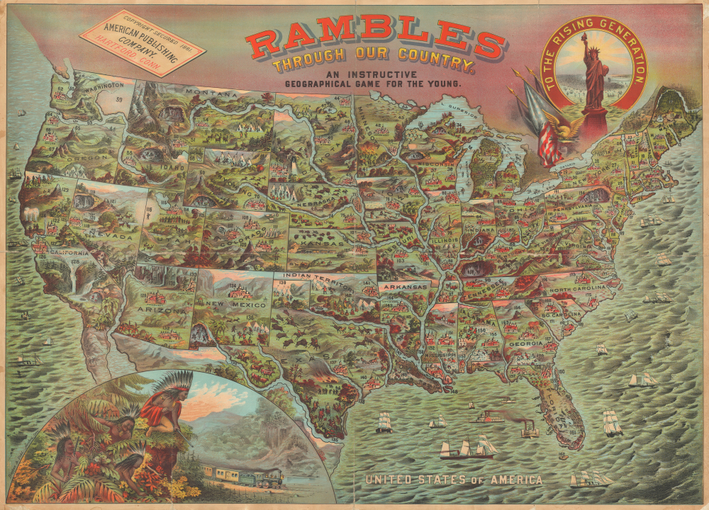


Title
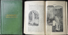
Rambles throughour Country. An Instructive Geographical Game for the Young.
1881 (dated) 24.5 x 34 in (62.23 x 86.36 cm) 1 : 6842880
1881 (dated) 24.5 x 34 in (62.23 x 86.36 cm) 1 : 6842880
Description
FOR THE ORIGINAL ANTIQUE MAP, WITH HISTORICAL ANALYSIS, CLICK HERE.
Digital Map Information
Geographicus maintains an archive of high-resolution rare map scans. We scan our maps at 300 DPI or higher, with newer images being 600 DPI, (either TIFF or JPEG, depending on when the scan was done) which is most cases in suitable for enlargement and printing.
Delivery
Once you purchase our digital scan service, you will receive a download link via email - usually within seconds. Digital orders are delivered as ZIP files, an industry standard file compression protocol that any computer should be able to unpack. Some of our files are very large, and can take some time to download. Most files are saved into your computer's 'Downloads' folder. All delivery is electronic. No physical product is shipped.
Credit and Scope of Use
You can use your digial image any way you want! Our digital images are unrestricted by copyright and can be used, modified, and published freely. The textual description that accompanies the original antique map is not included in the sale of digital images and remains protected by copyright. That said, we put significant care and effort into scanning and editing these maps, and we’d appreciate a credit when possible. Should you wish to credit us, please use the following credit line:
Courtesy of Geographicus Rare Antique Maps (https://www.geographicus.com).
How Large Can I Print?
In general, at 300 DPI, you should at least be able to double the size of the actual image, more so with our 600 DPI images. So, if the original was 10 x 12 inches, you can print at 20 x 24 inches, without quality loss. If your display requirements can accommodate some loss in image quality, you can make it even larger. That being said, no quality of scan will allow you to blow up at 10 x 12 inch map to wall size without significant quality loss. For more information, it is best consult a printer or reprographics specialist.
Refunds
If the high resolution image you ordered is unavailable, we will fully refund your purchase. Otherwise, digital images scans are a service, not a tangible product, and cannot be returned or refunded once the download link is used.
Cartographer S
William H. Dodd (May 25, 1826 - February 20, 1914) was a Hartford, Connecticut based lithographer and publisher. He operated the firm Bingham and Dodd with John H. Bingham (1831 - 1910) from 1860 until 1884 and then started his own firm, William H. Dodd and Company, which operated in Hartford until around 1910. More by this mapmaker...
John Henry Bingham (March 7, 1831 - June 10, 1910) was an American lithographer. Born in New York, Bingham and John Kelley formed the partnership Bingham and Kelley which was active in 1857 and 1858. Bingham then went into business with William H. Dodd in 1860 in Hartford. In 1861, Bingham, Dodd, and Company advertised in the Hartford, Connecticut City Directory, stating that they printed labels for druggists and perfumers, views of buildings, portraits, and landscapes from nature as well as 'engravings on stone, of checks, notes, bill heads, certificates of stock, circulars, maps, charts, etc.'. That partnership lasted until 1884. By 1900, he and his family then moved to Chicago, where he continued to work as a lithographer. He married Anna Maria Ehret (1835 - 1909) on February 19, 1854, with whom he had thirteen children. Learn More...
American Publishing Company (1865 - 1903) was a Hartford, Connecticut-based publishing house. The firm was founded by Elisha Bliss (October 13, 1821 - September 28, 1880). Bliss was one of the first to recognize the genius of Samuel Clemens (Mark Twain) and, in 1867, encouraged the young journalist to write for him. Spurred by the popularity of Twain's writings, the American Publishing Company rose quickly in prominence, publishing many important works. When Elisha Bliss died in 1880, the firm was taken over by his sons, Francis Edward 'Frank' Bliss (1843 - 1915) and Walter Bliss (1858 - 1917). The firm, like many publishers of the period, operated on a subscription basis with door-to-door salesmen taking orders for delivery at a later date. Their most lucrative production was a 1898 uniform edition of Mark Twain's works. In 1903, the American Publishing Company was acquired and absorbed into Harper and Brothers. Learn More...
References
Rumsey 3886.000. Hornsby, S. J., Picturing America: The Golden Age of Pictorial Maps, pages 5, 7. Huntington Library, Jay Last Collection, priJLC_SPO_005003.