
Israel - Palestine - Holy Land
Finest 17th century large-scale map of the Holy Land.
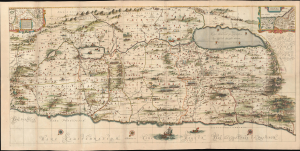
[Situs Terrae Promissionis.]
$6,500.00
Acquire
- Digital Map Information
- Suitable for large format printing
- File Size: 118.78 MB
- File Type: ZIP / TIFF
- ICC color profile embedded
- Delivered instantly via download link
Commonly known as the 'Hornius Map', this is the 1662 Johannes Jansson and Georgius Hornius 6-sheet map of the Holy Land in a beautifully colored, joined example. This map is an expansion on the allegorical Holy Land cartography pioneered by Christian van Adrichem around 1590. Jansson expanded and embellished Adrichem's map to illustrate the text composed by Georgius Hornius (George Horn) for volume six of his Novus Atlas, Accuratissimia Orbis Antiqui Delineatio. (more details)
Rare, separately-issued Biblical Jerusalem.
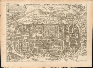
Jerusalem comme elle estoit du temps que Nostre Sauveur Jesus Christ souffrit mort et passion pour nous.
$4,500.00
Acquire
- Digital Map Information
- Suitable for large format printing
- File Size: 26.38 MB
- File Type: ZIP / TIFF
- ICC color profile embedded
- Delivered instantly via download link
This is a rare, separately-issued c. 1670 Gerard Jollain the Elder broadsheet map of Biblical Jerusalem, after Christian van Adrichem: an allegorical depiction of Jerusalem during Christ's lifetime. This work was instrumental in codifying elements of Christian veneration of the Holy City, in particular the Stations of the Cross. (more details)
Scientific and Biblical Geography Meet.
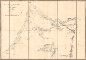
Reconaissance topographique de la Tribu de Juda.
$4,000.00
Acquire
- Digital Map Information
- Suitable for large format printing
- File Size: 76.98 MB
- File Type: ZIP / TIFF
- ICC color profile embedded
- Delivered instantly via download link
This is Alban-Emmanuel Guillaume Rey's c. 1859 large-format folding map of the Holy Land, and more specifically, the lands of the Tribe of Judah, one of the ancient Twelve Tribes of Israel. Rey's expedition to Palestine, which resulted in this map, was an early example of Biblical geography, combining modern surveying techniques with the scholarly study of religion, archaeology, linguistics, and other emerging disciplines. (more details)
Second Map Printed in Palestine by a Palestinian Mapmaker.
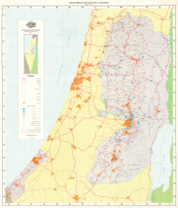
المستعمرات الإسرائيلية في المناطق المحتلة ١٩٦٧ – ١٩٩٣ / [Israeli Settlements in the Occupied Territories 1967-1993].
$3,900.00
Acquire
This is a scarce Arabic-language wall map of Israel-Palestine published in 1994 by Dr. Khalil Toufakji of the Arab Studies Society in Jerusalem. A map of great importance, focusing on Israeli Settlements in the Occupied Palestinian Territory, this is the second map ever printed in post-1948 Palestine and made by a Palestinian map maker. (more details)
Influential, orderly view of Biblical Jerusalem.
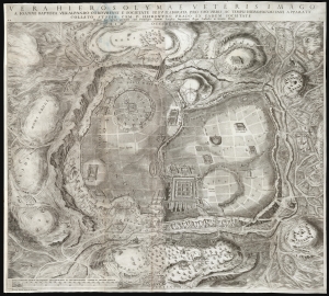
Vera Hierosolymae veteris imago.
$3,000.00
Acquire
- Digital Map Information
- Suitable for large format printing
- DPI: 600
- File Size: 154.73 MB
- File Type: ZIP / TIFF
- ICC color profile embedded
- Delivered instantly via download link
This is Juan Batista Villalpando's large 1604 map of Jerusalem. This attractive and influential plan of the Holy City appeared in his commentary on Ezekiel, published to complete the work of Hieronymus Prado. Villalpando's architectural interpretation of scripture influenced the design of monasteries, churches, and synagogues well into the 17th century. (more details)
Last Days of Mandatory Palestine.
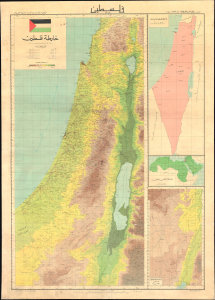
A large wall map of Palestine as it appeared in 1948, in the waning days of the British Mandate, produced by the Palestine Liberation Organization Research Center c. 1966. The map's compilation was overseen by Said Kamel Sabbagh, an accomplished Palestinian-Lebanese geographer, and thus represents the PLO's approved reference map for the Mandatory period. It represents the opening phase of the Nakba or 'Catastrophe.' (more details)
German edition of one of the most important 19th century maps of the Holy Land.
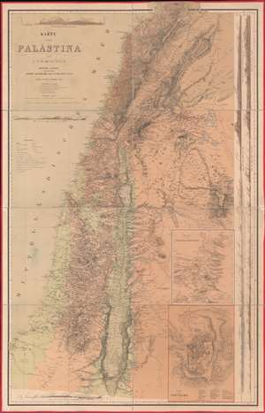
Karte von Palästina.
$2,500.00
Acquire
- Digital Map Information
- Suitable for large format printing
- File Size: 100.2 MB
- File Type: ZIP / TIFF
- ICC color profile embedded
- Delivered instantly via download link
One of the most important 19th-century maps of the region, this is the 1866 German edition of the Charles William Meredith van de Velde map of the Holy Land. Created from Van de Velde's surveys, the map depicts from Syria to the Dead Sea and from the Mediterranean Sea to Mount Zalmon (Alsadamus Mons). Per Mapping the Holy Land: The Foundation of a Scientific Cartography of Palestine, Van de Velde's map of Palestine
represented the complete body of Western geographical knowledge on Palestine, critically compiled, verified on-site and completed by his own measurements and his own (physical) experience, including the hardships needed to make a scientific map.Van de Velde effortlessly blends the modern and the ancient. Myriad cities and towns are labeled throughout, including Jerusalem, Hebron, Tyre, Sidon, and Damascus, and inset maps focus on Jerusalem itself and Jerusalem and its environs. Several terrain profiles appear around the sheet as well. One, in the upper left corner above the title, depicts the road from Beirut to Damascus. Another, below the title, illustrates the region from Cap Carmel to the Lake of Tiberias. Several profiles appear along the right border and run one into another, making it difficult to discern exactly where one stops and the next begins at a glance. (more details)
A Medieval Holy Land.
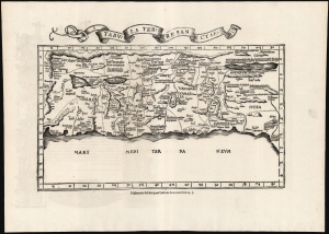
Tabula Terre Sanctae.
$2,250.00
Acquire
- Digital Map Information
- Suitable for large format printing
- Full resolution TIFF file
- ICC color profile embedded
- Delivered instantly via download link
This is the Lorenz Fries 1535 edition of Pietro Vesconte's 14th-century manuscript map of Palestine. It is one of the earliest obtainable iterations of a c. 1320 manuscript map compiled to accompany Marino Sanudo's letters promoting a new crusade. Thus, it is one of the earliest surviving maps to support a specific military effort. Relating to this, Vesconte's map was the earliest surviving map to present the region in a Biblical context, naming the areas occupied by the Tribes of Israel, thus opening a long history of presenting the Levant in a religio-historical context. (more details)
Earliest acquirable medieval plan of Jerusalem.
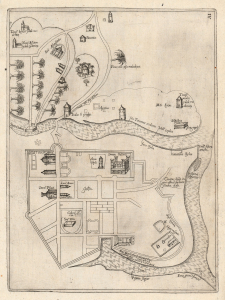
[Jerusalem.]
$2,000.00
Acquire
- Digital Map Information
- Suitable for large format printing
- Full resolution TIFF file
- ICC color profile embedded
- Delivered instantly via download link
This rare plan of Jerusalem is the earliest printed iteration of Pietro Vesconte's manuscript plan of the city. While not committed to print until this 1611 edition by Jacques Bongars, the map is the work of the 14th-century Venetian cartographer Vesconte, who produced it c. 1320 to promote Marino Sanudo's proposed crusade to recapture the city. As such, it is one of the earliest surviving plans to support a specific military effort. (more details)
Masterpiece of chromolithography.
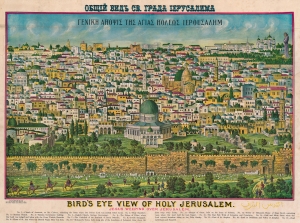
Bird's Eye View of Holy Jerusalem. Jesus Weeping Over Jerusalem. / Γενικη Αηοψις Της Αγιας Ηολεως Ιερουσαλημ. / القدس الشف
$2,000.00
Acquire
- Digital Map Information
- Suitable for large format printing
- File Size: 65.83 MB
- File Type: ZIP / TIFF
- ICC color profile embedded
- Delivered instantly via download link
A rare example of Rand McNally's 1900 chromolithograph view of Jerusalem. Although here unattributed, this view is a revised version of an earlier view issued in 1896 by the Palestinian / Syrian immigrant Aece Hage. Sometime after Hage's original printing, the view was acquired and revised by the Rand McNally Company, who updated and 'Christianized' it, adding a figure of Jesus in the upper right. They published from about 1900 both on their own account and to order - in this case, for the Chapel of Our Lady of the Cedars of Mt. Lebanon in West Roxbury, Massachusetts. The map is titled in Greek and English. Aece Hage's own title, in Arabic, also appears at the bottom right. Text below the view identifies 17 locations, which correspond to numerical assignments. The cartographer identifies Christian, Muslim, and Jewish religious sites. (more details)
The Holy City for the Armchair Pilgrim.
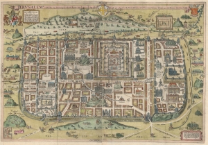
Ierusalem, et suburbia eius, sicut tempore Christi floruit ... descripta per Christianum Adrichom Delphum.
$2,000.00
Acquire
- Digital Map Information
- Suitable for large format printing
- File Size: 43.73 MB
- File Type: ZIP / TIFF
- ICC color profile embedded
- Delivered instantly via download link
This is an elegant example of Christian van Adrichem's influential 1584 plan of the Biblical Jerusalem. It was included in his 1584 Theatrum Terrae Sanctae, a Biblical atlas intended to provide visual structure to Catholic catechism - not only to inform the religious scholar, but to provide the basis for a sort of 'virtual pilgrimage' to the holy sites of Jerusalem when actual travel there was, for most, utterly impossible. (more details)
The Nakba. A rare cartographic look at the Palestinian perspective of the Arab-Israeli Conflict.
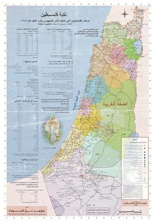
This is a 1998 Salman Abu Sitta map of Palestine and the Nakba in 1948 - a rare cartographic look at the Palestinian side of the Arab-Israeli Conflict. The Nakba (meaning 'disaster,' 'catastrophe,' or 'cataclysm' in Arabic) refers to the dispossession of the Palestinians of their land and homes, the destruction of Palestinian society, and the permanent displacement of most of the Palestinian population in 1948. (more details)