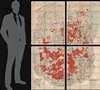
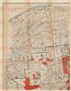
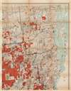
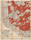
Digital Image: 1909 Wood and Smith Wall Map of the Adirondacks, New York
AdirondackForest-woodsmith-1909_d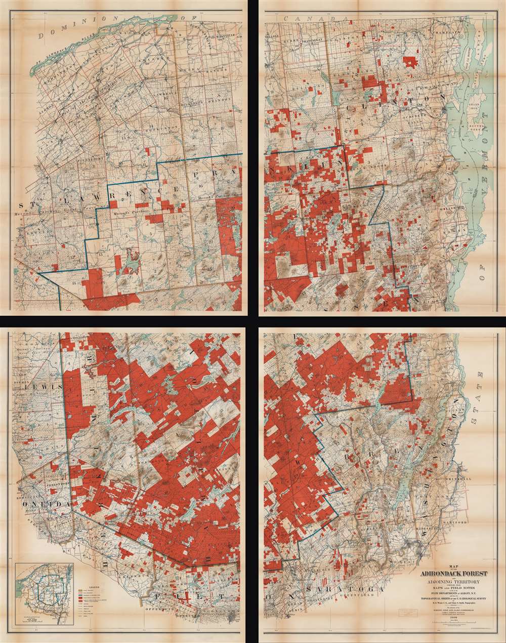


Title
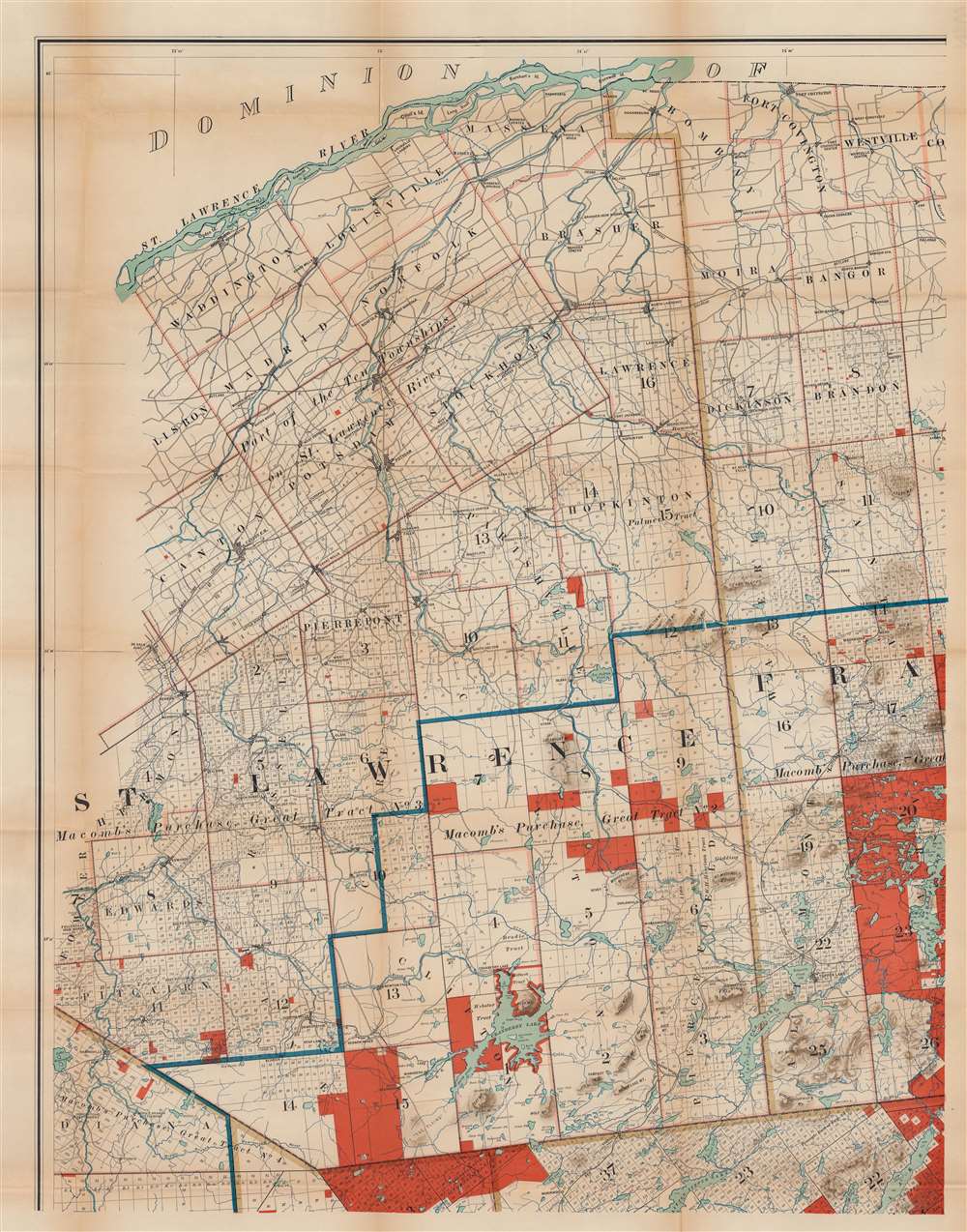
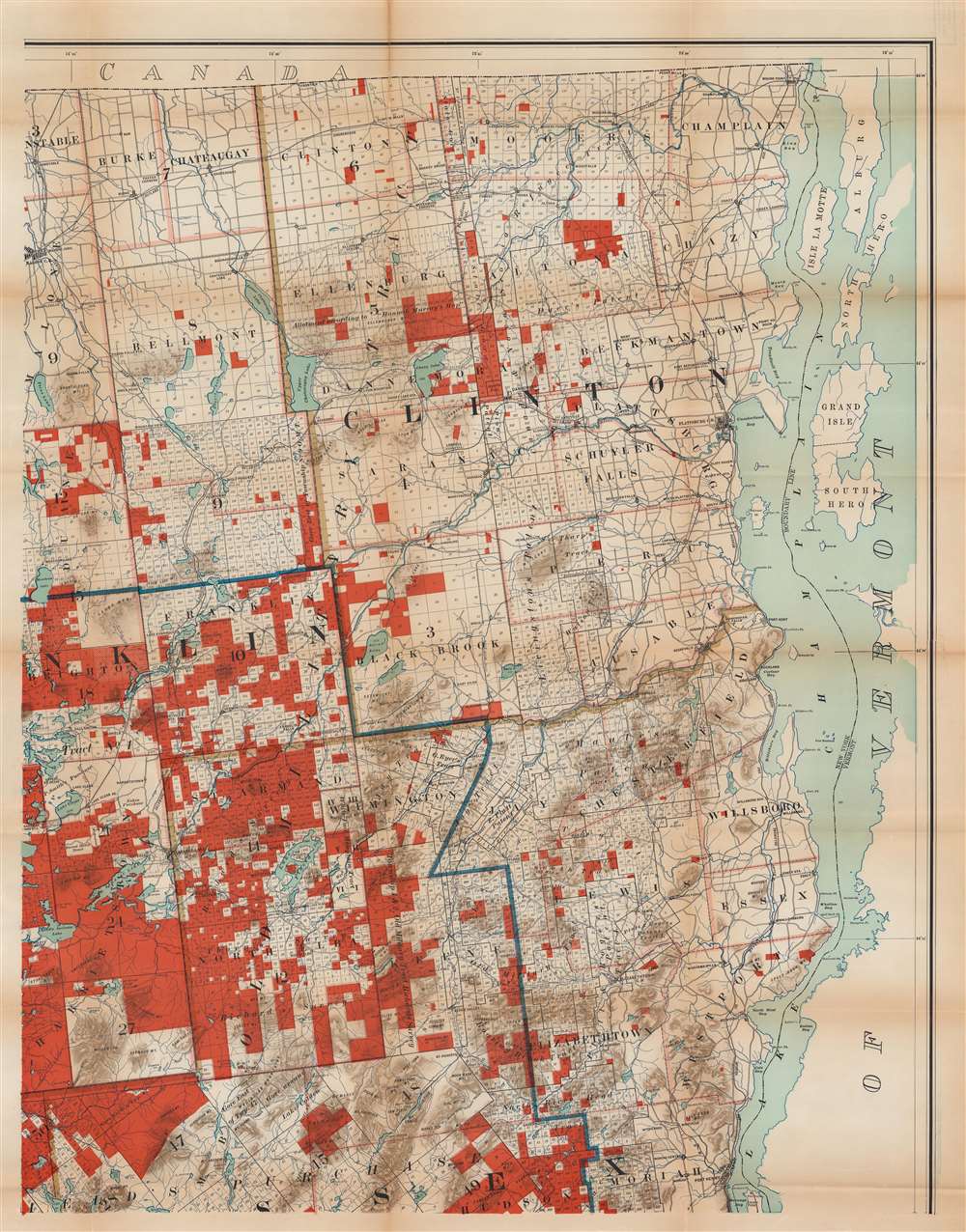
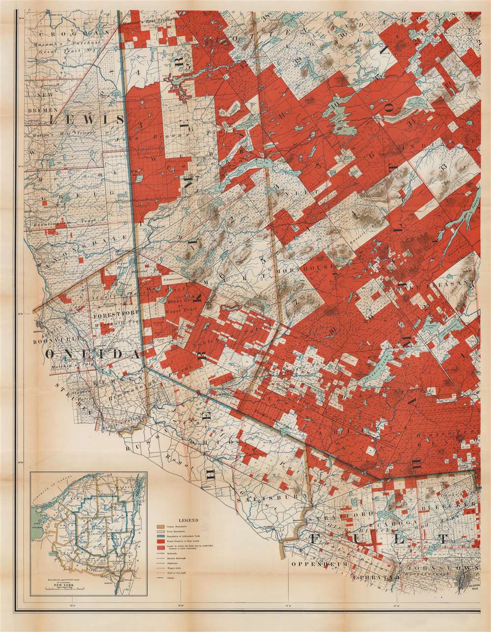
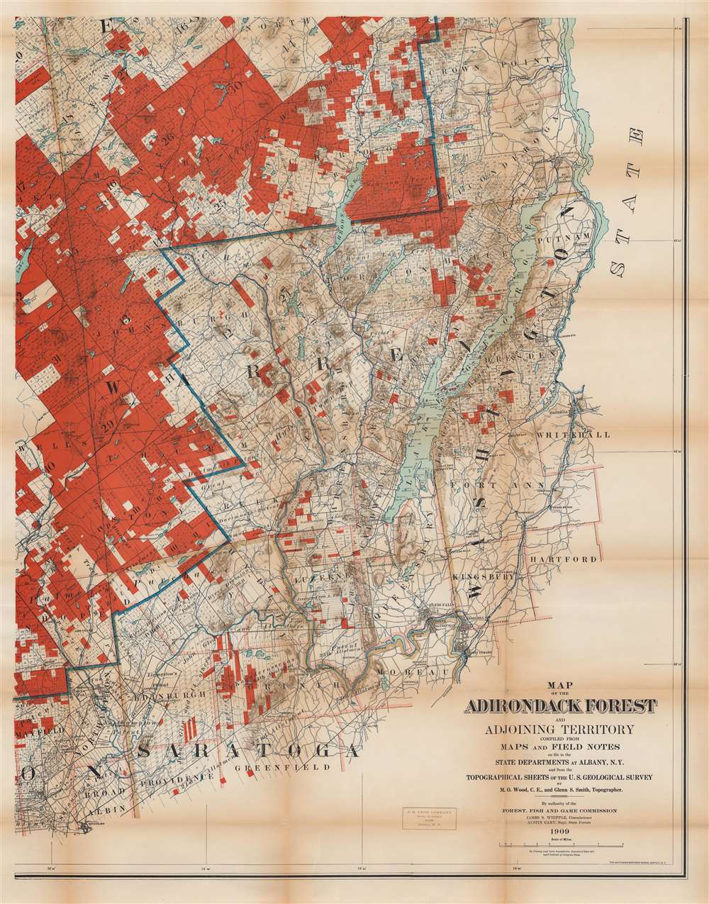
Map of the Adirondack Forest and Adjoining Territory.
1909 (dated) 73 x 56 in (185.42 x 142.24 cm) 1 : 126720
1909 (dated) 73 x 56 in (185.42 x 142.24 cm) 1 : 126720
Description
FOR THE ORIGINAL ANTIQUE MAP, WITH HISTORICAL ANALYSIS, CLICK HERE.
Digital Map Information
Geographicus maintains an archive of high-resolution rare map scans. We scan our maps at 300 DPI or higher, with newer images being 600 DPI, (either TIFF or JPEG, depending on when the scan was done) which is most cases in suitable for enlargement and printing.
Delivery
Once you purchase our digital scan service, you will receive a download link via email - usually within seconds. Digital orders are delivered as ZIP files, an industry standard file compression protocol that any computer should be able to unpack. Some of our files are very large, and can take some time to download. Most files are saved into your computer's 'Downloads' folder. All delivery is electronic. No physical product is shipped.
Credit and Scope of Use
You can use your digial image any way you want! Our digital images are unrestricted by copyright and can be used, modified, and published freely. The textual description that accompanies the original antique map is not included in the sale of digital images and remains protected by copyright. That said, we put significant care and effort into scanning and editing these maps, and we’d appreciate a credit when possible. Should you wish to credit us, please use the following credit line:
Courtesy of Geographicus Rare Antique Maps (https://www.geographicus.com).
How Large Can I Print?
In general, at 300 DPI, you should at least be able to double the size of the actual image, more so with our 600 DPI images. So, if the original was 10 x 12 inches, you can print at 20 x 24 inches, without quality loss. If your display requirements can accommodate some loss in image quality, you can make it even larger. That being said, no quality of scan will allow you to blow up at 10 x 12 inch map to wall size without significant quality loss. For more information, it is best consult a printer or reprographics specialist.
Refunds
If the high resolution image you ordered is unavailable, we will fully refund your purchase. Otherwise, digital images scans are a service, not a tangible product, and cannot be returned or refunded once the download link is used.
Cartographer S
Millins O. Wood (June 3, 1868 - February 3, 1935) was an American civil engineer and cartographer. Born in Ohio, New York, Wood attended Union University and began working as a civil engineer immediately after graduation. An article lauding Wood for the 1908 edition of his map of the Adirondacks stated, 'No one could be better fitted to make this new map than Mr. Wood, as he is a proficient draftsman, and has an intimate knowledge of the Adirondack region'. More by this mapmaker...
Glenn Shepard Smith (April 1, 1869 - June 3, 1951) was an American engineer and topographer. Born in New York, Smith worked on a map of the Adirondacks with Millions O. Wood (June 3, 1868 - February 3, 1935) and editions were published in 1908 and 1909. He served on General John J. Pershing's staff during World War I. He commanded the 29th Engineers after World War I and oversaw the military surveys of Santo Domingo and reached the rank of colonel before retiring from the army. Then, he moved on to the U.S. Geological Survey and rose to the position of Topographic Engineer in Charge of the Western Division before he retired. He was buried in Arlington National Cemetery in Arlington, Virginia. Learn More...
Matthews-Northrup Works (fl. c. 1895 - 1930) were a Buffalo, New York based, in their own words, "writing, designing, engraving, printing, [and] binding" firm. The firm was founded by James Newson Matthews (November 21, 1828 - December 20, 1888) as the J. N. Matthews Company. William Phelps Northrup (April 2, 1850 - February 2, 1929) later joined the company as an apprentice and then partner, at which point the firm was reincorporated as the Matthews-Northrup Works. The Matthews-Northrup Works rose to prominence as publishers and printers of railroad maps, with dozens to their credit. When James died, his shares were inhered by George Edward Matthews (1855 - 1910), who ran the business until his death in 1910. Also in 1910, they famously redesigned the cover of National Geographic Magazine. Despite some six previous cover changes in just 21 years, the Matthews-Northrup layout proved so popular that it was used for nearly 50 years. The firm can also take credit for the Winchell typeface, designed in 1903 under E. E. Winchell's tenure as art director. Curiously, the partners of Matthews-Northrup maintained an unusual affectation in which only the officers of the company could wear beards or mustaches. In this same spirit, the firm also had its own private social club, the Fellowcraft Club, where the all-male employees could relax, play pool, drink and dine. Matthews-Northrup maintained offices on Washington Street, Buffalo, where they were based, as well as Madison Square, New York City, Garden Tower, Boston, and the Citizens Building in Cleveland. Learn More...
References
OCLC 5707964.