Digital Image: 1895 Map of the Eastern Congo Basin showing the tracks of 10 explorers
Congo-hinde-1895_d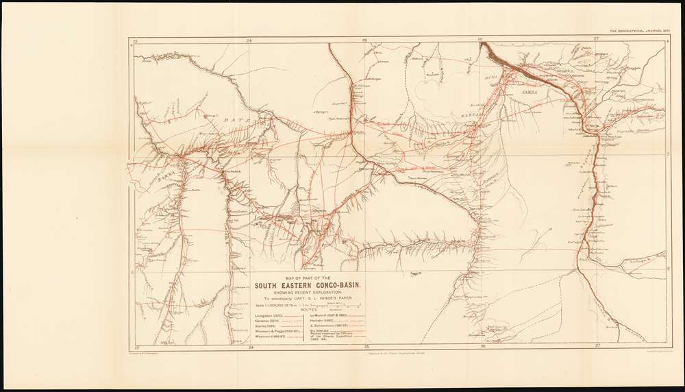

Title
Map of Part of the South Eastern Congo-Basin Showing Recent Exploration
1895 (undated) 12 x 20.75 in (30.48 x 52.705 cm) 1 : 1000000
1895 (undated) 12 x 20.75 in (30.48 x 52.705 cm) 1 : 1000000
Description
FOR THE ORIGINAL ANTIQUE MAP, WITH HISTORICAL ANALYSIS, CLICK HERE.
Digital Map Information
Geographicus maintains an archive of high-resolution rare map scans. We scan our maps at 300 DPI or higher, with newer images being 600 DPI, (either TIFF or JPEG, depending on when the scan was done) which is most cases in suitable for enlargement and printing.
Delivery
Once you purchase our digital scan service, you will receive a download link via email - usually within seconds. Digital orders are delivered as ZIP files, an industry standard file compression protocol that any computer should be able to unpack. Some of our files are very large, and can take some time to download. Most files are saved into your computer's 'Downloads' folder. All delivery is electronic. No physical product is shipped.
Credit and Scope of Use
You can use your digial image any way you want! Our digital images are unrestricted by copyright and can be used, modified, and published freely. The textual description that accompanies the original antique map is not included in the sale of digital images and remains protected by copyright. That said, we put significant care and effort into scanning and editing these maps, and we’d appreciate a credit when possible. Should you wish to credit us, please use the following credit line:
Courtesy of Geographicus Rare Antique Maps (https://www.geographicus.com).
How Large Can I Print?
In general, at 300 DPI, you should at least be able to double the size of the actual image, more so with our 600 DPI images. So, if the original was 10 x 12 inches, you can print at 20 x 24 inches, without quality loss. If your display requirements can accommodate some loss in image quality, you can make it even larger. That being said, no quality of scan will allow you to blow up at 10 x 12 inch map to wall size without significant quality loss. For more information, it is best consult a printer or reprographics specialist.
Refunds
If the high resolution image you ordered is unavailable, we will fully refund your purchase. Otherwise, digital images scans are a service, not a tangible product, and cannot be returned or refunded once the download link is used.
Cartographer S
Royal Geographical Society (fl. 1830 - present) is a British Society established in 1830 to promote geographical science and exploration. Originally titled the "Geographical Society of London", the RGS received its royal charter from Queen Victoria in 1859 shortly after absorbing several similar but more regional societies including the African Association, the Raleigh Club and the Palestine Association. The RGS sponsored many of the most important and exciting voyages of exploration ever undertaken, including the exploration of Charles Darwin, David Livingstone, Robert Falcon Scott, Richard F. Burton, John Speke, George Hayward, H. M Stanley, Ernest Shackleton and Sir Edmond Hillary. Today, the RGS remains a leading global sponsor of geographical and scientific studies. The Society is based in Lowther Lodge, South Kensington, London. More by this mapmaker...
Sidney Langford Hinde, (23 July 1863 - 18 October 1930) was a Canadian-born military medical officer involved in colonial operations in the Congo and East Africa in the 19th century. The son of Surgeon George Langford Hinde (41st Foot Welsh Regiment) and Harrietta Tudor Rayner, daughter of Edward Charles Rayner, Esq. of England. In 1895, Hinde was posted to Machakos Fort in the East African Protectorate Service where he was appointed Resident to the Maasai Chief and Collector of Maasailand. Hinde was credited with aiding the overthrow of the infamous African slave trader Tippu Tip, and his successor, Sefu. A valley on Mount Kenya is named after him, as is a waterfall on te Athi River. He his also memorialized in the scientific name of the Kenyan Mountain Viper, M. hindii. He wrote an article for the May, 1895 issue of The Geographical Journal entitled Three Years’ Travel in the Congo Free State which was accompanied by the present map. In later years, he wrote three books and an article for an ornithological journal. Learn More...
Bernard Vernon Darbishire (August 8, 1865 Dwygyfylchi, Wales - December 29, 1935, Surrey, England) was a Welsh mapmaker and member of the Royal Geographical Society. He matriculated at Oxford May 23, 1885, and maintained a long relationship with the university and town, producing many educational atlases and maps published by Oxford University Press. Works include The Kingsway Atlas of Physical Geography (1921) Oxford Outline Maps (of the World), (1911) and a series of wall maps printed between 1910 and 1911. He also contributed to Stieler’s Atlas of Modern Geography (editions between 1909 and 1915) and his own War Atlas (1915), a compilation of maps relevant to the first World War. His work with the Royal Geographical Society includes ‘Northern Korea’ (1892), ‘Sketch map of the Black Sea, after I.B. Spindler’ (1892), ‘Sketch map of the Black Sea, after I.B. Spindler’(1894), ’Part of British Guiana and Venezuela’ (1895), ‘Mr. G.G. Dixon's compass-survey of the River Barima : from the Eclipse Falls to the source’ (1895), ‘Map of the Luchu islands, to illustrate Mr. Basil Hall Chamberlain's paper’(1895).hind Learn More...
Source
Royal Geographical Society, 'The Geographical Journal.' Vol. V. No. 5]
References
Afriterra 3407. OCLC 556951797.