
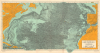
1968 Tharp and Heezen Map of the North Atlantic Ocean Floor

This item has been sold.
Physiographic Diagram of the North Atlantic Ocean.
A triumph for geology and for women in science.
A triumph for geology and for women in science.
A visually striking and scientifically significant 1968 Marie Tharp and Bruce C. Heezen physiographic map of the North Atlantic detailing the submarine topography. It is a revolutionary work. The massive map combines the genuine scientific work of interpreting and compiling thousands of sonar images with accomplished artistry. This work represents the culmination of over 30 years of collaboration between Tharp and Heezen, led by Tharp, to produce a meticulous sonar map of the ocean's floors. Among other accomplishments, their work led to the discovery of the Mid-Atlantic Rift, the Mid-Atlantic Ridge (as depicted here), and redefined both submarine geology and our understanding of plate tectonics. Moreover, Tharp's work was pioneering in elevating the role of women in the sciences.A Closer Look
The map offers a striking axonometric view of the terrain throughout, with a focus on the seabed. Coverage extends from the Great Lakes to France and from the St. Lawrence River and Newfoundland to the Greater Antilles and the Cape Verde Islands. The spine-like Mid-Atlantic Ridge is prominent. Most of the subterranean peaks and valleys are labeled with a numerical system running into the thousands - likely references in a supplementary work not included here.Tharp and Heezen's Maps
We have been able to identify 4 maps copyrighted to Tharp and Heezen. These include maps of- The North Atlantic (1957, 1968)
- The South Atlantic (1961)
- The Indian Ocean (1964)
- The World (1977)
Publication History and Census
This map was copyrighted in 1968 by Heezen and Tharp. It is based upon research completed by Bruce C. Heezen and Marie Tharp of the Geological Department at Columbia University. It was printed in Washington, D.C. by William and Heintz Map Corporation and published by the Geological Society of America. Tharp and Heezen first published a North Atlantic Chart in 1957; this is the 'revised' edition, though, being at least 30% larger and far more detailed, it should be considered a separate work. This map is well represented in institutions, but few examples have found their way to the private market.Cartographers
Marie Tharp (July 30, 1920 - August 23, 2006) was a prominent American oceanographic cartographer and geologist - recognized as a pioneer in the male-dominated world of geology. Tharp was born in Ypsilanti, Michigan. She was introduced to mapmaking through her father, who was a surveyor for the U.S. Department of Agriculture. She studied at the University of Ohio, earning Music and English degrees. During World War II, she earned a Masters in Geology at the University of Michigan, graduating in 1944, and later a second bachelor's in mathematics (1948). She first worked as a research assistant at Lamont Geological Laboratory in Columbia University in New York. Tharp was Bruce Charles Heezen's (1924 - 1977) assistant while he was a graduate student, and he gave her the task of drafting seafloor profiles. Her discoveries of the Mid-Atlantic Rift and the Mid-Atlantic Ridge, while initially dismissed because of her gender, eventually led to a life-long collaboration with Heezen. Today, Tharp is best known for her decades long project to map the ocean floors with sonar imaging. This revolutionary work contributed to our modern understanding undersea geography, plate tectonics, and continental drift. Ironically, women at that time were unwelcome on scientific marine voyages, so while she mapped the oceans, she never personally went to sea. Her published maps include the North Atlantic (1957), South Atlantic (1961), Indian Ocean (1964), and the world (1977). She remained at Columbia University until retiring in 1983. Further Details...
Bruce Charles Heezen (April 11, 1924 - June 21, 1977) was an American geologist active at New York's Columbia University. Heezen was born in Viton, Iowa. He graduated from the University of Iowa in 1947 and went on to an MA (1952) and PhD (1957) at Columbia University. There he met the pioneering female geologist, Marie Tharp (1920 - 2006), with whom he collaborated to map the ocean's floors for some 30 years. Tharp was Heezen's assistant while he was a graduate student. When she showed Heezen that her plotting of the North Atlantic revealed a rift valley, Heezen dismissed it as 'girl talk'. She persisted and they eventually discovered that not only was there a North Atlantic rift valley, but a mountain range with a central valley that spanned the earth. Heezen died of a heart attack in 1977 while aboard the NR-1 submarine studying the Mid-Atlantic Ridge near Iceland. Further Details...
Condition
Very good. Some wear on old fold lines. A few spots of toning. Slight pea-sized infill at 2 fold intersections.
References
OCLC 4912758. North, Gary. W., 'Marie Tharp and Her Ocean Floor Maps', The Portolan, #79, 2010.