
1787 Robert de Vaugondy Pair of Separate-Issue Celestial Maps


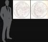
Hémisphère Céleste Arctique ou Septentrional calculé et construit pour l’année 1763 ... / Hémisphère Céleste Antarctique ou Austral calculé et construit pour l’année 1763 ...
Separately-issued Celestial Charts.
- Digital Map Information
- Suitable for large format printing
- File Size: 66.13 MB
- File Type: ZIP / TIFF
- ICC color profile embedded
- Delivered instantly via download link
Separately-issued Celestial Charts.
This is a stunning c. 1787 pair of separately issued celestial maps by Didier Robert de Vaugondy and Charles-François Delamarche. The maps employ a two-plate engraving system to highlight constellations in red - a unique feature not replicated elsewhere in Robert de Vaugondy's corpus.A Closer Look
Both maps are centered over their respective geological poles; however, celestial data is centered over their ecliptic poles, the two points where the ecliptic axis, the imaginary line perpendicular to the ecliptic, intersects the celestial sphere. From these points, concentric rings emerge. Constellations are highlighted in red. Stars are illustrated using the 1603 Johann Bayer model, wherein relative brightness is defined using a Greek lettering system. The map also includes nebulas, several of which were updated and added by Delamarche for this edition of the charts.Publication History and Census
The charts are calculated for 1763, and were initially published by Robert de Vaugondy in 1774. This edition, bearing the Delamarche imprint in the lower left, suggests they must have been printed after 1786, when Delamarche acquired and updated Vaugondy's cartographic stock. Both are the 3rd states, updated by Delamarche with new constellations and other astronomical features. Scarce on the market. Pedley notes examples at the BnF and the British Library. The charts appear on the market occasionally, usually separately, so a matched set is a rare discovery.Cartographers
Robert de Vaugondy (fl. c. 1716 - 1786) was a French publishing firm run by Gilles (1688 - 1766) and Didier (c. 1723 - 1786) Robert de Vaugondy. They were map publishers, engravers, and cartographers active in Paris during the mid-18th century. Gilles was the nephew of Pierre Moulard Sanson, and was thus the inheritor of Nicolas Sanson (1600 - 1667), whose stock supplied much of their initial material and whose legacy supplied much of their initial reputation. Graduating from Sanson's maps, Gilles, and more particularly Didier, began to produce their own substantial corpus. The Vaugondys were well-respected for the detail and accuracy of their maps, for which they capitalized on the resources of 18th-century Paris to compile the most accurate and fantasy-free maps possible. The Vaugondys compiled each map based on their own geographic knowledge, scholarly research, journals of contemporary explorers and missionaries, and direct astronomical observation. Moreover, unlike many cartographers of this period, they took pains to reference their sources. Nevertheless, even in 18th-century Paris, geographical knowledge was limited - especially regarding those unexplored portions of the world, including the poles, the Pacific Northwest of America, and the interiors of Africa, Australia, and South America. This gap in knowledge let to divergent geographical approaches, epitomized by the Buache-Vaugondy debates at the French Academie des Sciences - one of the key pivotal moments in the history of modern cartography. Buache, in his Exposé, argued for a Theoretical Geography, which postulated that a systematic and scientific approach could accurately fill in the map in advance of actual exploration. Vaugondy's scathing critique of the Exposé, presented as the Considerations, argued for empirical restraint in cartography, suggesting that unexplored areas should simply be left blank and that mapping itself should rely on documentable current discovery. While Bucahe, with more political acumen and connections, initially came out ahead in the debates, the subsequent decades saw voyages of discovery by Captains James Cook, Jean Francois de Galaup de La Perouse, and George Vancouver disprove most of his map. Nonetheless, by that time, Vaugondy, advanced in age, did not live long enough to see his approach become ascendant. Didier died more celebrated than solvent, and his maps were acquired by Jean-Baptiste Fortin, who in 1787 sold them to Charles-François Delamarche (1740 - 1817). Delamarche, more businessman than cartographer, prospered from the Vaugondy maps, but defrauded Vaugondy's widow, Marie Louise Rosalie Dangy, of her rightful inheritance and may even have killed her. Further Details...
Charles-François Delamarche (August 1740 - October 31, 1817) founded the important and prolific Paris-based Maison Delamarche map publishing firm in the late 18th century. A lawyer by trade, Delamarche entered the map business with the 1787 acquisition from Jean-Baptiste Fortin of Robert de Vaugondy's map plates and copyrights. Delamarche appears to have been of dubious moral character. In 1795, the widow of Didier Robert de Vaugondy, Marie Louise Rosalie Dangy, petitioned a public committee for 1500 livres, which should have been awarded to her deceased husband. However, Delamarche, proclaiming himself Vaugondy's heir, filed a simultaneous petition and walked away with the funds, most of which he was instructed to distribute to Robert de Vaugondy's widow and children. Just a few months later, however, Delamarche proclaimed Marie Dangy deceased, and it is highly unlikely that any funds found their way to Robert de Vaugondy's impoverished daughters. Nonetheless, where Robert de Vaugondy could barely make ends meet as a geographer, Delamarche prospered as a map publisher, acquiring most of the work of earlier generation cartographers Lattre, Bonne, Desnos, and Janvier, thus expanding significantly upon the Robert de Vaugondy stock. Charles Delamarche eventually passed control of the firm to his son Felix Delamarche (c. 1750 - c. 1850) and geographer Charles Dien (1809 - 1870). It was later passed on to Alexandre Delamarche, who revised and reissued several Delamarche publications in the mid-19th century. The firm continued to publish maps and globes until the middle part of the 19th century. Further Details...
Condition
Good. Some discoloration along right side of Southern Hemisphere sheet. Minor centerfold stabilization on verso.
References
BnF: FRBNF40673740, FRBNF40673739. Pedley, Mary Sponberg, Bel et Utile: The Work of the Robert de Vaugondy Family of Mapmakers, #1, 2.